Bitter Cold Gives Way To Another Accumulating Snow Event; Weekend Storms?

It’s a frigid start to the day, especially by March standards. With a fresh snow cover down, many reporting sites are now approaching zero. Officially, Indianapolis is down to 4 (F) as of this update at the 7a hour. For the most part, dry conditions will prevail today, but we could notice a couple of very light snow showers/ flurries at times this morning.

An upper level disturbance will pass through here Tuesday and again could be enough to ignite light snow showers.

The primary story through midweek is the cold as highs don’t make it above freezing until Friday afternoon. With the increasingly high and more powerful March sun angle, that’s another impressive feat.

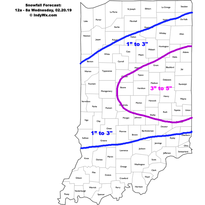
Attention will shift to the threat of a stripe of accumulating snow Thursday evening into Friday.

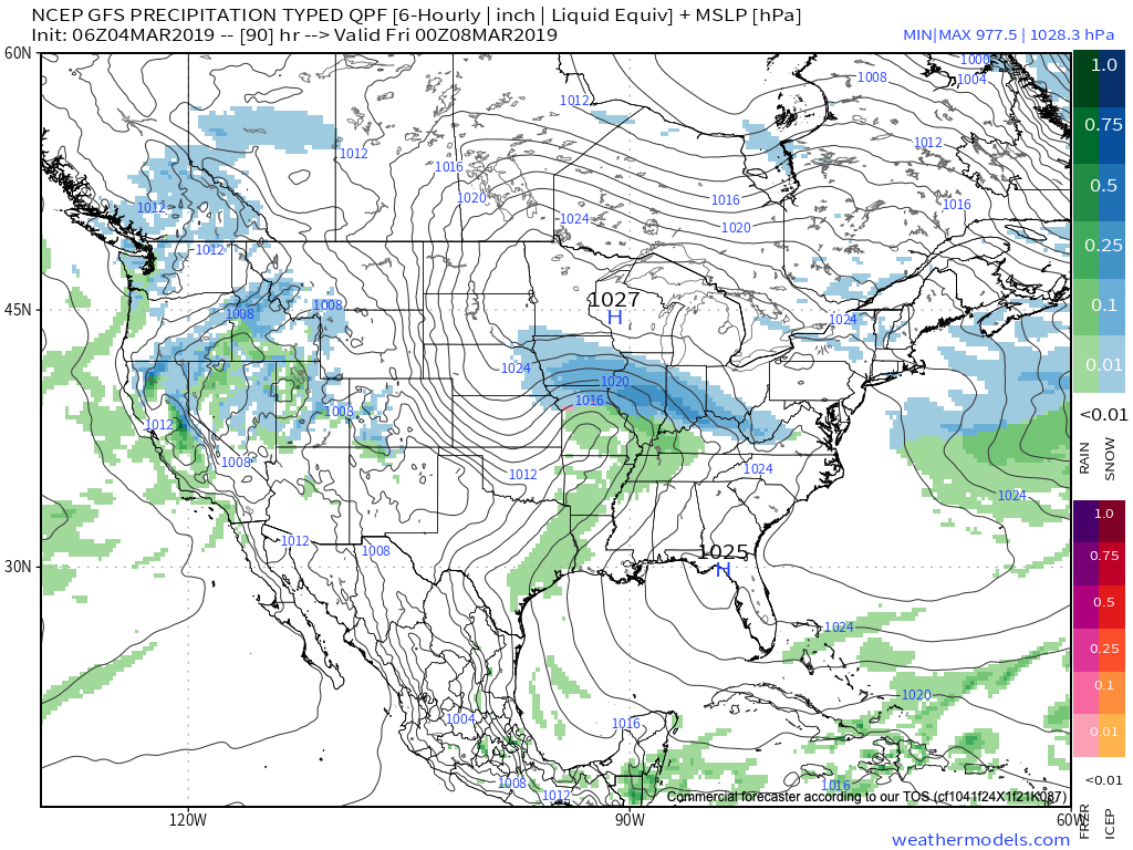
As this upper level wave scoots southeast out of the central Plains and across the Ohio Valley, a band of accumulating snow will occur to the north and northeast of the track. As things stand now, we expect snow to build in here Thursday evening, continuing into Friday. While we still have time to watch things unfold, this is the kind of system that could deposit a few/ several inches of wet snow. Stay tuned.

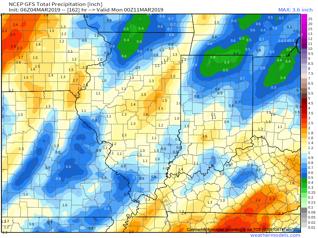
Just as soon as we get rid of our late week snow maker, a new storm system will approach this weekend with the threat of heavier rain and embedded thunder late Saturday into early Sunday.

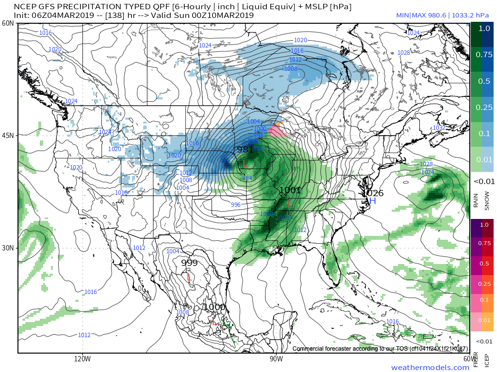
Rainfall totals of 0.75″ to 1.25″ are possible with our weekend system before precipitation ends as wet snow showers/ flurries next Sunday.

We’ll have an updated video discussion this evening looking more in-depth at the long range pattern… Make it a great Monday!

Evening Video Update: Snow, Storms, And A Major Pattern Shift On The Horizon…

You must be logged in to view this content. Click Here to become a member of IndyWX.com for full access.  Already a member of IndyWx.com All-Access?  Log-in here.

All-Access Client Brief: Plowable Snow Moves In Overnight…

Brief: Heavy Snow & Sleet

Forecaster: McMillan

What: Heavy Snow & Sleet

When: 12a to 8a Wednesday

Temperatures: Upper 20s to lower 30s

Wind: E 15-25 MPH

Blowing/ Drifting: Moderate before mixing with sleet

The setup remains the same as a warm front lifts north during the overnight. Copious amounts of moisture will arrive into central Indiana and with cold air in place, a period of moderate to heavy snow will develop. Timing into the city, itself, should come around, or just before, midnight. While the snow will be of the heavy, wet variety, gusty easterly winds will result in blowing and drifting snow (especially on north-south roadways) before precipitation transitions to sleet. We’ve “beefed” our accumulation forecast up to include a 3″ to 5″ band across east-central Indiana, including Indianapolis, as short-term guidance is indicating a period of significant “forcing” (or lift in the atmosphere) that will lead to heavy snowfall rates before the transition to sleet. A couple of hours with snowfall rates in excess of 1″ per hour will likely be observed in that 1a to 3a window. Precipitation will transition to sleet and a period of freezing rain between 3a and 5a from south to north, before turning to all rain in the city before sunrise. Further north, a transition to rain won’t be noticed until after 8a, but the majority of precipitation will likely be over with by that point (just lingering drizzle and fog).

Confidence: High