Watching From Afar: Summer-Like Warmth, But Heaviest Rain/ Severe Threat Remains NW Of Immediate Region…

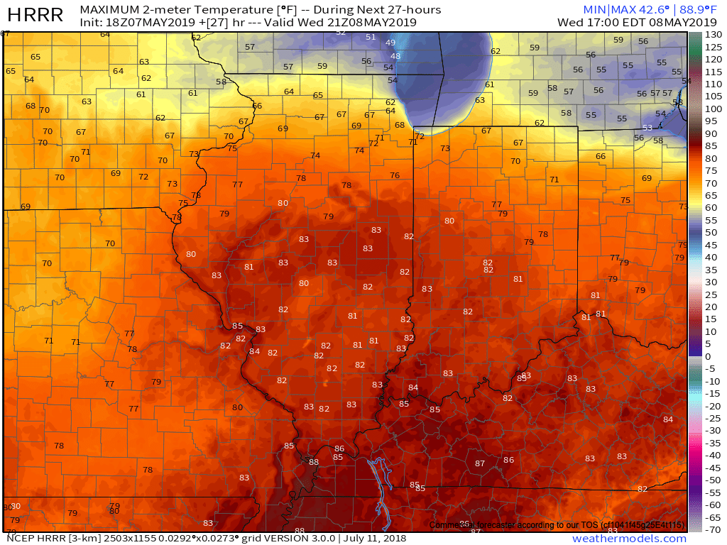
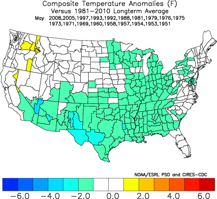
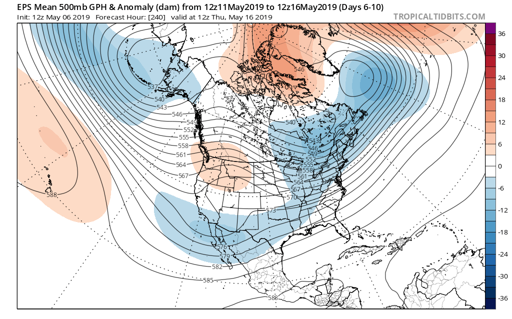
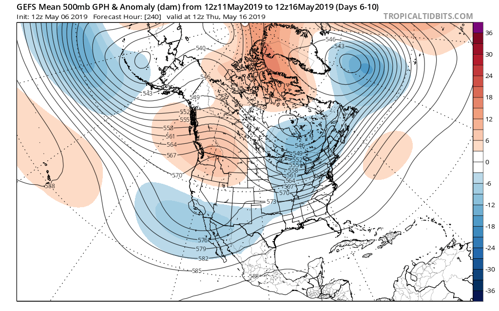
An expanding upper level ridge will drive the warmest air so far this season into the Ohio Valley, including central Indiana, as we get set to close the work week and head into next week.

This will not only deliver mid to upper 80s, but the first truly “oppressive” feel of the season as moist Gulf of Mexico air flows northward into the Ohio Valley. At times, dew points will approach the 70 degree mark.

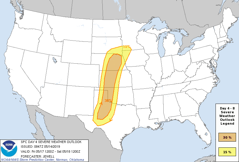
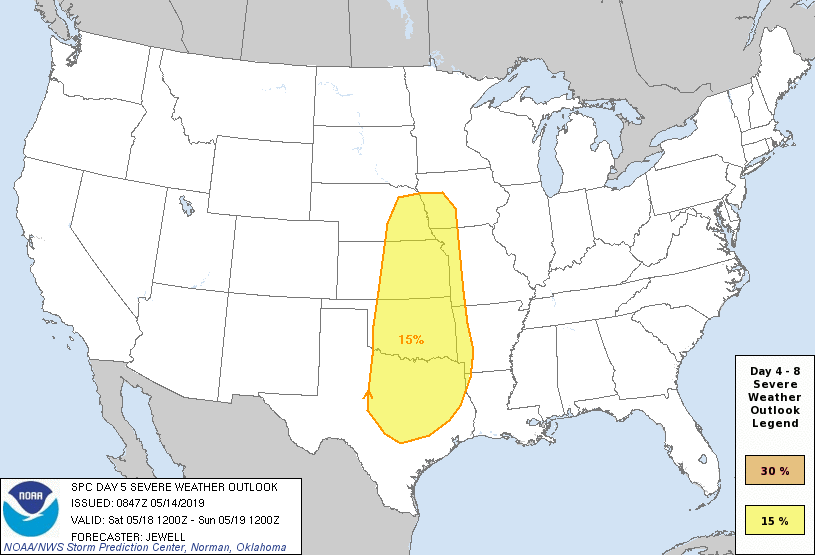
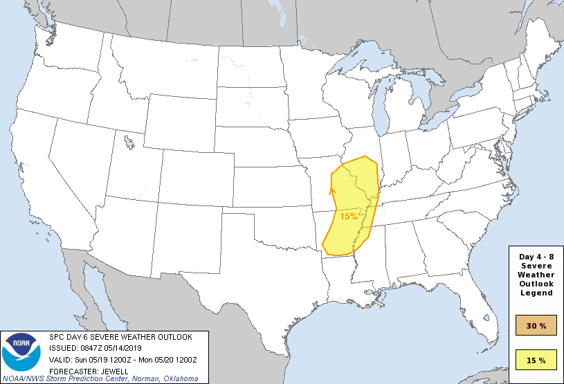
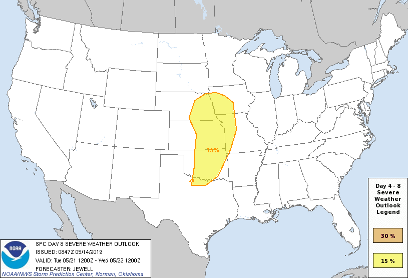
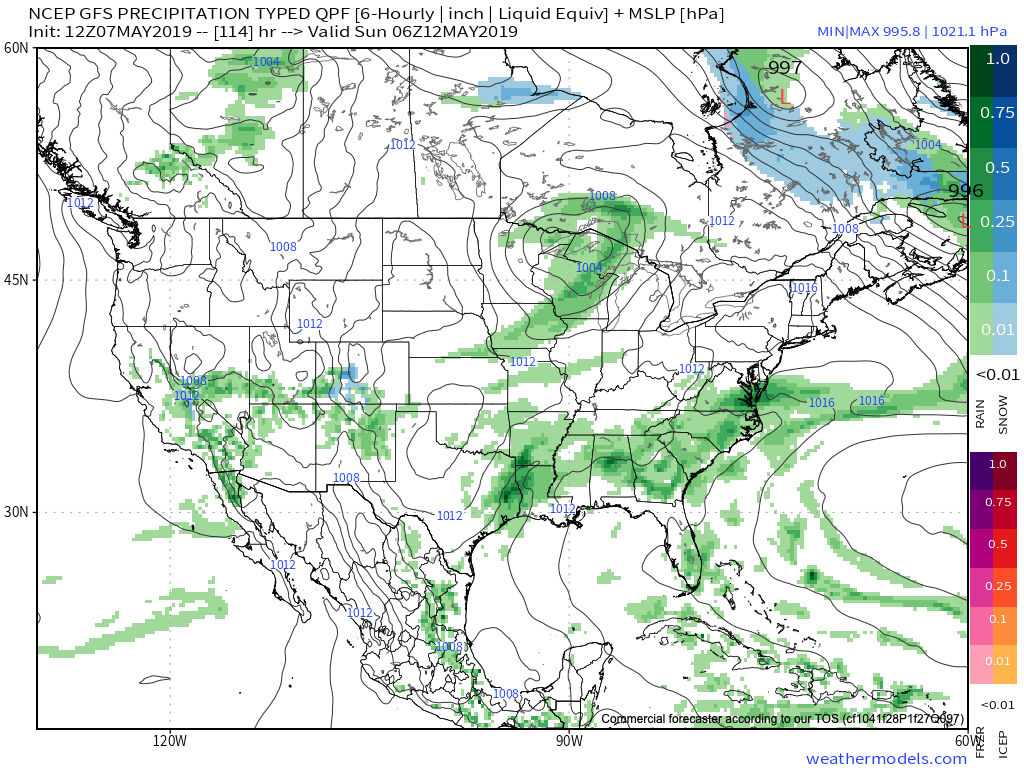
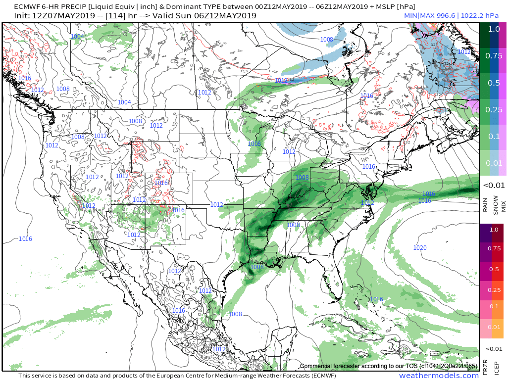
Though the pattern will turn warm and humid, the worst of the heavy rain events are expected to remain to our west-northwest. (Unfortunately, this pattern is one that will lead to a multi-day severe weather and eventual flood threat for the Plains into the upper Midwest).

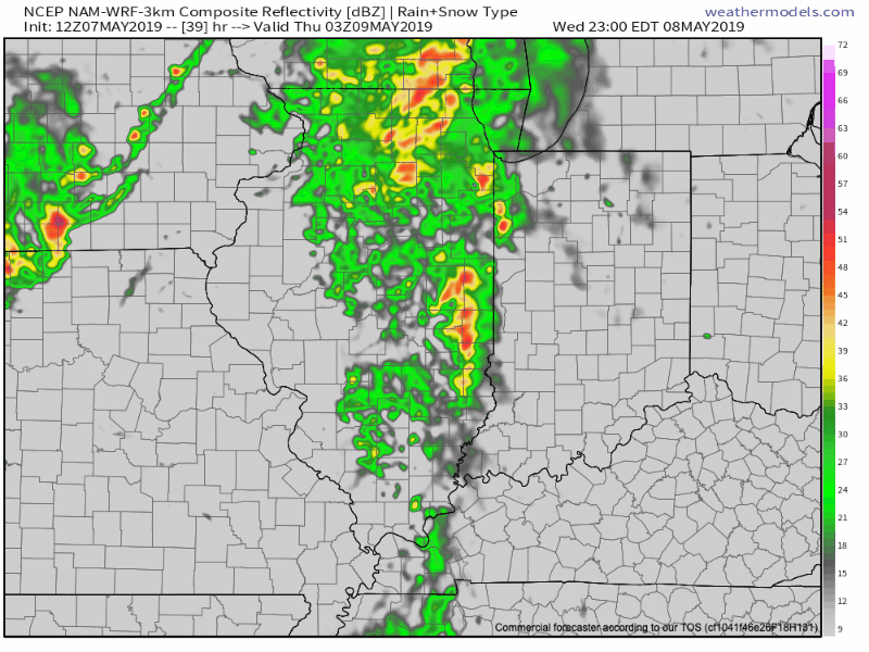
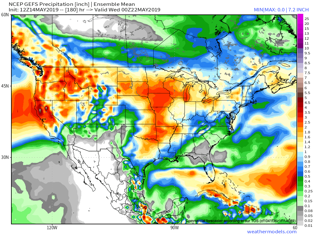
That isn’t to say we won’t see rain and storms at times (most numerous Thursday night across northern and east-central Indiana, Sunday afternoon across all of the state, and again Tuesday), but instead the most concentrated heavy rain and severe potential will be focused from OK, MO, IA, and into MN and WI over the upcoming 7-day period. Instead of us looking at widespread 2″ to 4″ totals, we’re instead looking at 7-day rainfall amounts around an inch, with locally heavier amounts.

From a severe perspective, similar to the heavy rain events, this, too, is expected to remain to our west for the better part of the upcoming 7-day period. While storm chasers coverage on the Plains this weekend into next week, we’ll, thankfully, be watching the bulk of the action from afar for the better part of the period.

Days 4-8 Severe Weather Outlook, courtesy of the Storm Prediction Center (SPC), can be found below:

Friday’s Severe Weather Outlook
Saturday’s Severe Weather Outlook
Sunday’s Severe Weather Outlook
Monday’s Severe Weather Outlook
Next Tuesday’s Severe Weather Outlook

Tuesday Afternoon Rambles: Weekend Model Differences; What’s Beyond The Cooler Mid-May Shift?

I. A couple widely scattered light showers have flared up this afternoon, but most central Indiana neighborhoods have enjoyed dry conditions with sunshine and temperatures in the mid-upper 70s. Look for more of the same Wednesday, including filtered sunshine through a good chunk of the day. Warm Air Advection (WAA) will help boost temperatures into the lower 80s for most of the immediate area.

II. Better aerial coverage of showers and thunderstorms will develop late Wednesday night into Thursday night. We believe 3 rounds of showers and storms are possible during this time frame (at least impacting portions of the central Indiana viewing area):

  • Late Wednesday night into the predawn Thursday
  • Thursday afternoon
  • Thursday evening as the cold front sweeps through the state

III. High pressure will build into the region as we close the week. This will lead to improving weather conditions, including increasing sunshine. A very nice close to the work week/ open to the weekend is dialed up! Make those patio plans now!

IV. Modeling differs on the handling of our weekend weather feature(s). The GFS (image 1) maintains the idea of a dry Saturday, followed by showers Sunday as a cold front sweeps through the region. Moisture would be limited with such a solution. The European (image 2), however, is more bullish on a more widespread rain event arriving Saturday PM into Sunday AM. Stay tuned as we work to reach some sort of agreement between the data.

V. After a cooler than normal period of weather through the middle of the month, we’re thinking the coolest anomalies will pull back into the intermountain west and 4-Corners region. Do we foresee any major late-May heat? No, but we should moderate against the norms during the last week to 10 days of the month.

After a drier stretch of weather through the mid-May period, precipitation should return to at least average levels through the late month stretch. Early indications would then suggest wetter than normal times return as we get set to open June…

More Evidence Behind Mid-May Shift To Cooler And Drier…

Though May has opened warmer than average (to the tune of 1 degree F above normal, month-to-date), there’s growing evidence behind a shift towards not only a cooler pattern for mid-month, but drier, as well.

MJO:

The Madden Julian Oscillation is forecast to move through Phase 7 (a cooler phase in May across the eastern half of the country).

PNA:

The Pacific North America pattern is forecast to remain positive into mid-May. This favors a cooler than normal south-central into the eastern portion of the country, as well.

To no surprise, we see modeling now in excellent agreement of the cooler mid-month shift that awaits on deck. Recall that this wasn’t the case last week when the GFS and EPS were in vast disagreement.

The cooler shift also will provide relief from the seemingly unending wet regime we’ve been in as of late.

Hang in there; after a warm, wet open to the month, the pattern will begin to shift around in significant fashion as we move into the weekend and beyond…