Client Brief: Updates On The Latest With Saturday’s Rain/ Wind…
Type: Heavy Rain & Strong Wind
What: Heavy rain and gusty winds
When: Saturday
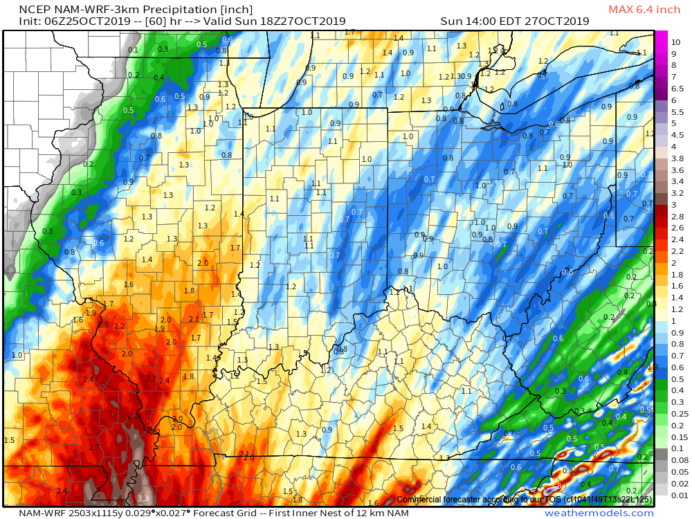
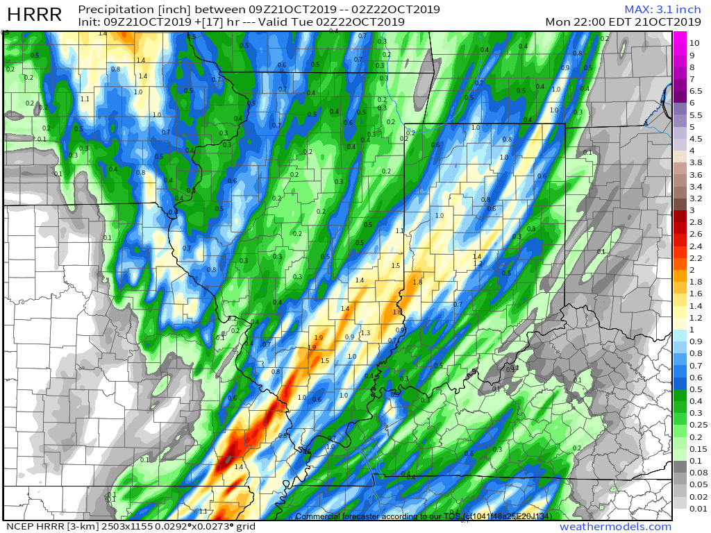
Rain Amounts: 1″ to 2″
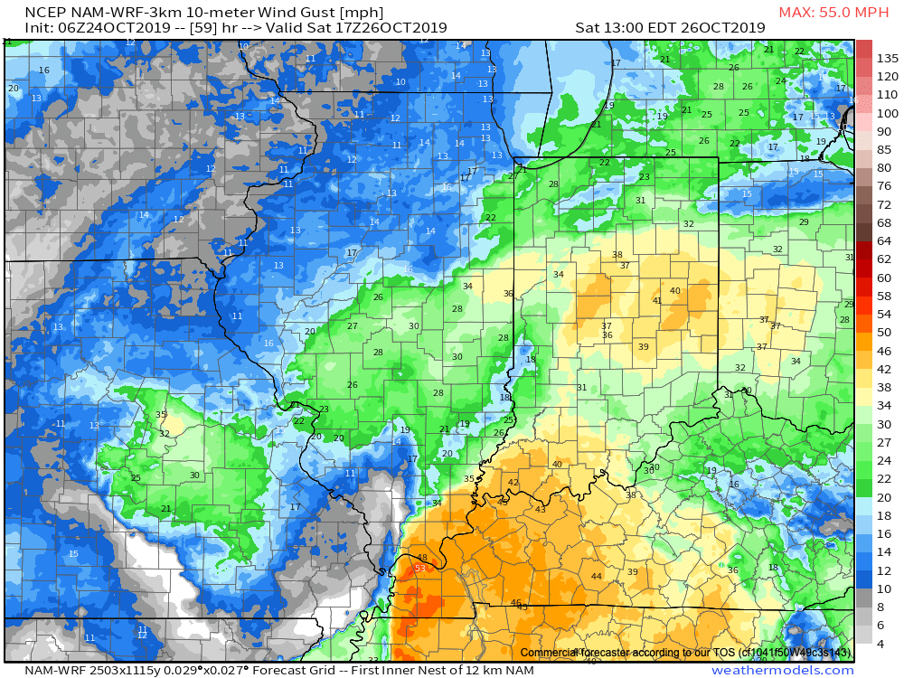
Wind: Variable 15-30 MPH with gusts to 45 MPH
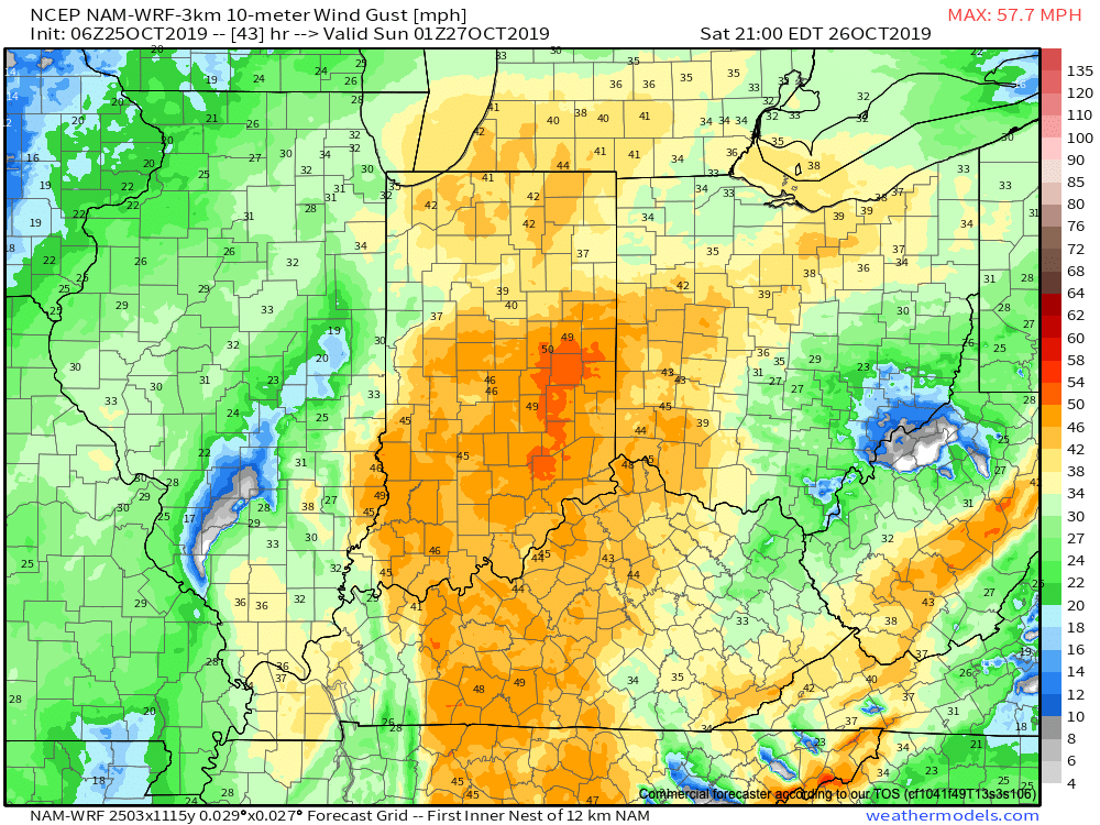
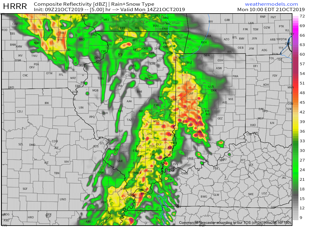
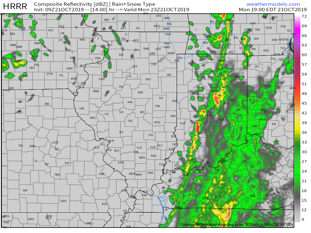
It continues to look like a significant rain and wind maker wants to take up residence across the Ohio Valley this weekend. Focusing more specific to central Indiana, Saturday is the day for the biggest impacts. A rather expansive rain shield will lift north across the state late tonight into Saturday morning, becoming heavy at times during the day Saturday. The other item to focus on is the wind. East winds will become strong and gusty during the day Saturday before shifting to the southeast, south, and eventually southwest as the area of low pressure moves very close to overhead. During this timeframe, winds may gust to 45 MPH Saturday night. Once the area of low pressure moves to our northeast, winds will shift around to the west Sunday morning and diminish. Overall, storm total rainfall amounts across central Indiana continue to look like they will check-in between 1″ and 1.5″ for most with a few locally heavier reports. The last of the rain will exit to the northeast before sunrise Sunday.