Category: Heavy Rain
 Enjoy Today; Very Busy Times Coming…Let’s get the easy and good stuff out of the way first- today will feature simply stunning weather conditions across the region. Wall-to-wall sunshine and temperatures climbing into the middle 60s after a chilly start! Enjoy!
A warm front will lift through the state late tonight and Thursday morning. This may help ignite scattered thunderstorms early Thursday morning. We’ll then see a “lull” in the action before additional waves of thunderstorms rumble in during the afternoon and evening. Some of these storms may reach severe limits with hail and damaging straight line winds of greatest concern.
A secondary area of low pressure will slowly traverse the Ohio Valley Friday and deliver widespread moderate to heavy rain. As the low scoots to our east, it’ll help pull much colder air into the area. Temperatures will fall through the day and rain will begin to mix with wet snow Friday night. While we won’t deal with accumulation here, areas from northern Indiana over to northern Ohio may pick up a light slushy accumulation of snow.
We’ll clear things out just in time for Saturday, but it’ll be a cool and breezy day, especially early. Most of Easter Sunday will also feature sunny and pleasant conditions, but moisture will increase late and we’ll mention the chance of showers by evening.
Early next week is back to the active regime with multiple waves of showers and thunderstorms Monday and Tuesday. Heavy rainfall and embedded strong to severe thunderstorms will be possible.
Upcoming 7-Day Precipitation Forecast:
- 7-Day Rainfall Forecast: 2.5″ – 3.5″
- 7-Day Snowfall Forecast: 0.00″
Permanent link to this article: https://indywx.com/2015/04/01/active-is-an-understatement/
We’re shifting gears into more of a spring like weather pattern over the course of the next 4-6 weeks. Things appear to get rather active and warmer than average, as…
You must be logged in to view this content. Click Here to become a member of IndyWX.com for full access. Already a member of IndyWx.com All-Access? Log-in here.
Permanent link to this article: https://indywx.com/2015/03/30/warmer-and-stormy-look/
Good morning and happy Friday! A wet day is on tap as moisture streams north from the Gulf of Mexico. Periods of heavy rain will be a good bet, especially…
You must be logged in to view this content. Click Here to become a member of IndyWX.com for full access. Already a member of IndyWx.com All-Access? Log-in here.
Permanent link to this article: https://indywx.com/2015/03/13/rain-gear-needed-push-for-70-next-week/
You must be logged in to view this content. Click Here to become a member of IndyWX.com for full access. Already a member of IndyWx.com All-Access? Log-in here.
Permanent link to this article: https://indywx.com/2015/03/12/wet-friday-coming/
 Great Day Today…Patchy dense fog will give way to sunshine quickly today along with mild temperatures! Be sure to enjoy as clouds will lower and thicken tonight and give way to a soaker of a Friday. We anticipate a wash out Friday, complete with heavy rain from late morning into the afternoon and evening. We may even hear a rumble of thunder Friday evening. The good news here is that models are trending drier for now Saturday. We’ll mention morning rain, but sunshine should increase through the second half of the day. Sunday will be a fantastic day!
A cold front will move through the region Tuesday and could offer up a shower, but most folks should remain dry. Cooler air will filter in here behind the front, but nothing too out of the ordinary for this time of year.
We target later next week for potentially much colder air…
Upcoming 7-Day Precipitation Forecast:
- 7-Day Rainfall Forecast: 1.00″ – 1.50″
- 7-Day Snowfall Forecast: 0.00″
Permanent link to this article: https://indywx.com/2015/03/12/beautiful-day-before-more-rain/
Forecast models are coming around to a more aggressive, wetter, solution for Tuesday. As such, we’ll hit the rain a little harder in our forecast. Anticipate a wet afternoon, especially…
You must be logged in to view this content. Click Here to become a member of IndyWX.com for full access. Already a member of IndyWx.com All-Access? Log-in here.
Permanent link to this article: https://indywx.com/2015/03/09/milder-air-and-rain/
 Mostly Quiet Weather For Now…A weak weather system will once again scoot by to our north later today. While this may increase our cloud cover this afternoon and evening, most, if not all, of the precipitation should remain north of our immediate region. Best chances of seeing a light shower later today will be across the northern third of the state. We’re back to sunshine Monday!
The first of two weather systems will impact the state Tuesday. We’ll introduce the chance of a shower across central Indiana, but most of the area will be dry. More widespread rains will fall across southern and southeastern portions of the state.
The story for mid week remains the delightful weather conditions- dry, sunny, and mild! We’ll gladly welcome 55-60 temperatures Wednesday and Thursday!
A significant storm system will lift north out of the Gulf of Mexico late week and deliver widespread moderate to heavy rains Friday into Saturday. Heavy rain is likely to close the week, but model data differs on just how fast the rain will diminish as we move into the weekend. Stay tuned.
Upcoming 7-Day Precipitation Forecast:
- 7-Day Snowfall Forecast: 0.00″
- 7-Day Rainfall Forecast: 1.00″ – 1.50″
Permanent link to this article: https://indywx.com/2015/03/08/relatively-quiet-week-until-late-in-the-period/
-
Filed under 7-Day Outlook, Arctic Cold, European Model, Forecast, Heavy Rain, Rain, snow, Unseasonably Cool Weather, Unseasonably Warm, Windy
-
March 7, 2015
 Spring Fever Anyone?! A weak weather system is racing through the region this morning. Clouds and gusty southwest winds are accompanying this, but the air mass is too dry to sustain any sort of precipitation (with the exception of a snow flurry across northern portions of the state). Sunshine should increase as we progress from morning into the afternoon hours. Although we’ll remain colder than average this weekend, highs in the lower 40s will feel downright balmy when compared to the bitterly cold times we’ve gone through over the past several weeks.
Early next week will feature a wet weather maker move northeast out of the Deep South, but this should remain east of our region. We note the European model tries to deliver some light rain Tuesday, but for now we’ll keep our forecast rain-free and dry.
A real surge of “spring fever” will push in here by the middle of the week with highs in the middle 50s Wednesday and upper 50s Thursday (some areas will touch 60 Thursday). White Leg Warnings will have to be issued, no doubt ;-).
Unfortunately, weather conditions will take a dramatic turn downhill late week into the weekend as a big storm system lifts north out of the Gulf of Mexico. Colder and raw times are ahead, including a gusty wind-driven rain. Moderate to heavy rainfall totals appear to be a good bet from 6-7 days out.
Upcoming 7-Day Precipitation Forecast:
- 7-Day Rainfall Forecast: 0.50″ – 1.00″
- 7-Day Snowfall Forecast: 0.00″
Permanent link to this article: https://indywx.com/2015/03/07/now-were-talking/
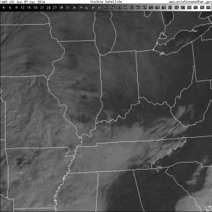
1.) It’s nice to see the sun for once. While we’ll still have mid and high level cloudiness to deal with later today, we’ll gladly take what we can get of the good ole vitamin D this time of the year!

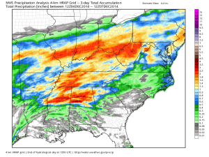
2.) Rain over the Thursday-Friday period followed along very closely to what modeling suggested. Heaviest rains fell central and south.

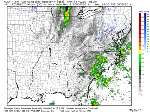
3.) A cold front will move through Monday evening with a few showers, gusty winds, and set up a cold week, overall.

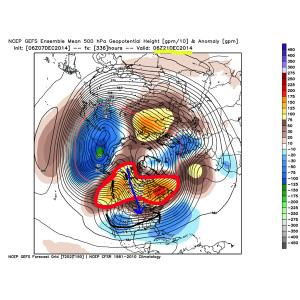
4.) In the long range, we continue to really like the looks of things from a winter weather lover’s point of view. Undercutting jet supplying storm potential, arctic intrusion, and a blocky look… Details will have to be sorted through as time draws closer, but from this perspective, the pattern continues to look like it’s heading towards one capable of widespread colder than normal air and winter storm potential Christmas week.

Permanent link to this article: https://indywx.com/2014/12/07/sunday-morning-rambles-3/
First, be sure and scroll down to the next post (from Thursday night) on our long range thinking. We’re focusing on a wet 24 hours ahead, Hoosiers. Rain will build…
You must be logged in to view this content. Click Here to become a member of IndyWX.com for full access. Already a member of IndyWx.com All-Access? Log-in here.
Permanent link to this article: https://indywx.com/2014/12/05/wet-stretch-ahead/
 Enjoy Today; Very Busy Times Coming…Let’s get the easy and good stuff out of the way first- today will feature simply stunning weather conditions across the region. Wall-to-wall sunshine and temperatures climbing into the middle 60s after a chilly start! Enjoy!


