Quick short-term update this morning to discuss the potential of severe weather later this evening and into the nighttime hours. (We’ll have a more in-depth video update posted this evening, including longer range thoughts).
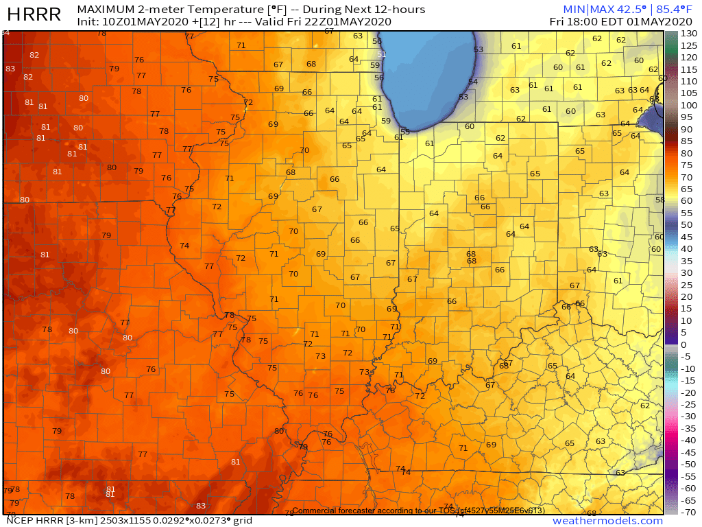
This morning has featured a few rain showers scattered about central Indiana, but the heavier, more organized, rain from the overnight is long gone (for now). While showers will impact central Indiana at times into the early afternoon hours, it’s not until late evening and the nighttime hours that we anticipate more organized shower and thunderstorm activity. Given the ingredients in place, there’s the potential of a few rotating storms tonight and subsequent risk of tornadoes. Sunshine, or not, it’ll be important to remain weather-aware tonight and have a means of getting the latest warnings that may be issued. Should we see a period of sunshine later this afternoon, the threat of severe weather will be elevated tonight.
The Storm Prediction Center (SPC) includes central and western portions of the state in a Slight Risk of severe weather in their most recent Day 1 Outlook.
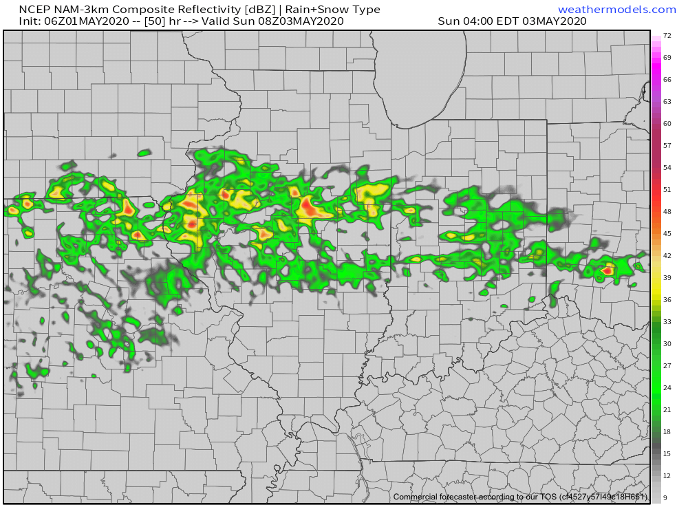
The window of severe weather potential appears to come after 8p for central Indiana, continuing into the overnight hours.
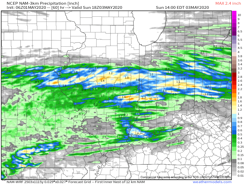
Locally heavy rain will shift from western Indiana (tonight) into the eastern half of the state (Monday). Widespread 1″ to 2″ of additional rain is likely.
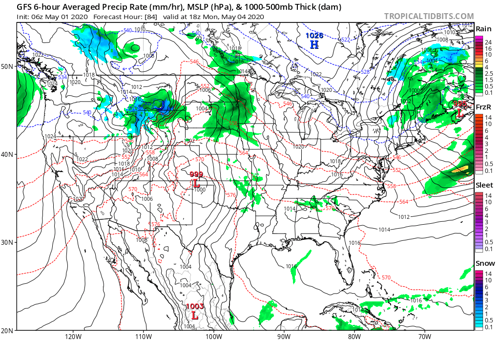
As the upper low “cuts off” early-mid week, shower chances will continue along with cooler temperatures.
Make it a great Sunday! Chat with y’all a bit later today!