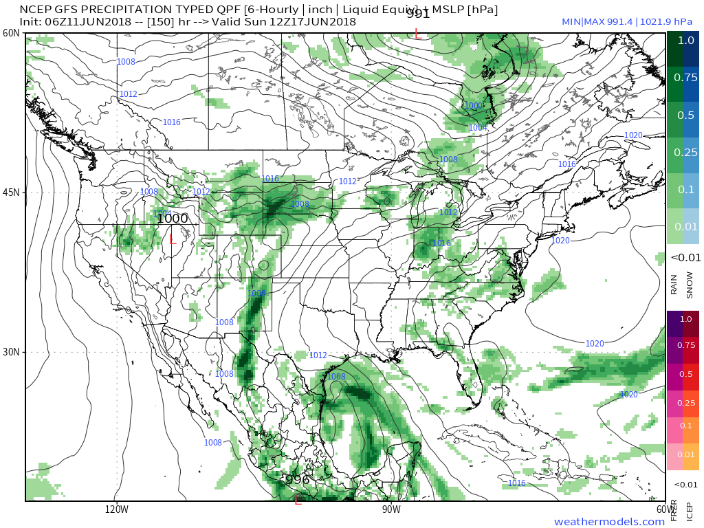
It was a tale of two worlds across the state on Friday. Despite a couple of non-severe, gusty showers that impacted western portions of the state Friday evening, the majority of the “excitement” took place in the eastern half of the state. Multiple large hail, wind, and tornado reports were included along with heavy rain. When we look at storm total rainfall through 8a today, we note widespread 2″ to 3″ amounts across eastern Indiana. Muncie recorded amounts in excess of 3″!
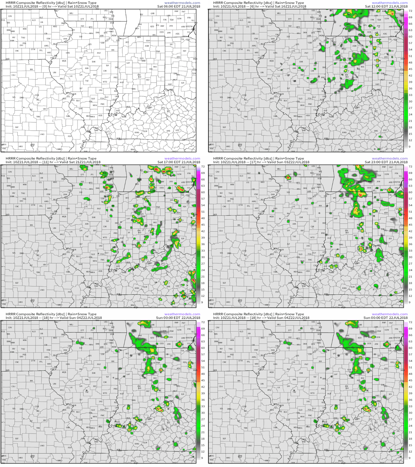
 As we look ahead, our weekend weather will continue to be dominated by a “cut off” area of low pressure. As it meanders around the region, shower and thunderstorm chances will remain. Aerial coverage of rain will reach greatest heights during the afternoon and evening hours today and Sunday. With the colder air aloft, don’t be surprised if a few of the stronger showers produce hail.
 Additionally, highs today will run close to 10° below the average high of the mid-80s.
As we open up the new week, showers and embedded thunder will also be around Sunday before the upper low begins to lose it’s influence on the region. We’ll maintain shower chances into the new work week, but overall coverage should be diminished Monday.

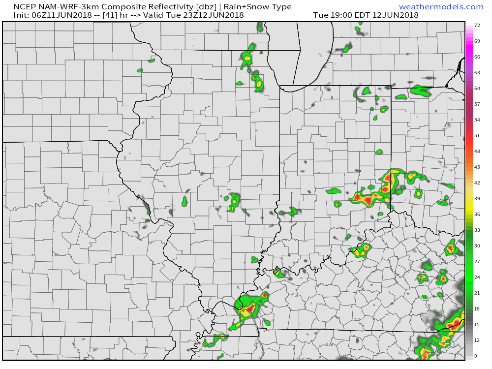
Shower and embedded thunder chances remain Sunday. Image courtesy of weathermodels.com.
A couple of cold fronts will make a run at the Ohio Valley over the upcoming week. The first will pass through during the midweek stretch, followed by a stronger frontal passage as we get ready to head into the weekend. Each front will provide a shower/ thunderstorm threat. A stronger push of pleasantly refreshing air should arrive behind front number 2 as we head into next weekend.
On the temperature note, models continue to show a cooler than average pattern as we open August.
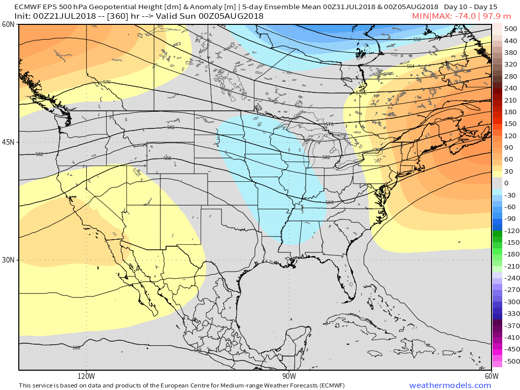
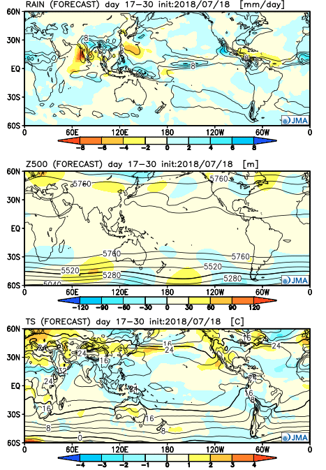
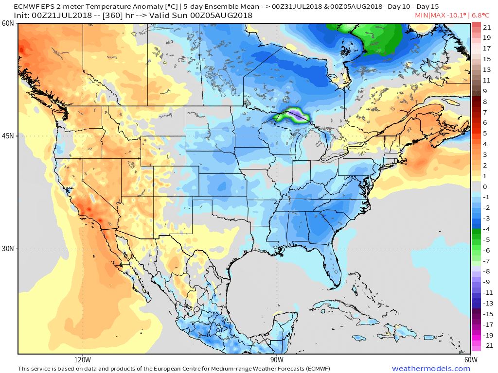 Longer term, the NEW JMA Weeklies suggest the worst of the summer heat is now behind us as they keeps the Weeks 3-4 time period unseasonably refreshing…

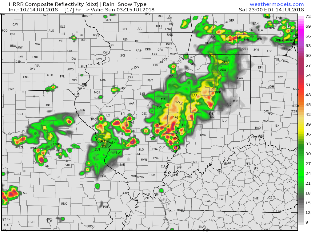
 We’ll notice thunderstorms becoming more numerous for our friends in Illinois through the afternoon and evening, but central Indiana should remain mostly dry until tonight. Forecast radar products want to bring these storms into the state after the 7p to 8p time frame. We’ll keep close tabs on radar trends this afternoon.
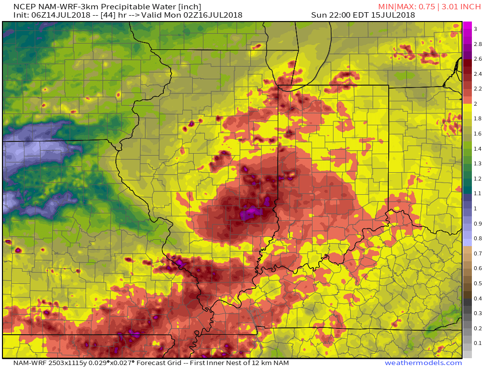
 (Again, with high moisture content, any thunderstorm that passes through your neighborhood will be capable of producing torrential rainfall). For that matter, the same story can be said with storms that develop Sunday and Monday, as precipitable water values will remain around 2″ until the front sweeps through the state.
 Overall, dry conditions should prevail until late next weekend when a secondary, even stronger, front will make a run at the region. We’ll ramp storm chances back up ahead of this expected front and the air mass behind the boundary in the Week 2 time period will be even cooler than we we’ll enjoy the middle part of the upcoming week.
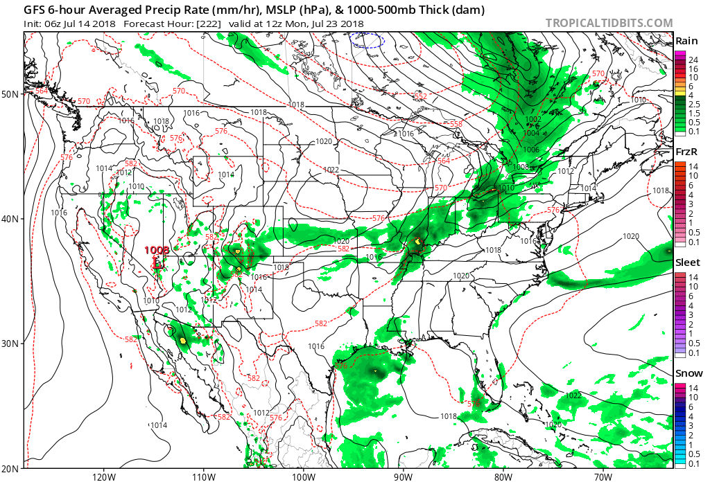 Speaking of cool, the pattern continues to look vastly different as we put a wrap on the month than what we’ve grown accustomed to over the past couple of weeks. Note the dominant trough the models show setting up shop over the Mid West…
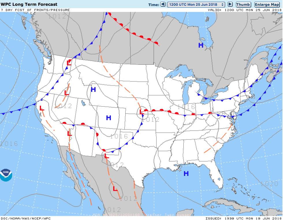
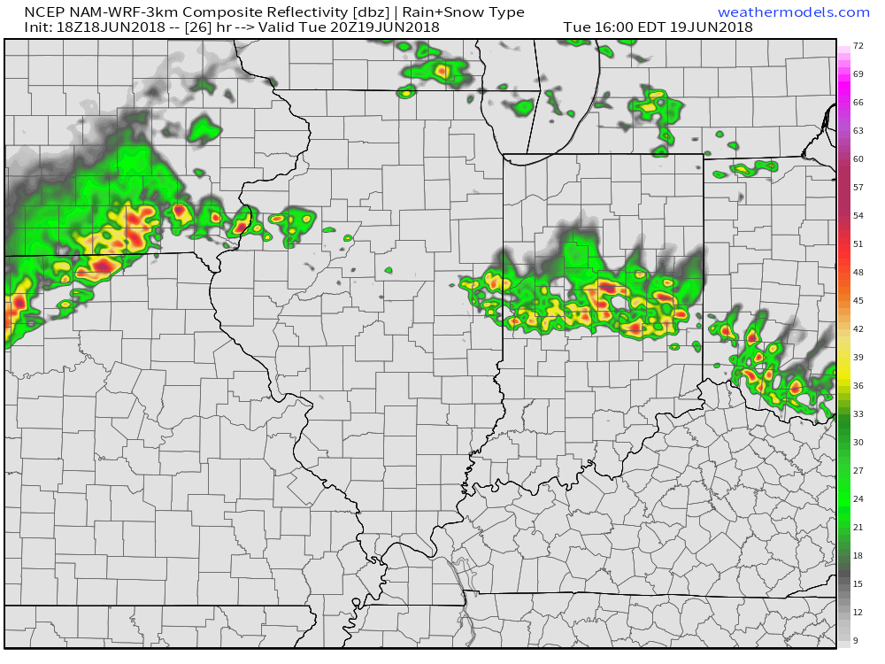 Despite cooler (still mighty humid) temperatures arriving, the overall pattern won’t change significantly into late week and this weekend. With the frontal boundary draped across the Ohio Valley, periods of showers and thunderstorms will remain in the forecast. At times, disturbances will track along the boundary and lead to increased coverage of storms. Perhaps Thursday and Friday will serve up the greatest coverage of thunderstorms as a surface wave moves out of the central Plains into the Great Lakes.
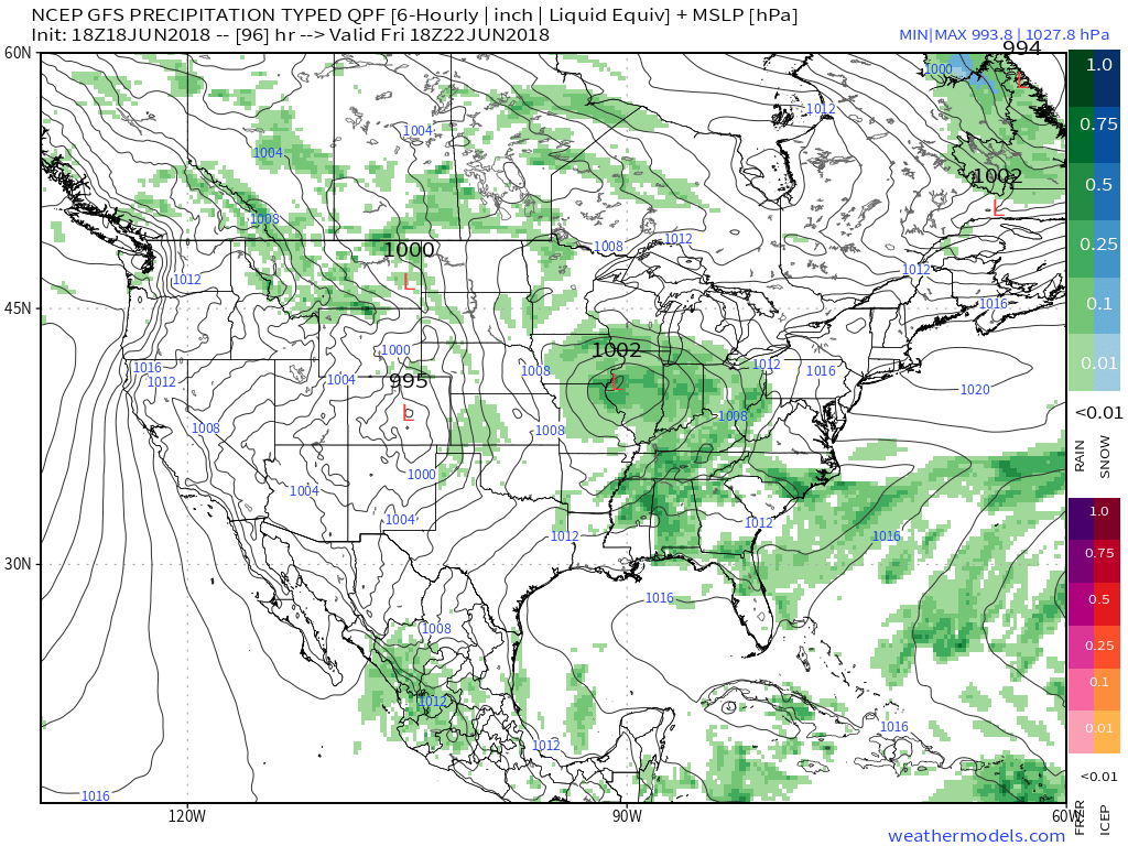 The combination of a juicy air mass and a stationary boundary draped overhead spells a flash flood risk. The lack of any sort of overall steering current suggests the potential of thunderstorms that may train over the same communities at times. As mentioned earlier, precipitable water values (PWATS) will approach and exceed 2″ and this will support torrential downpours at times.
 Officially, we think the upcoming 7-day period will deal out widespread 2″ to 3″ rainfall totals across central Indiana, but there will be locally heavier amounts where thunderstorms train.
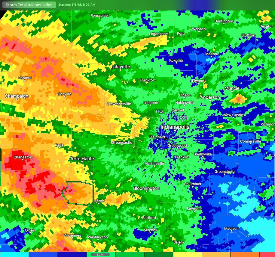 Moisture continues to stream across central and southern Indiana this morning, and some of this rain is falling at a moderate to heavy rate.
 Widespread rain will eventually come to an end later this afternoon before scattered showers and thunderstorms redevelop this evening into tonight. Potential is also present for the possibility of another thunderstorm complex impacting parts of the region late tonight into early Tuesday- especially across the southwest part of the state. Scattered thunderstorm chances will remain Tuesday (more of the splash and dash variety as opposed to a widespread soaker).
 Eventually, drier air will work into the state for midweek and rainfall coverage will diminish Wednesday and most of Thursday.