You must be logged in to view this content. Click Here to become a member of IndyWX.com for full access. Already a member of IndyWx.com All-Access? Log-in here.
Category: Heavy Rain
Permanent link to this article: https://indywx.com/2020/01/06/long-range-update-and-latest-weekend-thinking/
Jan 06
Gearing Up For A Busy Late Week-Weekend…
You must be logged in to view this content. Click Here to become a member of IndyWX.com for full access. Already a member of IndyWx.com All-Access? Log-in here.
Permanent link to this article: https://indywx.com/2020/01/06/gearing-up-for-a-busy-late-week-weekend/
Jan 05
VIDEO: Quiet Open To The Week Gives Way To A Busy Close…
You must be logged in to view this content. Click Here to become a member of IndyWX.com for full access. Already a member of IndyWx.com All-Access? Log-in here.
Permanent link to this article: https://indywx.com/2020/01/05/video-quiet-open-to-the-week-gives-way-to-a-busy-close/
Jan 04
MJO Flexes Its Muscles…
A highly amplified MJO through Phase 5 will lead to a mean trough across the west with a persistent ridge over the east coast over the next couple of weeks. Week 2 ensemble data correlates almost perfectly with the Phase 5 analog composite (albeit a bit colder in the west).

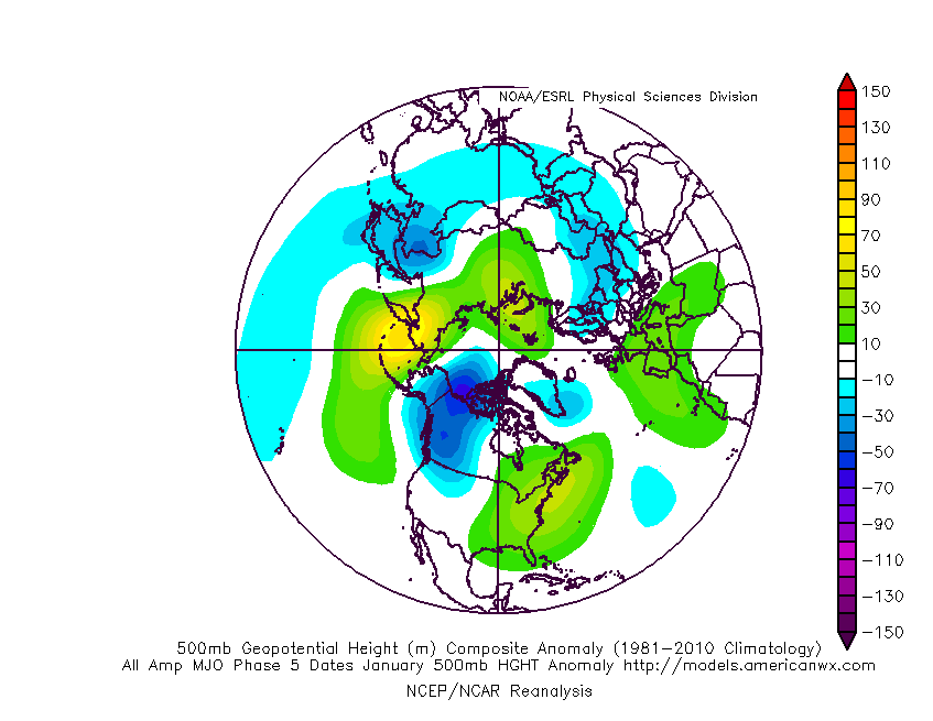

The end result will be a very active storm track across our portion of the country, sustained cold from the Plains and points west, and sustained warmth along the eastern seaboard. In between, we’ll remain in a transitional time of things with shots of warmth and cold (very “back and forth” regime, locally).

Precipitation will run well above average through 1/20, including periods of heavy rain with storm systems that track through the area.
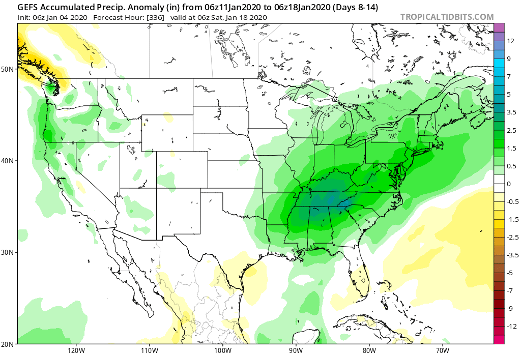
At times, we’ll need to monitor “waves” that move up along pressing boundaries into the eastern ridge. As cold periodically tries to push, it could present wintry challenges for portions of the Ohio Valley. Our first potential issue with this may present itself late next week.
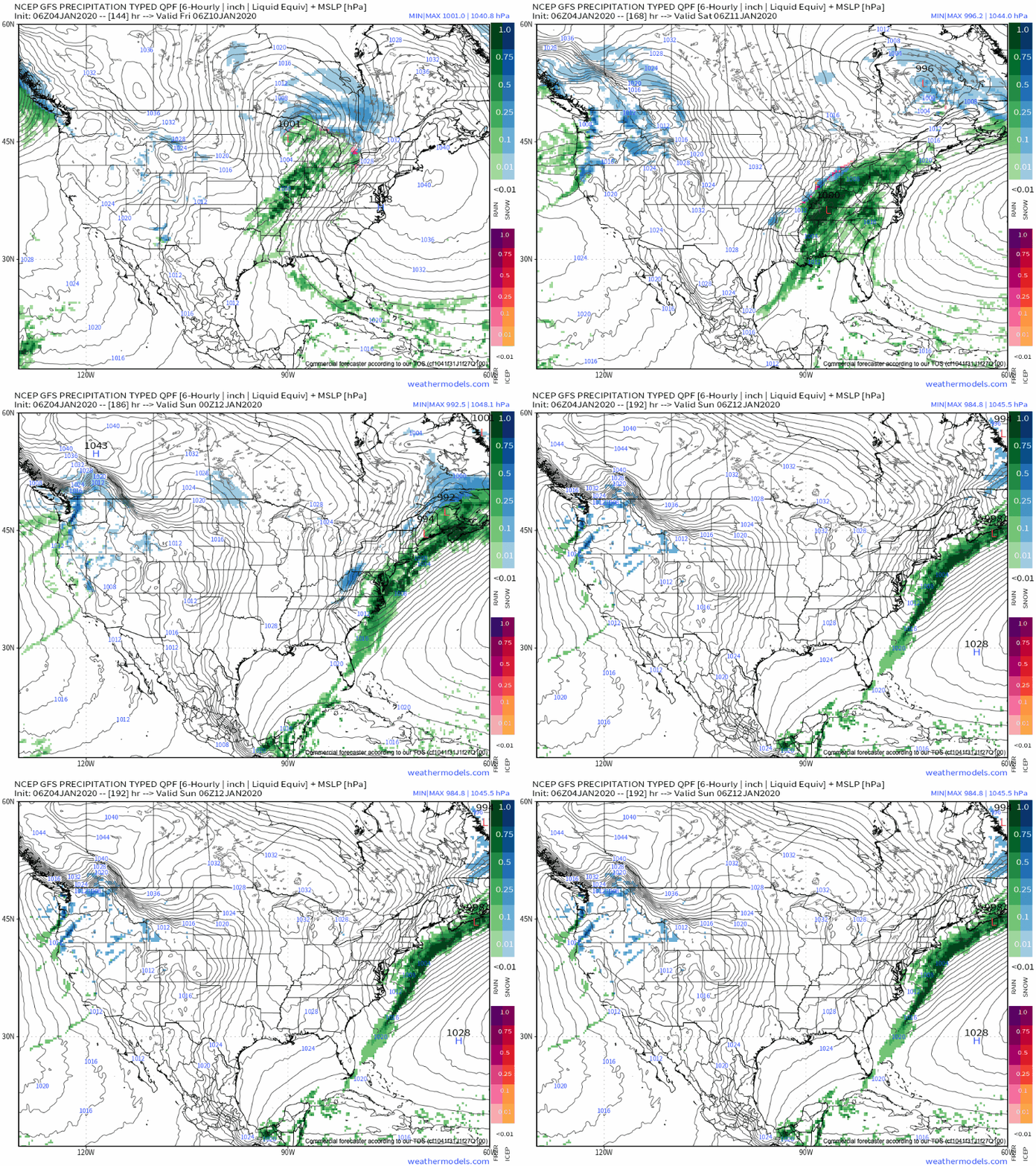
We’ll have to stay tuned to see if the MJO rumbles into the colder phases or circles back through the warm phases late month. As mentioned last night, it’s also worth keeping tabs on potential Scandinavian ridging down the road.
Fun times ahead.
Permanent link to this article: https://indywx.com/2020/01/04/mjo-flexes-its-muscles/
Dec 29
VIDEO: Wet Close To The Weekend; Wintry Threats Loom…
You must be logged in to view this content. Click Here to become a member of IndyWX.com for full access. Already a member of IndyWx.com All-Access? Log-in here.
Permanent link to this article: https://indywx.com/2019/12/29/video-wet-close-to-the-weekend-wintry-threats-loom/
Dec 28
VIDEO: Heavy Rain And Storms Arrive Tonight; Window Of Opportunity Opens For Wintry Mischief Early Jan…
You must be logged in to view this content. Click Here to become a member of IndyWX.com for full access. Already a member of IndyWx.com All-Access? Log-in here.
Permanent link to this article: https://indywx.com/2019/12/28/video-heavy-rain-and-storms-arrive-tonight-window-of-opportunity-opens-for-wintry-mischief-early-jan/
Dec 27
VIDEO: Heavy Rain Storm Blows Into Town This Weekend…
Our quiet weather pattern will come to a rather abrupt halt over the weekend as a heavy rain event unfolds late Saturday night through Monday morning. This evening’s video update walks through the various periods where more intense rainfall is expected:

Permanent link to this article: https://indywx.com/2019/12/27/video-heavy-rain-storm-blows-into-town-this-weekend/
Dec 27
Cooler Today; Heavy Rain Arrives Over The Weekend…
A cold front will slip south through central Indiana over the next couple of hours. This will result in a much cooler feel when compared to the past couple of days, but still milder than normal for late-December. We’ll note temperatures generally holding steady in the mid 40s before falling into the 30s this evening.
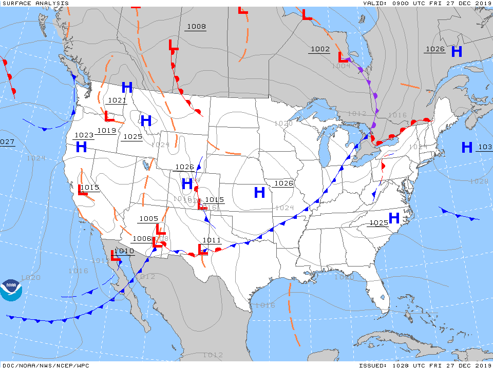
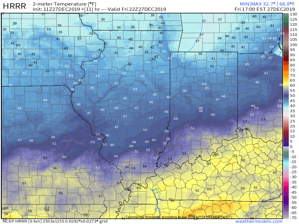
As we flip the page to Saturday, changeable weather can be expected by evening. For the majority of the daytime, expect considerable cloudiness and cool conditions. Our wind direction will back around to the south Saturday night and this will result in rising temperatures (into the lower 60s by Sunday morning) along with periods of showers and thunderstorms developing during the overnight hours into Sunday.
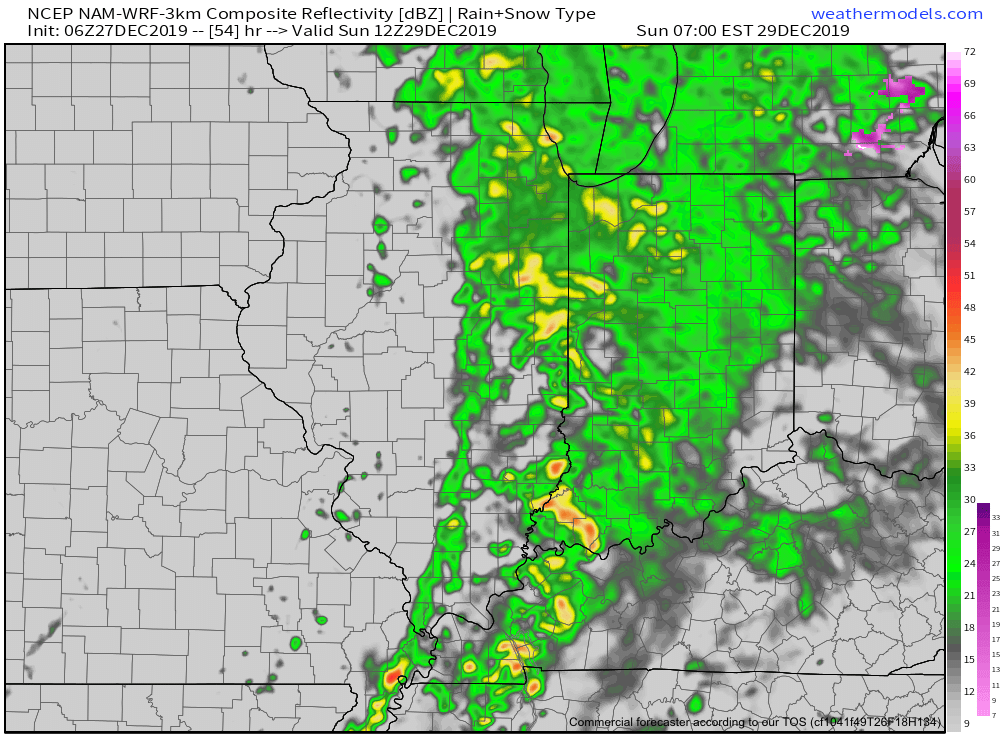
We’ll keep close eyes on a secondary wave of moisture that will develop Sunday afternoon. While it still appears as if the bulk of the heavy rain associated with this secondary wave will remain to our east, portions of east-central Indiana can expect heavier storm totals. The large majority of central Indiana can expect total rainfall amounts of 0.75” to 1.25”, with 1.25” to 2” across east and southeast areas.

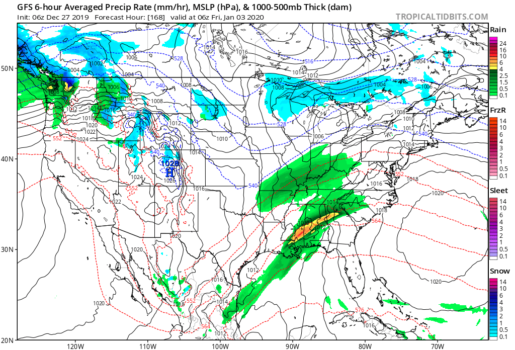
We’ll turn windy and colder for New Year’s Eve (northwest gusts of 30-40 MPH), but dry things out. Our next system of note won’t arrive until late next week.
More later this evening in our latest video update. Make it a great Friday!
Permanent link to this article: https://indywx.com/2019/12/27/cooler-today-heavy-rain-arrives-over-the-weekend/
Dec 26
Evening Video Update: “Different” Feel Friday Is Replaced By Sunday Morning Thunder; Colder Next Week…
You must be logged in to view this content. Click Here to become a member of IndyWX.com for full access. Already a member of IndyWx.com All-Access? Log-in here.
Permanent link to this article: https://indywx.com/2019/12/26/evening-video-update-different-feel-friday-is-replaced-by-sunday-morning-thunder-colder-next-week/
Nov 29
VIDEO: Heavy Rain Arrives Saturday; Walking Through The 1st Week Of December…
You must be logged in to view this content. Click Here to become a member of IndyWX.com for full access. Already a member of IndyWx.com All-Access? Log-in here.
Permanent link to this article: https://indywx.com/2019/11/29/video-heavy-rain-arrives-saturday-walking-through-the-1st-week-of-december/
