You must be logged in to view this content. Click Here to become a member of IndyWX.com for full access. Already a member of IndyWx.com All-Access? Log-in here.
Category: Heavy Rain
Permanent link to this article: https://indywx.com/2020/10/26/video-zeta-heads-for-the-central-gulf-coast-tracking-2-rounds-of-rain-locally-and-a-much-drier-cooler-weekend/
Oct 25
Chilly And Damp Open To The Work Week Gives Way To Heavier Rain Midweek; Dry, Cool Halloween On Deck…
Considerable cloudiness will be around today, but we should hold off on any significant rainfall until Monday (only expecting sprinkles or areas of drizzle beforehand). It’ll be a chilly day with highs struggling to make it out of the 40s today.

As we move into Monday, the first of 2 waves of moisture will overspread the state. We think a more widespread shield of rain (still primarily on the light side) will arrive early-to-mid afternoon, continuing into Tuesday morning.
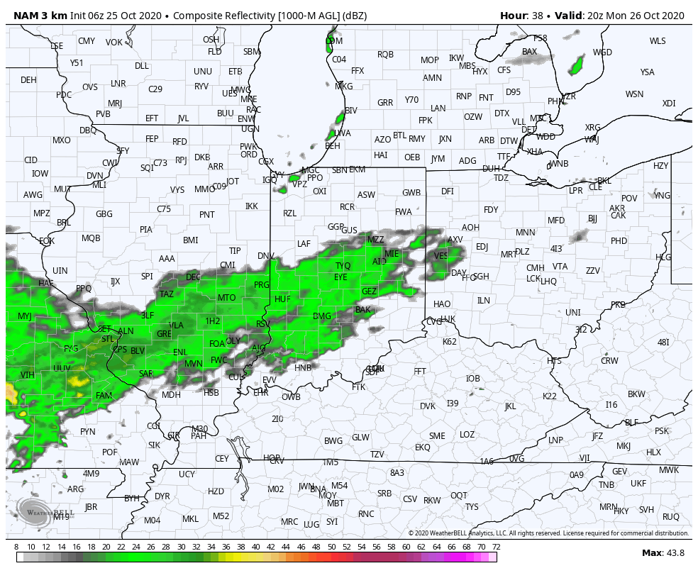
In general, rainfall amounts should check-in between 0.25″ and 0.40″ across central Indiana with this “1st wave” (most of which falls Monday PM).

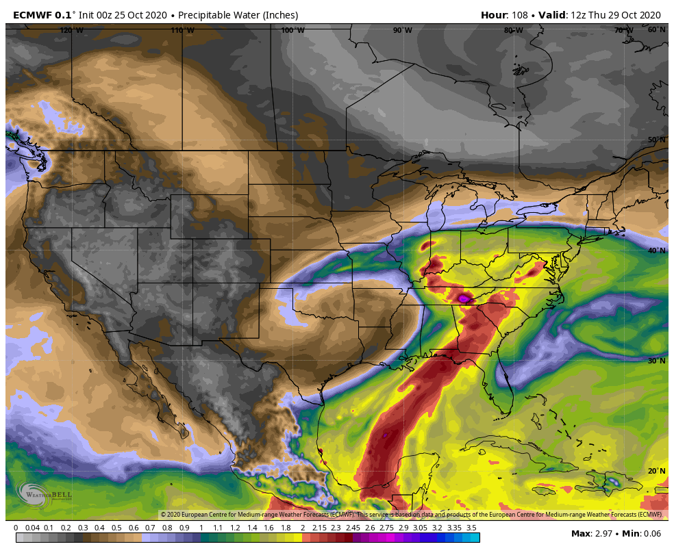
Things become more complex by midweek as a stronger surface low moves out of the Plains and across the Ohio Valley. Additionally, we’ll need to keep close eyes on Zeta’s remnants as it’s possible the aforementioned storm system could pull the remnant tropical moisture into the mix. Regardless of whether or not tropical moisture directly or indirectly gets involved, a period of heavy rain is likely Wednesday evening through the day Thursday.

Precipitable water values will approach 2″ for a period of time midweek, supporting the likelihood of heavy rainfall. (Also note the deep, tropical plume feeding into the Southeast region, courtesy of Zeta’s remnants).
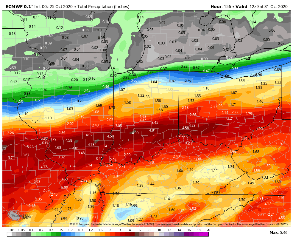
Additional rainfall midweek should be in the 1.5″ to 2.5″ range for most of the region, but locally heavier amounts are possible, especially across southern portions of the state.
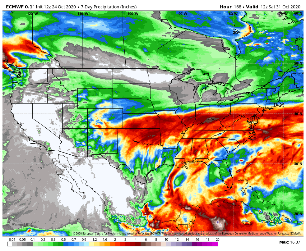
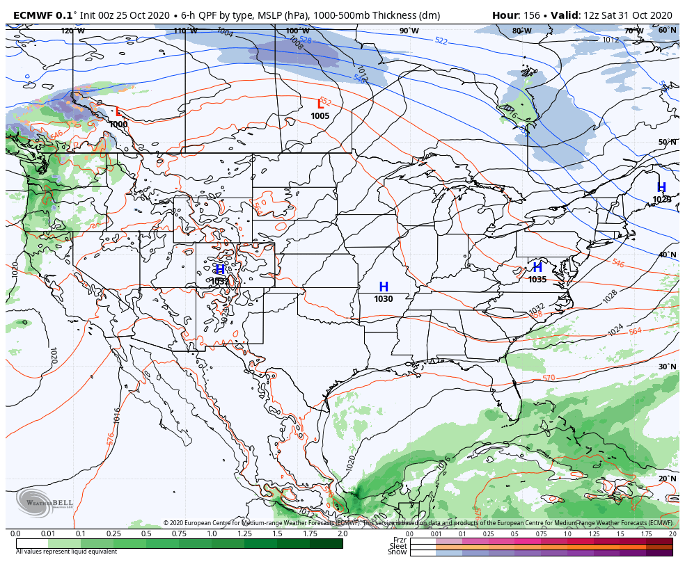
We’ll clear all of this mess out of here as we head into the weekend and we still believe we’re looking at ideal Halloween weather- dry, crisp, and sunny, thanks to a sprawling area of high pressure.
Permanent link to this article: https://indywx.com/2020/10/25/chilly-and-damp-open-to-the-work-week-gives-way-to-heavier-rain-midweek-dry-cool-halloween-on-deck/
Oct 22
VIDEO: Storms Ignite Ahead Of Sharply Colder Air Friday PM; Looking Into Early November…
You must be logged in to view this content. Click Here to become a member of IndyWX.com for full access. Already a member of IndyWx.com All-Access? Log-in here.
Permanent link to this article: https://indywx.com/2020/10/22/video-storms-ignite-ahead-of-sharply-colder-air-friday-pm-looking-into-early-november/
Oct 21
VIDEO: No Changes To The Idea Of A Very Active Close To The Month; Timing Out Storms To End October…
You must be logged in to view this content. Click Here to become a member of IndyWX.com for full access. Already a member of IndyWx.com All-Access? Log-in here.
Permanent link to this article: https://indywx.com/2020/10/21/video-no-changes-to-the-idea-of-a-very-active-close-to-the-month-timing-out-storms-to-end-october/
Oct 20
Evening Client Video: From “Drought To Flood” Tonight For Some, Unfortunately; Early Next Week Also Presents A Problem…
You must be logged in to view this content. Click Here to become a member of IndyWX.com for full access. Already a member of IndyWx.com All-Access? Log-in here.
Permanent link to this article: https://indywx.com/2020/10/20/evening-client-video-from-drought-to-flood-tonight-for-some-unfortunately-early-next-week-also-presents-a-problem/
Oct 18
VIDEO: Heavy Rain Overspreads South-Central Indiana Tonight; Unsettled Week Ahead…
You must be logged in to view this content. Click Here to become a member of IndyWX.com for full access. Already a member of IndyWx.com All-Access? Log-in here.
Permanent link to this article: https://indywx.com/2020/10/18/video-heavy-rain-overspreads-south-central-indiana-tonight-unsettled-week-ahead/
Oct 17
VIDEO: Gearing Up For An Active Week…
You must be logged in to view this content. Click Here to become a member of IndyWX.com for full access. Already a member of IndyWx.com All-Access? Log-in here.
Permanent link to this article: https://indywx.com/2020/10/17/video-gearing-up-for-an-active-week/
Sep 13
Extended Dry Period…
IND is now running more than 1.2″ below normal for the month and this is coming off a dry finish to August.
Note the localized, but significant, area of bone dry conditions extending east from eastern IL across central Indiana (while surrounding areas have cashed in on significant rains over the past 30 days):
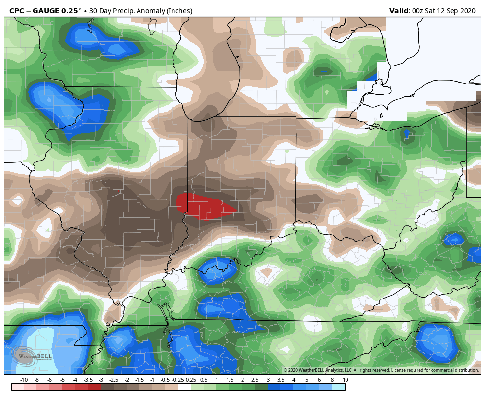

The upcoming 7-days won’t offer up much relief from the dry conditions as high pressure dominates. Even the mid-to-late week cold front should pass through the region mostly dry.
Most guidance only drops between a trace and 0.10″ of rain on central Indiana over the next (10) days as the dry pattern rolls along. The GFS and European ensemble products highlight the dry regime well:


Ironically, the overall pattern should shift in dramatic fashion as autumn matures and heads into winter. We still expect an about face late autumn as the wet anomalies paint themselves across our region as the southeast turns dry, thanks to the La Nina pattern…
Permanent link to this article: https://indywx.com/2020/09/13/extended-dry-period/
Sep 12
VIDEO: Soon-To-Be Sally Heads For The North-Central Gulf Coast; Pattern Takes An Active Turn Towards Late Month…
You must be logged in to view this content. Click Here to become a member of IndyWX.com for full access. Already a member of IndyWx.com All-Access? Log-in here.
Permanent link to this article: https://indywx.com/2020/09/12/video-soon-to-be-sally-heads-for-the-north-central-gulf-coast-pattern-takes-an-active-turn-towards-late-month/
Aug 27
Long Range Update: Meteorological Fall Opens On A Very Active Note…
Before we dive into our latest long range discussion, Laura continues to track north this morning through western Louisiana, and remains a category 2 as of the latest update (5a eastern time). Our thoughts and prayers are with all of those affected by Laura as they wake up this morning and begin to see the horror left behind from this beast of a storm.
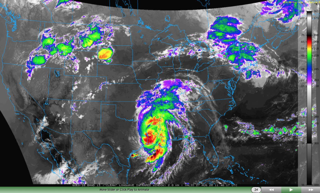
Laura will take a hard “right” turn Friday and deliver gusty winds and heavy rain to the TN Valley and into the mid-Atlantic through the weekend.

We won’t deal with any impacts from Laura’s remnants up this far north, but we will increase coverage of shower and thunderstorm activity now through Saturday evening. This is thanks to a warm, sultry airmass in place along with an approaching cold front. As that boundary drives through the region Saturday evening, a much drier airmass will arrive for the 2nd half of the weekend.

Rainfall amounts between this afternoon through Saturday afternoon should top out between 0.50″ and 1″ for most, but there will be localized 1″ to 2″ totals in the heavier storms.
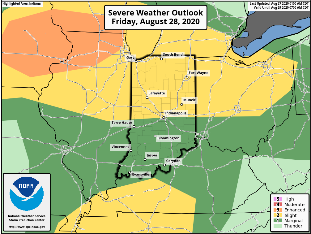
Friday will also pose a severe weather threat across the state, including the potential of damaging straight line winds as a couple “bowing” segments that move from the upper Midwest into the central Ohio Valley.
As we look ahead, we’re tracking 3 significant cold fronts between now and September 10th:
I. Aug. 29th
II. Sept. 3rd
III. Sept. 10th
Each of these cold fronts will be capable of producing strong storms and locally heavy rain, and behind each boundary, the air will grow cooler and cooler. While “transitional” warmth (relative to normal) is likely ahead of the boundaries, the first 1/3 of September should run cooler than normal across our region. Things also looks MUCH wetter than normal through the upcoming couple of weeks- a byproduct of the busy nature of the pattern.
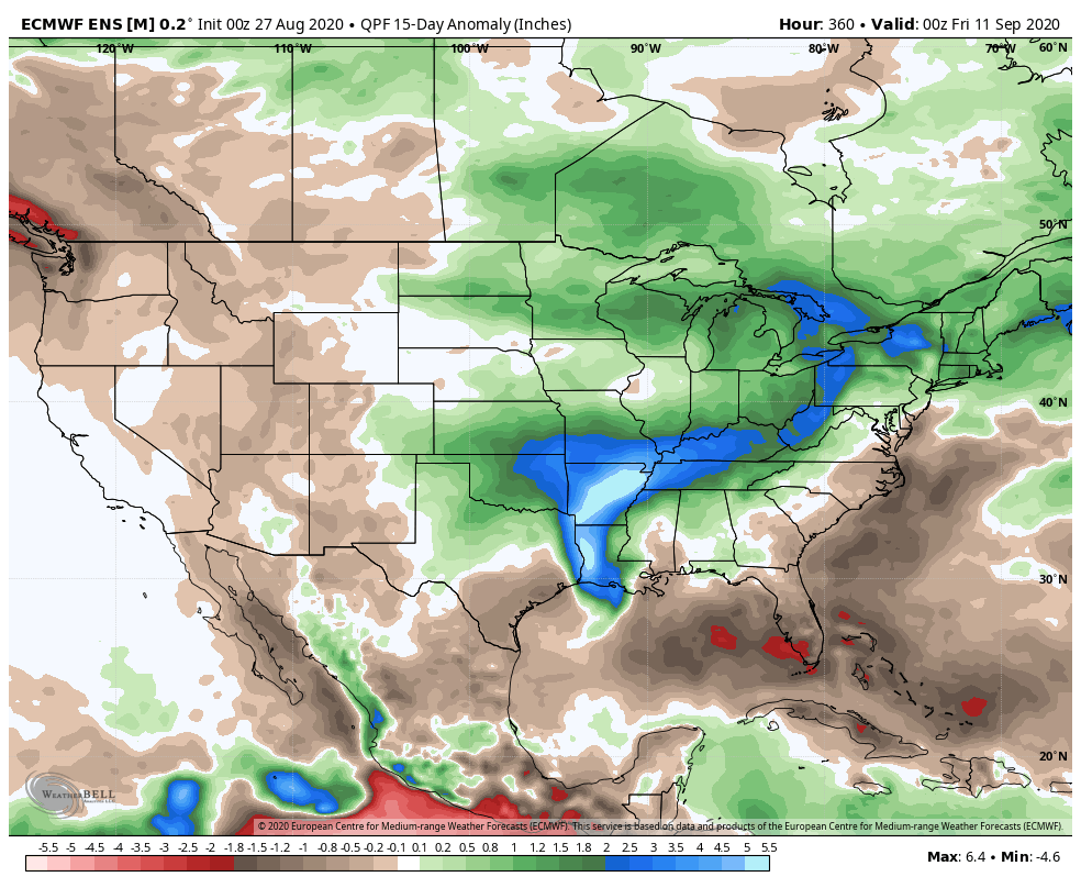
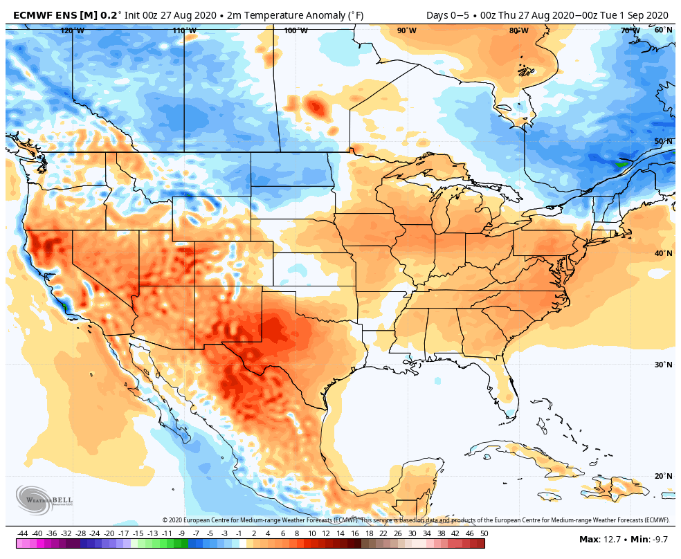
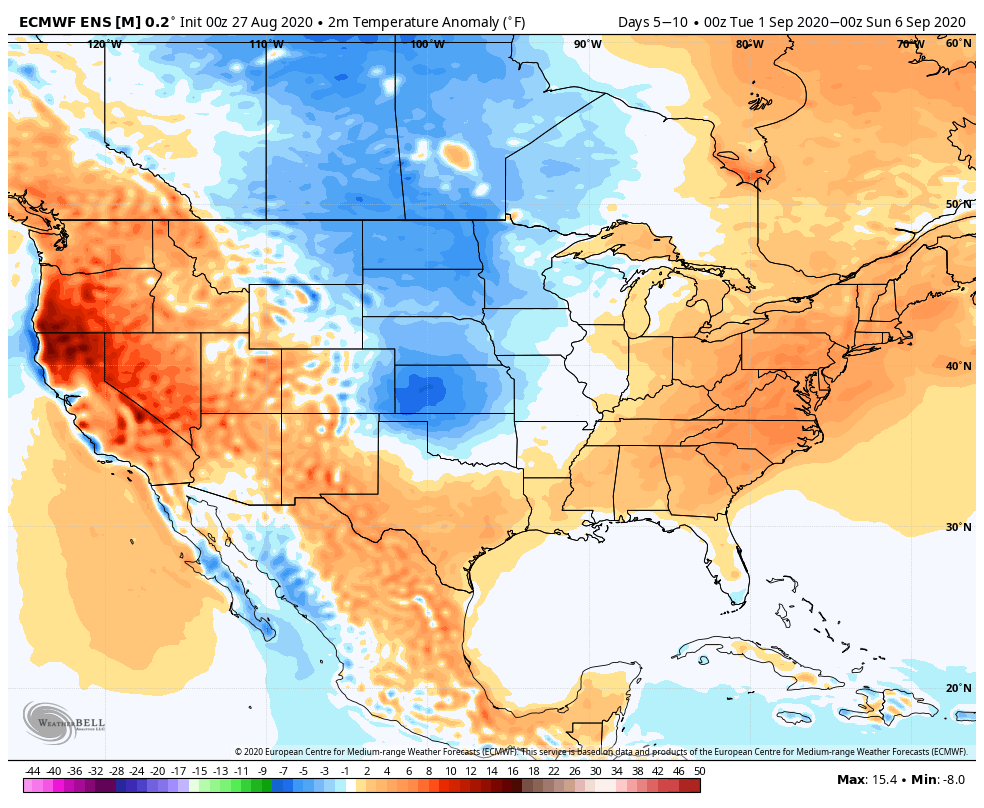
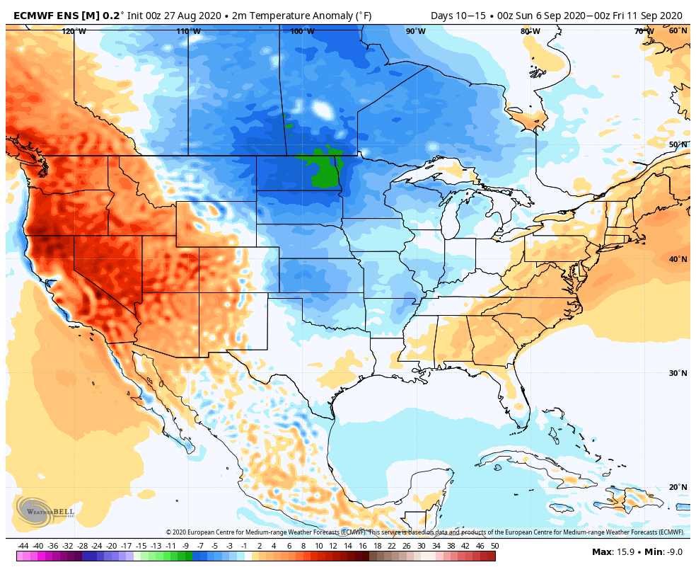
Note how the latest JMA Weeklies are also similar handling the pattern (we’ll take the week-by-week snap shots into our video a bit later) over the upcoming 3-4 weeks:
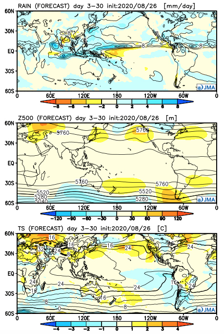
One more item of note, the tropics aren’t done, unfortunately. There should be another hurricane threat in the medium to longer range period (early September) and early thoughts here include that threat centering more on the East Coast vs. the Gulf.
Permanent link to this article: https://indywx.com/2020/08/27/long-range-update-meteorological-fall-opens-on-a-very-active-note/
