Friday Morning Thoughts…

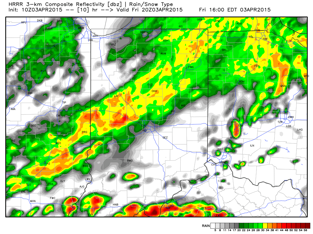
1.) First and foremost, our thoughts and prayers go out to our neighbors to our south this morning as a serious flood situation is underway.

Unfortunately, more rain is ahead today and will include our region across central Indiana.  Waves of rain and embedded thunder will continue into the evening.

1

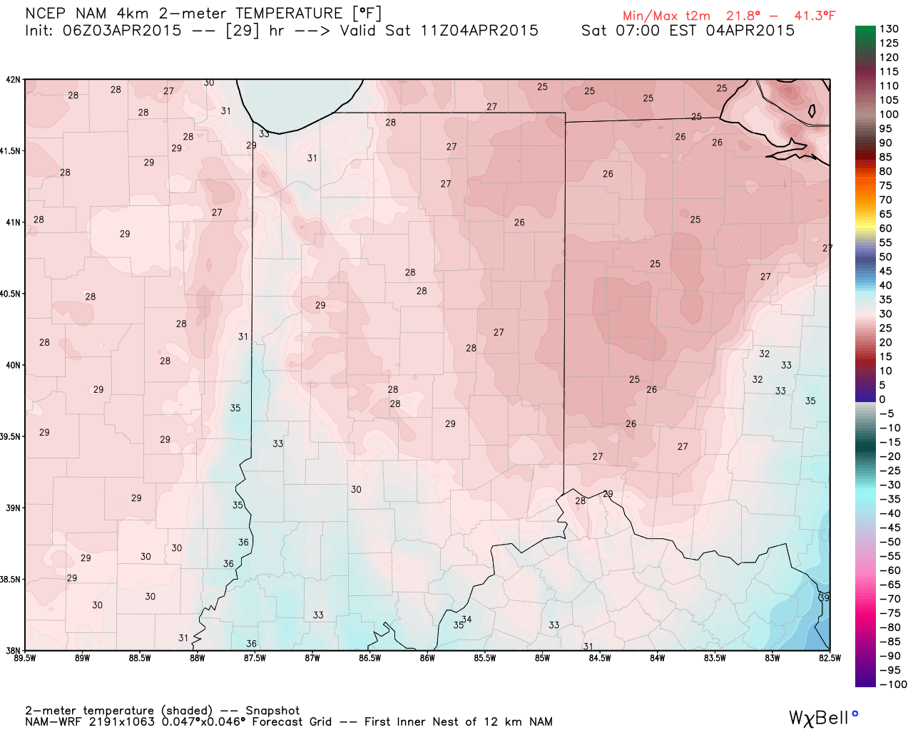
2.) A much colder air mass will arrive this afternoon and evening along with a gusty northwest wind.  Wind chills will fall into the 20s by evening.  Eventually we’ll bottom out in the upper 20s Saturday morning.

3

3.) Easter weekend will feature beautiful weather across the area, thanks to high pressure.  Though it’ll be cold Saturday morning, lots of sunshine will warm us quickly.

2

4.) Wet and stormy times return next week, including multiple days of heavy rain potential and possibly strong to severe thunderstorms.  In short, a very active week is on deck.

4

Wet And Stormy At Times…

The Storm Prediction Center has placed all of central Indiana under a Slight Risk of severe weather today, and included southwestern Indiana under an enhanced risk.    While some noisy…

You must be logged in to view this content. Click Here to become a member of IndyWX.com for full access.  Already a member of IndyWx.com All-Access?  Log-in here.

Active Is An Understatement…

Screen Shot 2015-04-01 at 7.25.50 AMEnjoy Today; Very Busy Times Coming…Let’s get the easy and good stuff out of the way first- today will feature simply stunning weather conditions across the region.  Wall-to-wall sunshine and temperatures climbing into the middle 60s after a chilly start!  Enjoy!

A warm front will lift through the state late tonight and Thursday morning. This may help ignite scattered thunderstorms early Thursday morning.  We’ll then see a “lull” in the action before additional waves of thunderstorms rumble in during the afternoon and evening.  Some of these storms may reach severe limits with hail and damaging straight line winds of greatest concern.

A secondary area of low pressure will slowly traverse the Ohio Valley Friday and deliver widespread moderate to heavy rain.  As the low scoots to our east, it’ll help pull much colder air into the area.  Temperatures will fall through the day and rain will begin to mix with wet snow Friday night.  While we won’t deal with accumulation here, areas from northern Indiana over to northern Ohio may pick up a light slushy accumulation of snow.

We’ll clear things out just in time for Saturday, but it’ll be a cool and breezy day, especially early. Most of Easter Sunday will also feature sunny and pleasant conditions, but moisture will increase late and we’ll mention the chance of showers by evening.

Early next week is back to the active regime with multiple waves of showers and thunderstorms Monday and Tuesday.  Heavy rainfall and embedded strong to severe thunderstorms will be possible.

Upcoming 7-Day Precipitation Forecast:

  • 7-Day Rainfall Forecast: 2.5″ – 3.5″
  • 7-Day Snowfall Forecast: 0.00″

Warmer And Stormy Look…

We’re shifting gears into more of a spring like weather pattern over the course of the next 4-6 weeks. Things appear to get rather active and warmer than average, as…

You must be logged in to view this content. Click Here to become a member of IndyWX.com for full access.  Already a member of IndyWx.com All-Access?  Log-in here.