Humid, Stormy Times Continue; Watching The Tropics…
 Highlights:
- Humid feel continues
- Strong to severe storms possible Tuesday
- Watching tropical remnants closely
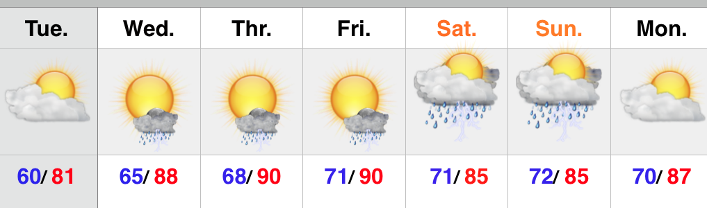
We’re waking up to similar weather conditions that we dealt with to close the weekend- scattered heavy downpours and very humid. It certainly won’t rain the entire day, but scattered storms will bubble up again as we progress into the afternoon and evening. With the humid air mass locked in, any shower or storm that develops will produce torrential downpours.
A frontal boundary will slip into the region tomorrow and provide enough lift to present a strong to severe thunderstorm threat Tuesday. We’ll continue to keep a close eye on things. This front will stall out near the area and serve as a focal point for thunderstorm development through the upcoming few days.
The tropics continue to be of interest later this week, but we stress that forecast models are really struggling with handling the details. Solutions range from a flood threat presented by the European and Canadian; however the GFS would suggest the tropical remnants don’t get involved in our pattern. We’re leaning more towards the Euro/ Canadian blend as of now as we feel the SE ridge will help steer the tropical remnants northeast into the Ohio Valley late week (timing may have to be find tuned as we draw closer). Again, stay tuned.
Upcoming 7-Day Rainfall Forecast: 2″ – 3″ (locally heavier totals)