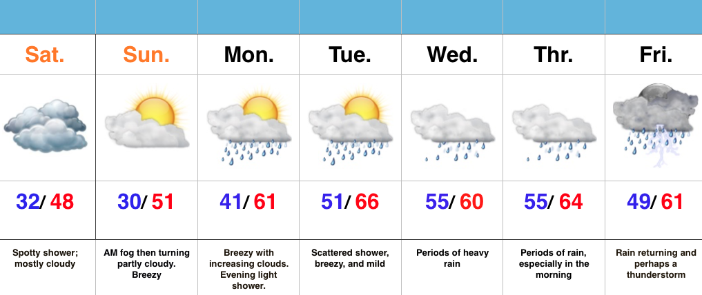
Warm Pattern Turns Increasingly Wet…
 Highlights:
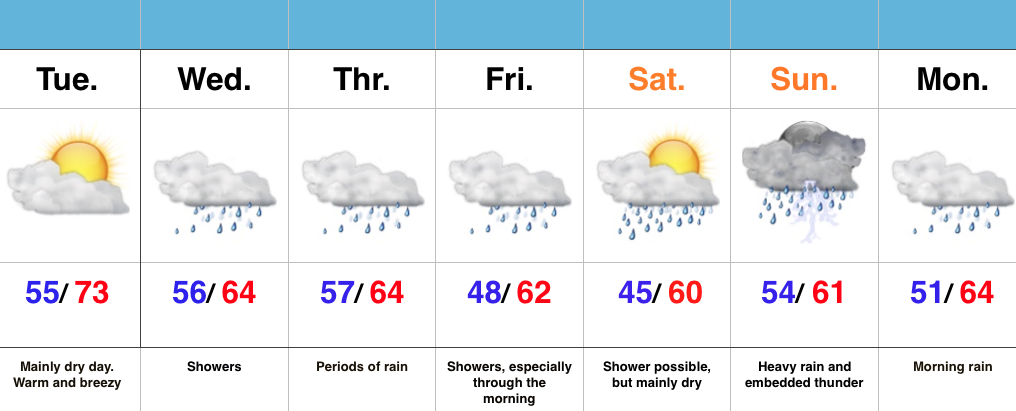
- Warm, mostly dry Tuesday
- Rain builds in mid week
- Weekend questions
Enjoy Today’s Sun…Today looks to be the pick of the week, including mostly dry conditions and temperatures that will feel more like April. Find a way to get out and enjoy it!
Moisture will surge northeast into the region during the day Wednesday and a wavy front will sag south into the area to close the work week. The combination of a deep moisture transport out of the Gulf will help ignite locally heavy downpours. While questions are certainly there in regards to timing, we’re leaning more towards the optimistic side of things with this update…thinking enough dry air may invade the area for a mostly dry Saturday. This is an, admittedly, low confidence forecast.
Regardless of whether or not we can enjoy a mostly dry start to the weekend, moisture will stream back into the area for the second half of the weekend. Heavy rain and embedded thunder looks likely Sunday.
7-Day Precipitation Forecast:
- Snowfall: 0.00″
- Rainfall: 2.00″ – 2.50″