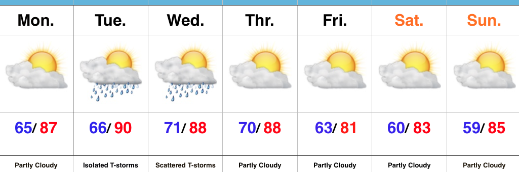
Mid Week Storms…
 Highlights:
- Less humid open to the week
- Mid week storms
- Drier weekend
Warm, But Less Humid…As Sunday afternoon progressed into evening, notably drier air moved into central IN. That less humid feel will be with us as we open the work week, but will still warm quickly (upper 80s this afternoon).
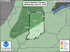
An increasingly moist air mass will return Tuesday into Wednesday and will promote locally heavy rainfall within thunderstorms that develop. We expect isolated to widely scattered storm coverage Tuesday and scattered coverage Wednesday. While uniform significant rainfall isn’t likely, localized torrential downpours will be possible as precipitable water values (PWATs) increase. Additionally, strong to severe storms will be possible.
A drier air mass will return to close the week and head into the weekend. At one time, models suggested we’d deal with a slow-moving “cut off” low pressure system, but recent trends continue the drier theme.
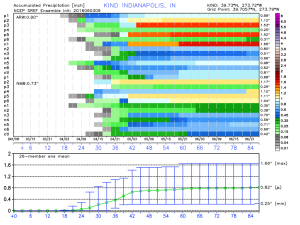
Upcoming 7-Day Precipitation Forecast:
- Snowfall: 0.00″
- Rainfall: 0.25″-0.75″ (locally heavier amounts)
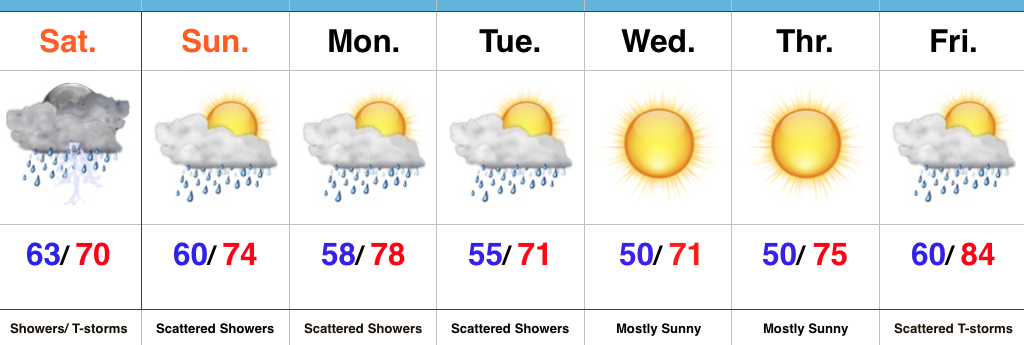
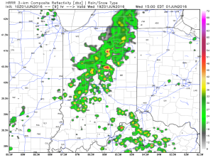
 Steady rain and embedded thunderstorms will continue through the morning hours and into the afternoon.
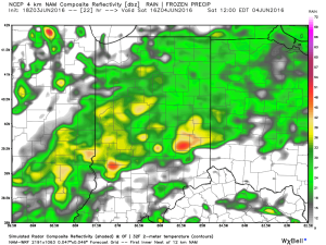
 Eventually, a cold front will sweep through the state Saturday night and help “slosh” the widespread rain shield east of the region. By the time this happens, we expect widespread rainfall totals between 0.50″ and 1.00″ across central IN (with locally heavier totals).
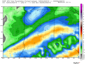
 Cooler weather will push in this weekend and continue into early and middle parts of next week. While the widespread rain will come to an end, upper level energy will remain and could help ignite scattered showers at times (particularly during the afternoon and evening hours) into early next week.
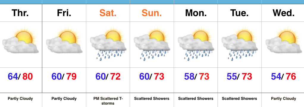
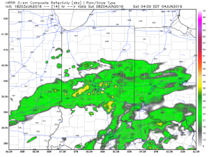
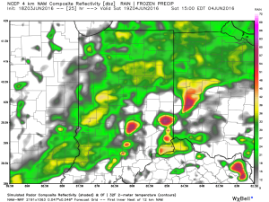
 As precipitable water values climb to around 2″, locally heavy rainfall will accompany any storms that develop.
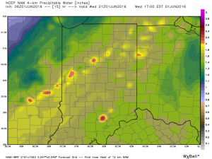 We caution that the key word here is “scattered.” There will be “haves and have nots” when it comes to rainfall totals by tonight. Some neighborhoods may receive less than 0.10″ while others receive over 1″.
 Unseasonably cool air will follow for the mid range.
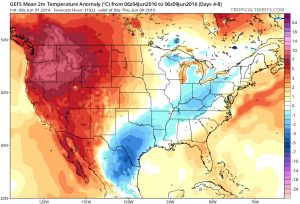 A fresh 7-day will be up later today! Have a nice Wednesday, friends.