You must be logged in to view this content. Click Here to become a member of IndyWX.com for full access. Already a member of IndyWx.com All-Access? Log-in here.
You must be logged in to view this content. Click Here to become a member of IndyWX.com for full access. Already a member of IndyWx.com All-Access? Log-in here.
You must be logged in to view this content. Click Here to become a member of IndyWX.com for full access. Already a member of IndyWx.com All-Access? Log-in here.
Tuesday will remain dry across central Indiana with plentiful sunshine and warm temperatures. The quiet times will give way to unsettled conditions as we progress through the second half of the week, including periods of locally heavy rain.
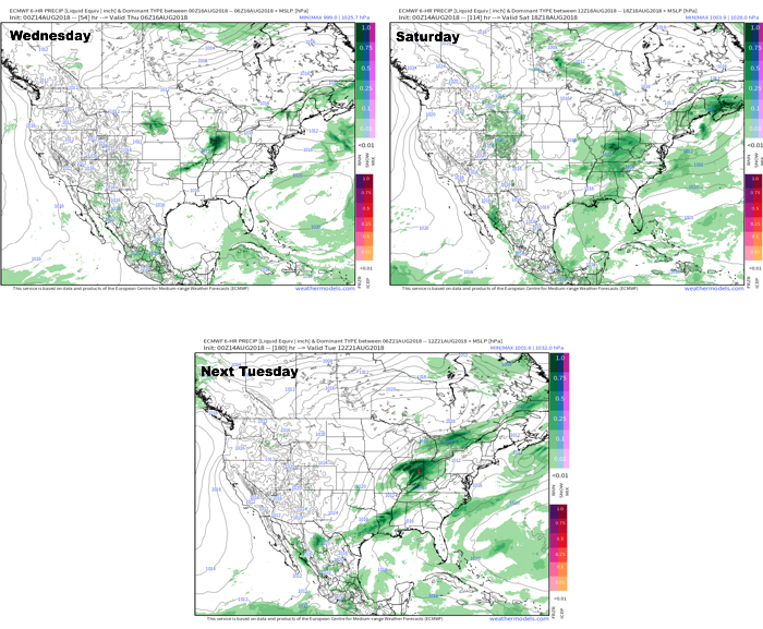
This is all part of a pattern that will remain active around these parts. We note the latest European model delivers three storm systems between now and this time next week. Each of these systems will be capable of producing hefty rainfall across the region.
In the more immediate term, after a dry Tuesday, rain will arrive on the scenes Wednesday afternoon.
Forecast radar 1p Wednesday. Image courtesy of weathermodels.com.
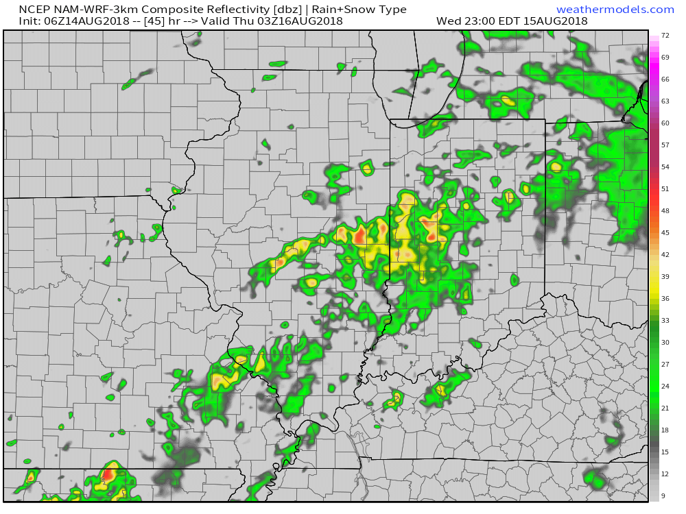
Rainfall coverage and overall intensity will increase as Wednesday evening gives way to night, continuing into Thursday morning.
Forecast radar 11p Wednesday. Image courtesy of weathermodels.com.Forecast radar 6a Thursday. Image courtesy of weathermodels.com.
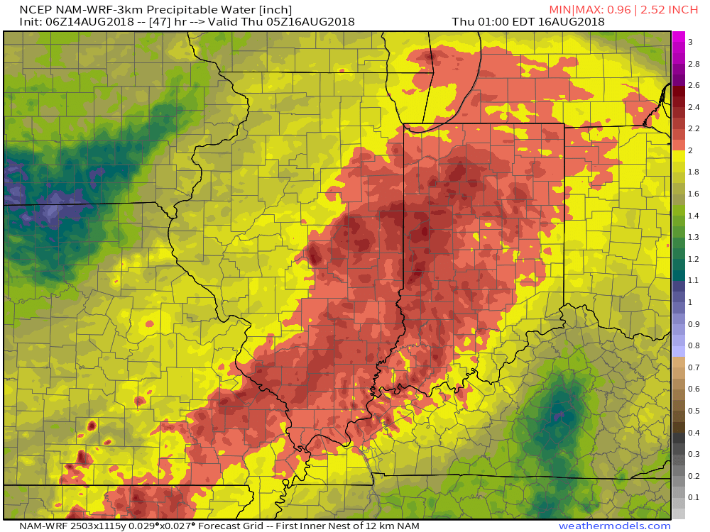
Note the high resolution models suggesting widespread precipitable water values (PWATs) in excess of 2″. This is a significant ingredient that will help fuel heavy rain Wednesday evening into Thursday morning.
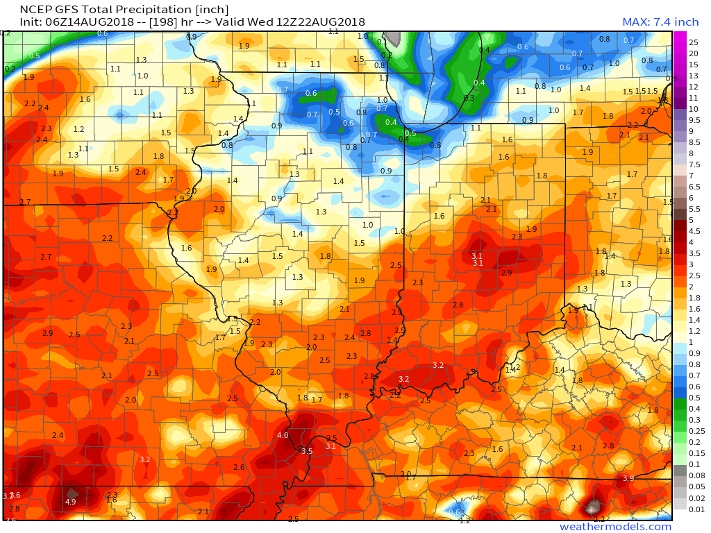
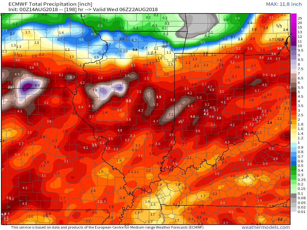
As mentioned above, a couple of other storm systems promise for continued unsettled times over the weekend and on into early next week. When we total things up by the middle of next week, both the GFS and European model agree on widespread 3″ to 5″ totals.
You must be logged in to view this content. Click Here to become a member of IndyWX.com for full access. Already a member of IndyWx.com All-Access? Log-in here.
 In the more immediate term, after a dry Tuesday, rain will arrive on the scenes Wednesday afternoon.

 As mentioned above, a couple of other storm systems promise for continued unsettled times over the weekend and on into early next week. When we total things up by the middle of next week, both the GFS and European model agree on widespread 3″ to 5″ totals.