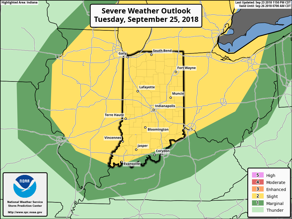
Periods Of Heavy Rain & Strong-Severe Storms To Open The Work Week…
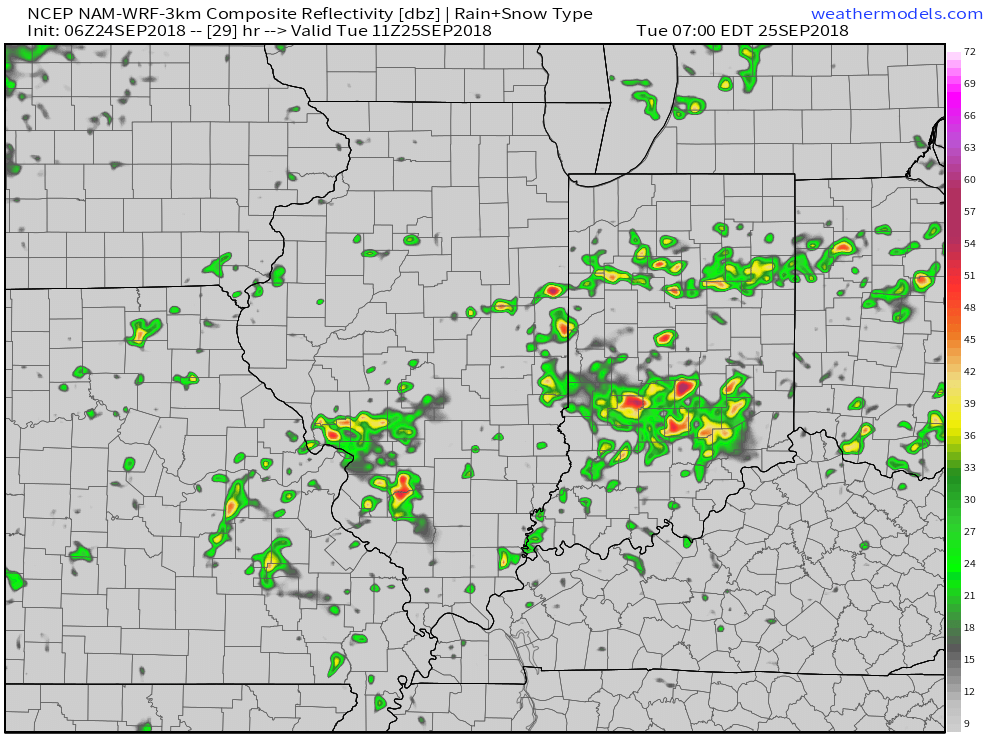
An unsettled open to the work week is upon us. Periods of showers and thunderstorms can be expected this morning through Wednesday morning. Tuesday will present the most widespread thunderstorms and a few of these could reach strong-to-severe levels. Locally heavy rain can be expected at times. The greatest concerns from a severe perspective center around large hail and damaging straight line winds, but a couple of tornadoes can’t be ruled out.
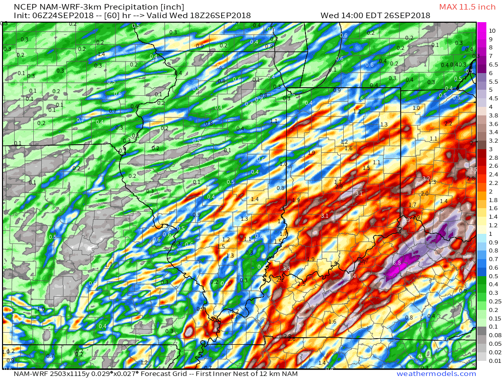
Heaviest rain amounts will fall across eastern parts of the state where widespread 1″ to 2″ with locally higher amounts are expected by Wednesday morning. With that said, localized 1″+ amounts will also fall across northwest parts of the state as shown on the latest high resolution NAM.
 The frontal boundary will sweep through the state late Tuesday and allow a cooler and drier air mass to filter into the region Wednesday. You’ll notice a true fall feel out the door Wednesday morning- low to mid 50s. Highs Wednesday afternoon will remain in the 60s.

 Florence will crawl through the Carolinas this weekend and spread devastating flooding well inland- 20″ to 30″. Even the high ground of the North Carolina Blue Ridge will experience severe flooding Sunday into Monday- 6″ to 12″. These are forecast radar totals shown now through 2p Sunday. The Blue Ridge will see heavy rain continue into Monday evening.
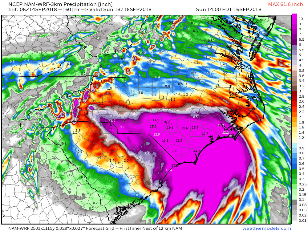 Back here on the home front, expect an extended stretch of dry and warm weather. Plentiful sunshine can be expected as we head into the weekend along with a warming trend- mid 80s and lows in the mid to upper 60s. High pressure will remain in firm control.
 The next item of excitement for our region will be from a cold front late next week. This will help increase shower and thunderstorm chances along with delivering cooler air next weekend.