Heavy Rain Ends As Snow This Evening…
A wet day is in store for central Indiana as a wave of low pressure moves along a stalled frontal boundary this afternoon. Once that low scoots by, the front will get a shove to the southeast and much drier weather will return as we go through the 2nd half of the weekend. The transition in between will be a combination of heavy rain eventually ending as wet snow this evening. Let’s time things out:
This morning’s initial wave of steady rain is now pushing into Ohio (as we write this just before 9a). Scattered showers are left behind.

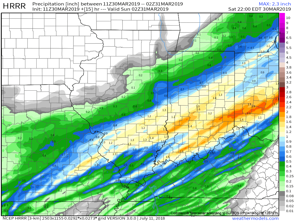
That said, another wave of steady and, at times, heavy rain will return early this afternoon. A couple of thunderstorms are possible across southern Indiana.

Precipitation coverage will be widespread from noon until around 8p, including additional rainfall amounts over 1″ in many spots across central Indiana. Localized ponding and low-land flooding will be a good bet this afternoon into the evening hours.
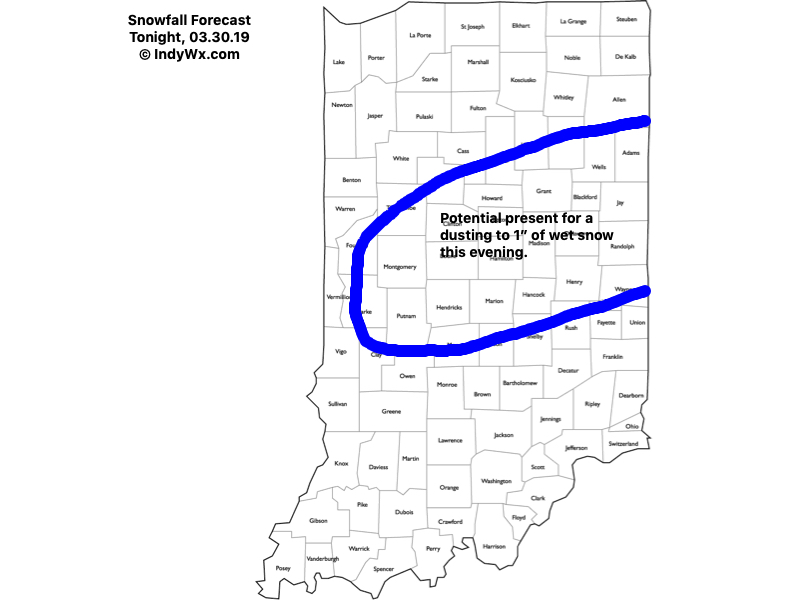
As the area of low pressure scoots to our east, it’ll help pull the cold front south through central Indiana during the mid to late evening hours. Accordingly, rain will transition to a period of wet snow between 6p and 8p across central Indiana. More specific to Indianapolis, we think rain will switch to snow around 7p.

While snow won’t last a long time and temperatures will be above freezing as the snow is falling, briefly heavy intensity will likely result in a quick wet coating to around an inch in spots from central parts of the state, including east-central Indiana.
All precipitation will exit the state before midnight. While we could have a couple of scattered snow showers early Sunday morning, most of the day will be dry with increasing amounts of sunshine as the day progresses. It’ll be much colder with highs not making it out of the 30s.
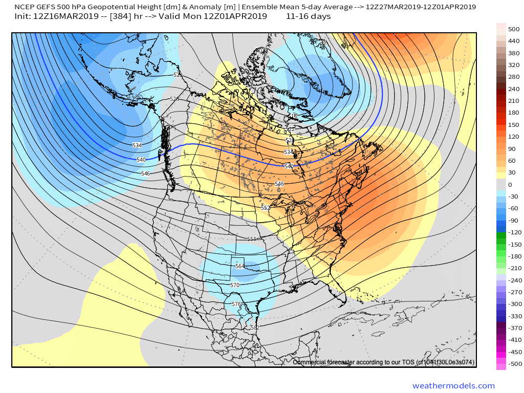
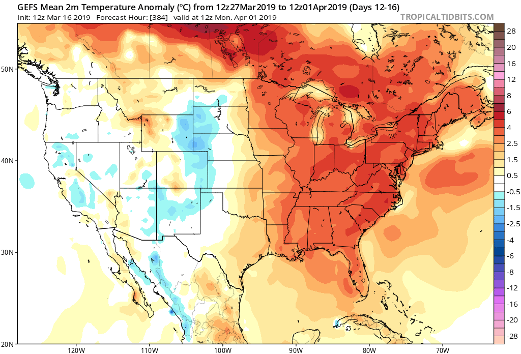
Improving weather conditions will build in here through the early parts of the work week, along with moderating temperatures, thanks to high pressure. – Much more on the week ahead and longer range later today with our PM video update.