You must be logged in to view this content. Click Here to become a member of IndyWX.com for full access. Already a member of IndyWx.com All-Access? Log-in here.
Category: Harvest ’20
Permanent link to this article: https://indywx.com/2020/09/25/video-summer-like-weekend-before-major-changes-next-week/
Sep 24
VIDEO: Wetter Trends Next Week? Potential Of More Widespread Frost Late Next Week…
You must be logged in to view this content. Click Here to become a member of IndyWX.com for full access. Already a member of IndyWx.com All-Access? Log-in here.
Permanent link to this article: https://indywx.com/2020/09/24/video-wetter-trends-next-week-potential-of-more-widespread-frost-late-next-week/
Sep 23
VIDEO: Reasons To Believe The Chill To Open October Has Some Staying Power…
You must be logged in to view this content. Click Here to become a member of IndyWX.com for full access. Already a member of IndyWx.com All-Access? Log-in here.
Permanent link to this article: https://indywx.com/2020/09/23/video-reasons-to-believe-the-chill-to-open-october-has-some-staying-power/
Sep 22
Another Big Shot Of Cool Air Dialed Up, But What About Rain?
“Transient” warmth and continued dry weather will carry us through the short-term period, but don’t get used to it.
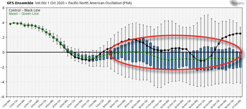
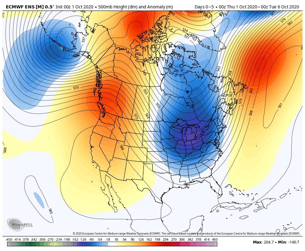
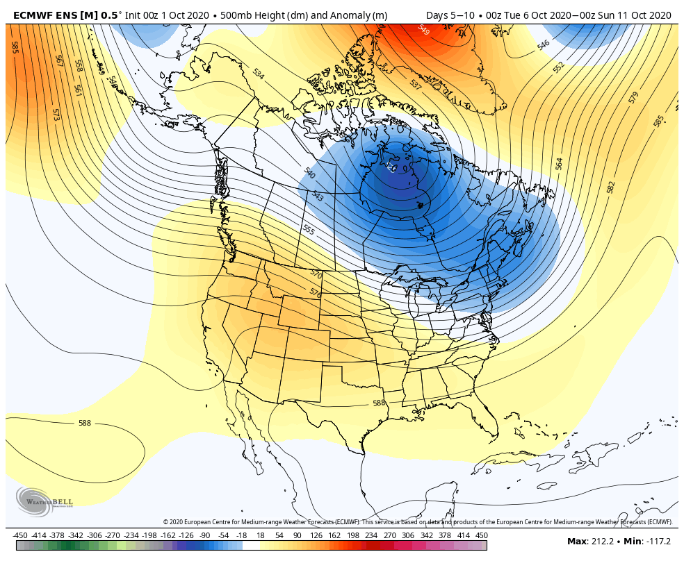
Another sharp trough will plunge into the eastern portion of the country next week and offer up the coolest air of the young fall season, along with better chances of at least light rain. The upcoming cool blast is in response to the positive PNA and negative EPO.
The airmass associated with this trough next week will be early November-like for a day or two, and well below late September/ early October norms for the remainder of the period.
Unlike our last trough, this one will feature more upper level energy and this combined with the unseasonably cold air (at the surface and aloft) will generate periods of at least light rain during the early part of the work week.
We’re not talking about a lot of rain, but a badly needed 0.25″ to 0.50″ is better than nothing.
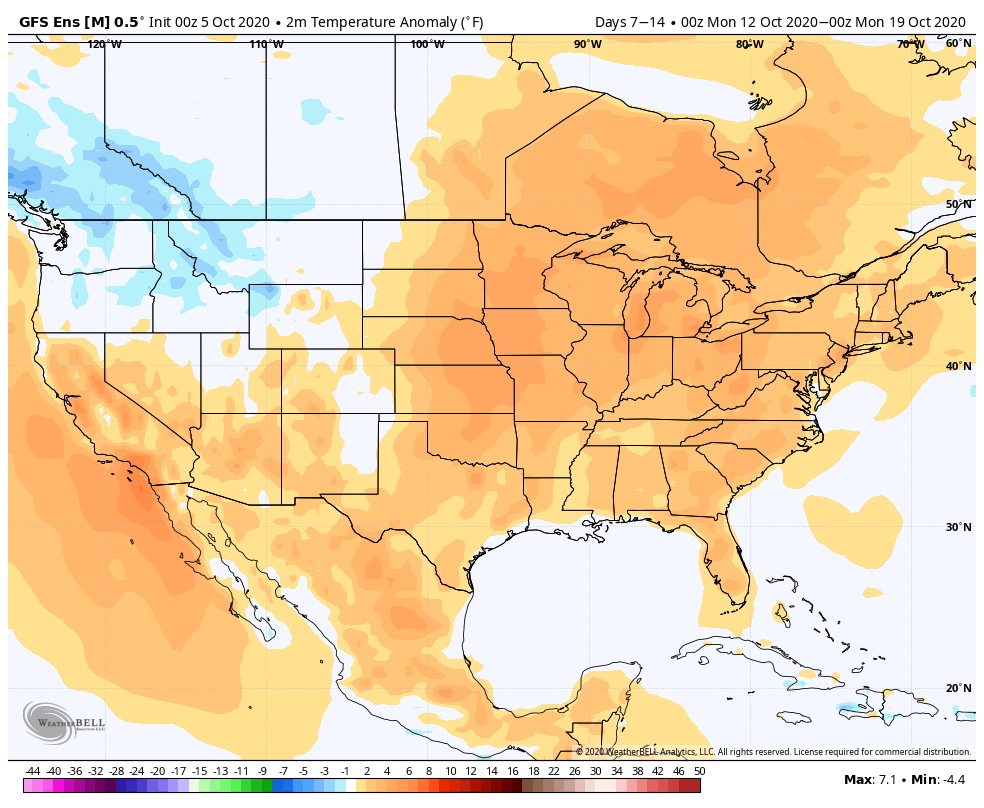
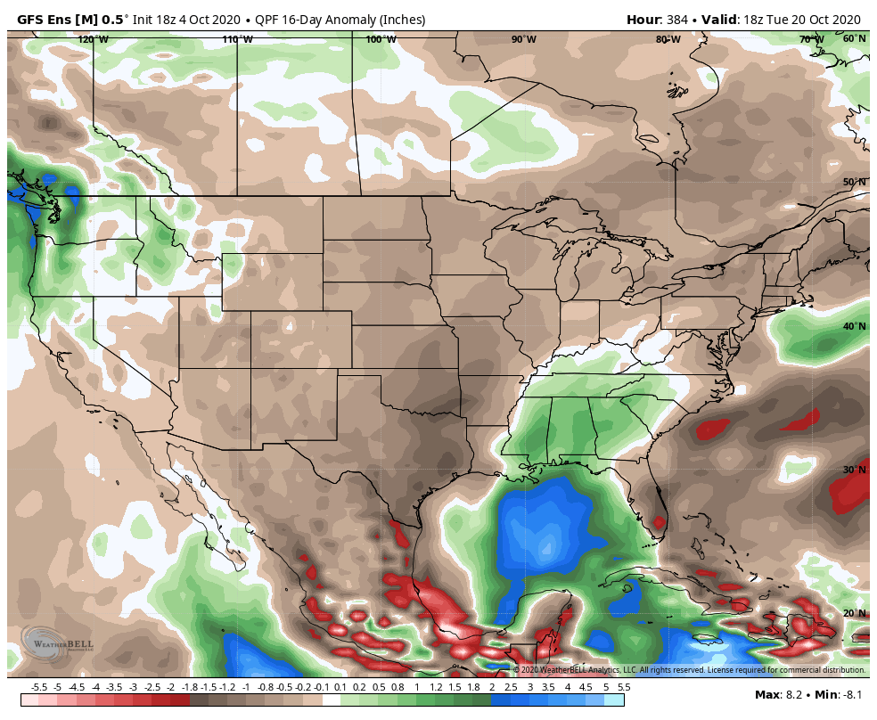
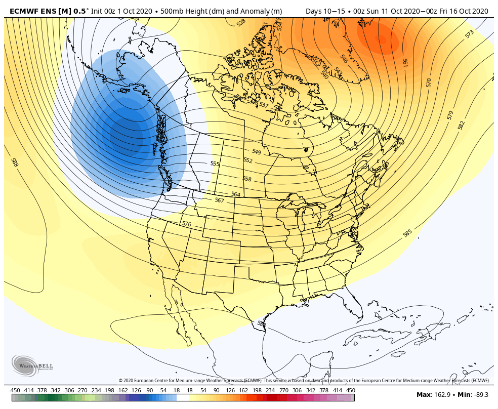
Looking farther out, there’s reason to buy into the cooler than normal pattern having staying power into the first 1/3 of October, and perhaps beyond. More on this in future updates. Make it a great Tuesday!
Permanent link to this article: https://indywx.com/2020/09/22/another-big-shot-of-cool-air-dialed-up-but-what-about-rain/
Sep 21
VIDEO: Talking Our Next Chance Of Rain; Early November-like Chill Next Week…
You must be logged in to view this content. Click Here to become a member of IndyWX.com for full access. Already a member of IndyWx.com All-Access? Log-in here.
Permanent link to this article: https://indywx.com/2020/09/21/video-talking-our-next-chance-of-rain-early-november-like-chill-next-week/
Sep 20
VIDEO: Turning Briefly Warmer Before Another Chilly Plunge…
You must be logged in to view this content. Click Here to become a member of IndyWX.com for full access. Already a member of IndyWx.com All-Access? Log-in here.
Permanent link to this article: https://indywx.com/2020/09/20/video-turning-briefly-warmer-before-another-chilly-plunge/
Sep 17
Long Range Update: Extended Dry Pattern Rolls Along; New Winter Seasonal Data Is In…
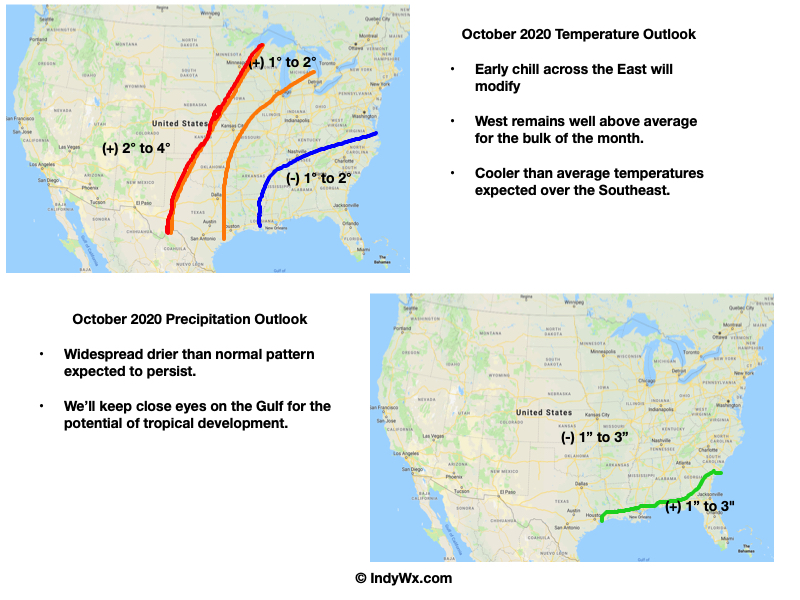
Unfortunately there likely won’t be any significant changes to our precipitation pattern until late autumn and winter. Until then, we’ll have to take any drop of rain we can find. Once the pattern flips though, it may do so in quick and rather dramatic fashion (still expecting a wet winter).
The consensus of long range data shows the dry pattern continuing over the upcoming few weeks, including the JMA Weeklies, CFSv2 Weeklies, and ensemble products.
Analogs and other teleconnections support this dry theme. At least in the immediate range (through mid October) the only way to bust up this dry pattern is to get tropical moisture involved.
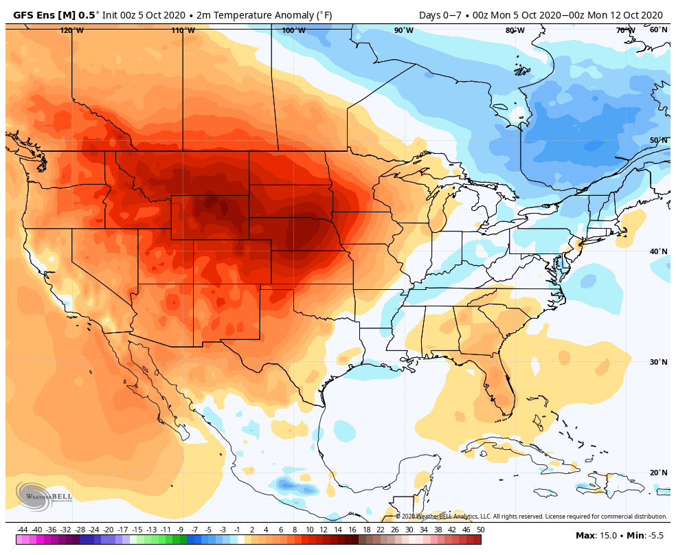
The new JMA Weeklies maintain the ‘mean’ ridge position across the West for the majority of the upcoming few weeks, but there will likely be attempts to expand the ridge across the northern tier Week 2 and 3 that would lead to at least transitional periods of much warmer air, after the cool period in the short term.
The model sees the ridge expanding Weeks 3-4 and the associated warmth that spreads east after the chilly regime.
The new JAMSTEC seasonal data is also in and maintains a warm look this winter. A lot of this has to do with an expected persistent southeastern ridge. We agree with this but, as is the case each winter, there will be challenges that have to be dealt with.
We also agree with the active storm track through the Ohio Valley and associated well above normal precipitation in the December through February period.
Permanent link to this article: https://indywx.com/2020/09/17/long-range-update-extended-dry-pattern-rolls-along-new-winter-seasonal-data-is-in/
Sep 16
Another Problem Brought On By Dry Ground…
The upcoming (10) days will offer little, if any, relief from the recent dry stretch. Note the expanding (albeit still localized in the grand scheme of things) area of dry over the past (30) days:
Some areas from south-central IL into central IN have only seen 0.10” to 0.50” over the past month.
While a cold front will slip through the state Thursday, only isolated, weak showers are expected. Most will avoid any rain (best chance of seeing a passing shower will be across northern IN but even these won’t amount to much).
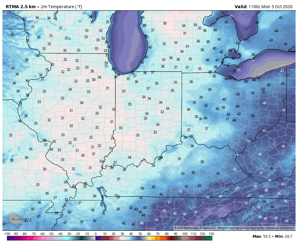
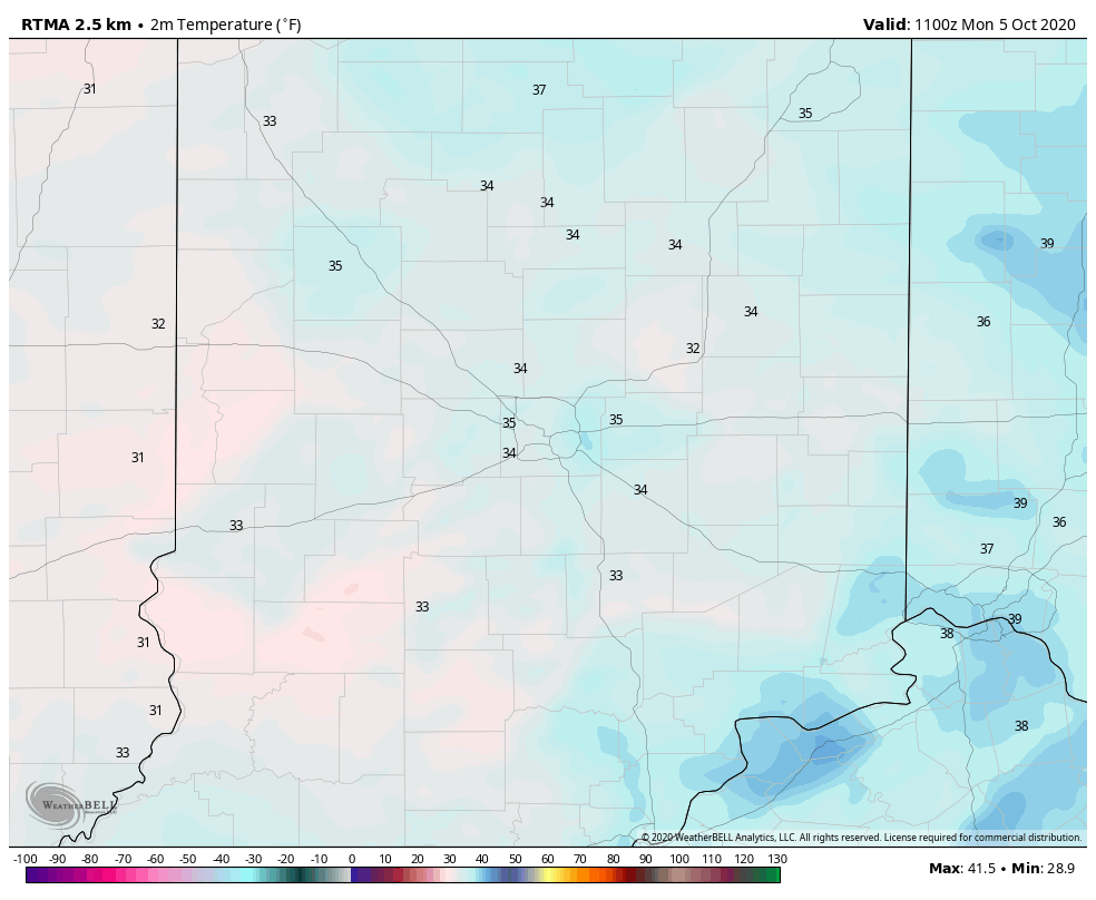
Of more interest will be the true jab of fall air behind the boundary. The dry ground will aid in allowing temperatures to fall to lower levels than if we had recently been dealing with wet conditions. In fact, outlying areas across central and northern parts of the state can expect the first frost of the season (2-3 weeks earlier than average) this weekend into early next week with overnight lows falling into the mid to upper 30s.
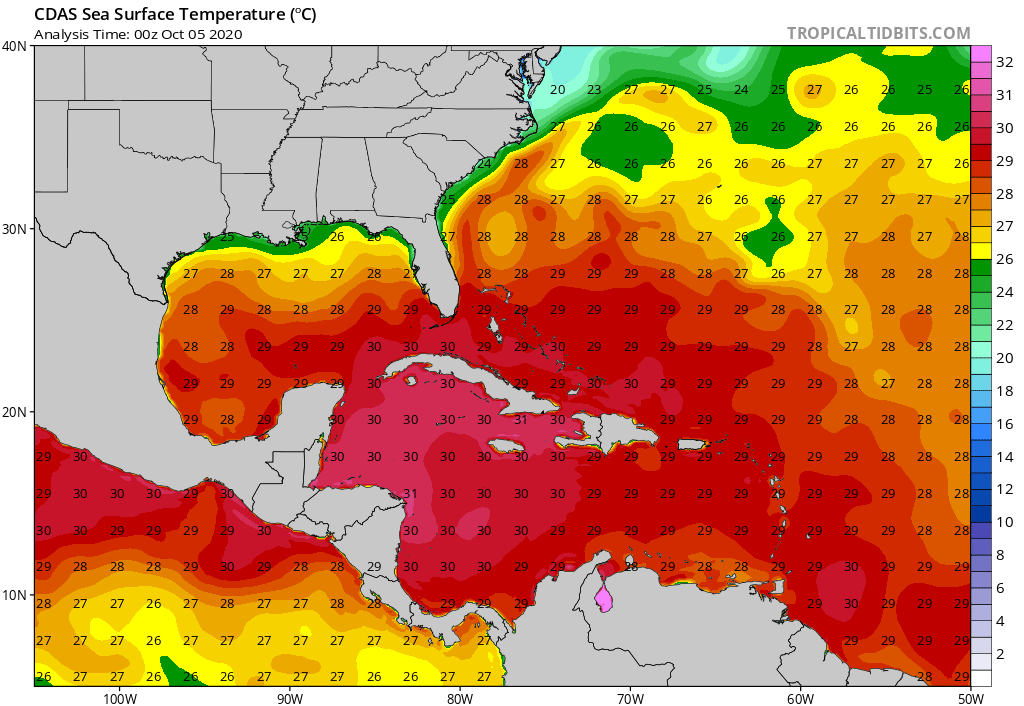
Quick follow up: Many have asked, and we are safe along the beaches of Walton Co. here in the Florida panhandle. Sally (now a category 2, 100 MPH hurricane) is making landfall near Gulf Shores, AL- 150 mi. to our west. We’ve accumulated over 15” of rain since 12a Tuesday and torrential downpours continue. Early this morning winds have gusted over 60 MPH and water spouts have been observed just off the coast of where we’re staying. As long as we maintain power, we’ll have a fresh video post later today.
Permanent link to this article: https://indywx.com/2020/09/16/another-problem-brought-on-by-dry-ground/
Sep 13
Extended Dry Period…
IND is now running more than 1.2″ below normal for the month and this is coming off a dry finish to August.
Note the localized, but significant, area of bone dry conditions extending east from eastern IL across central Indiana (while surrounding areas have cashed in on significant rains over the past 30 days):
The upcoming 7-days won’t offer up much relief from the dry conditions as high pressure dominates. Even the mid-to-late week cold front should pass through the region mostly dry.
Most guidance only drops between a trace and 0.10″ of rain on central Indiana over the next (10) days as the dry pattern rolls along. The GFS and European ensemble products highlight the dry regime well:
Ironically, the overall pattern should shift in dramatic fashion as autumn matures and heads into winter. We still expect an about face late autumn as the wet anomalies paint themselves across our region as the southeast turns dry, thanks to the La Nina pattern…
Permanent link to this article: https://indywx.com/2020/09/13/extended-dry-period/
Sep 08
2 Sides To Every Storm…
An early taste of winter is descending on the Rockies today (the town of Breckenridge camera will be fun to check in on from time to time over the next 24 hours). Places, such as Denver, that were in the 90s yesterday will fall into the 20s and 30s today with snow.
Note the big spread in temperatures across the country this morning and corresponding 24 hour temperature change:
We’ll remain on the mostly dry and warm side of this event until the weekend.
Once the storm system lifts northeast and gets close enough to impact our region, it’ll be in a much weaker state. Scattered showers and thunder are possible over the weekend, but widespread significant rainfall isn’t expected.
After heavy rains fell across north-central Indiana Monday, a much drier theme can be expected throughout the next several days. A widely scattered shower or thunderstorm is possible before Saturday, but most should remain rain-free. Even as the storm system draws closer, weekend rainfall should average only between 0.25″ and 0.50″ for most.
Cooler air (nothing to the extent or magnitude of what our friends out west are seeing) will filter in here late weekend and early next week. Lows into the 50s can be expected with a couple of days of highs in the 70s.
Permanent link to this article: https://indywx.com/2020/09/08/2-sides-to-every-storm/