VIDEO: Unseasonably Chilly First 1/3 Of October, But Then What?
You must be logged in to view this content. Click Here to become a member of IndyWX.com for full access. Already a member of IndyWx.com All-Access? Log-in here.
You must be logged in to view this content. Click Here to become a member of IndyWX.com for full access. Already a member of IndyWx.com All-Access? Log-in here.
Yesterday’s 0.08″ of rain at IND was the “heaviest” for the month, but still well shy of modeled output. There were a few heavier totals across southern portions of the state. Even though this wasn’t supposed to be a heavy rain maker, I thought we’d see higher totals than we did. The dry ground really took its’ toll on the moisture as it moved across the state (interesting to see the rain shield intensify yet again just east of us across Ohio).
Today will be a gorgeous fall day- expect a clear and chilly start to give way to a few afternoon clouds and highs in the lower 60s.
A secondary cold front will sweep through the region tomorrow evening, helping serve up even chillier conditions as we get set to close the week. A few showers (light in nature) can be expected for the 2nd half of the work week, mostly thanks to upper level energy. The other item to note? West breezes kicking up to 25 MPH tomorrow afternoon.

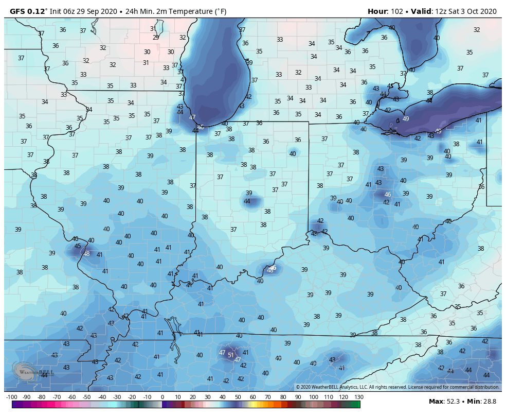
We should hang on to just enough overnight cloud cover to prevent any frost formation across central Indiana until Friday night/ Saturday morning. Skies are expected to clear and winds should diminish to allow the coolest air of this particular airmass to settle over the region. Mid 30s will be common across central Indiana by Saturday morning. The combination of the early chill and dryness certainly will activate the fall color change much earlier this year compared to normal. In fact, I’d expect an early to middle October peak this year.
The next feature will scoot across the Ohio Valley Sunday with an increase in cloud cover and potential of showers. We note the European’s output is close to 0.50″ with this system, but we won’t bite on that. Instead, we forecast between 0.20″ and 0.30″ Sunday. It’ll also be an unseasonably cool day with highs only topping out in the middle 50s.

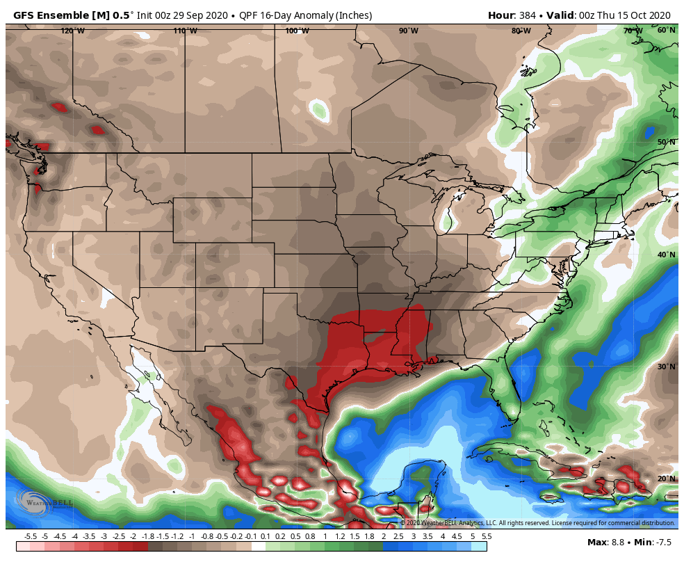
Let’s hope we can squeeze what little moisture we can out of Sunday’s weather maker because the pattern looks very dry over the next couple weeks, as a whole, and likely beyond. The only way we can buck this dry trend between now and late November is to get some tropical moisture injected in the pattern up this way. I wouldn’t hold my breath…
More later today in our video update! Enjoy your Tuesday!
You must be logged in to view this content. Click Here to become a member of IndyWX.com for full access. Already a member of IndyWx.com All-Access? Log-in here.
You must be logged in to view this content. Click Here to become a member of IndyWX.com for full access. Already a member of IndyWx.com All-Access? Log-in here.
You must be logged in to view this content. Click Here to become a member of IndyWX.com for full access. Already a member of IndyWx.com All-Access? Log-in here.