 Highlights:
- Afternoon showers
- Patchy frost Thursday morning
- Chilly air reinforcements
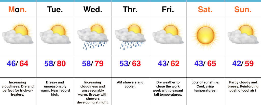
Flannel Weather…Late October averages across central Indiana include highs in the lower 60s and lows in the lower 40s. The balance of this forecast update will include temperatures well below those seasonal norms. Have the coats, jackets, and flannel 🙂 at the ready!
While early parts of our Wednesday could feature a couple looks at the sun, mostly cloudy conditions will dominate our hump day along with scattered afternoon showers. Thursday will be a ‘tweener- morning frost will give way to more in the way of sunshine, with an increasingly gusty southwest breeze by the afternoon!
Our next cold front will approach to close the work week. Showers will spread into the state after a dry start to the day and a cold northwest wind will hit like a wall Friday evening. Look for a sharply colder close to the day.
A deep trough of low pressure will dominate our weekend, supplying the coldest air so far this season, along with considerable cloudiness. Spokes of upper level energy will rotate overhead and help generate a light shower or two, especially Sunday. Yes, temperatures will be cold enough to allow for a little snow to mix in as well.
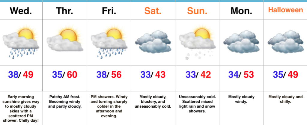
Looking ahead to Halloween- reinforcing chilly air should be spilling south behind a Monday frontal passage and this will set the tone for chilly conditions as the trick-or-treaters take to the streets. Plan to bundle up!
The 2017-2018 IndyWx.com Winter Outlook is now available!
Upcoming 7-Day Precipitation Forecast:
- Snowfall: Trace
- Rainfall: 0.25″ – 0.75″
 Highlights:
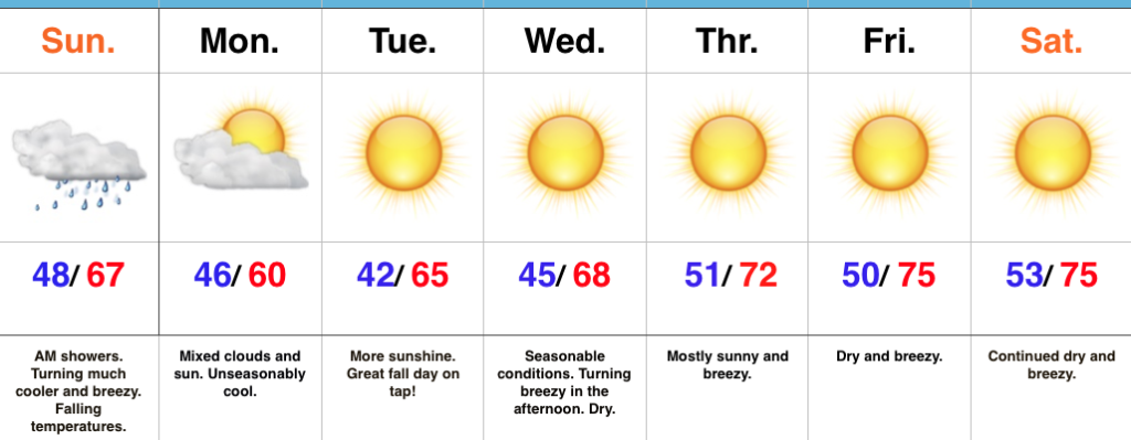 Highlights:
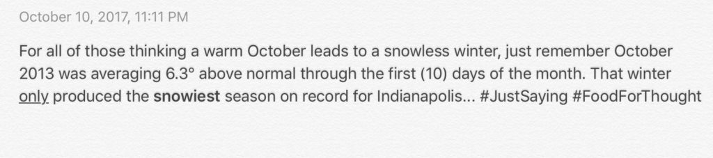
 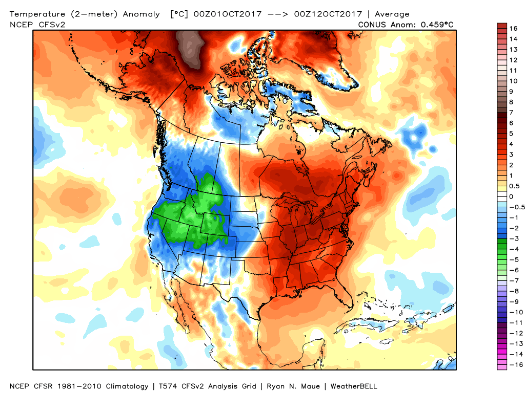 In coffee shops and my travels around the great state of Indiana, I’ve overheard lots of talk centered on because October has been so warm, another lackluster snow season awaits. Let us remind you that the infamous snow season of ’13-’14 featured a very warm first half of October.
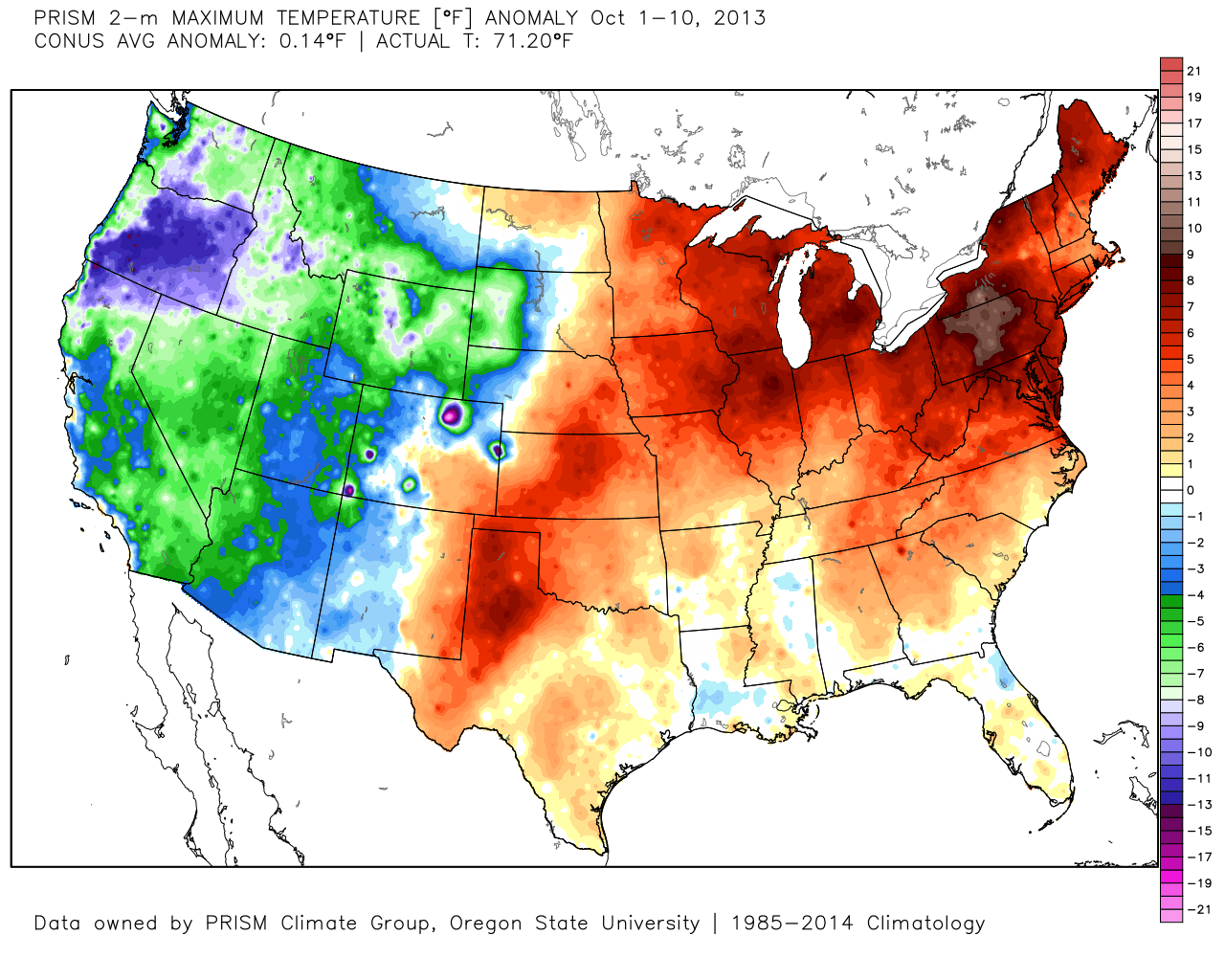
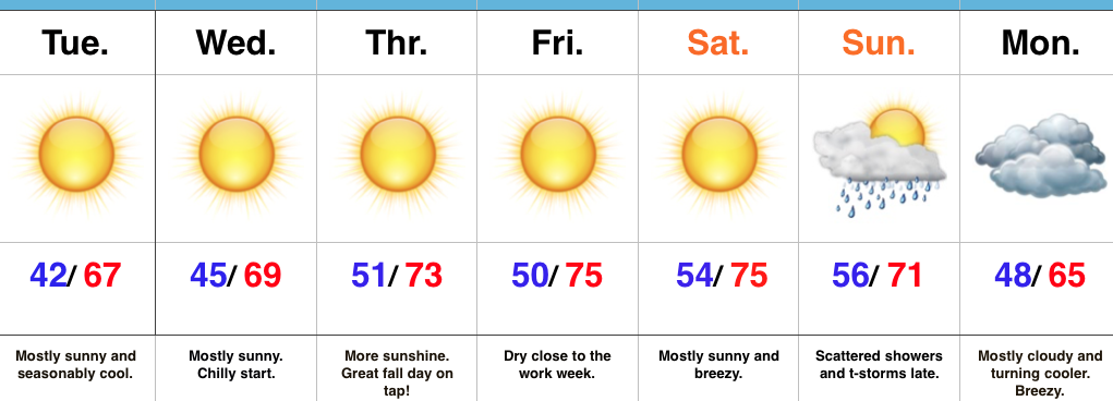
 The upcoming 7-10 days will feature more of a transitional period of weather that we’ve come to know and love around these parts. Warmth will spread northeast this weekend ahead of an approaching cold front (around 80° Saturday) before falling temperatures Sunday afternoon behind the frontal passage. The chilliest air so far this season will descend upon the region early next week. That said, the chill won’t hold and another surge of above normal warmth will spread northeast by the latter parts of next week.
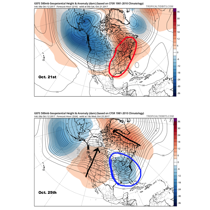 It should also be noted that analog data and research also would lean heavily in the cold direction to wrap up October and these findings also favor a chilly November… More on that later! Speaking of later, an updated 7-day will be posted this evening. Make it a great day!