Latest Thoughts On Memorial Day And Race Weekend…
As the race weekend and Memorial Day draw ever-closer, data is able to pick up on some of the specifics associated with our weather for the all-important long weekend.
After scrolling through the data this evening, it appears as if we need to bracket late Friday night-Saturday morning and again late Saturday into Sunday morning for the potential of two rounds of gusty storms. Some of these storms could reach strong to severe levels, and the Storm Prediction Center continues to outline central Indiana for a Slight Risk Saturday (large hail and damaging straight line winds are of greatest concern, locally).
 Despite having to dodge a couple rounds of gusty storms this weekend, we want to stress that the majority of the holiday weekend should feature rain-free hours, and certainly isn’t worth cancelling any outdoor plans. In fact, after a beautiful Carb Day, most of the daytime hours both Saturday and Sunday should be rain and storm free. Have a means of getting the latest weather information, but plan to enjoy long stretches of rain-free hours this weekend.
Much more later!
 2.) We bracket the hours of 2p-8p (couple hours earlier from yesterday’s thinking) as the period of potential most widespread strong to severe thunderstorms across central Indiana, and the HRRR forecast radar shows what the radar may look like this evening. Have a means of getting the latest warnings.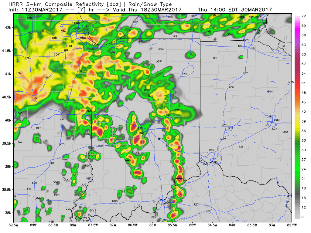
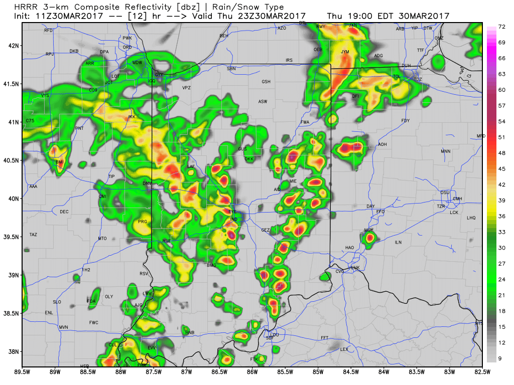 3.) Scattered showers will continue into Friday morning before drier air arrives during the evening hours.
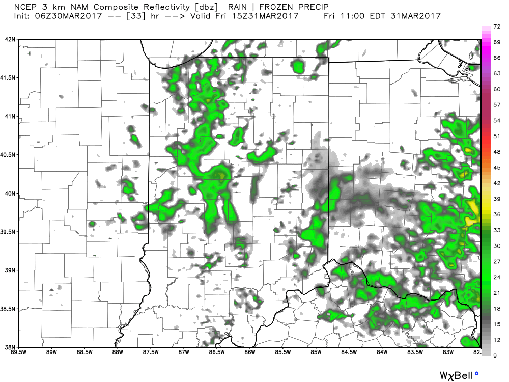 4.) This drier trend Friday PM is one that will continue into the weekend. High pressure will supply mostly dry weather through the entire weekend (small shower chances return Sunday evening), including sunshine.
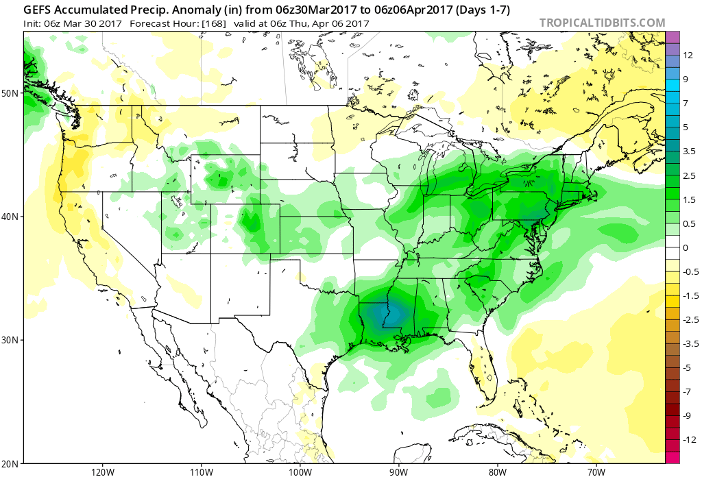
 5.) Another active period of weather awaits next week, including multiple rain chances early and late week. The latter storm looks to be the bigger event with heavy rain and thunderstorm potential Wednesday into Thursday. 7-day rain numbers check in between 1.5″-2″ with locally heavier amounts.
 6.) The story becomes a chilly one next weekend, and models suggest central Indiana may be dealing with frost and freeze conditions by next Saturday or Sunday morning.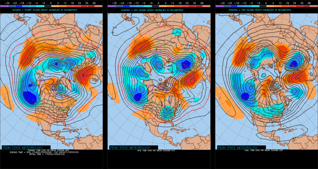
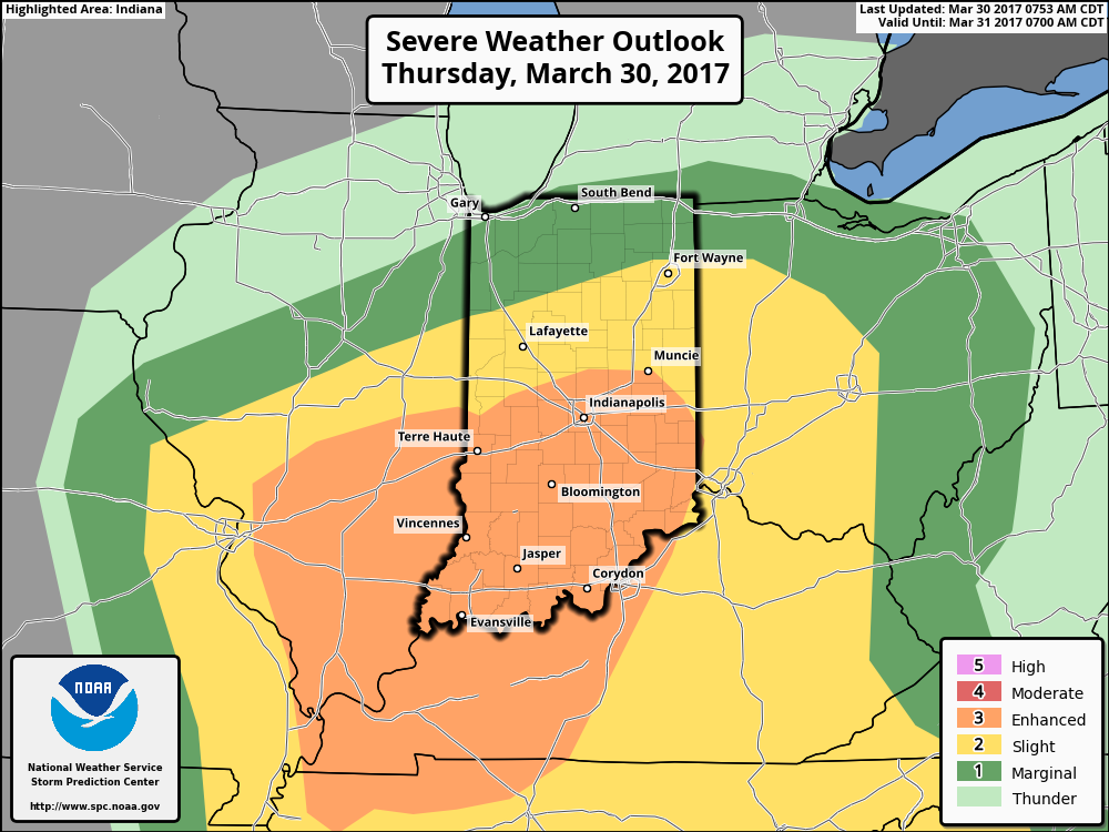
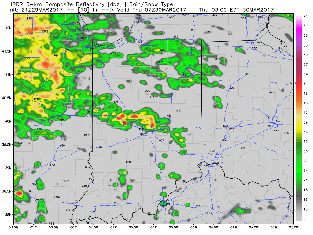 Multiple rounds of showers and thunderstorms will likely impact central Indiana through the mid and late morning hours Thursday.
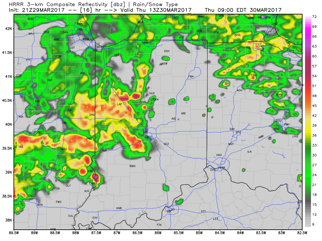 As we press into the early afternoon hours, model data suggests we see a “lull” in the stormy weather and potentially even a few breaks in the cloud cover. This would serve to “up the ante” in regards to the prospects of severe weather potential Thursday afternoon, particularly mid and late afternoon through the evening hours. Accordingly, the Storm Prediction Center continues to highlight central Indiana for the risk of severe weather Thursday.
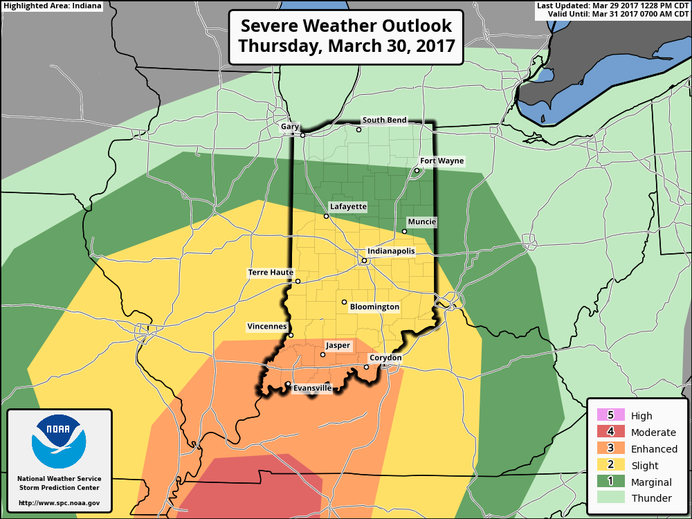 In fact, given a look at the most recent data, I wouldn’t be surprised to see the “enhanced” risk area expand further north in future updates. This would also include all modes of severe weather (large hail, damaging straight line winds, and potentially a tornado). As things stand this evening, we bracket the hours of 4p and 10p Thursday for the greatest potential of severe weather.
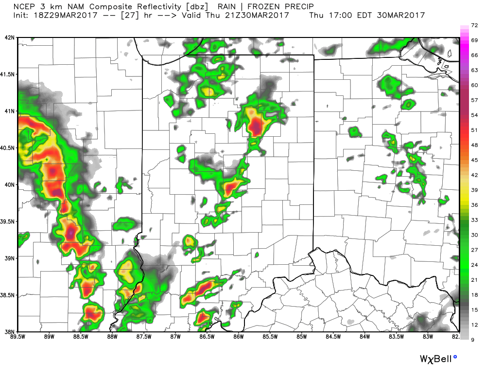 As we push into the overnight hours Thursday into Friday, unsettled weather will continue, but we’ll get rid of the severe potential. “Nuisance” type showers will continue into the first half of Friday before drier air arrives Friday afternoon and evening. This drier theme will settle in for the weekend and provide a very pleasant open to April.
 Highlights: