“Trouble” Brewing Mid Month.
We continue to closely monitor the goings on towards the middle of the month- more specifically March 12th through the 14th. There are indications a significant late season winter storm is brewing and the overall pattern is one that is aligning itself in a way that certainly has to raise an eye brow. That said, it’s far too early for precise details. Is a major storm possible? Absolutely. Is it okay to pin down a given area for heavy snow totals at this stage? Absolutely not.
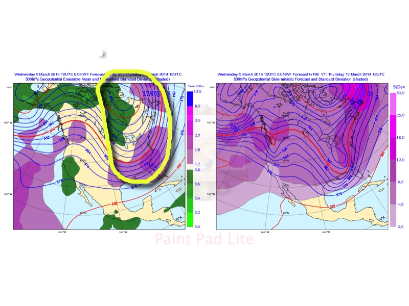
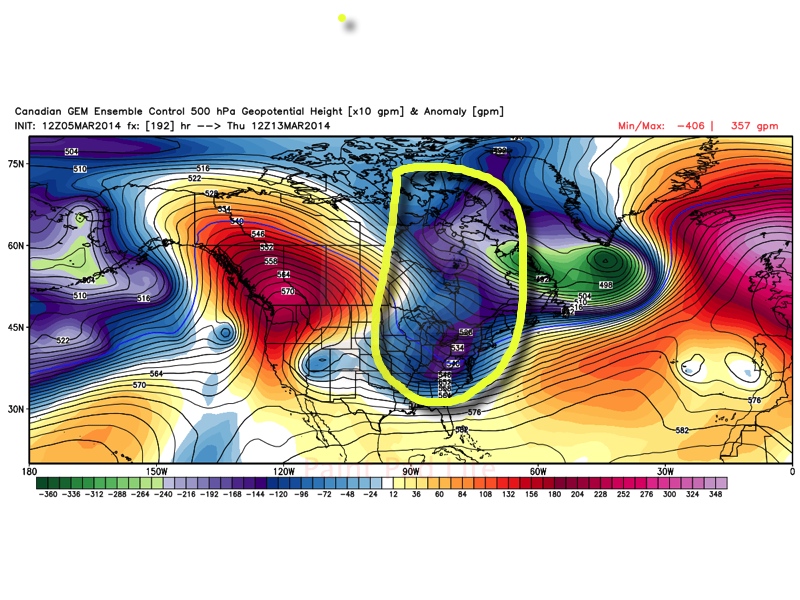
First, let’s take a look at the latest ensemble charts.
GFS

European
Canadian
At this stage in the game (more than a week away from the expected event), we suggest investing much more in the ensembles as opposed to a single operational model run. (Case in point just from today alone…the 0z run of the European suggested the interior northeast was ground zero for widespread 12″ type snowfall totals with little to nothing expected across central Indiana. Flip ahead 12 hours later and the 12z European takes the heavy snow axis through the heart of central Indiana on into the Northeast region).
Wikipedia has a nice write up on ensemble forecasting:
Ensemble forecasting is a numerical prediction method that is used to attempt to generate a representative sample of the possible future states of a dynamical system. Ensemble forecasting is a form of Monte Carlo analysis: multiple numerical predictions are conducted using slightly different initial conditions that are all plausible given the past and current set of observations, or measurements. Sometimes the ensemble of forecasts may use different forecast models for different members, or different formulations of a forecast model. The multiple simulations are conducted to account for the two usual sources of uncertainty in forecast models: (1) the errors introduced by the use of imperfect initial conditions, amplified by thechaotic nature of the evolution equations of the dynamical system, which is often referred to as sensitive dependence on the initial conditions; and (2) errors introduced because of imperfections in the model formulation, such as the approximate mathematical methods to solve the equations. Ideally, the verified future dynamical system state should fall within the predicted ensemble spread, and the amount of spread should be related to the uncertainty (error) of the forecast.
Though this is an event set to take shape close to a week from now, confidence on a significant storm across the east is higher than normal due to:
1.) Excellent agreement amongst the three primary mid range ensemble charts.
2.) The significance of the trough depicted on each set of ensembles.
While there are some differences, it’s highly unusual to see such relative agreement at this stage in the game. We continue to bracket March 12th through the 14th time period for potential impacts from this storm across central Indiana. Many questions will remain unanswered for now concerning precipitation type or amount, but we’re leaning more towards a winter weather maker at this early juncture for the Ohio Valley region. We stress this can, and likely will, change multiple times in the days ahead.
Regardless, we strongly agree with the week 2 temperature anomalies courtesy of the GFS. Should this come to fruition then March 12th through the 18th would feel more like early February then early to mid March. Again, we think the GFS is on to something with the return of the cold pattern.

As we move ahead know that we’ll be here keeping a close eye on the goings on behind the scenes around the potential “trouble” brewing for mid month. As we continue to dig into the details with this potential storm, you worry about finding ways to enjoy the spring like feel Friday and again Monday :-). We forecast both days to certainly have many craving spring as temperatures zoom well into the 50s both days. Get out there and enjoy it!