Scattered to numerous showers and thunderstorms continue to impact central Indiana, along with localized flash flooding (precipitable water values are currently above 2″ in spots and suggest localized very heavy…
You must be logged in to view this content. Click Here to become a member of IndyWX.com for full access. Already a member of IndyWx.com All-Access? Log-in here.
Dry Start To The Week…High pressure will remain in control of our weather today and supply lots of sunshine and seasonable temperatures.
Rain Chances Increasing…A cold front will drop closer to the region Tuesday and will help to serve as the trigger in widely scattered shower and thunderstorm development Tuesday afternoon. Mid week is where our questions lie and they have to do with just how far the front makes it before stalling. A combination of the GFS, European, and Canadian forecast models shows a variety of results. The European is most progressive and dries the region out quickly mid week with high pressure building into the area. The Canadian is the exact opposite as it paints a wide swath of heavy rain through the heart of the state (2″ type rains through late week). Finally, the GFS is in between the two. We think the GFS has the best idea as of now, but we’ll keep a close eye on things as we move through the next couple days. Stay tuned.
Pleasant Weekend…We’re confident on a weekend that should feature beautiful late-summer weather conditions- lots of sunshine, seasonable temperatures, and low humidity!
7-Day Precipitation Outlook:
7-Day Rainfall Forecast: 0.50-1.00″
7-Day Snowfall Forecast: 0.00″
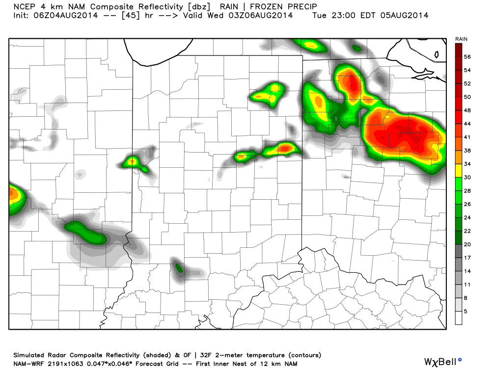
Forecast radar shows widely scattered showers and thunderstorms returning Tuesday. This is just the beginning of an unsettled few days ahead mid week.
Severe clear can be used to sum up the start to our Sunday. High pressure is in control and will result in a sun-filled day with temperatures trying their best…
You must be logged in to view this content. Click Here to become a member of IndyWX.com for full access. Already a member of IndyWx.com All-Access? Log-in here.
Happy Saturday! Upper level energy will hang around the region today, creating a continued chance of scattered showers and thunderstorms. Similar to Friday, a few of these could be strong…
You must be logged in to view this content. Click Here to become a member of IndyWX.com for full access. Already a member of IndyWx.com All-Access? Log-in here.
Continued Cooler Than Normal…The Great Lakes region and northern Ohio Valley will remain under the influence of a swirling upper low. This will keep better rain shower and embedded thunderstorm chances across northern parts of the state this afternoon. We’ll maintain mention of a widely scattered shower here this afternoon and again Friday, but coverage will be reduced from that which we’ve seen over the past couple days.
Questionable Saturday…Forecast models certainly aren’t in agreement on our weekend forecast and range from a dry and warm Saturday (European solution) to one that features plenty of cloudiness and showers around (GFS solution). The GFS has been the most consistent on our weekend forecast the past several days and we’ll lean our Saturday forecast more in that direction for now. Stay tuned.
Slow Warming Trend Ahead Of Next Storm…A warming trend will continue into the early and middle parts of next week as temperatures reach seasonal to slightly above average levels for a couple days. Our next significant storm system appears to be on the horizon late next week and include rain and storm chances along with another cool down.