Category: Forecast

Periods Of Heavy Rain Then Much Cooler…

A “wavy” frontal boundary will be located over our region through the next 36-48 hours before getting a “shove” south from a cold front Saturday. 


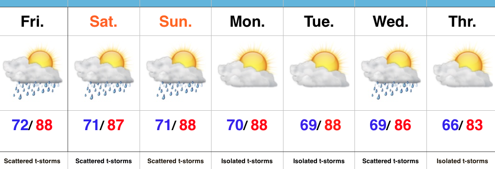
The combination of the stationary front along with a tropical-rich air mass in place will be enough in and of itself to produce periods of heavy rain today into Saturday morning. Add in a couple of disturbances moving along the boundary and the heavy rain prospects grow even higher. A strong to severe storm also can’t be ruled out-primarily this afternoon and again Friday afternoon. 

Already this morning (6:30a) we note widespread showers and embedded thunder impacting IL and northern IN. 


As mentioned, the air mass is plenty “juicy” to fuel locally heavy rain through the period. Precipitable water values (PWATs) will surge north of 2″ for all of central IN later today. 


While it won’t rain the entire time, periods of heavy rain will remain in our forecast today through Saturday morning. Widespread 1″-2″ totals will be common, with locally heavier totals. 


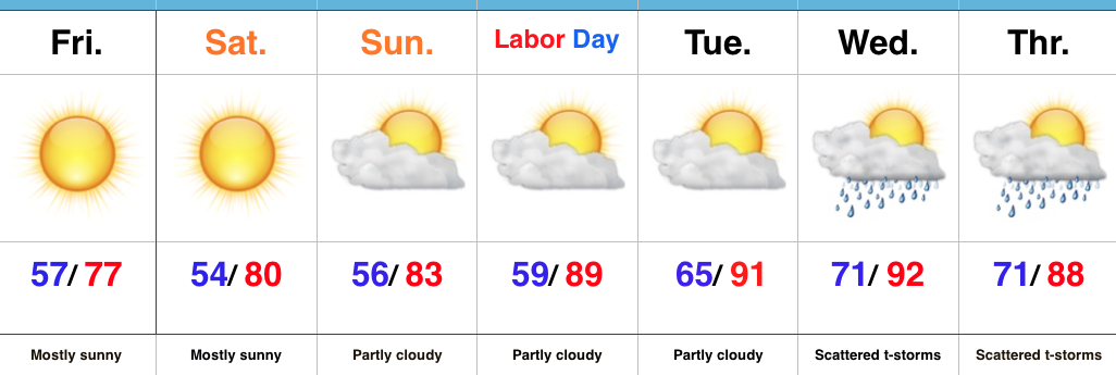
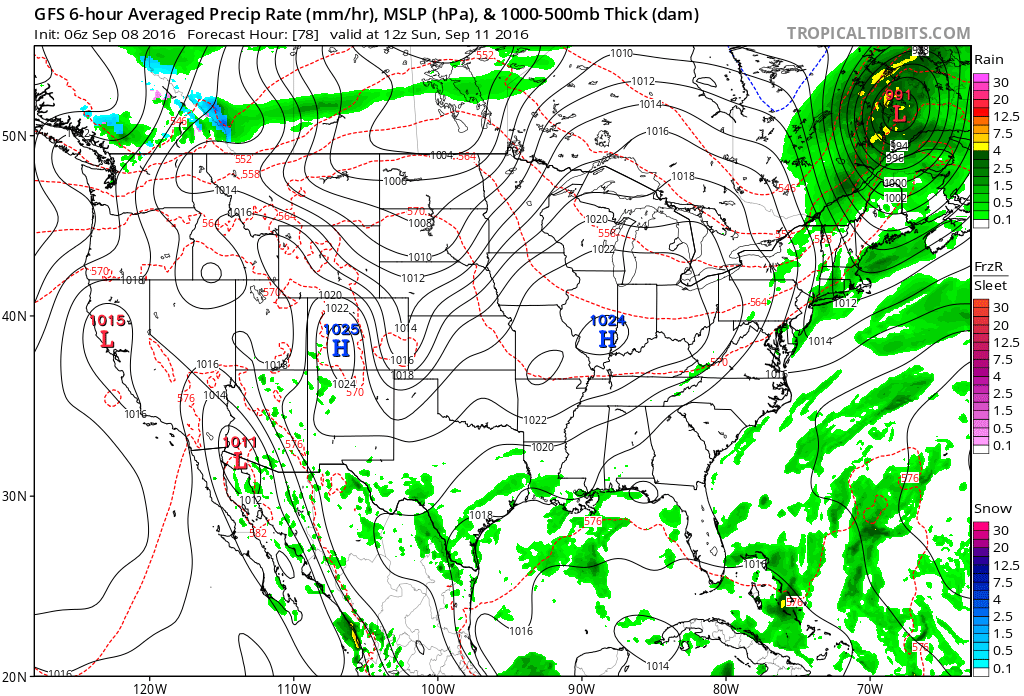
High pressure will build overhead Sunday and lead to quite the change. A much cooler and drier air mass will return along with brighter skies to wrap up the weekend. 


Lows in the middle 50s will be common for the city, itself, Sunday through Tuesday mornings. Upper 40s to lower 50s are a good bet away from the metro. 

Permanent link to this article: https://indywx.com/periods-of-heavy-rain-then-much-cooler/

Hot Weather Returns…

Screen Shot 2016-09-02 at 7.24.49 AMHighlights:

  • Sun-filled days
  • Turning hot
  • Storm chances return by mid week

Refreshing Temperatures (For Now)…High pressure and a dry northeast flow will continue to support refreshing conditions across the region.  Plentiful sunshine along with low humidity values will create ideal weather to spend time outdoors as we go into the long Labor Day weekend.  Perhaps a bonfire is in order this evening?

Eventually, our air flow will back around to the southwest and this will allow a much warmer and increasingly humid air mass to return.  Sunday will be noticeably hotter, but the true push of humidity will arrive Labor Day into Tuesday.  It’ll, officially, feel “oppressive” by mid week.  That increased moisture will also help ignite scattered storm chances Wednesday into Thursday.

Looking just beyond the (7) day period shows the potential of a cooler period building back in next weekend…

Upcoming 7-Day Precipitation Forecast:

  • Snowfall: 0.00″
  • Rainfall: 0.25″-0.50″

Permanent link to this article: https://indywx.com/hot-weather-returns/

Refreshing Times Ahead…

Screen Shot 2016-08-31 at 7.16.54 AMHighlights:

  • Scattered afternoon storms
  • Turning much drier and cooler tonight
  • Refreshing into the weekend

Cold Front Inbound…We’re getting to that time of the year where cold fronts will begin to pack more and more of a punch, offering up increasingly cool to, eventually, cold air…  An early fall-like front will surge south this evening.  Ahead of the boundary, scattered thunderstorms will develop this afternoon into the evening- particularly from central into southern portions of the state.  Storms will be moving relatively quickly this evening so flash flood concerns are limited.

Behind the front, much drier and cooler air will ooze into the region tonight and set us up for an absolutely delightful few days of weather, complete with dry skies and low humidity.  Temperatures into the upper 40s wouldn’t surprise us Saturday morning for outlying communities.

Eventually the heat will return from Labor Day into most of next week.  As moisture surges north, scattered storm chances will also return to our forecast by Tuesday.

Upcoming 7-Day Precipitation Forecast:

  • Snowfall: 0.00″
  • Rainfall: 0.50″-0.75″

Permanent link to this article: https://indywx.com/refreshing-times-ahead/

Well-Earned Break From The Heat, Humidity On Deck…

Screen Shot 2016-08-29 at 10.17.36 PMHighlights:

  • Scattered storm chances remain for now
  • Drier and much cooler air on deck
  • Dry, but hot Labor Day looms

Breath Of Fresh Air Awaits…Once we get through the next (48) hours, a much more pleasant, early fall-like, air mass awaits.  Beforehand, we still have plenty of heat and humidity to deal with, along with the all-too-familiar mention of scattered (but heavy) thunderstorms.  Thankfully, a cold front will push through the state Wednesday night into Thursday morning and usher in a much cooler and drier air mass to wrap up the work week and head into the long holiday weekend.  High pressure will supply a refreshing northeasterly flow Thursday into Friday, supporting breezy conditions and much cooler air.  It’ll be the type air mass that will make you take notice fall isn’t that far off, after all.

As we push closer to Labor Day, itself, our air flow will back around to the southwest and assist with a warmer and increasingly moist brand of air for the holiday, into the majority of the Week 2 period…

Upcoming 7-Day Precipitation Forecast:

  • Snowfall: 0.00″
  • Rainfall: 0.50″-0.75″ (locally heavier totals)

Permanent link to this article: https://indywx.com/well-earned-break-from-the-heat-humidity-on-deck/

Tropical Feel This Weekend…

Screen Shot 2016-08-26 at 6.01.18 AMHighlights:

  • Scattered weekend storms
  • Humid air mass
  • Less storm coverage early next week

Air You Can Wear…A very warm, moist, and unstable air mass will remain in place across the region this weekend.  While storms will be scattered, the moisture-laden air will help promote locally heavy storms at times.  Get used to heat indices in the mid-upper 90s into early next week.  Yuck!

Storm coverage will be on the decrease, overall, as we open the new work week.  That said, we have to maintain isolated coverage.  A weak boundary will slip through central IN the middle of next week and lead to scattered to numerous storms Wednesday.

In the tropics, Invest 99L remains at the forefront.  There are many more questions than answers at this time, but if the disturbance (somehow, someway) can make it into the southeastern GOM early next week, conditions will be much more favorable for development.

Upcoming 7-Day Precipitation Forecast:

  • Snowfall: 0.00″
  • Rainfall:  0.75″-1.25″ (locally heavier amounts)

Permanent link to this article: https://indywx.com/tropical-feel-this-weekend/