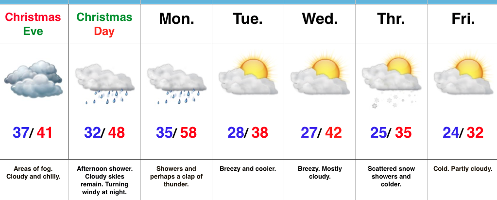
Merry Christmas Eve…
 Highlights:
- Areas of fog
- Rising temperatures Christmas night
- Turning more seasonable next week
Ah, Christmas Eve…From our home to yours, we wish you a very merry Christmas and a blessed holiday season. It’s hard to believe Christmas Eve is upon us. Despite areas of fog and an overcast, chilly day, weather really won’t present much of a challenge, locally, for travelers or last-minute shoppers (surely we don’t have any of those in central IN). 😉 Rudolph will be needed tonight as areas of fog and low clouds remain across portions of the state.
Conditions will remain damp and chilly into Christmas as most of the day remains in the 30s. Our air flow will shift to the south Christmas afternoon and provide a late day boost on the thermometer into the 40s after dark and near 50 by midnight. As we see the southerly wind erode the chilly conditions in place we’ll also have to be on the look out for a passing shower Christmas afternoon.
Better shower coverage will push in ahead of the cold front Monday morning. An embedded clap of thunder is also possible. Winds will shift to the NW with the passage of the cold front Monday afternoon and cooler air will spill into central IN Monday night. That high you see in the upper 50s will come just prior to the frontal passage.
After the mild start Monday, seasonable temperatures will return next week. Models are struggling with handling a piece of energy the middle of next week. We’ll keep an eye on it over the next day or so. Scattered snow showers will likely accompany a push of colder air Thursday.
Upcoming 7-Day Precipitation Forecast:
- Snowfall: Dusting
- Rainfall: 0.50″-0.75″
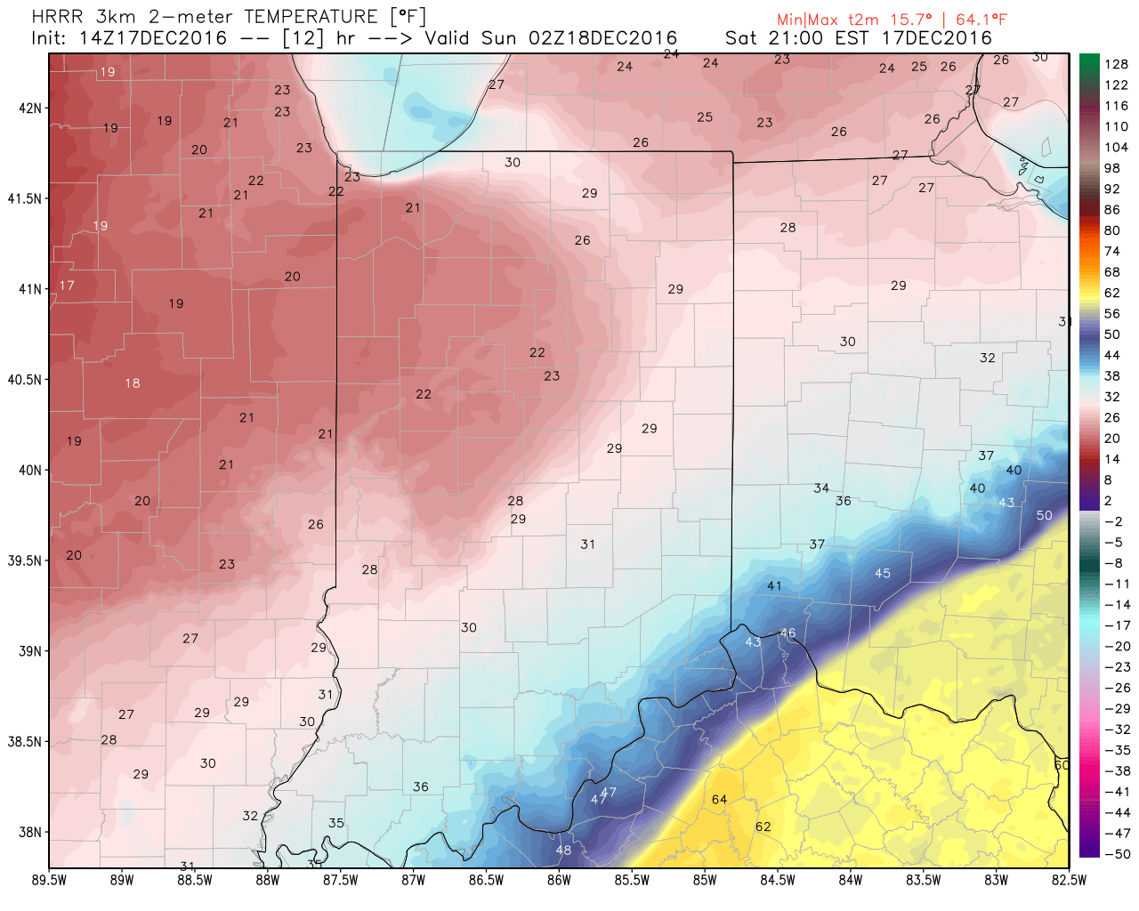
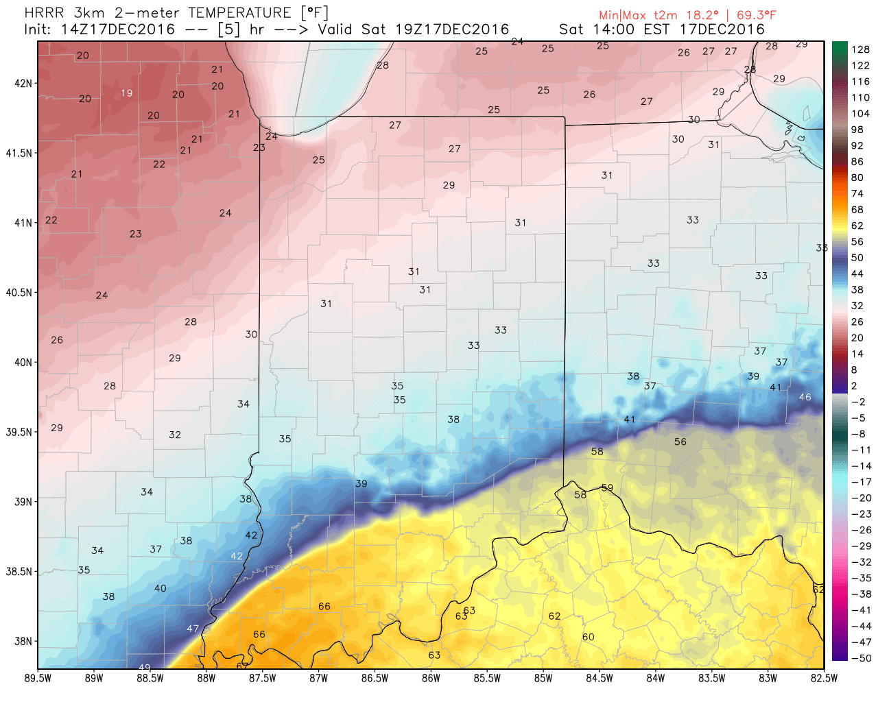 The heavy, dense, arctic air will win out as evening turns into nighttime. Indianapolis is back to the freezing mark around 6p and into the 20s by 9p.
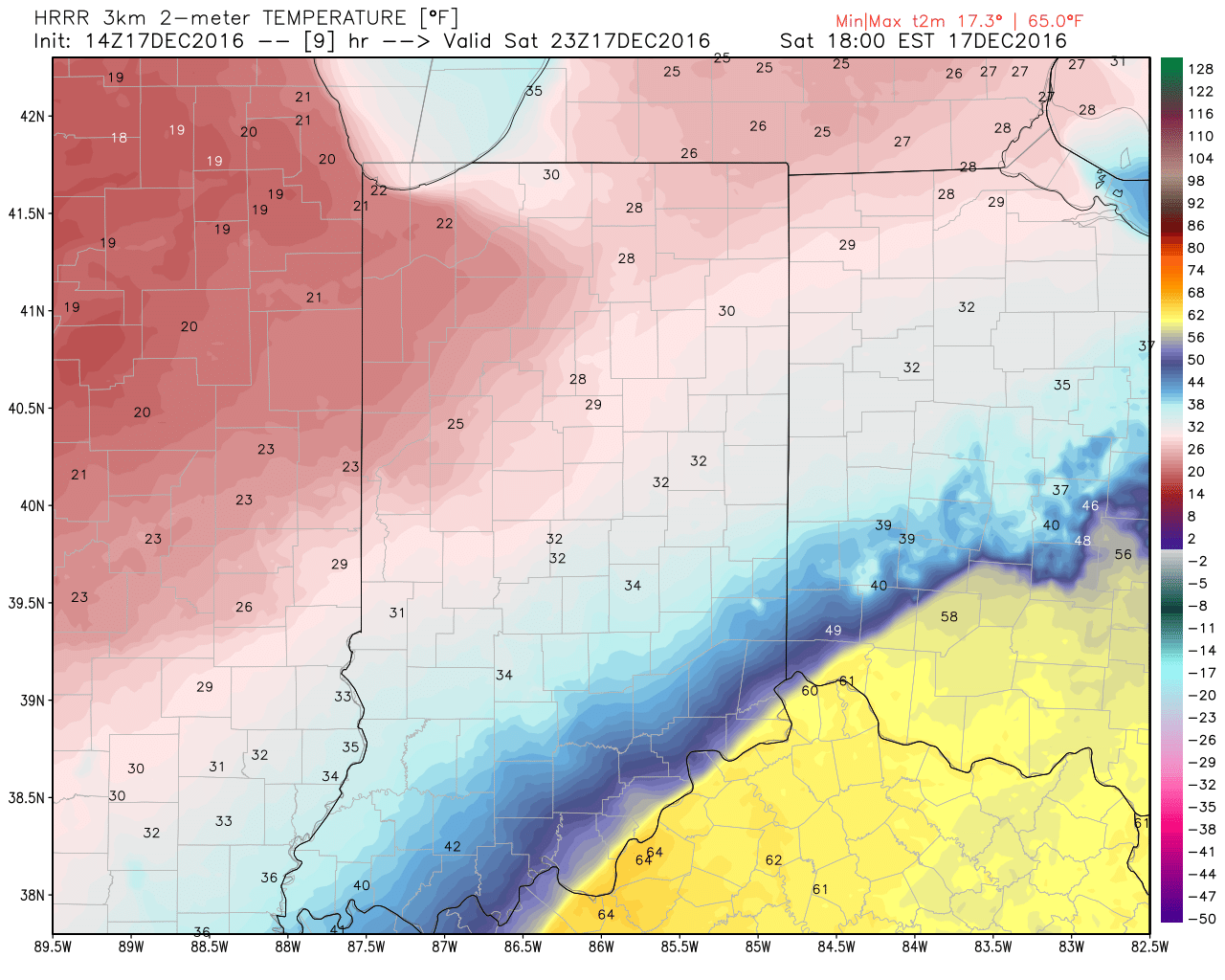
 Temperatures will continue to fall through the day Sunday and by Monday morning central Indiana will be in the single digits, with below zero readings across northern parts of the state.
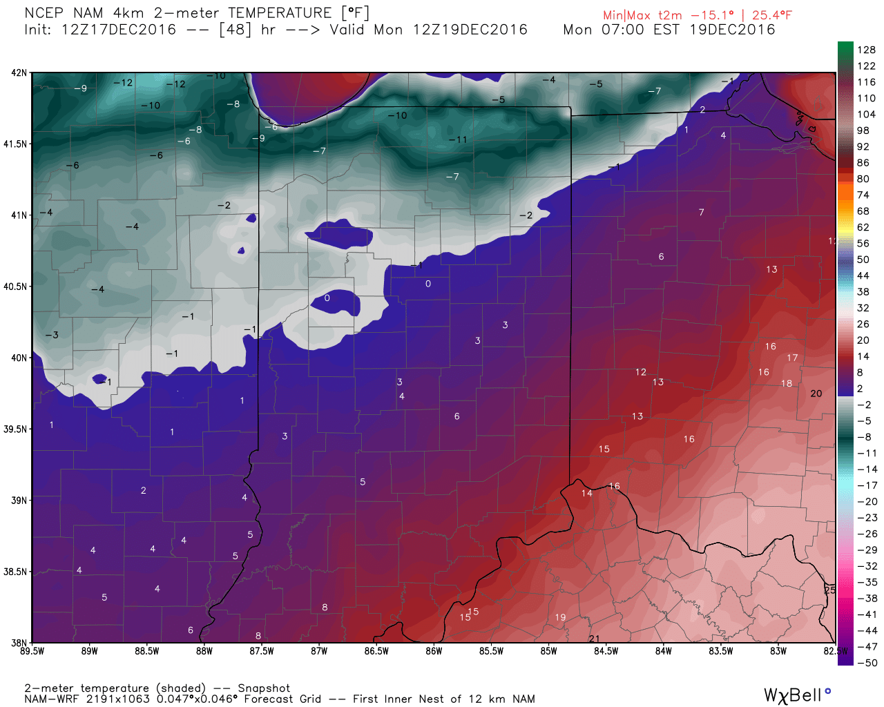 Wind chill values of 10 to 20 degrees below zero will be common by Sunday night into Monday morning across central Indiana.
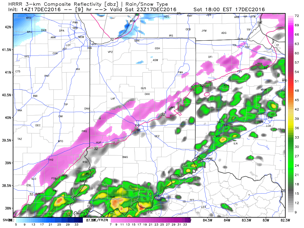
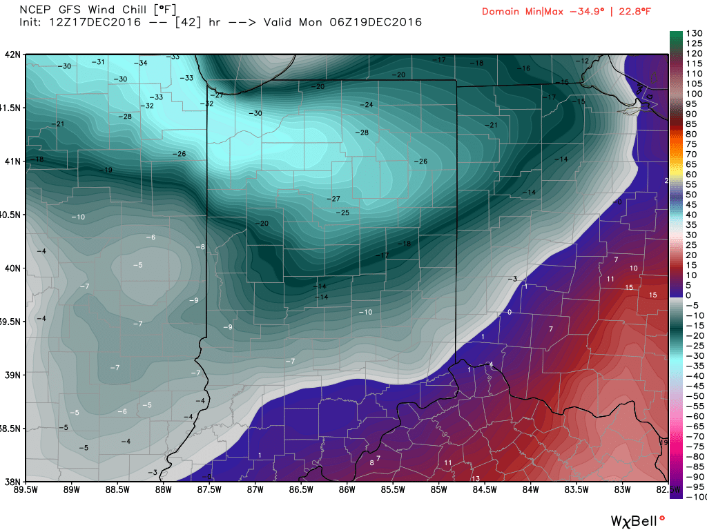 Areas of drizzle and freezing drizzle will continue across the region into the early afternoon, but begin to expand in coverage and intensity once again by evening. Note the area of freezing rain expand across central IN, including Indianapolis, between 4p and 7p.
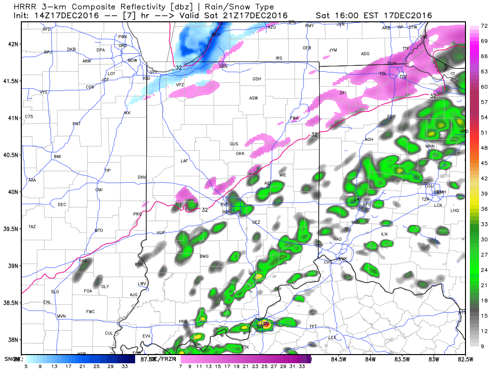
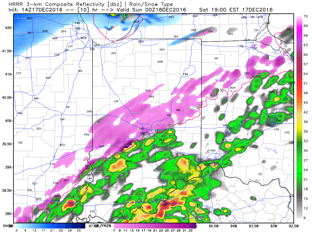 Freezing rain will eventually begin to mix with sleet and eventually transition to light snow during the overnight from northwest to southeast. A coating of snow to less than 1″ is a good bet on the new icy glaze that develops tonight.
