Strong Storm Potential Friday Before A Pleasant Saturday…
 Highlights:
- Strong-to-severe storms Friday
- Pleasant Saturday
- Humidity and storms return
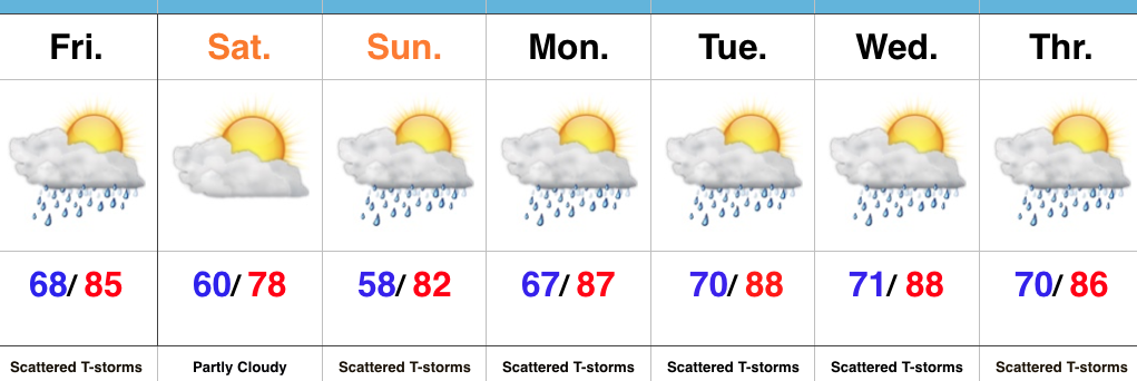
Active Friday For Some…Before we can discuss the pleasant and absolutely gorgeous weather conditions that will welcome in the weekend, we have to deal with a potentially “bumpy” few hours Friday afternoon into the early evening across portions of the state.
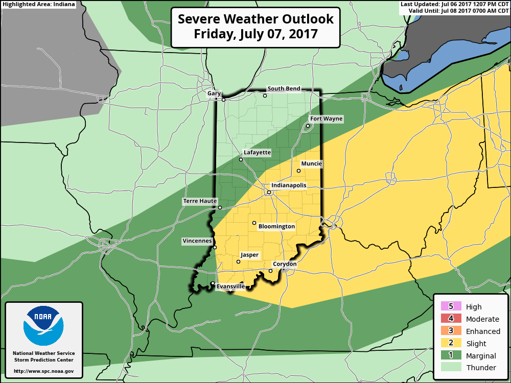
The Storm Prediction Center (SPC) outlines central and southern portions of the state for the threat of severe weather Friday. Damaging straight line winds are the greatest concern with a line of storms that develop Friday afternoon and push southeast. Drier weather will quickly build in behind a cold front Friday evening and help usher in a very pleasant open to the weekend. We’ll certainly notice the lower dew points Saturday and cooler feel with plentiful sunshine. Enjoy it!
Unfortunately the pleasant and dry conditions won’t last very long, and shower chances return as quickly as Sunday afternoon. Humidity and a true tropical feel will also engulf the region next week. This, combined with upper air disturbances moving through the Mid West and Ohio Valley, will aid in daily “splash and dash” thunderstorm coverage. With a moisture-rich air mass in place, stronger storms will produce torrential downpours. Overall, the active and unsettled summer that central Indiana has grown accustomed to shows no signs of let-up in the week ahead…
Upcoming 7-Day Precipitation Forecast:
- Snowfall: 0.00″
- Rainfall: 2.00″-3.00″ (locally higher totals)
 Highlights:
 Highlights:
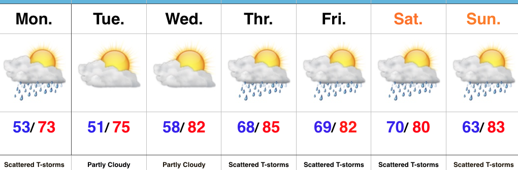 Highlights:
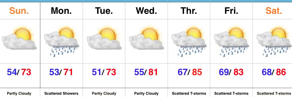 Highlights: