Summer Continues Into Next Week Before Cool Changes Take Over…
 Highlights:
- Summer-like heat continues
- Dry times prevail
- Much cooler air looms
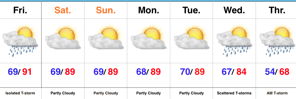
A Little Something For Everyone…If you’re a fan of summer, this forecast has it! If you’re a fan of fall, this forecast has that, too! Summer-like heat will dominate through the short-term with only a slight chance of an isolated thunderstorm today. Most will remain dry and that dry theme will carry us into the new work week ahead. Unseasonably hot (upper 80s to near 90 is downright hot) conditions will also continue as we open up the new week.
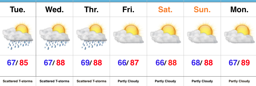
That said, a long advertised cold front will push towards the region by midweek and this will provide enough lift to create widely scattered thunderstorms Wednesday into Thursday morning. Significant and widespread rains aren’t, unfortunately, anticipated. The bigger deal will be the much cooler air that will spill into the region Thursday and set the stage for an unseasonably cool open to October.
Upcoming 7-Day Precipitation Forecast:
- Snowfall: 0.00″
- Rainfall: 0.10″ – 0.25″
 Highlights:
 Highlights:
 Highlights:
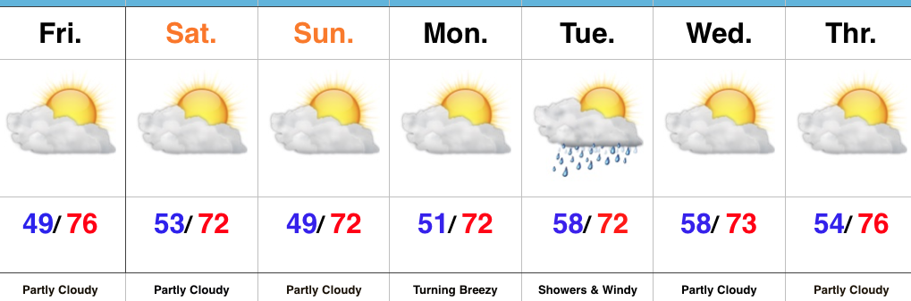 Highlights: