More Rain For Some; Watching Nate…
 Highlights:
- Wet close to the work week for some
- Saturday storms
- Watching Nate
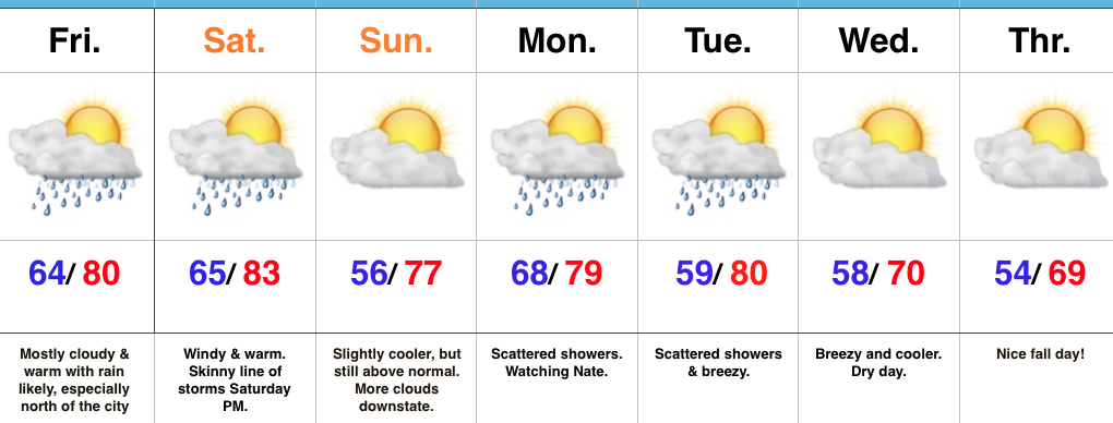
Unsettled Close To The Work Week…Thursday’s weather was just what the doctor ordered! Officially, here at IndyWx HQ, we recorded 0.73″. Many neighborhoods throughout central IN accumulated more than 1″ of much needed rainfall! Thankfully, additional rain chances are present as we wrap up the work week. Most widespread showers and embedded thunder will impact the northern half of the state Friday, especially the northern third of the state.
As we flip the page over to the weekend, mostly dry conditions can be expected, with the exception of a skinny line of thunderstorms that will blow through the state Saturday evening. These will come and go rather quickly and we’ll get into a slightly cooler and drier regime to wrap up the weekend.
Attention this weekend will be what comes of Nate. Overall, ideas haven’t changed over the past 24 hours, including an eventual late weekend landfall along the north-central Gulf Coast. That said, precise all-important details concerning overall strength are still debatable. Interests along the north-central Gulf Coast should monitor updates closely. Here on the home front, we note subtle differences between the GFS and European in regards to inland impacts. For now, we’ll go with a blend between the two, thinking most of the more significant, steady rains remain southeast of central Indiana.
Eventually a cold front will sweep through the state Tuesday night. This will result in a NW wind shift and cooler air spilling in here later next week.
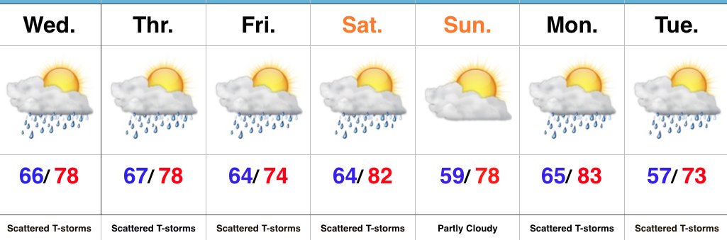
Upcoming 7-Day Precipitation Forecast:
- Snowfall: 0.00″
- Rainfall: 0.25″ – 0.75″
 Highlights:
 Highlights:
 Highlights:
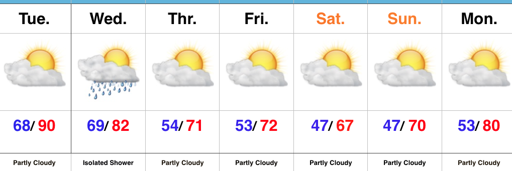 Highlights: