Focusing On Wednesday Evening Severe Potential…
Good afternoon! We wanted to cut a video discussing our thinking around timing and primary threats from any severe weather that gets going across central Indiana tomorrow evening.
Good afternoon! We wanted to cut a video discussing our thinking around timing and primary threats from any severe weather that gets going across central Indiana tomorrow evening.
|
Tue. |
Wed. |
Thr. |
Fri. |
Sat. |
Sun. |
Mon. |
|
|
|
|
|
|
|
|
|
70/ 90 |
71/ 89 |
71/ 89 |
70/ 86 |
70/ 86 |
70/ 84 |
67/ 80 |
|
– – – |
– – – |
Light |
Light |
Light |
Light |
Light |
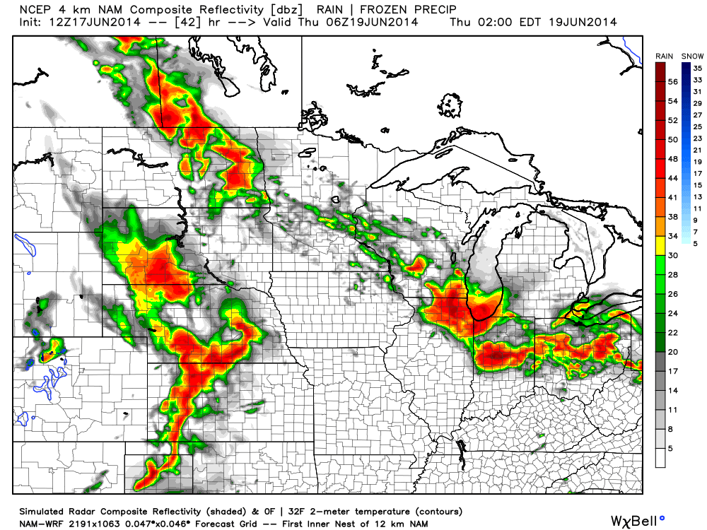
Hot and humid will sum things up nicely over the next 48 hours. Prepare to sweat as temperatures approach 90 both days and dew points remain between 65 and 70- oppressive! Better rain and storm chances enter the picture late Wednesday night and remain in our forecast into the upcoming weekend. Periods of locally heavy rainfall can be expected and we’ll also have to monitor for severe potential Wednesday night/ Thursday- with the big concerns being strong winds and large hail. Rainfall potential between tomorrow night and Sunday will reach 1.5″-2″ with locally heavier amounts. Looking further ahead…we still forecast a cooler pattern to develop next week. Much more later!
Walking out the door this morning feels dramatically different than what we’ve enjoyed over the weekend! Not only are humidity levels much higher, but temperatures are 15-20 degrees warmer than what they were this time 24 hours ago across the Ohio Valley and Great Lakes.

With the increased warmth and humidity, it’s not going to take much to kick scattered showers and thunderstorms off. That’s exactly what we’re seeing across central Indiana this morning. Locally heavy downpours are possible under any of the stronger storms.
Look at the Northeast region radar snapped at 8am, courtesy of the Penn State e-wall site:

As for precipitation amounts, it still appears as if we’re in a wetter than normal regime over the next couple weeks. As of this morning, we’re officially running 1.56″ above normal at IND year-to-date. A look over a blend of GFS, Euro, and Canadian would imply widespread 2-3″ amounts over the upcoming two weeks, with locally heavier totals where local downpours occur. This is NOT what one wanting a hot pattern to lock in wants to hear.
While warmth and humidity will be the story this week, we still think we turn cooler to wrap up June. We’ve been talking about a cooler than normal pattern developing for late month and latest guidance continues to suggest that thinking has merit. Much more later! BTW- your 7-day forecast can be found here.


Mon. Tue. Wed. Thr. Fri. Sat. Sun. 68/ 85 70/ 89 71/ 90 70/ 89 71/ 85 68/ 86 67/ 84 Light –…
You must be logged in to view this content. Click Here to become a member of IndyWX.com for full access. Already a member of IndyWx.com All-Access? Log-in here.
Our nice weekend is set to continue for another 18-24 hours with another unseasonably cool night ahead. While humidity will increase during the afternoon Sunday, most of Sunday will be dry, albeit warmer. High temperatures will climb into the middle 80s for many central Indiana communities.
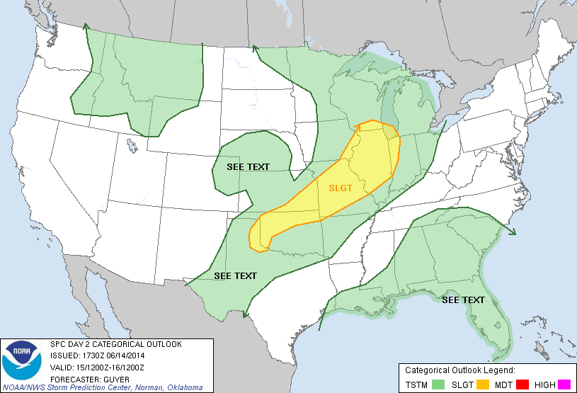
Times will begin to change as we go into Sunday night as just the beginning of a series of convective elements come together to impact the region through Tuesday. Thunderstorms will likely rumble into far western portions of the state as early as 4-5pm. Speaking of far western portions of Indiana, the updated severe weather outlook from the Storm Prediction Center highlights western Indiana for a slight risk of severe thunderstorms. Again, this is a late day severe weather risk with damaging wind and large hail of greatest concern.
Forecast simulated radar shows the convection rumbling east Sunday night and most of central and eastern Indiana get in on the thundery action before Sunday is finished. Here’s a look at what the radar may look like from 8pm Sunday to midnight Monday morning.
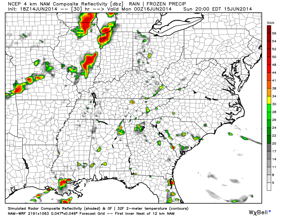
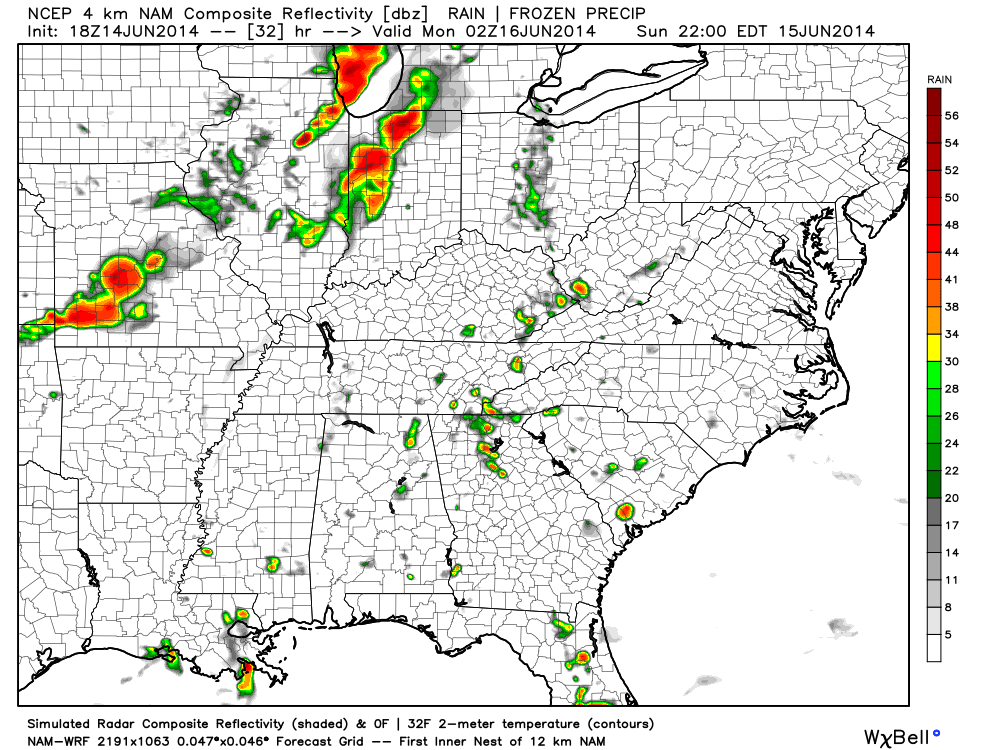

While the storms will likely weaken as they track east, a strong thunderstorm or two is certainly possible for the greater Indianapolis region Sunday night. We’ll keep you posted with future updates. Have a relaxing Saturday night.