
As our attention shifts to the medium range, it’s becoming increasingly apparent that this weekend will be dominated by an upper level ridge “ballooning” over the Ohio Valley. Both the GFS and European forecast models (and their ensembles) show this.
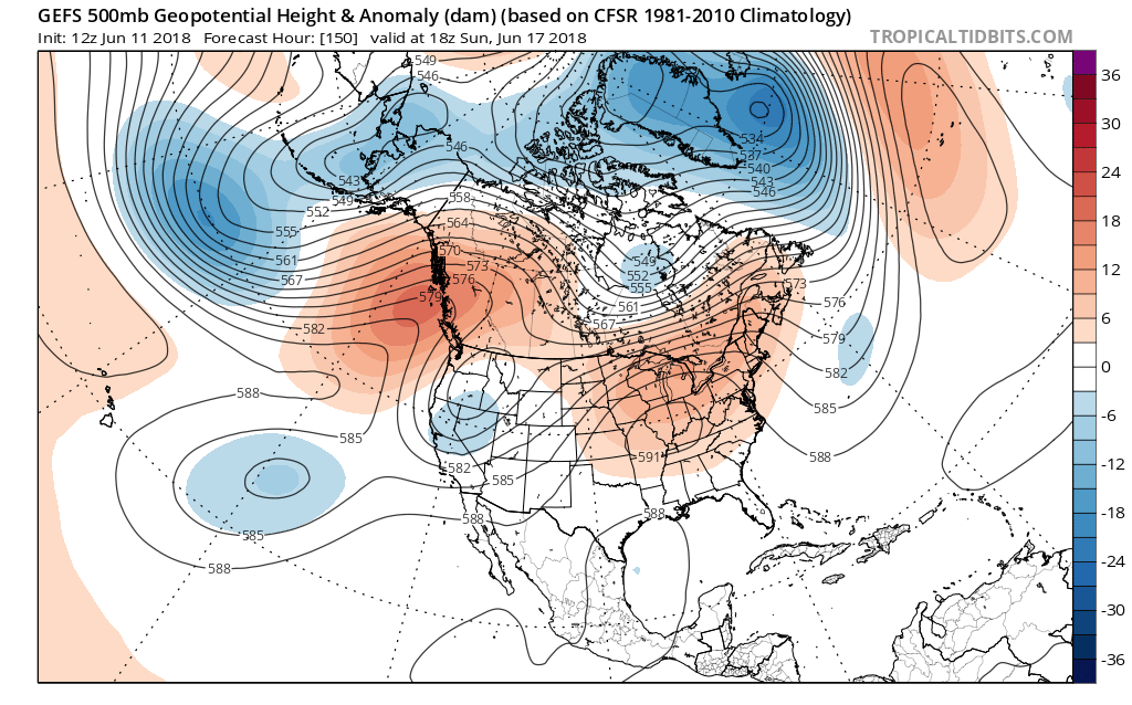
 The end result shouldn’t only be an increasingly hot pattern taking hold Friday through Monday, but one that features mainly dry conditions, as well. With the upper ridge expanding over the immediate region, the majority of central Indiana neighborhoods should expect to remain mostly dry this weekend (only “isolated” coverage of storms expected at best).
Highs Friday through Monday should flirt with 90°- if not exceed the 90° mark at times (hottest days appear to arrive Saturday and Sunday).
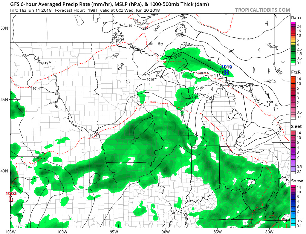
 Rain and storm coverage should increase early next week as a cold front approaches the region. With the increasing moisture, temperatures should also cool- at least slightly, as well…


 An early look at next weekend shows general agreement with the GFS and European forecast models: drier air returning along with slightly cooler air. We’ll keep you updated!
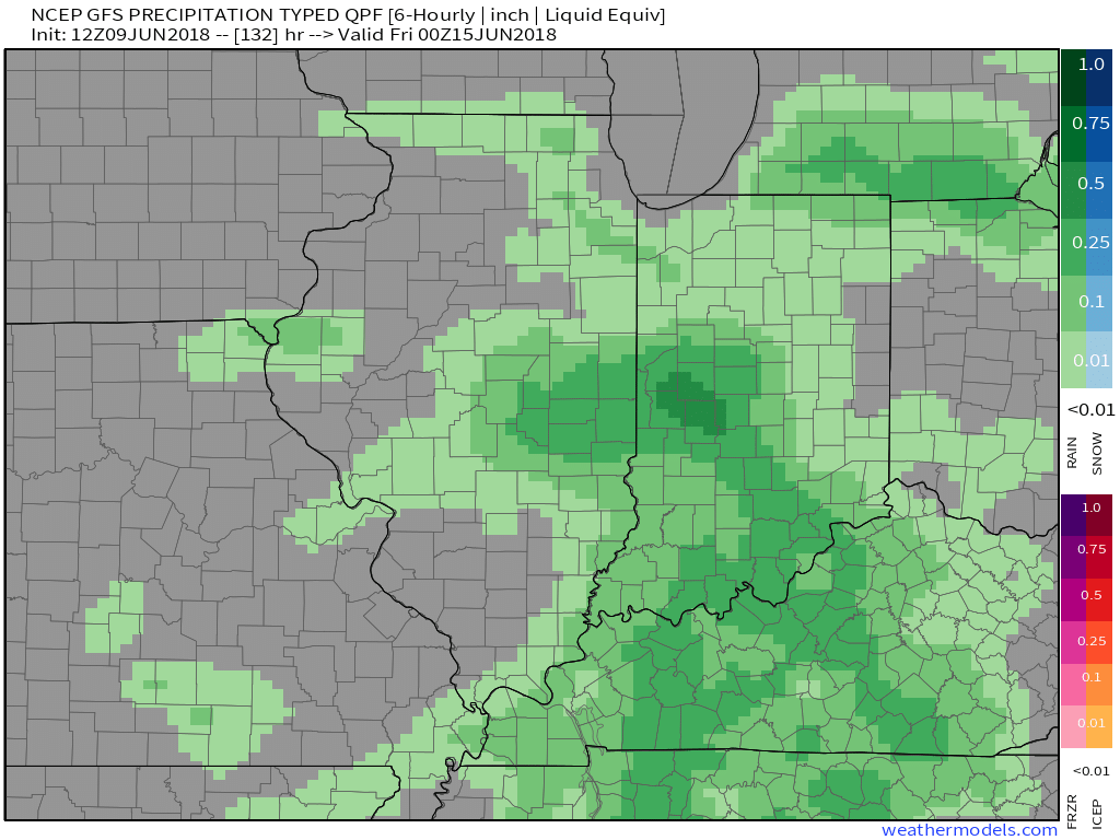
 Unfortunately, this won’t be a widespread soaking rain, but there will be a few neighborhoods that cash in on locally heavy downpours. Where thunderstorms track, a couple of 1″+ reports can be expected.
 A pleasant air mass will arrive on the scene for the second half of the weekend and remain with us into early next week. With lower humidity in place, overnight lows will fall into the 50s early next week.