Considerable Cloudiness Remain; Mid Week Snow Flakes…
 Highlights:
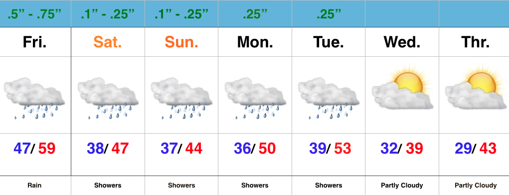
- Showers/ drizzle return tonight
- Scattered snow showers Wednesday
- Dry and mild to close the week
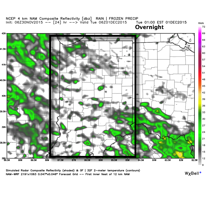
We’re getting the work week kicked off with weather conditions that have been common over the Thanksgiving weekend- cloudy and cold. Moisture will return slowly this evening and overnight with showers and drizzle moving back in. We’re not looking at significant rains by any stretch of the imagination, but this is what the radar could look like during the overnight, courtesy of Weatherbell.com.
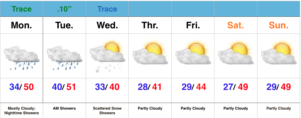
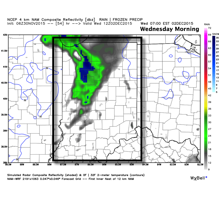
 Showers will exit Tuesday morning and most of the day will be rain-free. Colder air will slowly move back into the state Wednesday morning and as wrap-around moisture pivots through central and northern IN Wednesday scattered snow showers will result. We’re not looking at any accumulations, but it’ll be nice to see a little of the white stuff falling.
 Once our Wednesday snow showers exit we’ll get back to dry skies and mild temperatures to wrap up the work week and head into the weekend.