As I sit here in the good ole weather office, snow is falling and the Christmas lights are shining at the McMillan household. Just doesn’t get any better! Unfortunately, for winter lovers out there, the overall weather pattern over the upcoming couple weeks won’t offer up much in the way of wintry precipitation, as strong ridging results in a rather prolonged period of uneventful and mild weather across these parts (at least compared to normals).
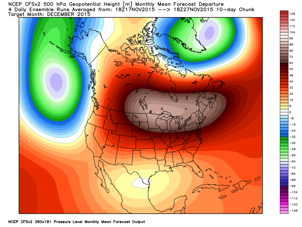
The GFS ensembles show ridging expanding over our region this weekend into early next week. Source: Weatherbell.com
That said, there are indications that our weather pattern may be changing enough to at least put us on the playing field for wintry potential as we rumble into the back half of the month, including the all-important Christmas period.
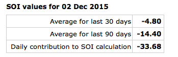
The SOI continues to tank and while the impacts (storminess) of a tanking SOI are delayed, we’re in the time frame now where this may result in busy times, or an active storm track, come mid and late December.
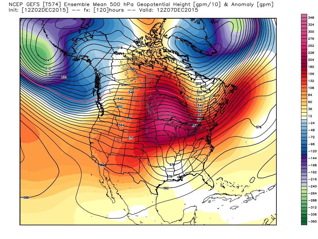
 Right on schedule, we see the GFS ensembles going towards a much different look around mid month. Note the heights (ridging) pulling further and further north while the southern stream energizes. This is likely a byproduct of that tanking SOI that we see now.
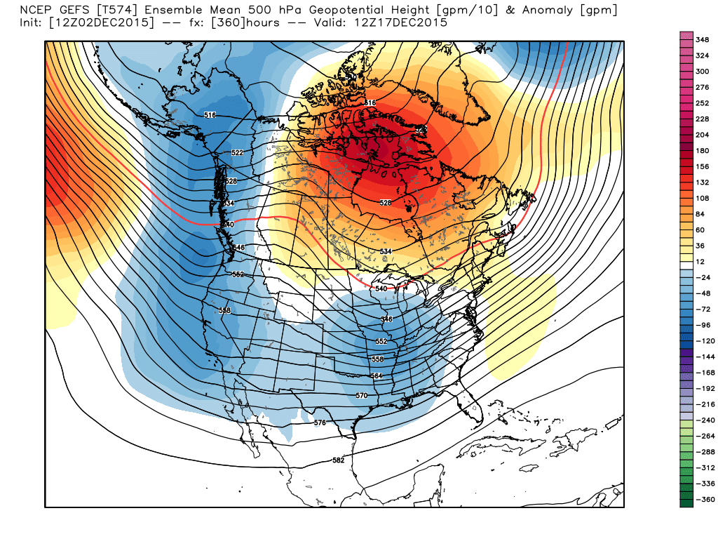
GFS ensembles. It’s a “night and day” difference out at mid month. Source: Weatherbell.com
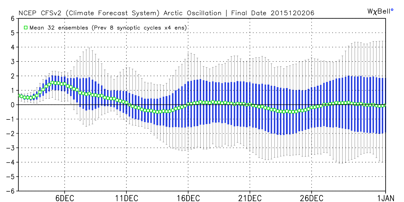
We also note the AO, or Arctic Oscillation, trending more in a negative to neutral direction. While still not significantly negative, this is an improvement from a winter lover’s perspective from the positive values we’ve seen of late.
 We’re only two days into meteorological winter and still feel very confident about our winter outlook, focusing on the back half of winter for the worst conditions, relative to averages. That said, even though the first couple of weeks of December, as a whole, may not be as cold or snowy as you’d like, it doesn’t mean we can’t reverse things enough to put us in a position to make for more “interesting” times around these parts leading up to Christmas….
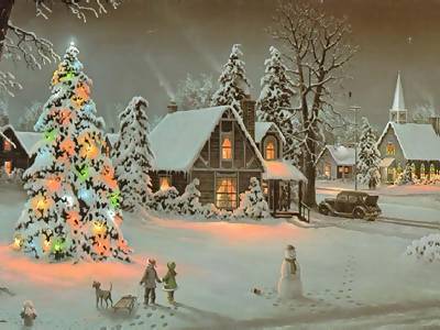
Could this be the scene this Christmas across central IN? Much more later!