
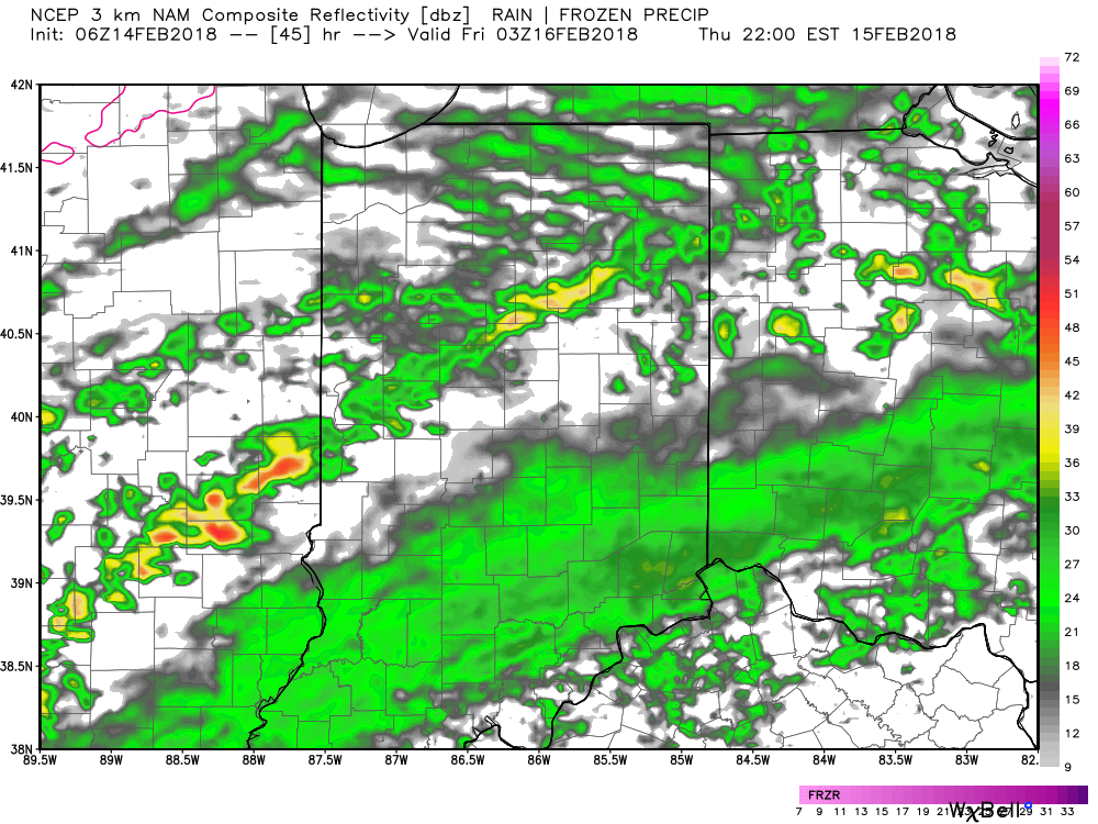
I. A weak weather maker will help spread a mixture of light rain and snow across the state later today, particularly this afternoon and evening. Precipitation amounts will remain light and insignificant, but serve as a nuisance as you go about your weekend plans.
 II. We’re hopeful for much needed sunshine Sunday as we’ll be in between storm systems, however any sun that we see won’t last long.
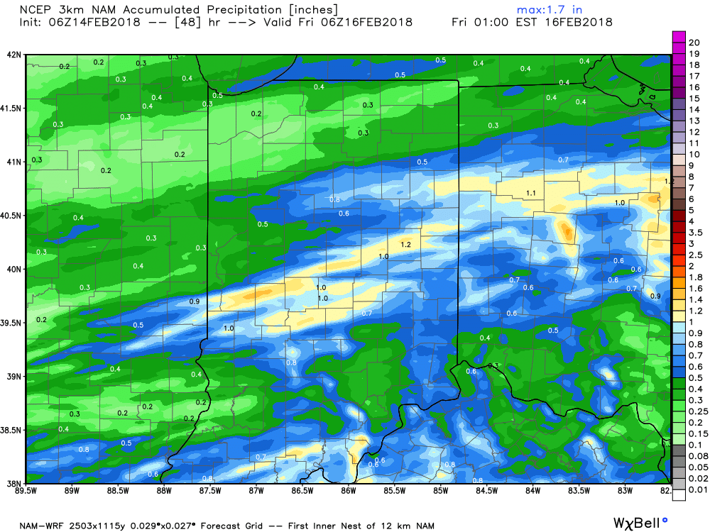
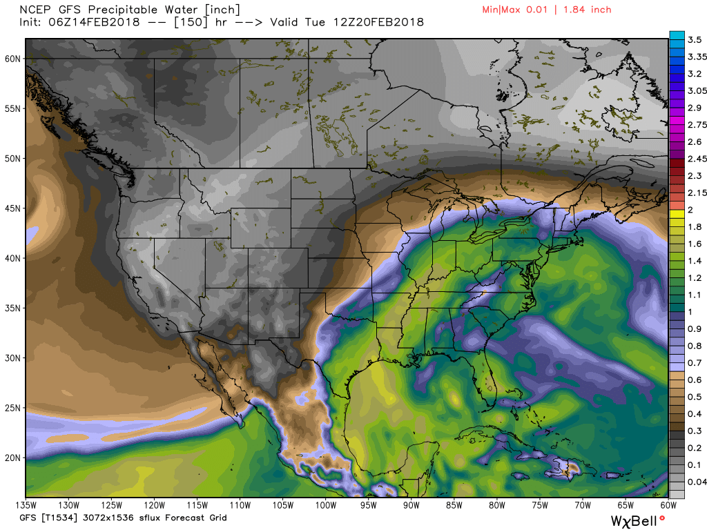
A rather ominous setup for heavy rain will take place Monday into Wednesday. This will include a combination of ingredients as a strong southeast ridge will prevent much forward motion of a “wavy” front that will drape itself across the Ohio Valley region. Additionally, the subtropical jet will transport moisture-rich air northward into the area (true Gulf of Mexico connection).
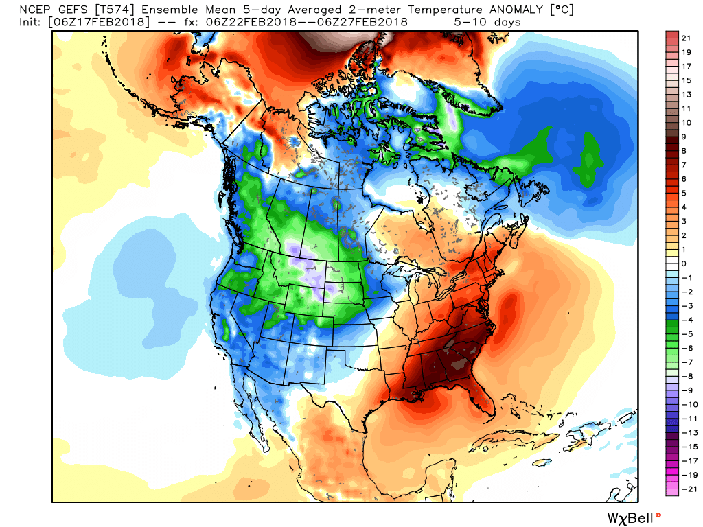
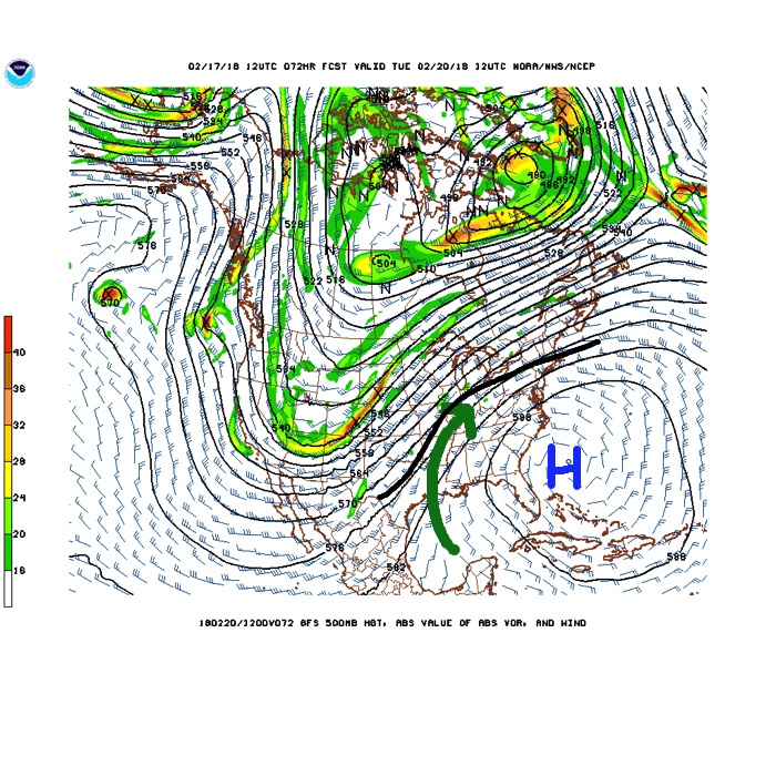 While this is an unseasonably warm pattern (we forecast highs of 50°, or above, 5 out of 7 of the upcoming days, and at least 2 60°+ days), it’s one that will likely result in periods of heavy rain not only next week, but in waves over the upcoming 10 days.
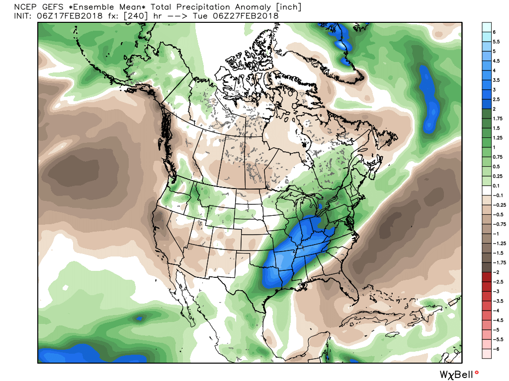 Widespread 10-day rainfall numbers of 3″ to 4″ will be likely in this setup, including locally heavier amounts of 5″ to 6″ in spots. Certainly, if you live near waterways we suggest having a plan in place as it’s not a matter of if, but when flooding takes place in spots across the region with such a setup.
III. Longer-term, we still need to be wary of the potential of a colder pattern returning as we get into March. That forecast deep negative arctic oscillation (AO) has to raise an eyebrow for the possibility of making up for lost time in the cold weather department before we can signal “all clear” on winter…

 III. We’ll turn briefly colder to close the work week. A couple of light snow showers are possible Friday morning and a wave of low pressure will “try” to push moisture into the cold air Saturday. As of now, we remain unimpressed with the prospect of impactful wintry weather Saturday, but have included the potential of wet snow in our Saturday forecast. Precipitation appears to be very light. Nonetheless, we’ll continue to keep an eye on things.
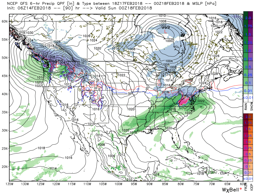 IV. The pattern continues to scream and warm and wet next week as a big ole southeast ridge remains in place. This will direct the steering current into the TN and OH Valley regions and multiple waves of rain, occasionally heavy, will result beginning early next week and continuing into the middle and latter portions of the week. Widespread 2″ to 3″ totals with locally heavier amounts seems to be a good bet next week.
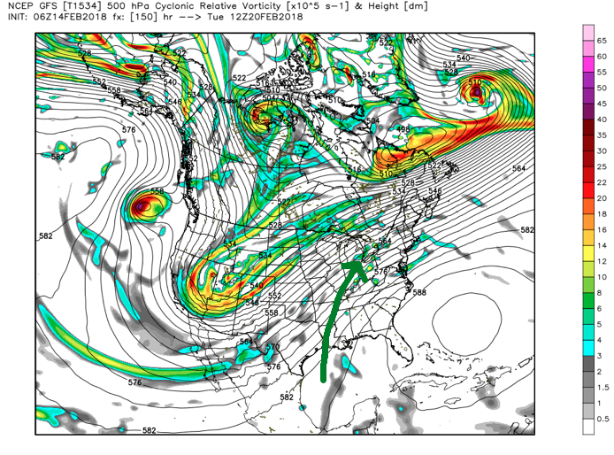
 V. We note data continues to suggest a colder period looms as we close out the month of February and head into March. Note how the GEFS and EPS continues to tank the Arctic Oscillation (AO). Winter’s not over, not by a long shot…
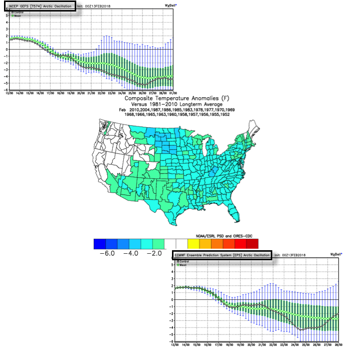
 As we look at today’s MJO plot note how we’ve meandered about Phase 7 much longer than initially expected. Also (still) note the attempt to move into the colder phases towards the end of the period, which we’ll talk about here in a bit.
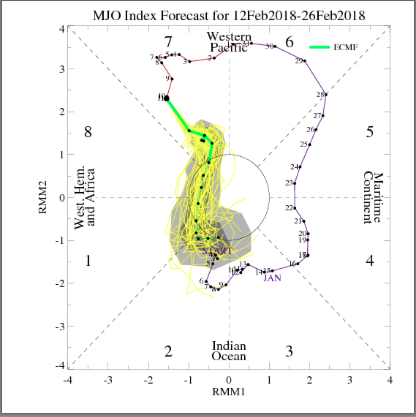 The result has been a cold north-central that has “bled” into the Ohio Valley, while the immediate eastern seaboard and especially southeast has already gotten off to a warm to blow torch start to the month.
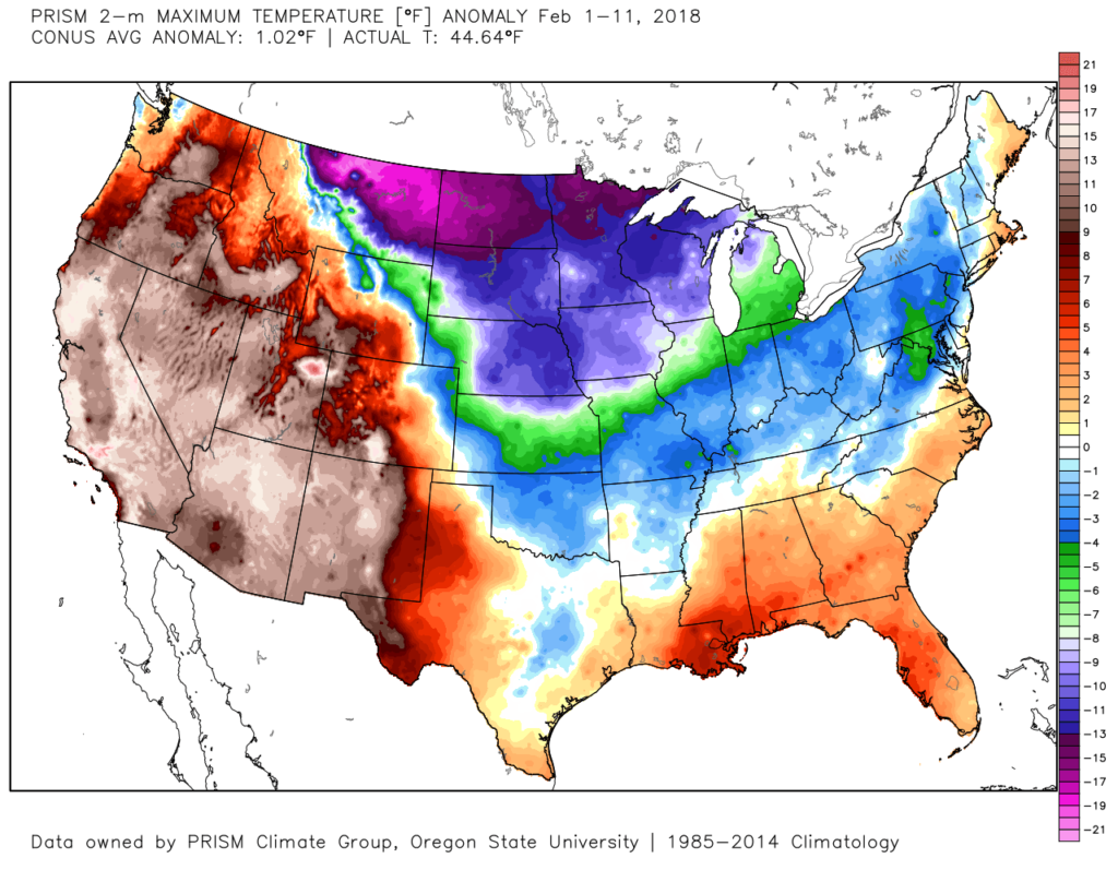 Looking ahead, there’s no denying the overall warm pattern (relatively speaking) over the upcoming couple weeks. Phase 7 will continue to do work on the pattern.
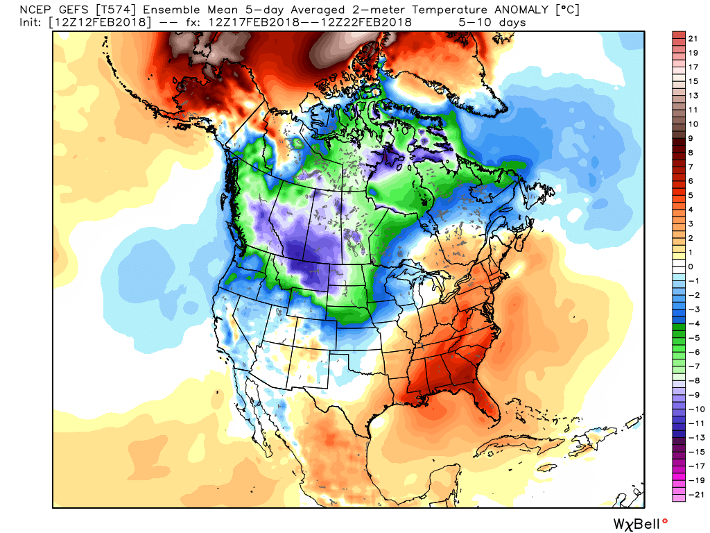
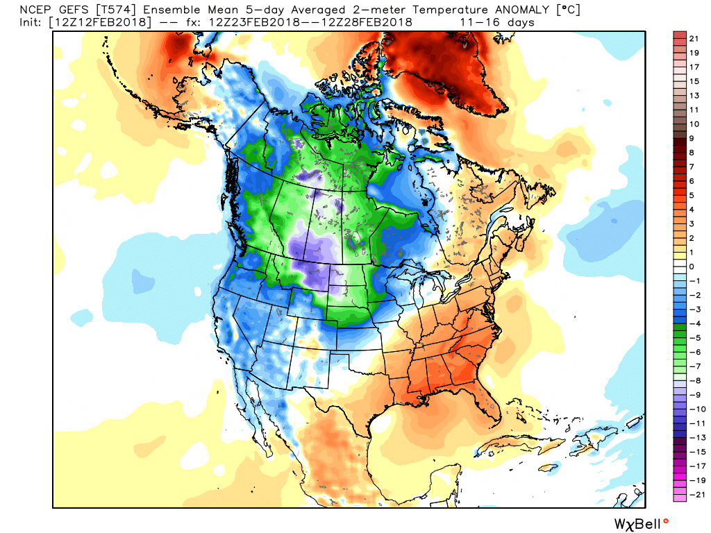 Obviously this is right in the heart of when we thought the colder MJO phases would combine with favorably cold teleconnection signals to produce a period of frigid weather. Instead, cold shots will be fleeting and any sort of winter weather threats of significance will be few and far between over the next 10-14 days. In short, Phase 7 will overrule the colder teleconnection signals that will evolve over the period.