Category: Forecast Models

Dinnertime Rambles: Quiet Through The Short-Term And Longer Range Musings…

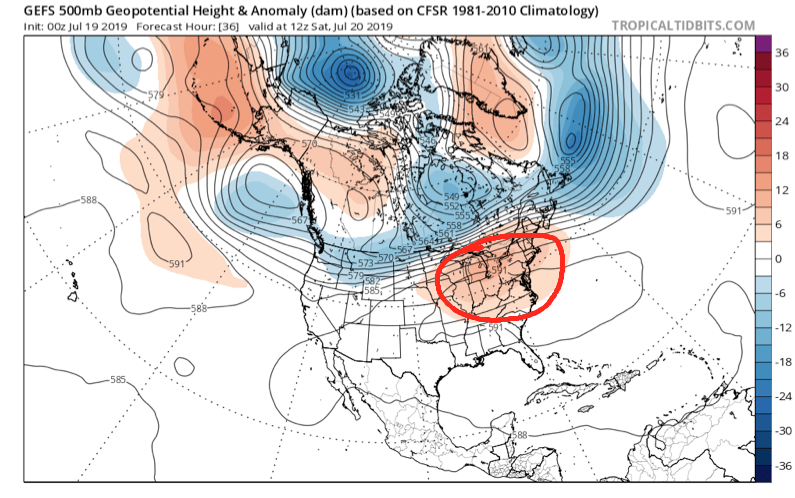
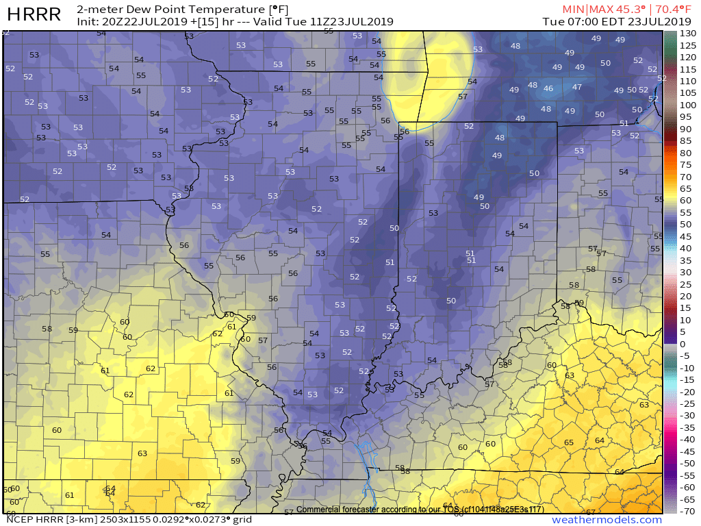
I. Drier air continues to surge south and with it will come much cooler temperatures overnight into Tuesday morning. We still believe most central Indiana reporting sites will fall into the middle 50s Tuesday morning. Turn off that A/C and open up those windows!

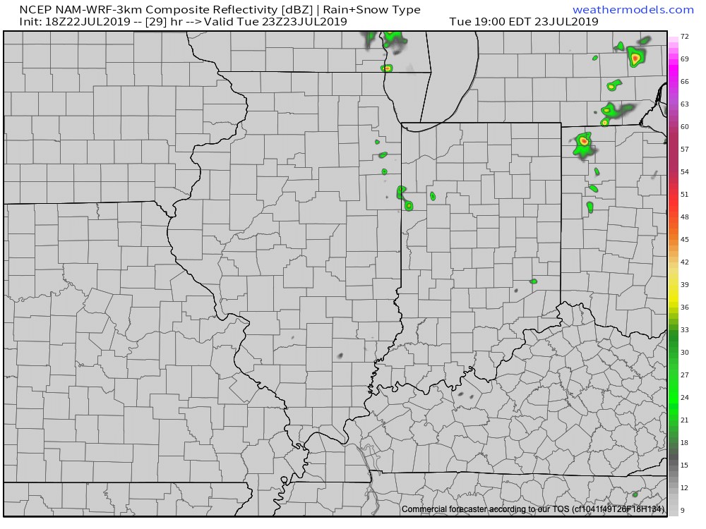
II. Weak upper level energy will push south and lead to isolated to widely scattered instability-driven showers across northern parts of the state tomorrow afternoon. A couple of these quick-moving showers could scoot into central Indiana, but we continue to believe most will remain free of any precipitation tomorrow.

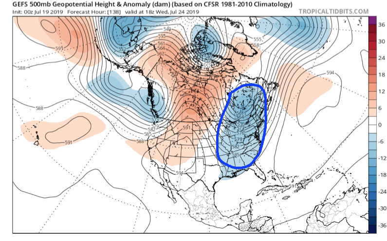
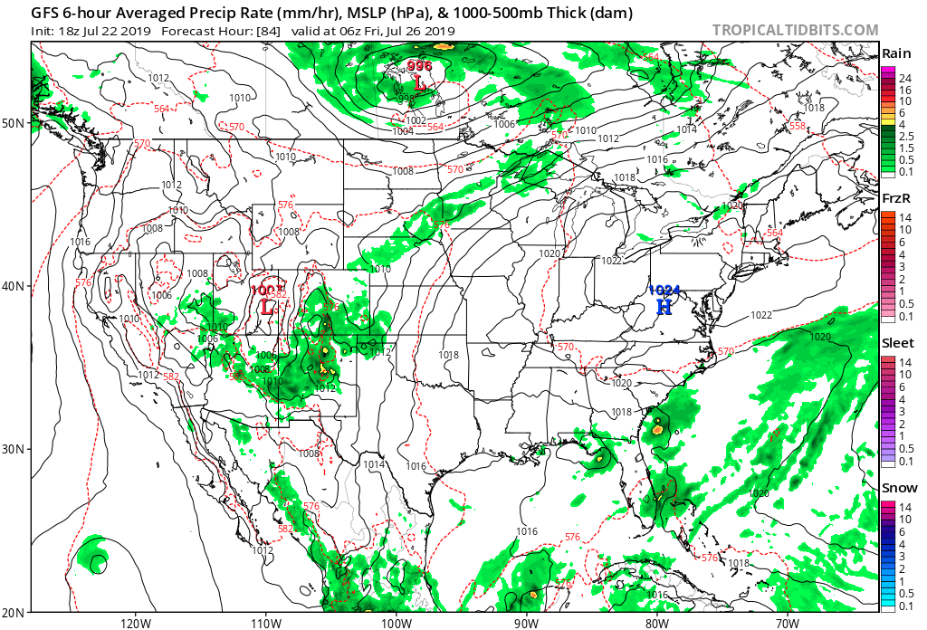
III. Overall, we’re looking at a very quiet weather pattern through the weekend with an extended period of dry weather, thanks to high pressure. Temperatures will slowly warm from the unseasonably cool and refreshing levels into mid week to more of a seasonal feel this weekend.

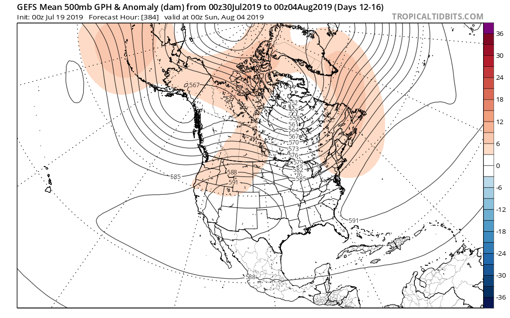
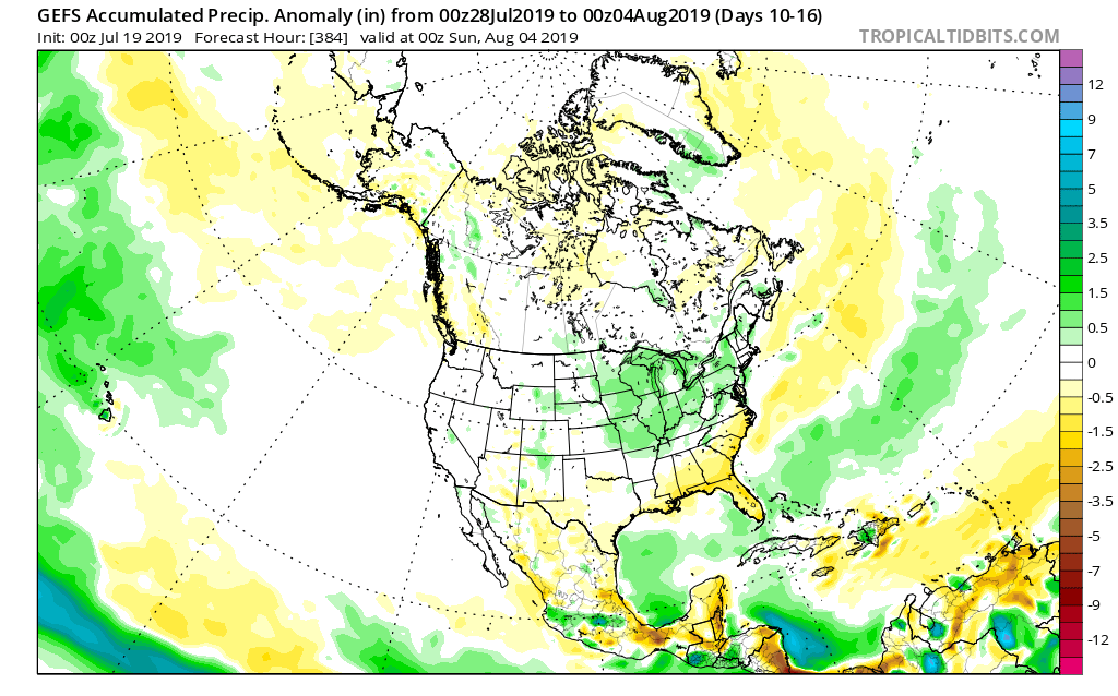
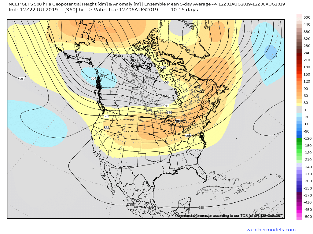
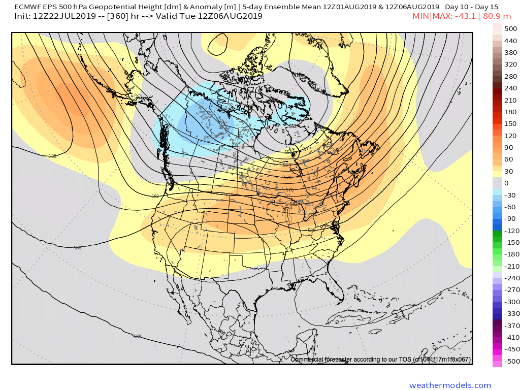
IV. As we look ahead, the upper air pattern should transition to more of a classic summer-like regime to open August. However, data shows the ridge continuing to “retrograde” west with time, resulting in a period of wetter conditions with a northwest flow aloft Days 10-15 (roughly Aug 2nd- Aug 7th). It’s always good to see agreement between the European and GFS ensemble products below.

V. Research continues on the upcoming fall and winter and it’s becoming increasingly difficult to ignore the warm sea-surface temperatures across the northeastern Pacific. Interestingly, most seasonal model data maintains this warm “blob” into the late fall and early winter. Note where we are currently (center photo) vs. where the projection off the UKMET (top left) for Oct-Dec and European (bottom left) for Nov-Jan.

While only 1 of several ingredients used in building our seasonal outlooks, this can promote the tendency for more persistent western ridging and downstream trough (associated colder pattern) across the East…

Permanent link to this article: https://indywx.com/dinnertime-rambles-quiet-through-the-short-term-and-longer-range-musings/

VIDEO: Relief Is Here; Quiet Pattern Into The Weekend…

You must be logged in to view this content. Click Here to become a member of IndyWX.com for full access.  Already a member of IndyWx.com All-Access?  Log-in here.

Permanent link to this article: https://indywx.com/video-relief-is-here-quiet-pattern-into-the-weekend/

VIDEO: Big Changes On Deck; Looking Into August…

You must be logged in to view this content. Click Here to become a member of IndyWX.com for full access.  Already a member of IndyWx.com All-Access?  Log-in here.

Permanent link to this article: https://indywx.com/video-big-changes-on-deck-looking-into-august/

Dangerously Hot Now, But We’re Talking About An Entirely Different Weather Pattern To Close July And Open August…

Over the weekend we’ll bake in some of the hottest and most humid air we’ve dealt with around these parts since 2012, however big relief is on the horizon.

We’ll get rid of the expansive upper level ridge responsible for the heat this weekend and replace it with a significant trough (at least by late summer standards).

Weekend heat and humidity will be about as bad as it can get around central Indiana. It’ll be important to build in frequent breaks indoors if you have any sort of lengthy outdoor activities planned.
A major pattern flip will result in unseasonably cool and refreshing air next week.

A strong cold front will sweep through the Ohio Valley Sunday and Monday with increasing coverage of showers and thunderstorms (a few may be strong). It’s this front that will help usher in the refreshing changes for next week. We’ll go from heat indices between 104-108 this weekend to overnight lows in the upper 50s to lower 60s at times next week. Ahhhhhh….

As we look ahead to early August, there’s certain to be additional warm-hot days, however, the mean pattern doesn’t look to promote any sort of sustained significant heat through the early portion of the month. Perhaps the most interesting item showing up on the longer range guidance (EPS and GEFS) is a return of a northwesterly flow aloft and the potential of a wetter regime building in as we traverse the early August period.

Hang in there, the reward on the other side of the weekend will be worth it with cool, Canadian air flowing south.

Permanent link to this article: https://indywx.com/dangerously-hot-now-but-were-talking-about-an-entirely-different-weather-pattern-to-close-july-and-open-august/

VIDEO: Keeping An Eye On Storms To Our Northwest This Morning; Pattern Change On Deck Next Week…

You must be logged in to view this content. Click Here to become a member of IndyWX.com for full access.  Already a member of IndyWx.com All-Access?  Log-in here.

Permanent link to this article: https://indywx.com/video-keeping-an-eye-on-storms-to-our-northwest-this-morning-pattern-change-on-deck-next-week/