Category: Forecast Models

Thoughts Shift From Storms To Snow…

Before we discuss the weekend winter storm threat, we still have to get through the overnight period-morning hours Tuesday with embedded heavy rain and storms.  Some of these storms could offer up gusty winds and a few could be strong as they rumble across central Indiana Tuesday morning.

Most of the storms should push through west-central Indiana well before the morning rush hour.
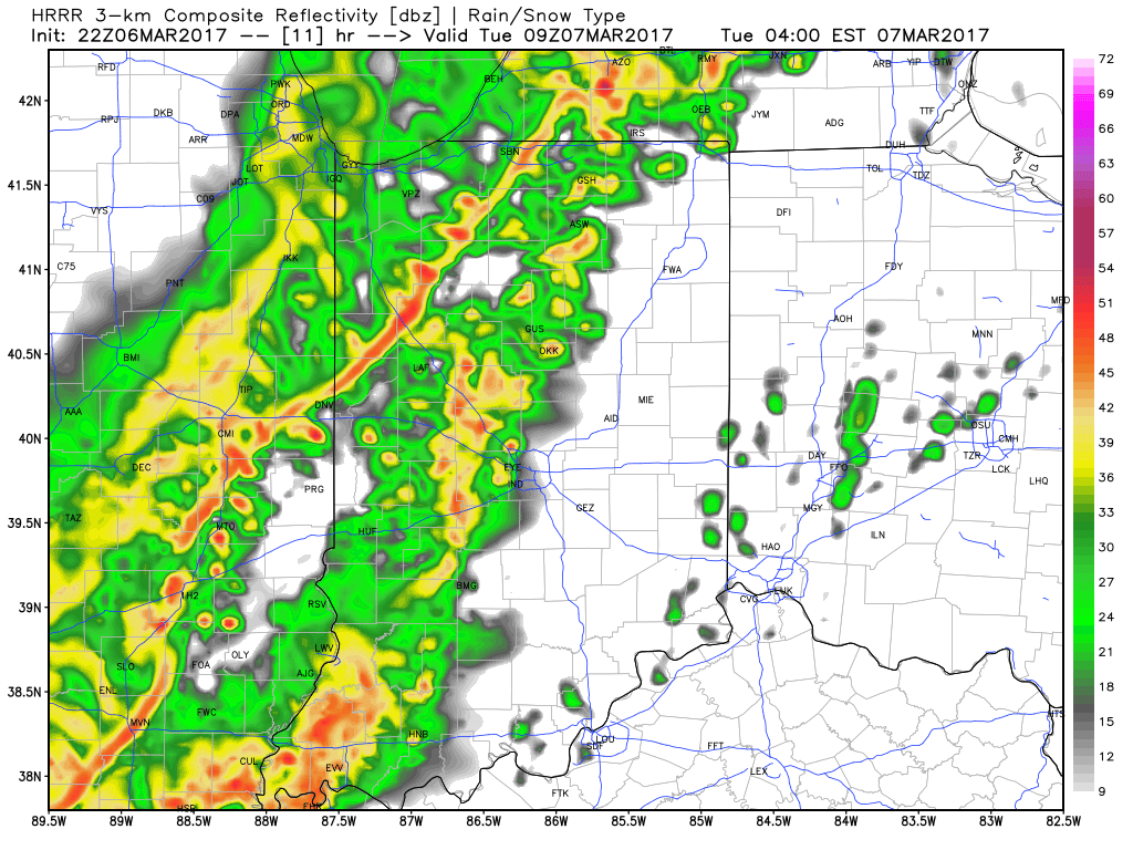
Forecast radar 4am Tuesday.
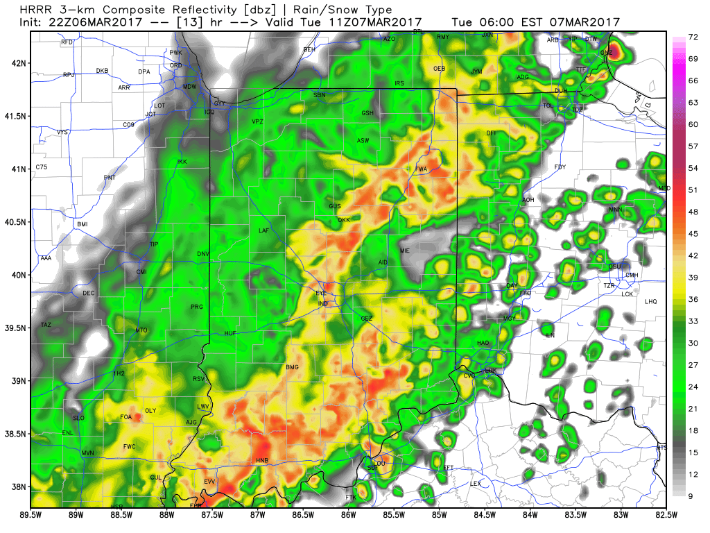
Forecast radar 6am Tuesday.

Attention will then shift to the winter storm threat this weekend- particularly Friday night through early Sunday morning.  We still have to fine tune the all-important specifics, but confidence is rising on the possibility of a significant wintry event impacting at least portions of the region this weekend.  March snow events provide added headaches of dealing with the impacts of marginal temperatures, higher sun angle/ time of day, etc.  Conversely, the tight thermal gradients noted with most late season, spring snow events can be impressive, as they can quickly feedback, ultimately leading to swaths of thumping wet, heavy snow.  Hoosiers don’t have to think back too terribly far to some impressive and impactful March snow events.  Modeling today is in relatively good and surprising agreement, especially considering the lack of agreement models have dealt us weather ‘folk for the past few months.  🙂

GFS ensemble members are focusing in on a snow event this weekend.

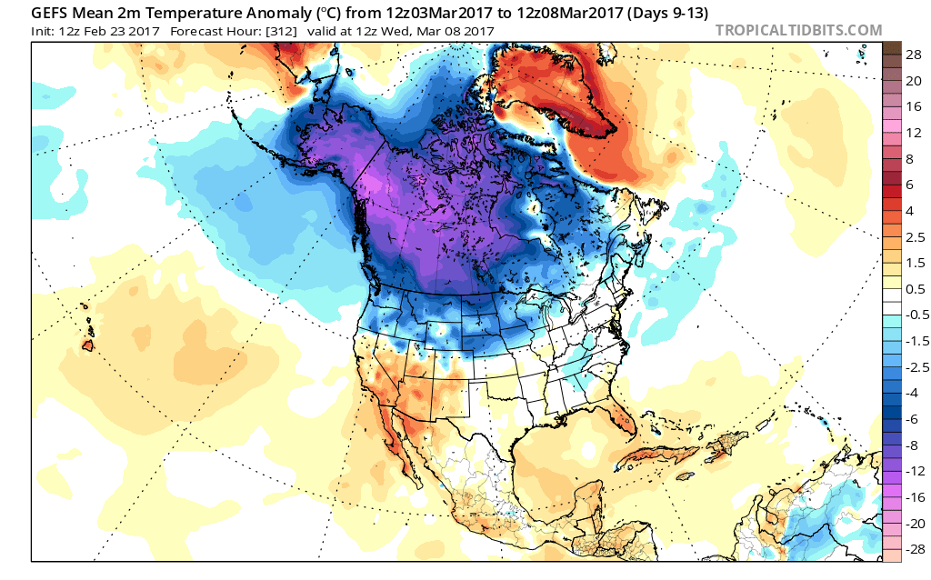
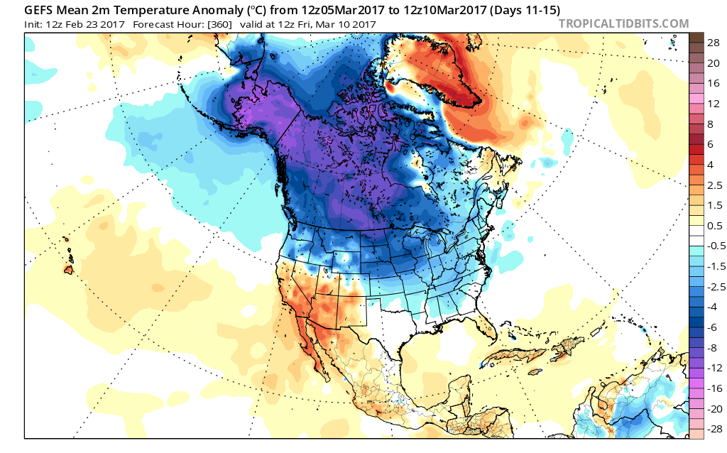
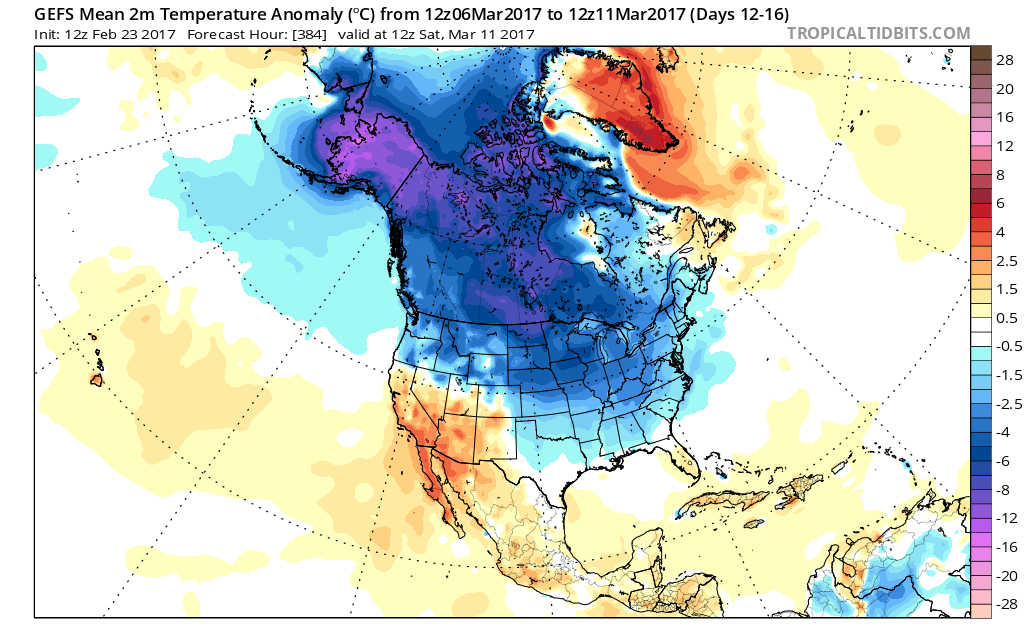
It’s still early in the game and a lot can (and likely will) change with model runs over the next few days.  It’s wise not to make knee-jerk reactions to the operational model solutions, but instead understand the overall pattern driving the potential of this memorable March wintry event.  Anomalously cold air in southern Canada will spill south this weekend and help aid in the “fun and games” ahead.  At the same time, given the time of year, “suppression depression” isn’t likely as their will be resistance from the south-central Plains and southeast ridging in place.  As of now, we think the I-70 corridor could be the “sweet spot” for snow totals, understanding fine-tuning will be required moving forward.  Where a snowpack accumulates this weekend, expect temperatures Sunday night/ Monday morning to fall into the 10s.

Much more later!

Permanent link to this article: https://indywx.com/2017/03/06/thoughts-shift-from-storms-to-snow/

Sunday Afternoon Rambles…

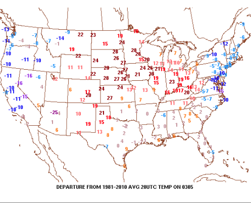
1.)  It’s another unseasonably pleasant afternoon across central Indiana.  Despite a gusty SW breeze (open county is approaching 40 MPH throughout central IN Sunday afternoon), the sunshine and warm temperatures are providing a phenomenal second half of the weekend.

Temperatures are running 20+ degrees above normal this afternoon.

2.)  Clouds will begin to increase tonight and give way to showers as we open the work week.  There will be plenty of dry time Monday morning into the afternoon, but a passing shower will remain in our forecast.  Heavier rain and embedded thunderstorms will arrive on the scene Monday night into the wee morning hours Tuesday.  As a whole, we expect between 0.50-1″ of rain, overall, by Tuesday morning.

Greatest rainfall coverage will arrive overnight Monday night.

3.)  We’ll trend cooler for the mid week stretch, but nothing “cold” for this time of year.  In fact, temperatures will remain above average as high pressure provides dry conditions.

Weak high pressure builds in for mid week.

4.)  Confidence is high on an active period of weather arriving for the weekend into potentially early parts of next week.  That said, despite overall high confidence on a busy time of things, the specifics remain “murky,” at best.  It’ll be important to check back for updates on the weekend forecast as we progress through the upcoming week.  Solutions range anywhere from a period of rain and storms to possibly some wintry “mischief.”  One thing seems certain and that’s for a period of colder air (below normal) arriving in the 8-10 day period.  In fact, the latest European model suggests overnight low in the 10s late next weekend.

The weather turns active next weekend.

Permanent link to this article: https://indywx.com/2017/03/05/sunday-afternoon-rambles-3/

Looking Ahead To Spring…

Meteorological spring begins in a few days (runs March through May).  We’ve already touched on the expected busy severe weather season and want to dedicate this post towards looking deeper into the weather pattern and the resulting precipitation and temperature impacts.

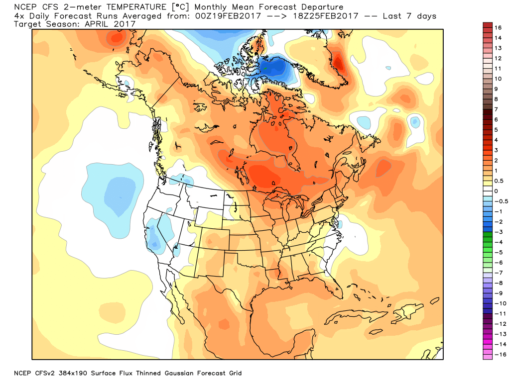
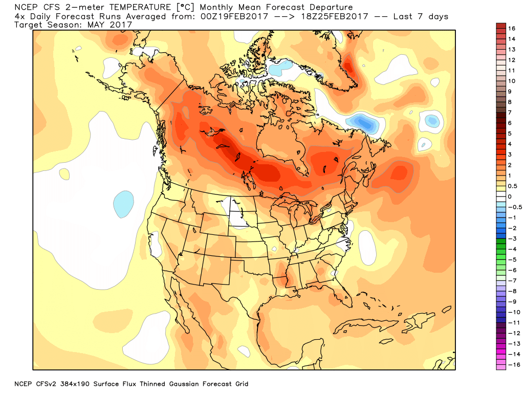
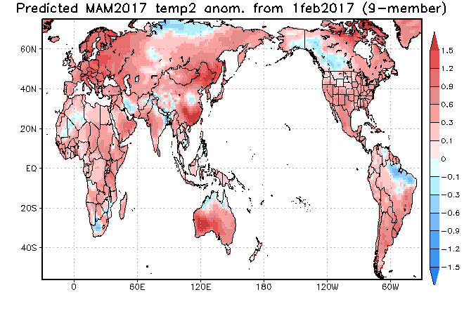
The latest longer-range data continues to be in very good agreement on the upper air pattern.  In short, the balance of the spring season looks to offer up a continued theme of warmer than average temperatures for our region.  (Not saying we won’t have to deal with a wintry “trick or two” over the first couple weeks of March).  When we look at spring, as a whole, we believe it’ll be one known more for the warmth and active, stormy times.

CFSv2 March Temperature Anomalies

CFSv2 April Temperature Anomalies

CFSv2 May Temperature Anomalies

JAMSTEC March through May Temperature Anomalies

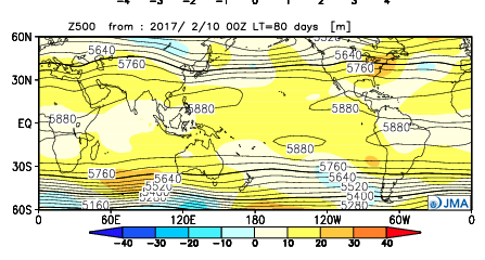
The latest JMA monthly idea is one that has to raise an eye brow as it would paint an early summer across the Ohio Valley and Great Lakes.  Anomalous warmth (true summer-like air) would develop with a strong ridge over the Great Lakes and northeast.  This is something we’ll have to keep an eye on.  A big caveat here is how strong and quickly the coming El Nino develops.  It should be noted, El Nino years can feature some of the hottest air early, not late, in the summer season (relative to averages), and the JMA would, indeed, yield an early summer with such a look.

JMA May Forecast 500mb Pattern

It should also be noted modeling is suggesting a wet look, locally, especially during the early portions of spring.  The JAMSTEC and JMA are particularly bullish on a wet pattern.

JAMSTEC March through May Precipitation Anomalies

JMA March through May Precipitation Anomalies

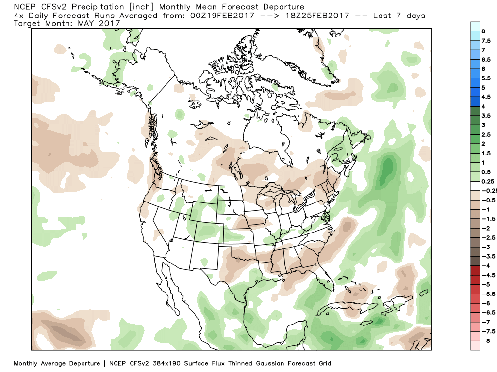
The CFSv2 hits the wet March hard before a drier regime mid and late spring.

March Precipitation Anomalies

April Precipitation Anomalies

May Precipitation Anomalies

In closing, we seem to have a bit of a bumpy ride in front of us as meteorological spring begins.  While Old Man Winter hasn’t been seen much as of late, don’t be shocked if he makes his presence felt a few more times through the first half of March- both from a cold and snow perspective.  That said, data really points towards more of an overall warm regime developing the second half of the month, and continuing through the majority of spring, for that matter.  We’re keeping a close eye on May for an early summer-like feel to take hold, locally.  Subsequent JMA updates will be monitored closely.  We also remain confident of an active severe weather season.  Note the tendency of model data (above) to pull the mean trough position to the northwest March into April.  The clash of late-season wintry conditions west, combined with unseasonably warm temperatures across the east (not to mention the warmer than average Gulf of Mexico) likely will equal busy times as we progress through the spring severe weather season.

Permanent link to this article: https://indywx.com/2017/02/26/looking-ahead-to-spring/

Don’t Get Lulled To Sleep…

Overall, as mild as this winter has been (particularly on the snow front), it’s easy to think we’re done with wintry precipitation- especially after this stretch of 60°+ weather.  That said, we still have to get through March, and as long-time Midwesterners know, the third month of the year can yield some wild swings, including late season wintry events.  Yes, including even the mild winters of the past…

Modeling is beginning to show at least a shift towards unseasonably cold conditions as we progress through the first couple of weeks of March.  In the face of the prolonged stretch of April-like warmth of late, this will be a shock in and of itself.


Longer-term indications would suggest the period of chilly, wintry-like, air has a window to take over, but the window is small.  Trends would seem to yield warmer solutions once past mid-month, with perhaps a “stick and hold” spring regime taking over.
Before that, we have a couple of weeks in front of us to open March that won’t only provide out-of-season cold, but we must also pay close attention to the potential of northwest flow clipper systems.  There’s no reason to get detailed and specific from this distance, but the pattern suggests we need to be on the look-out for the potential of one or two snow makers as we move through the first couple weeks of the month.  March clippers can be a headache as the March warmth south of the track of the system can help add energy and turn a weak event into an impactful snow event to the north of the low’s track.  Hoosiers don’t have to be reminded how significant March clippers can be at times.  Is this the year we have to deal with one or two of these stronger clippers?  Wouldn’t it be ironic after such a mild winter thus far?  Don’t let Mother Nature “lull” you to sleep…

Permanent link to this article: https://indywx.com/2017/02/23/dont-get-lulled-to-sleep/

Looking At Friday’s Severe Set-Up…

An updated 7-day forecast will hit later today.  This morning we wanted to take the time to dig in a little deeper on Friday’s severe weather threat.

Severe Weather Outlook:

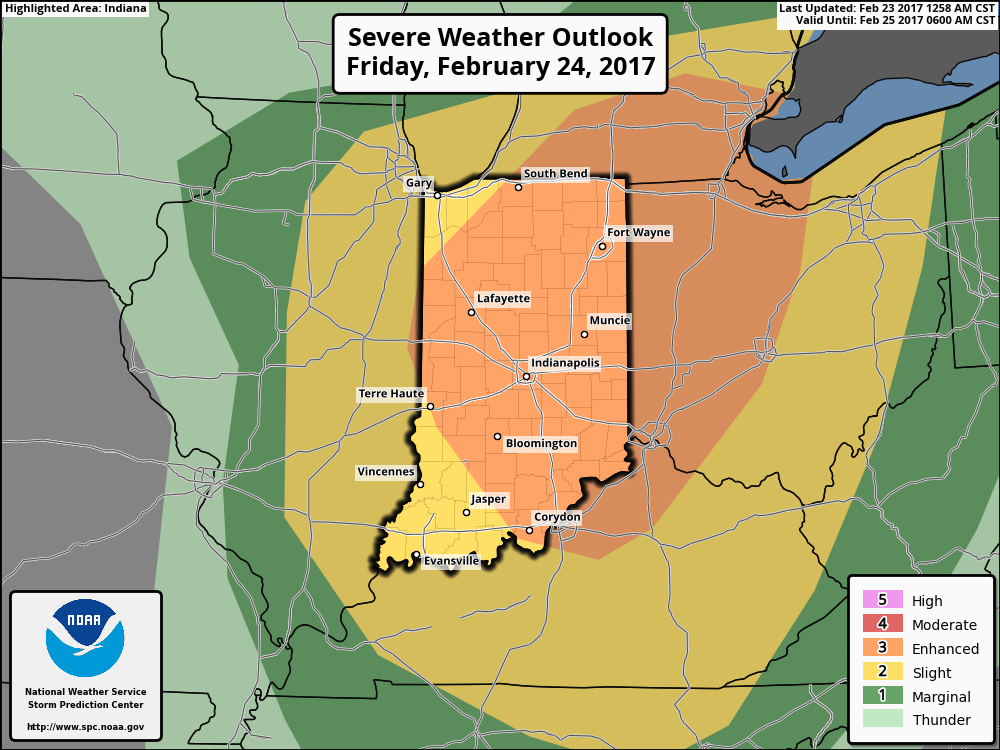
This morning the latest update from the National Weather Service Storm Prediction Center has expanded the ‘Enhanced Risk’ of severe weather Friday.  This includes all of central Indiana.

Summary:

A sub 1000 mb surface low pressure system will track northeast from northern MO (Friday morning) to central MI (Saturday morning).  Ahead of this, a warm front will lift north through central IN and into lower MI Friday afternoon.  A strong cold front will be located near the MS River Friday morning and barrel eastward, sweeping the state Friday night.

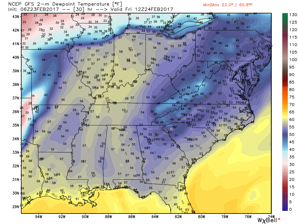
Unseasonably warm and moist air will be drawn northward and encompass the entire region Friday.  Forecast highs should break records tomorrow and be in the lower-middle 70s for most of the region (thinking we see plentiful sunshine during the daytime hours).  Dew points will near 60°. Considering this is late February, those are impressive ingredients coming into play.  The added sunshine tomorrow is actually a bad thing as it will add “fuel to the fire,” so to speak, and help play a role in potentially explosive thunderstorm development Friday evening.

Forecast dew points will reach around 60 degrees across the region Friday afternoon.

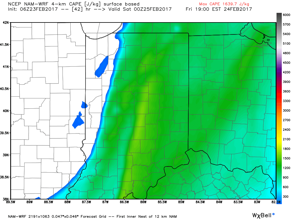
Surface-based CAPE (Convective Available Potential Energy) is modeled to reach between 1200-1600 J/kg Friday evening across the region.

Threats and Timing:

Most of Friday is going to be quiet, but it’s as we move into Friday afternoon and evening that we’ll need to keep close eyes to the sky and radar.  The potential exists for individual super cells to develop out ahead of an eastward-advancing line of thunderstorms Friday evening.  All modes of severe weather are possible Friday evening, including large hail, damaging winds, and tornadoes.  As of now, we bracket the hours of 4p and 10p for the period where severe weather may be impacting portions of central IN.

As mentioned yesterday, we highly recommend reviewing your family’s severe weather safety plan and ensure weather radios are charged with warning modes “on” Friday.

Permanent link to this article: https://indywx.com/2017/02/23/looking-at-fridays-severe-set-up/

Sunday Morning Rambles: Focusing On Severe Weather…

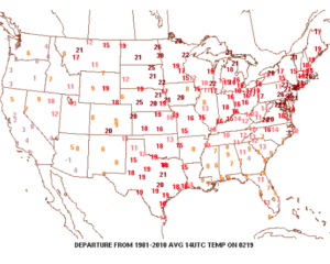
Low clouds and areas of fog will be slow to burn off this morning, but the sunshine should eventually return later this afternoon and evening, providing a phenomenal close to the weekend.

Despite the lack of sunshine this morning, temperatures continue to run much milder than average.  We’re currently running nearly 20° above where we should be at the 9a hour.
A quiet start to the work week is ahead as high pressure dominates early on.  That said, a weak storm system will scoot through the state Monday night and Tuesday morning and this will help offer up the chance of showers and perhaps a rumble of thunder.

The next (more significant) storm system will pose a severe weather risk to close the week.  We continue to keep a close eye on Friday and the Storm Prediction Center is as well, with western IL, IN, and western KY in their Day 6 Outlook.  It’s still early, but the primary focus with the severe potential this storm may pose will be large hail and damaging straight line winds.  Stay tuned as we continue to analyze the latest data.

We’ll turn sharply colder Friday night and Saturday.  Though it’ll feel much colder, we’ll really only “chill” to seasonal levels, including a gusty northwesterly breeze Saturday.

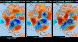
Longer-term, we’re rumbling into a much more active weather pattern through the mid range period.  As the mean trough sets-up position in the west, the ridge will flex it’s muscle across the east yet again during early portions of Week 2.  This will set the stage for a repeat of what we deal with Friday and, accordingly, we’ll have to monitor early next week for portions of severe weather yet again.
Permanent link to this article: https://indywx.com/2017/02/19/sunday-morning-rambles-focusing-on-severe-weather/

VIDEO: Spring-Like Weekend…

You must be logged in to view this content. Click Here to become a member of IndyWX.com for full access.  Already a member of IndyWx.com All-Access?  Log-in here.

Permanent link to this article: https://indywx.com/2017/02/17/video-spring-like-weekend/

VIDEO: Brief “Speed-Bump” On The Way To A Spring-Like Weekend…

You must be logged in to view this content. Click Here to become a member of IndyWX.com for full access.  Already a member of IndyWx.com All-Access?  Log-in here.

Permanent link to this article: https://indywx.com/2017/02/14/video-brief-speed-bump-on-the-way-to-a-spring-like-weekend/

High Pressure Supports A Quiet Week; Colder Then Warming Again…

Quick post from the road on this Sunday morning before a more extensive update tonight. 

High pressure will build into the Ohio Valley and support a quiet week, overall. 


A “pop” of cold air will flow into the state on gusty northerly winds Tuesday night and set-up a cold midweek stretch. 


Highs will fall into the 30s Wednesday and Thursday with lows in the upper teens to lower 20s. However, like so many other cold shots over the past 6 weeks, it’s of the “in and out” variety. By late week, southwest winds are developing and helping temperatures moderate going into the weekend. 


We should remain dry next weekend before a more significant storm system arrives during early portions of Week 2. With dry conditions, a strengthening southwest flow and strong upper ridge, highs next weekend will approach 65°-70°.  

With two weekends in a row of spring-like weather in February we sure have to believe we’ll have to pay for the nice conditions late month into March before true sustained spring conditions can take hold…

Permanent link to this article: https://indywx.com/2017/02/12/high-pressure-supports-a-quiet-week-colder-then-warming-again/

Friday Morning Notebook: Warmer Times This Weekend…

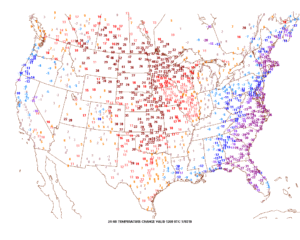
Happy Friday, friends.  We’re still cold this morning, but a look at the change in temperatures compared to 24 hours ago shows the milder trend that will be with us through the upcoming weekend.  Highs today will reach the upper 40s and 55-60 Saturday.

Winds will turn strong and gusty out of the southwest this afternoon, noted by the tightly packed isobars (lines of equal pressure) along with considerable mid and high level clouds.

Clouds will lower and thicken Saturday and we may also have to deal with periods of fog, as well.  Showers and drizzle will lift into town as the day progresses, especially by afternoon and evening.
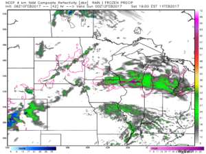
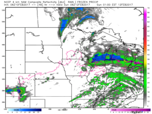
We don’t expect heavy rain this weekend.  In fact, model data continues to really back off on expected totals.  The general consensus is between 0.15″ and 0.25″ across central Indiana.
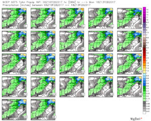
After a mild Saturday, cooler (but not cold) air will ooze into the Ohio Valley Sunday.
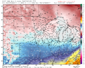
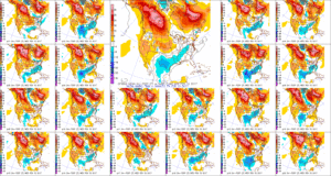
Resurgent cold air will blow into town during the middle and latter portions of the upcoming work week.  Highs will return to the 30s with overnight lows in the lower 20s.  We’ll likely add scattered snow showers into the mix as well.
Permanent link to this article: https://indywx.com/2017/02/10/friday-morning-notebook-warmer-times-this-weekend/

IndyWx.com