VIDEO: Pacific Pattern Keeps Things Busy Into The Week Ahead…
Updated 01.13.23 @ 7:21a
You must be logged in to view this content. Click Here to become a member of IndyWX.com for full access. Already a member of IndyWx.com All-Access? Log-in here.
Updated 01.13.23 @ 7:21a
You must be logged in to view this content. Click Here to become a member of IndyWX.com for full access. Already a member of IndyWx.com All-Access? Log-in here.
Updated 01.12.23 @ 7:55a
You must be logged in to view this content. Click Here to become a member of IndyWX.com for full access. Already a member of IndyWx.com All-Access? Log-in here.
Updated 01.11.23 @ 7:50a
You must be logged in to view this content. Click Here to become a member of IndyWX.com for full access. Already a member of IndyWx.com All-Access? Log-in here.
Updated 01.10.23 @ 6:15p
You must be logged in to view this content. Click Here to become a member of IndyWX.com for full access. Already a member of IndyWx.com All-Access? Log-in here.
Updated 01.09.23 @ 6:56a
Month to date, IND is running slightly behind average in the precipitation department. As we look ahead at this week, and beyond, it seems like we’re poised to make up for lost time in that regard.
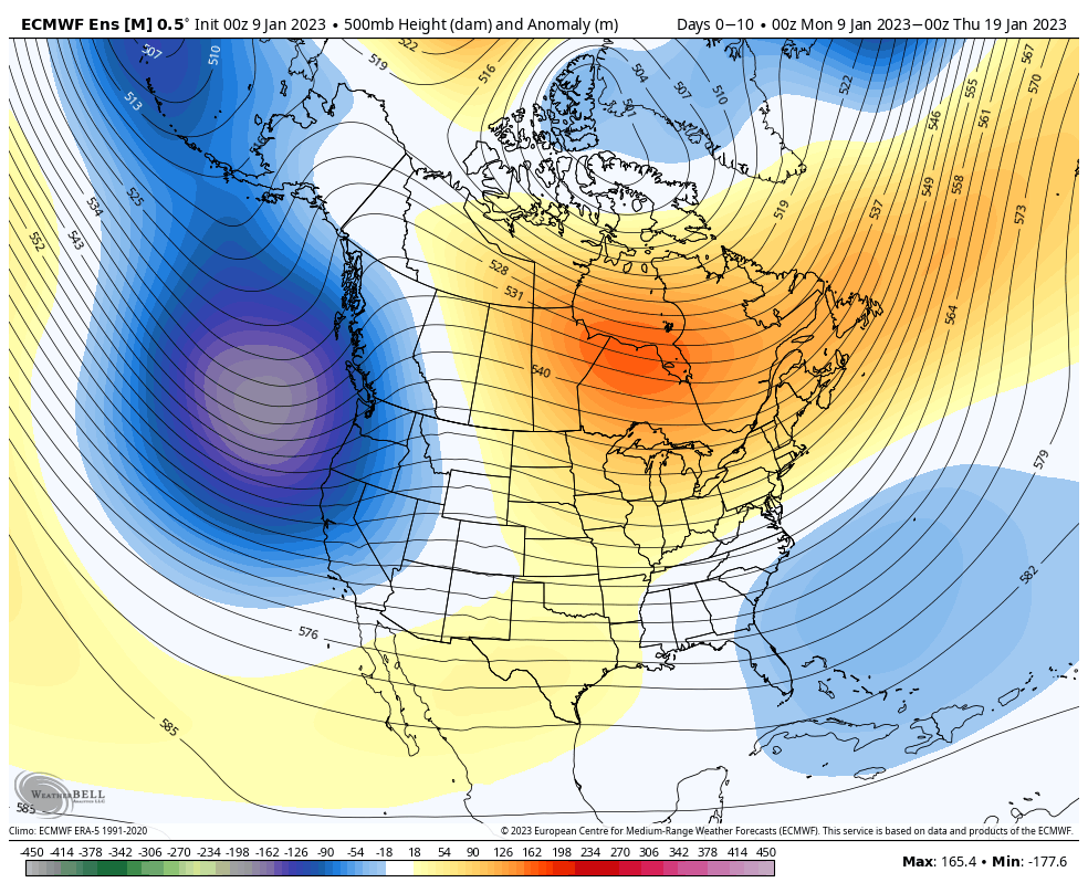

A hyper active Pacific jet will hand multiple storms off to the east in the coming week to 10 days. The first of which will arrive the middle of this week as low pressure moves from the central Plains into the eastern Great Lakes.
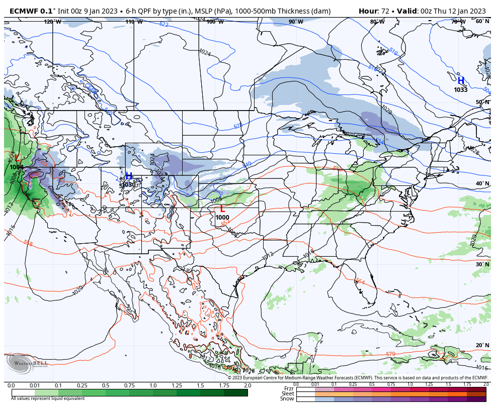
Rain will overspread the region Wednesday and we still need to monitor the possibility of a transition to wet snow Thursday.
Additional storm systems of note are dialed up Sunday night and Monday and again the middle of next week.