1.) Indianapolis is running much warmer (+9.1°) and slightly drier than normal (-0.15″) month-to-date. 2.) Snow is flying to our southwest, and accumulating for some in and around St.…
You must be logged in to view this content. Click Here to become a member of IndyWX.com for full access. Already a member of IndyWx.com All-Access? Log-in here.
You must be logged in to view this content. Click Here to become a member of IndyWX.com for full access. Already a member of IndyWx.com All-Access? Log-in here.
The SPC has shifted the slight risk area NW with their latest outlook. Before we talk storms, today is actually the pick of the week as we’re dry during…
You must be logged in to view this content. Click Here to become a member of IndyWX.com for full access. Already a member of IndyWx.com All-Access? Log-in here.
We have scattered showers and embedded thunderstorms to deal with today and Monday (along with plenty of dry time, too), but our attention is beginning to shift to the potential of strong to severe thunderstorms Tuesday- particularly Tuesday night.
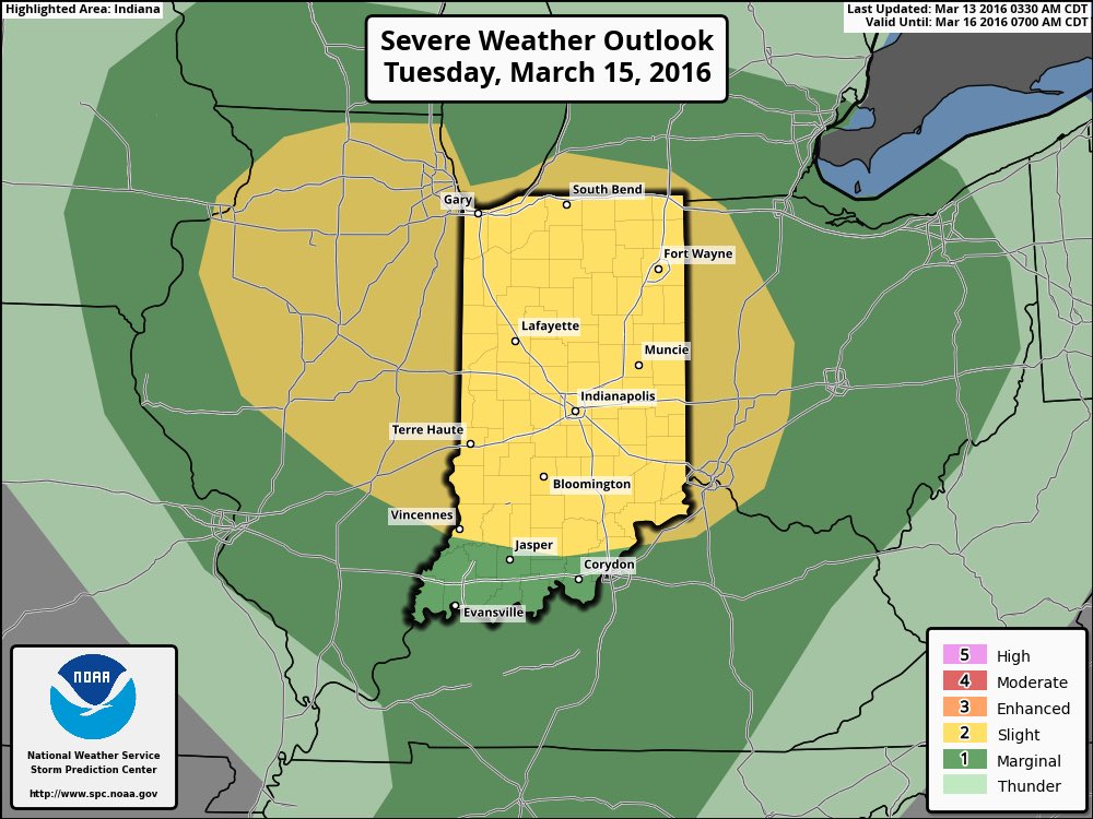
The SPC has outlined most of the state for a *Slight Risk* of severe thunderstorms Tuesday.
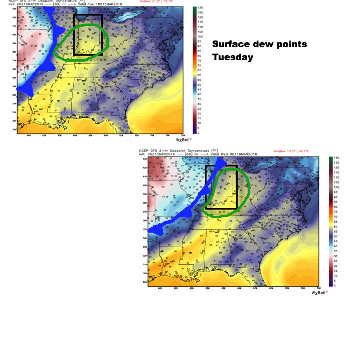
We note surface dew points surge into the upper 50s and lower 60s Tuesday.
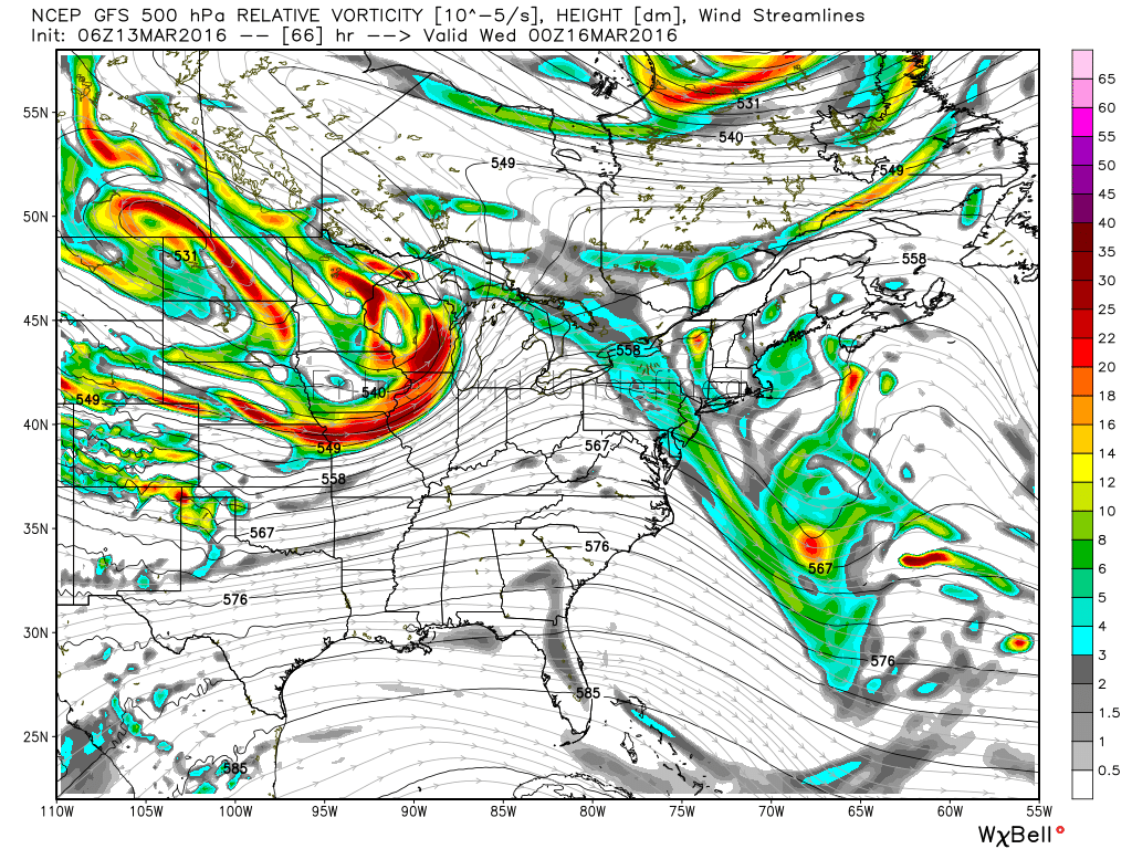
This should be sufficient enough to help fuel a developing thunderstorm cluster in IL Tuesday afternoon/ evening that will likely race eastward with time Tuesday night. We note a strong area of low pressure over the upper Mid West that will “bull-whip” a cold front through the region Tuesday night. This will tap into the available moisture and relative warmth (lower to middle 70s a good bet for highs Tuesday) to continue the storm threat through IN and into western OH during the late evening/ overnight.
All modes of severe weather appear to be in play right now, but we’re particularly concerned about the potential of damaging straight line winds within any thunderstorm complex that develops Tuesday afternoon/ evening. We’ll also have to monitor the potential of discrete cells that develop away from the primary storm complex.
You must be logged in to view this content. Click Here to become a member of IndyWX.com for full access. Already a member of IndyWx.com All-Access? Log-in here.