VIDEO: Unsettled Now, But A Beautiful 2nd Half Of The Weekend Ahead…
You must be logged in to view this content. Click Here to become a member of IndyWX.com for full access. Already a member of IndyWx.com All-Access? Log-in here.
You must be logged in to view this content. Click Here to become a member of IndyWX.com for full access. Already a member of IndyWx.com All-Access? Log-in here.
The National Weather Service has expanded the Flash Flood Watch to encompass more of the viewing area. This is in effect until 8p Tuesday.
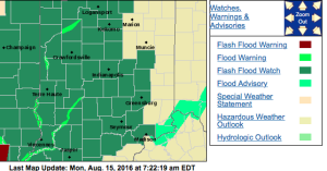 No doubt about it, today will be very wet across the entire region, including periods of heavy rain- especially across the western half of the state.
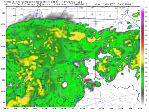
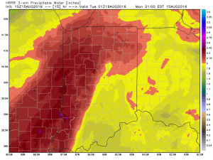
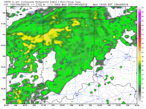 Tropical moisture will continue to stream into the state tonight into Tuesday. In fact, most intense rains will likely set up tonight and may feature “banding” signatures that would train over the same areas. Within these intense rain bands, prolific rainfall rates can be expected, enhancing the flash flood risk. Latest short-term model data shows this threat, and would place a premium focus on areas generally west of US-31. We’ll have to keep a close eye on things.
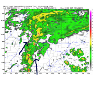 Plenty of “juice” is available to tap into across western sections tonight. Precipitable water values (PWATs) of 2″-2.5″ will be more than enough to fuel torrential rainfall.
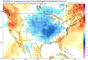
 Eventually (mid and late week), we’ll dry things out and a significant cool down is still in store developing this weekend into early next week. Lows will fall deep into the 50s with highs only in the 70s. Talk about an early taste of fall…
Central Indiana is enjoying some needed “down time” in the rainfall department this evening, but this won’t last as rain coverage and intensity returns overnight and Sunday morning. Like today, locally heavy downpours will be likely.


In looking at early 00z data, it appears as if we deal with (2) waves of rain Sunday:
Sunday morning will feature widespread rain across central Indiana, including localized heavy rain. Another “lull” in the activity will likely arrive Sunday afternoon into the evening hours, but we caution rain and embedded thunder will really begin to ramp up and increase in coverage and intensity yet again late Sunday night into the day Monday.
The second surge of moisture is more in direct association with the tropical moisture and energy moving north. This area of rain will likely include embedded rates of 3″-4″/ hour for some very localized areas. It’s impossible to pin point where these areas are, but don’t be surprised to hear (or see) some very heavy rain Monday.

When we factor in expected rain from tomorrow and Monday, it would appear as if central IN is in line to accumulate an additional 2″-4″ with locally heavier amounts. Flooding prospects will increase dramatically Monday as heavy rain falls on saturated soils. Please, take warnings seriously. Rapid water rises are likely.

We’re not even through the first 1/4 of this rain event, and we’ve already had several flash flood warnings issued today. Periods of rain, occasionally heavy, will continue through central IN through the weekend. Additional flash flood warnings will come. As of this report, localized rainfall totals are approaching 3″ in a few spots (Greencastle area, between Vincennes and Bedford, and around Muncie).
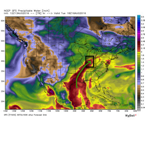
As mentioned, this is a long-duration event, but there will be dry times. Perhaps the most widespread heavy rains arrive on the scene late Sunday night into early next week. Monday into Tuesday looks very wet. The moisture and energy associated with the area of low pressure over Louisiana will meander northwest over the next (24) hours before moving north and eventually northeast along the frontal boundary that will be stalled over the region.
Precipitable water will once again surge to 2.5″+ and promote intense rainfall rates over a more widespread portion of the region Sunday night through Tuesday.
 Unlike the localized banding features of the rain today, the rain shield should be much more widespread Monday into Tuesday. Factor in the hefty rain totals today into Sunday, combined with additional heavy rain Monday and Tuesday, and it wouldn’t surprise us to see a few double digit rainfall reports by the time all is said and done Wednesday night/ Thursday. Widespread 4″+ totals will be common across central IN by the time all is said and done.
We flip the script next weekend and turn much drier and unseasonably cool. It’ll feel like an early taste of fall next weekend (perhaps even some upper 40s for a few folks across central portions of the state)?!
Heed flood warnings that come over the next few days. Rainfall rates will be downright tropical in nature and result in fast water rise.
You must be logged in to view this content. Click Here to become a member of IndyWX.com for full access. Already a member of IndyWx.com All-Access? Log-in here.