Icy Set-Up This Weekend…
Unfortunately, a strong arctic high still looks like it’ll descend into the upper Mid West Friday before moving east over the Great Lakes (Saturday) and into the northeast (Sunday). This will help shove a cold front south to the upper TN Valley Friday and dense, cold air will bleed south to encompass central Indiana as we wrap up the work week. As we progress into the weekend, warm moist air will override the shallow cold air locked in place at the surface. Ripples of energy will move along the boundary and periods of more concentrated, steadier precipitation will fall. Significant ice accumulations (greater than one quarter inch) will be possible for portions of central Indiana.
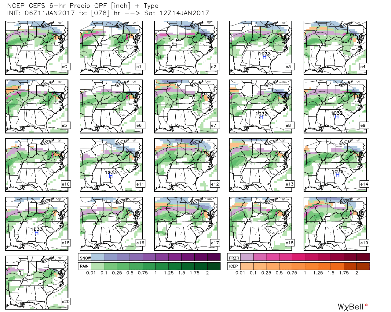 GFS ensemble members above show the overall good agreement on a central IN ice set-up for portions of the weekend.
Timing: As of now, I think most of Friday is dry and cold before moisture overspreads the region late Friday night into Saturday. Additional waves of moisture will push through the region during the second half of the weekend, as well.
Confidence: We have very high confidence on at least light to moderate icing in the Friday night – Saturday time frame, but confidence on additional icing thereafter begins to drop, thanks to disagreement in modeling. The GFS is warmer for the second half of the weekend and would reduce the threat of significant ice build-up as some brief thawing would be in place in between waves of moisture thanks to temperatures rising into the middle 30s. However, the European model is much colder and keeps IND below freezing Saturday and Sunday, with nearly half an inch of liquid during that time frame. That’s downright concerning and would result in significant issues with potentially downed tree limbs and power lines.
We do have concern the European could have a better handle on things right now. Modeling is notorious for underestimating the strength and depth of the cold air with these arctic highs and similar overrunning events of the past. Stay tuned.
Impacts: Greatest concern right now is for icing on exposed and elevated surfaces (bridges, tree limbs, power lines, etc.). With the milder air of midweek, along with marginally cold air, it’s possible crews will be able to keep roads passable during this event. Additionally, something else to consider is the rate of precipitation. While bad for elevated ice build-up, if precipitation rates are heavy enough, this can help reduce ice build-up on roadways.
Summary: We still have concern for the potential of an impactful ice event this weekend through central Indiana. Winter Storm Watches (and potentially Ice Storm Warnings) may be hoisted by the National Weather Service later this week for this event. Despite an overall high confidence in at least some icing impacting the region, questions do remain in regards to the temperature profile later in the forecast period this weekend, and caution the slighted deviation in surface temperature can make all the difference to impacts. At the very least, low pressure should pull out of the southern Plains early next week and this will serve to push enough warm air northeast to change everything over to plain ole rain early next week as we rise into the 50s.
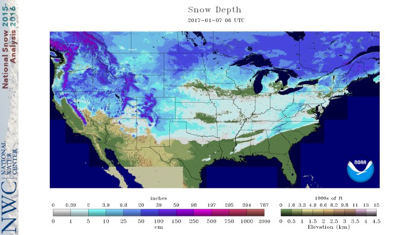
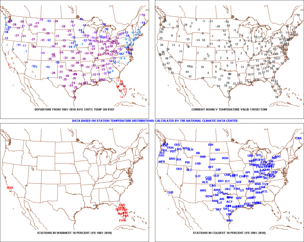 2.) Expanding Snowpack: 65.4% of the country is covered in snow this morning. The cold, arctic high suppressed the winter storm threat south as we alluded to in previous posts. Places across the Deep South that aren’t used to wintry precipitation are waking up to snowy and icy conditions this morning, including MS, AL, GA, SC, and into the Mid Atlantic. Heavier snowfall accumulated across east TN, including 5″-8″ in the high country. Heavy snow also fell through western and central NC and Blizzard Warnings are up in rare areas including VA Beach this morning.
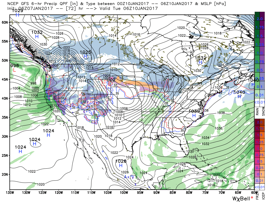
 3.) Moderating Temperatures: Our air flow will back around to the southwest and this will help temperatures begin to moderate early next week (around freezing Monday and all the way to around 50 Tuesday). As the moderating trend gets underway, we may have to deal with a brief period of freezing drizzle/ freezing rain Monday evening.
 4.) Rainy Midweek: A more significant surge of moisture will arrive midweek and result in periods of moderate to heavy rain Wednesday PM into Thursday. Potential is present for 1″+ during this timeframe.
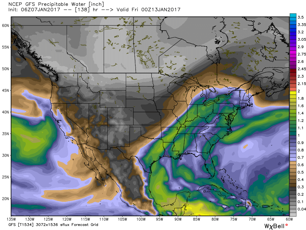 5.) Weekend Wintry “Fun And Games?” A tremendous battle will take place next weekend between a strong and sprawling arctic high pressure system and the southeast ridge. In between it’ll be fascinating to watch things unfold, and as you’d imagine, that includes Indiana. Despite the southeast ridge flexing it’s muscle, the concern here is that the shallow dense arctic air will “ooze” south and present an icy set-up for portions of the Ohio Valley and Mid West for the weekend. We still have some time to watch this, but the potential of significant icing is very much present for some and this will require a close eye through the week.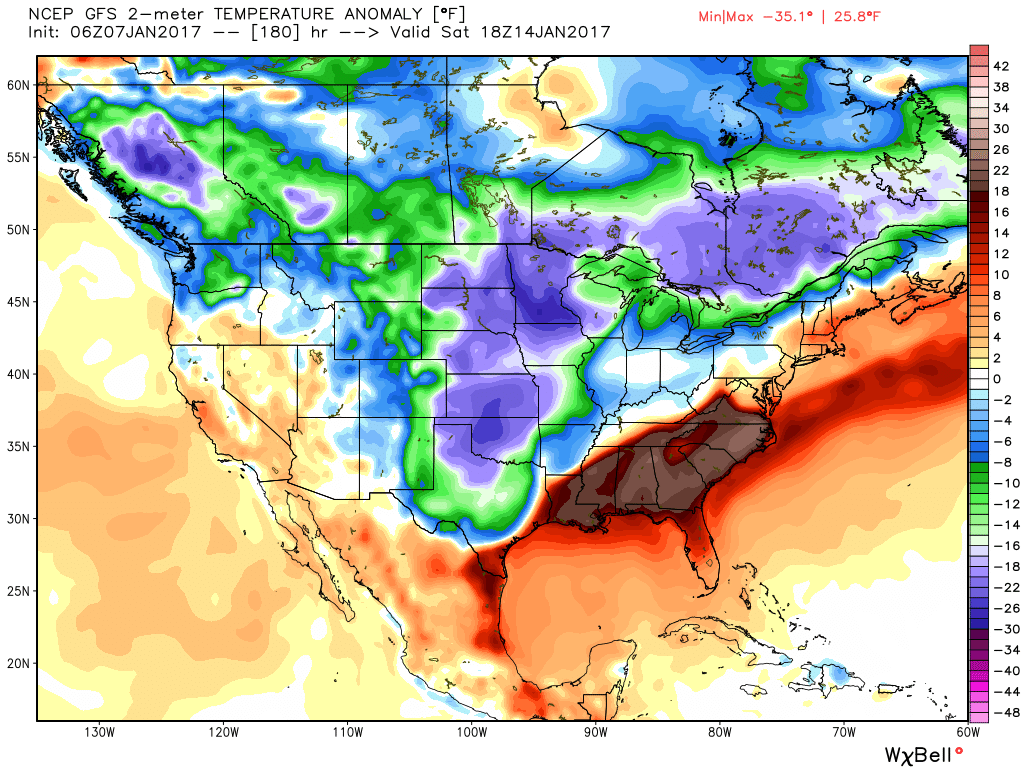
 This will take us through mid week and into the weekend with lows in the single digits and lower teens and highs generally in the lower and middle 20s. We still need to watch Thursday evening-night for a wave of low pressure that may attempt to deliver light snow, but this doesn’t look like a significant event from this distance.
 To further complicate matters, the European and Canadian solutions are much less robust and result in a more suppressed scenario. Forecasters (including yours truly) can only wish for the days to return of worrying about respected snow/ mix/ rain lines amongst the various data, versus the present time of models showing a storm only to take it away from run-to-run and other modeling not even showing the storm.
 That brings us to our next point and that’s the modeling performance, itself. For really the better part of a year now, modeling has been poor, at best- even in the short-term solutions. More recently speaking to the last few months, I can’t recall model data ever performing worse (13 years of forecasting experience).
 By Day (10), the cold pattern is well established over the Lower 48. This is a coast-to-coast cold signal (heart of the cold centered over the west and central) depicted by the European ensemble, along with other modeling.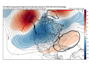
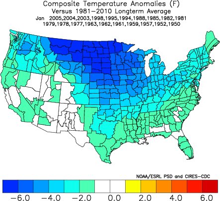
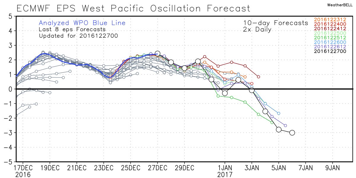
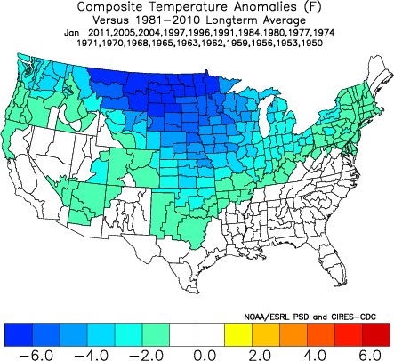
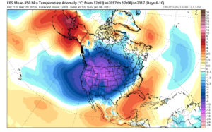 Teleconnections support a cold pattern returning.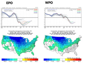
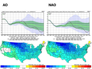
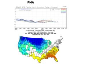 The agreement amongst teleconnections is nice to see and ups confidence in the overall direction of where this pattern is heading in regards to colder than average times looming. The negative PNA correlates nicely with the SE ridge that continues to make itself heard from time to time over the next few weeks. It should also be noted that the phases of the Arctic Oscillation (AO) and North Atlantic Oscillation (NAO) become more of a factor for mid and late winter.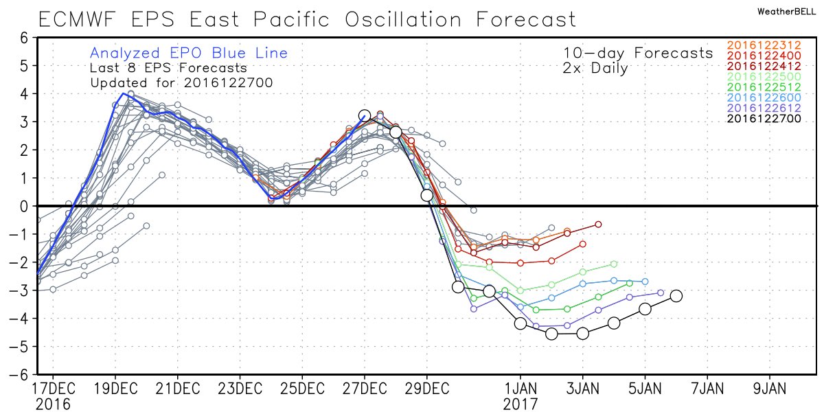
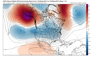
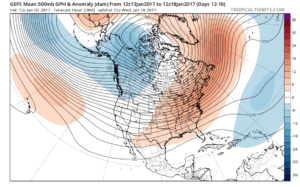
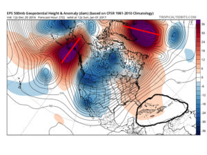
 Accordingly, we see the ensemble data flipping to a colder pattern over the upcoming (10) days. Note the low anomalies in the higher latitude regions today (Image 1) versus Day 10 (Image 2).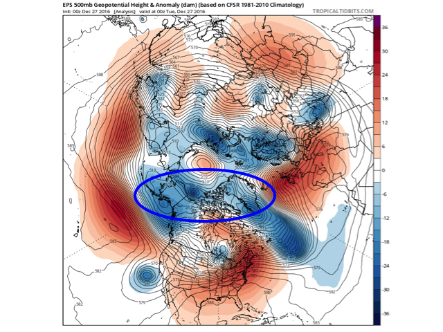
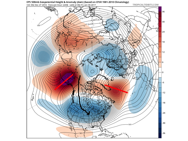 The pattern developing by Day (10) is one capable of producing another frigid regime- only January style. Cross-polar flow sets up shop and, unlike, December, some blocking is noted, as well. This can help the mean storm track shift further south. (Bye-bye Great Lakes cutters, though Mid Western and Ohio Valley Snow Lovers will find a new worry in the form of suppression potential ;-)). Individual storms will have their respected challenges, as always. As a whole, it’s a very cold, stormy look and a pattern capable of leading to an expanding snow pack across the Lower 48.