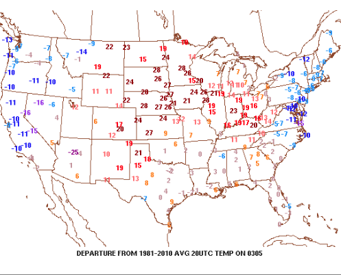
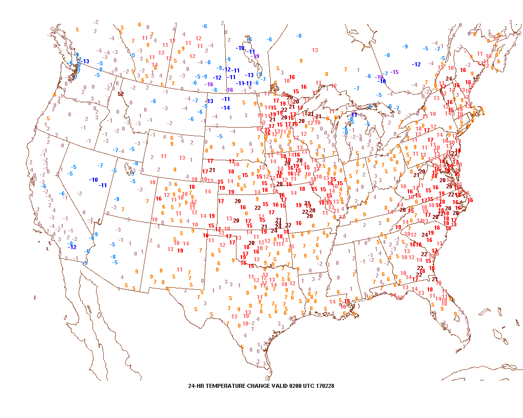
Monday evening is running much warmer than this time Sunday across most of the central, including right here in Indiana.
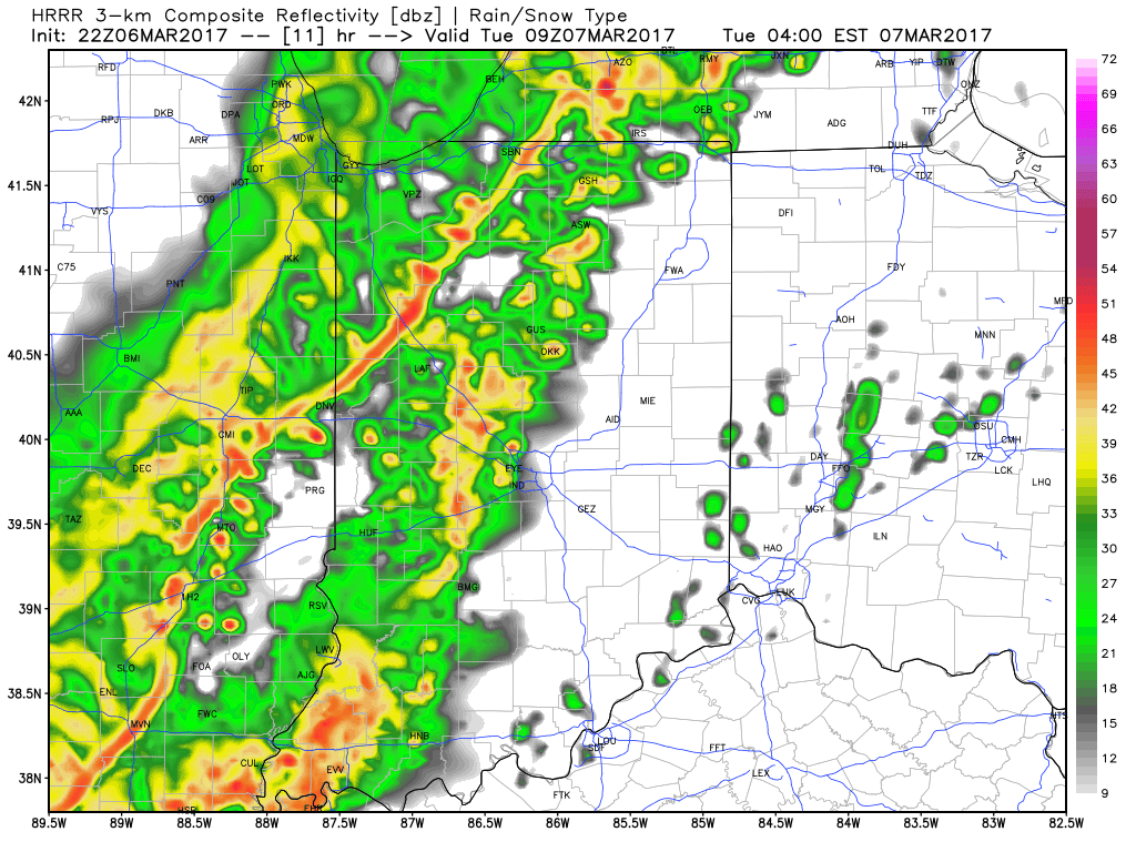
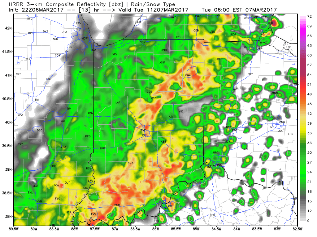
 This warmer regime is the sign of stormy times that will develop as we move into Tuesday. An initial round of showers and thunderstorms will impact central Indiana Tuesday morning and the HRRR forecast radar is picking up on this nicely, especially during the predawn hours.
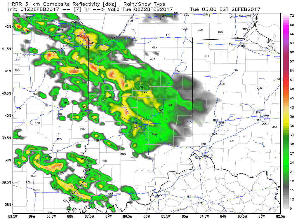 The wet, stormy start to the day will give way to a mostly dry time of things through the majority of the daylight hours Tuesday, but our concentration will be on the Tuesday night-Wednesday morning period, as the potential exists for some rather turbulent weather.
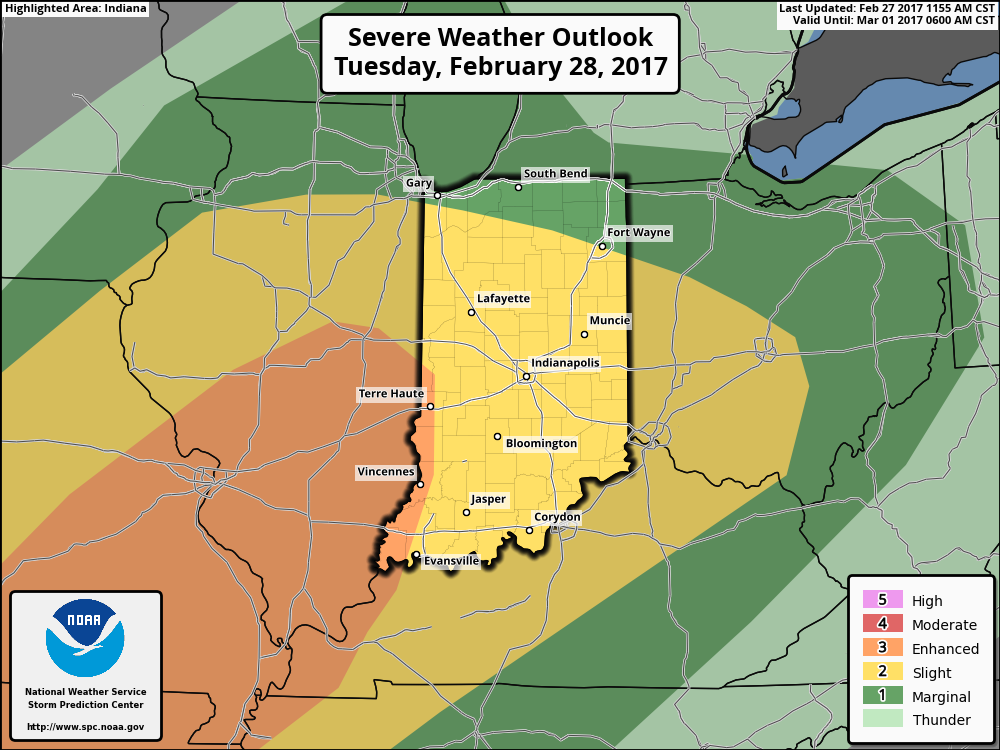
We note the National Weather Service’s Storm Prediction Center outlines all of the region for the chance of severe weather Tuesday night and also note the possibility the “enhanced” risk area may expand in future updates. Additionally, given some of the ingredients we’re observing this evening, there’s also the possibility we may see an upgrade to a “moderate” risk for portions of the region. It’ll be particularly important to pay attention to weather updates Tuesday night. Primary concerns are for large hail and damaging winds in a possible squall line that develops ahead of an approaching cold front. Additionally, if storms develop ahead of the primary line of storms, the potential exists for a couple of tornadoes. Have a means of getting the latest watches and warnings Tuesday night.
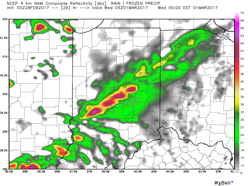
 Modeled radar suggests things may begin to get “busy” around these parts late evening and during the overnight. The latest high resolution NAM (hot off the press as of this update) paints a rather ominous look as midnight nears Wednesday morning.
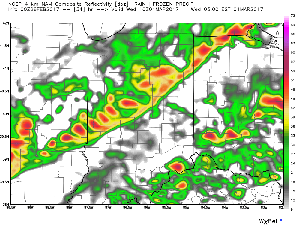
 We then note modeling bringing the squall line through central Indiana during the overnight and predawn hours. We’ll have to fine tune timing as we move through the day Tuesday, but we bracket the hours of 2a and 6a when a concentrated line of strong to severe storms rumbles through the state (northwest to southeast). Hail and damaging straight line winds are of greatest concern, but a quick spin-up tornado can’t be ruled out.
 Our weather will turn quieter, but colder, as Wednesday progresses into Wednesday evening, including blustery conditions with falling temperatures.
A fast-moving clipper system will dive southeast Thursday evening into early Friday morning and this could produce a snow shower, or two, across the region, but shouldn’t amount to much from a snow perspective (keeping true to the tune of the winter, heh?). The bigger story will be the “rude” feel to the air mass as we wrap up the work week, as highs only reach the upper 30s with a gusty wind.
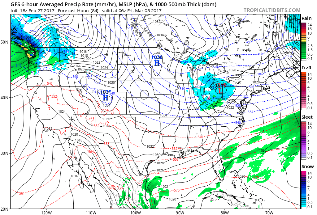 That said, the chilly late week conditions won’t last long, and a gusty southwesterly air flow will develop as early as Saturday. This will help give temperatures a significant boost Saturday afternoon after a cold start to the day. 60° is possible Saturday afternoon and the mercury may approach 70° Sunday!
More updates in the AM! Have a great night, friends!