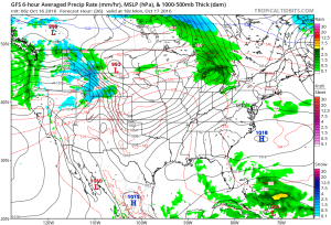
Before we talk about the warmth, we have some showers and embedded thunder to deal with across parts of the region today. Best rain chances today will be along and north of I-70, but a few showers could scoot south later this afternoon. We note most concentrated rain should fall through the early afternoon hours before moving out to allow for a dry evening.
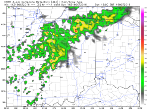
Forecast radar 12p, courtesy of Weatherbell.com
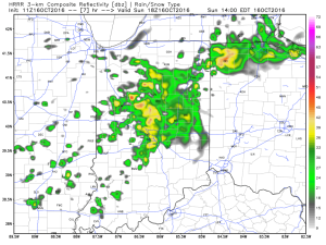
Forecast radar 2p, courtesy of Weatherbell.com
We get back to a dry pattern Monday and Tuesday. Along with the dry conditions, unseasonably warm temperatures can be expected. Along with the summer-like feel, very strong southwest winds will be noted (gusts to 30-40 MPH).
A strong SW flow will promote 30-40 MPH gusts early week. Courtesy of Tropicaltidbits.com
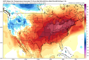
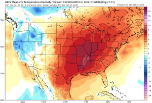
The warmest temperature anomalies will be located over the Ohio Valley this week. Courtesy of Tropicaltidbits.com
Highs Monday and Tuesday will top out in the lower to middle 80s and rival records across central IN. While that’s impressive enough, overnight lows of 65-70 are almost unheard of.
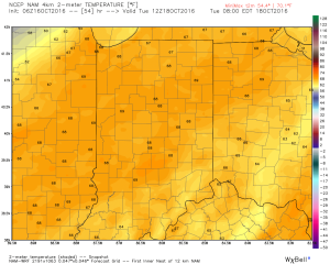
Overnight lows Tuesday morning will be close to 70 degrees. Courtesy of Weatherbell.com
Cooler air will begin to move in by late week as a trough replaces the warm ridge. While we’re very confident on the much cooler feel, details in regards to the specifics around rain timing and amounts remain “muddy” at best. We’ll forecast best rain chances to arrive Thursday, but caution this may have to be fine tuned as we move forward. Highs that were in the 80s for early week will crash late week (upper 50s to lower 60s).
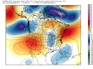
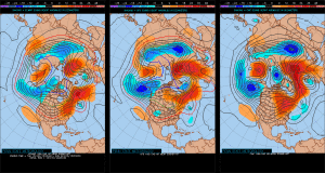
European ensemble shows the cool and unsettled late week pattern. Courtesy of Weatherbell.com
As of now, next weekend looks dry and cool, but it was only yesterday that rain chances looked like they may continue into the early portions of the weekend. Stay tuned. As previously mentioned, temperatures will be much cooler (upper 30s to lower 40s for lows and lower to middle 60s for highs).
Complete 7-day will be posted later!


 Tuesday will remain rain-free across the region, along with pleasant temperatures and humidity levels (mid 70s after a low in the lower 50s).
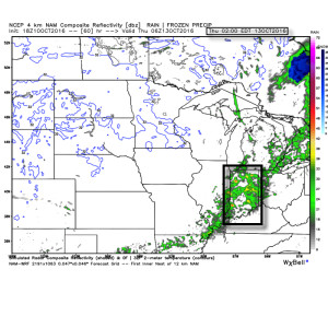 Rainfall amounts don’t look particularly impressive; generally 0.10″-0.25″ during the Wednesday night-Thursday morning time frame.
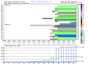 The cool air flowing in behind the front is impressive though. In fact, highs both Thursday and Friday will likely only reach the lower 60s (if that).
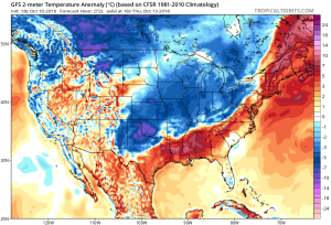 Despite the chilly air that will be with us to wrap up the work week, ensemble data is in excellent agreement on a significant warmer than average regime developing under a big eastern ridge in the 6-10 day. This will likely promote highs into the lower 80s next week for a few days. Impressive, no doubt, considering we’ll be rumbling through the second half of October by that point.