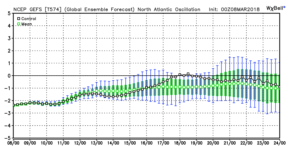
We note the modeling continues to want to keep the North Atlantic Oscillation (NAO) negative into late month. As mentioned in previous discussions, the NAO is “king” late winter and spring.
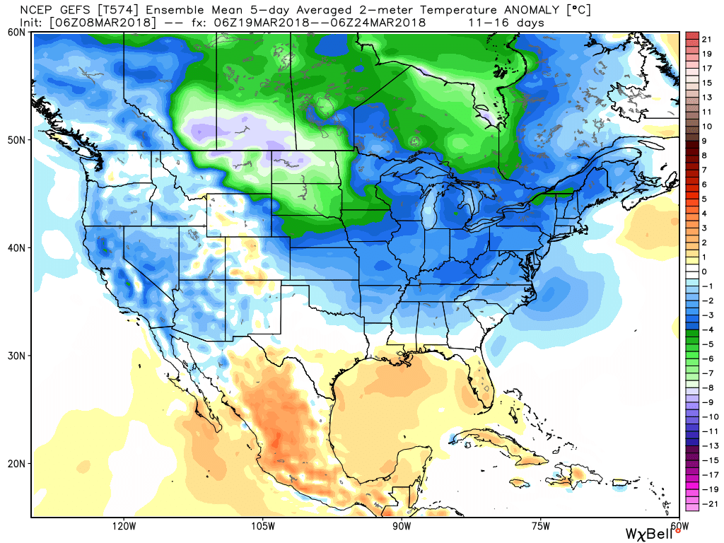
 It should be no surprise that the GEFS 5-day temperature anomaly shows widespread below normal air centered on March 22nd.
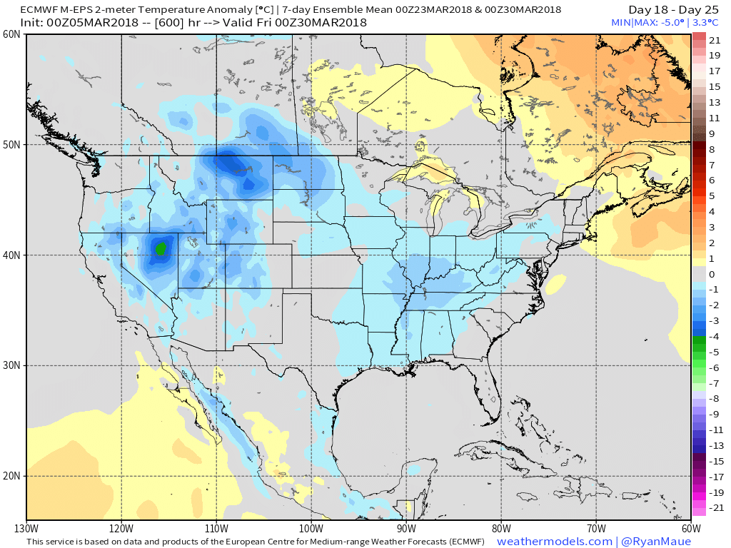
 This doesn’t mean brief surges of warmth, originating in the southern Plains, can’t shoot into the Ohio Valley for a couple of days. Perhaps we’ll “luck out” and enjoy a briefly milder time for St. Patrick’s Day. This does, however, mean that overall we have a long, long way to go before “stick and hold” spring can arrive, locally, and the balance of the upcoming 2-3 weeks looks colder than average.
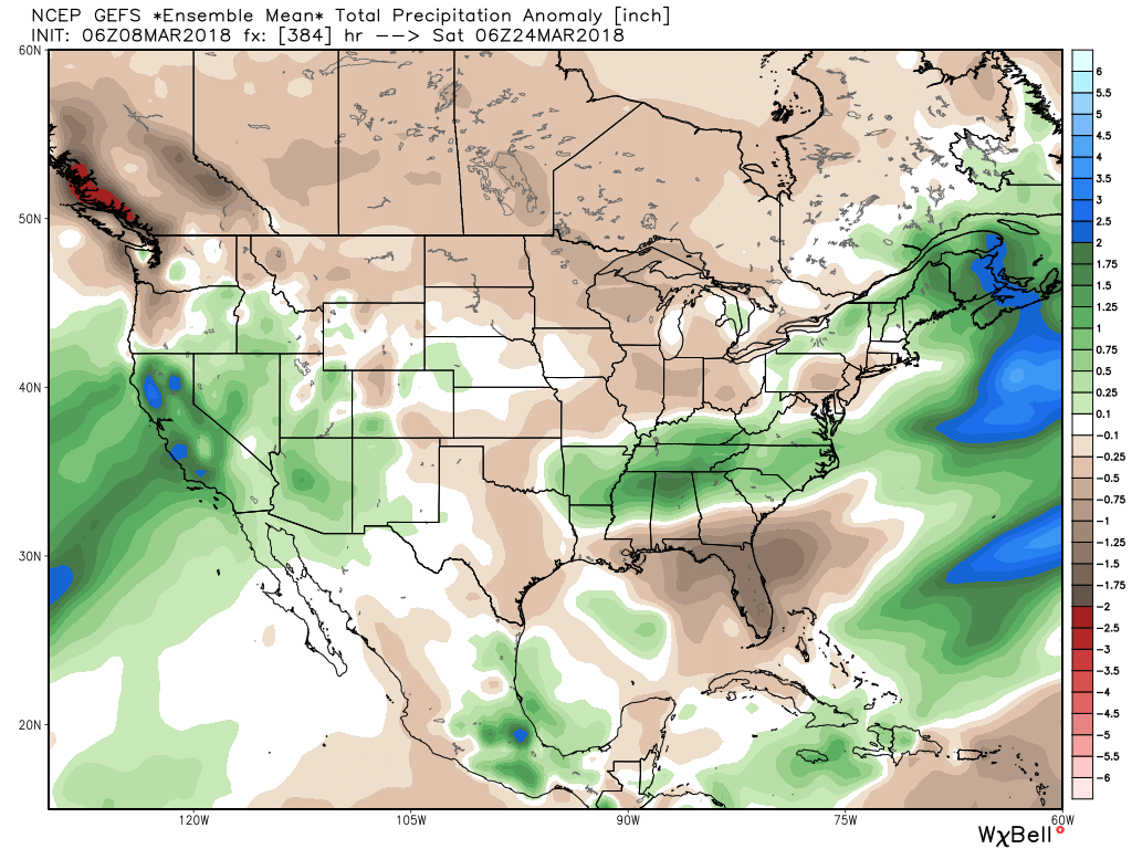
Side note: The upcoming couple weeks looks drier than average for our region, while the TN Valley into the Carolinas remains abnormally wet. Our friends in the southern Plains continue to deal with dry times and the drought will only worsen in coming weeks there…
 The first few days of March have gotten off to a warmer than average start, but the coming 5-10 days will run colder than average across a large portion of our region.
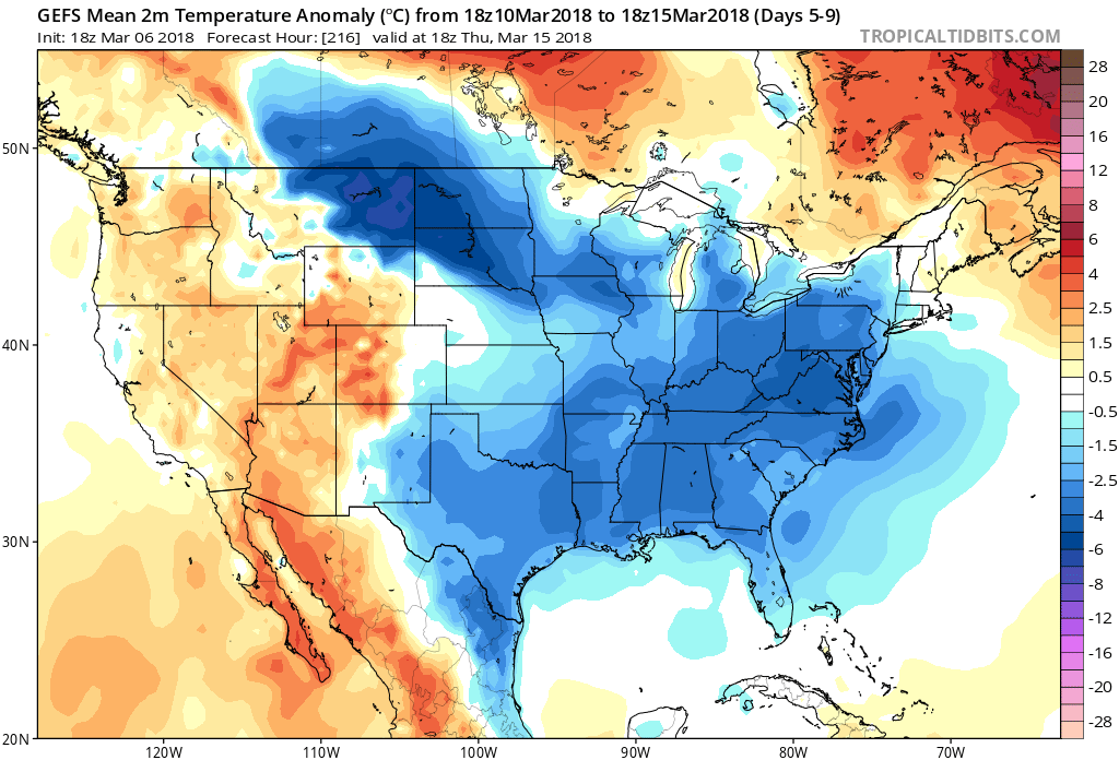 Perhaps of more importance, and a greater focus, locally, is the potential one of these storms will slow down and intensify into something more significant than a 12-24 hour period of snow showers and squalls. The first contender arrives over the upcoming weekend, but with this being 4-5 days out, confidence remains low.
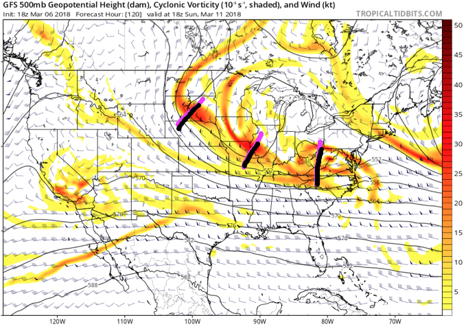 However, it’s important to understand model biases from this distance. So often, the GFS can rush things along in the medium range, only to later correct as time draws closer. If things slow, the associated energy will merge and result in the possibility of a significant, if not major, late-winter storm for portions of the Ohio Valley. As it is, a few of the GEFS ensemble members show this potential.
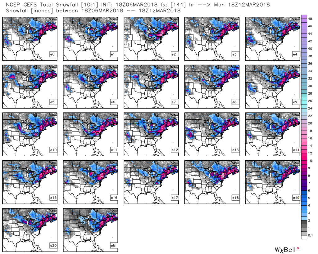 Unfortunately, there’s no way to be more specific from this distance. It’s easy to see both arguments (for and against a more significant storm) from this point, but with high latitude blocking in place (an ingredient missing most of the time from this winter, and several of the past few winters), we most certainly need to keep close tabs on subsequent model runs. Long-time Hoosiers remember when storms of significance actually did, indeed, impact the area. 🙂
 II. The next item we continue to monitor has to do with an initial piece of energy that will scoot across the Ohio Valley Friday. This is ahead of a more significant storm that will likely develop over the weekend and models continue to fluctuate on how they handle things. For now, we’ll maintain a rain/ snow mix Friday, but simply can’t get more specific than that. There are ways this could deposit a stripe of accumulating wet snow for some of the region, but it’s premature to try and nail down where this may occur.
 III. We also have to continue to keep a close eye on what transpires Sunday. We favor one surface low tracking along the Ohio River into the Appalachians before a secondary low takes over along the Mid Atlantic coastline Monday. Again, a swath of wet snow north of the low’s track Sunday into early Monday.
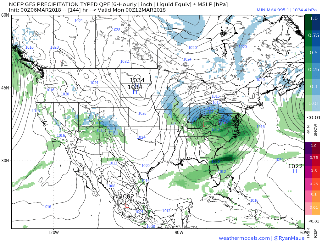 IV. While we should see warmth eject out of the southern Plains in the Week 2 time frame, the large majority of data says this will only be temporary and that cooler than normal temperatures will persist through the balance of the upcoming several weeks. With late season high latitude blocking in place it’s hard to disagree with that idea. Once blocking sets up (especially late in the season), it can be like “pulling teeth” to get any sort of sustained warmth. Just an idea here.