
A hot and humid Independence Day awaits with minimal storm coverage this afternoon. While an isolated storm is possible, overall storm coverage will be significantly less than Tuesday afternoon. The big story will be heat indices approaching 100° to 105° this afternoon. If you have plans outdoors today, hopefully it’s by a pool!
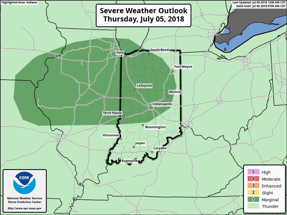
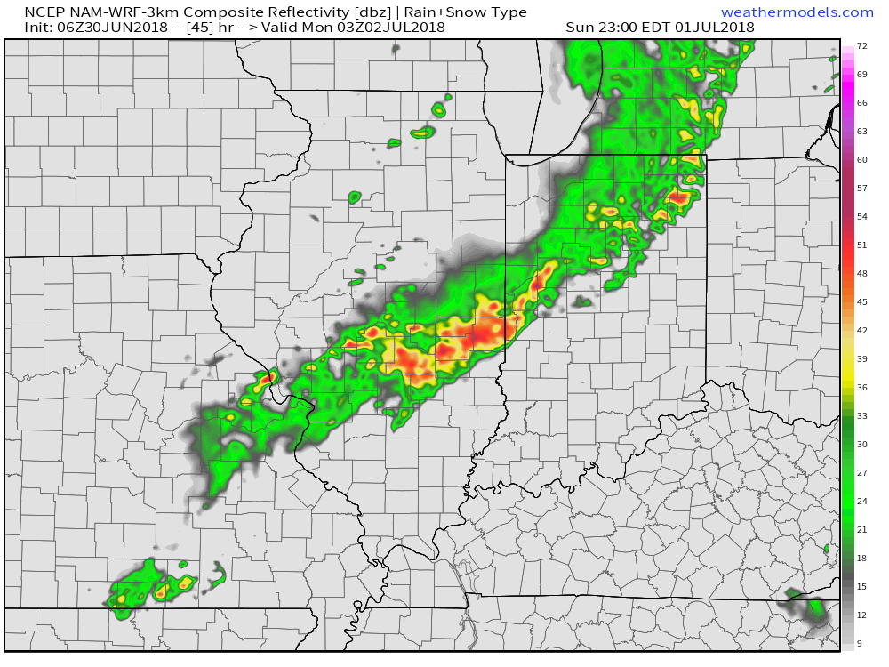
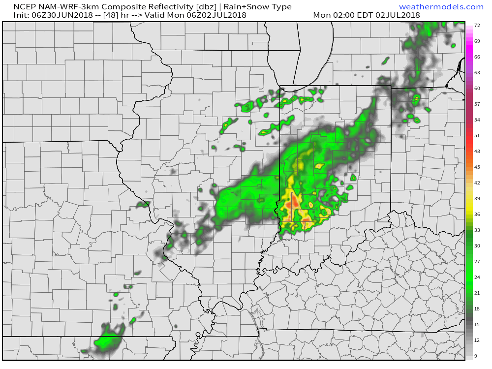
As we move into Thursday, a cold front will approach from the north. Ahead of this boundary, the potential is present for a gusty round of storms Thursday afternoon and evening.
 The Storm Prediction Center currently has a ‘Marginal’ risk of severe weather for portions of the state. It wouldn’t surprise us if a portion of this risk area is upgraded to a ‘Slight’ risk with future updates. The primary concerns? Stronger storms may include damaging winds and large hail.
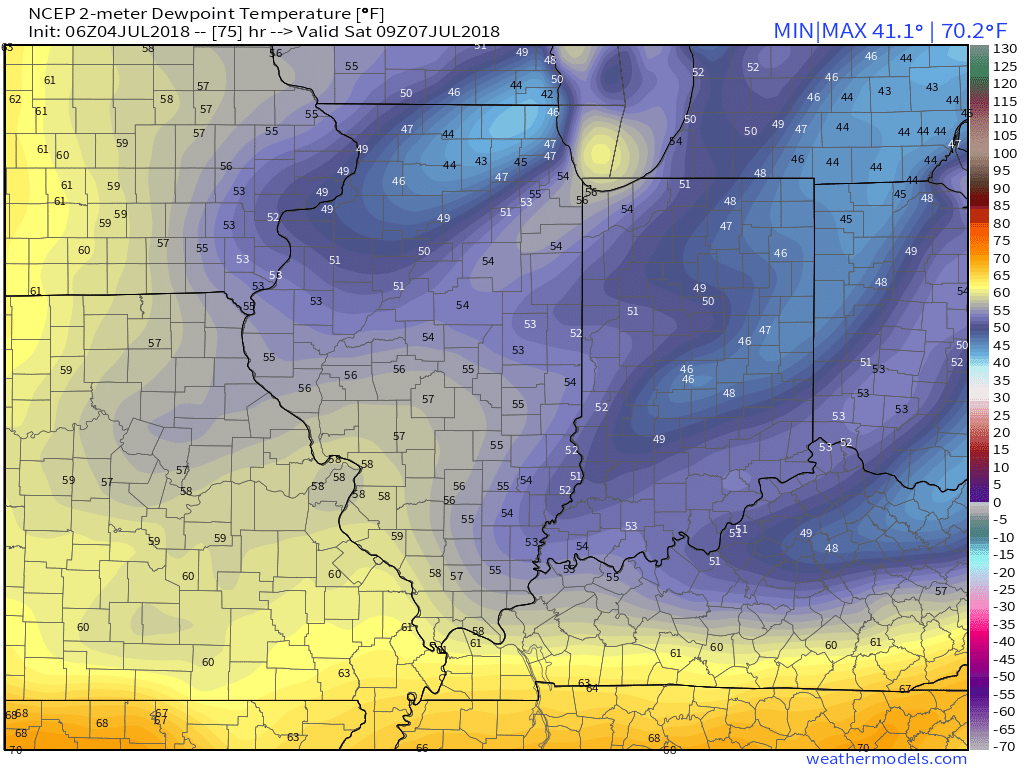
 Storm coverage will diminish during the day Friday with a drier air mass taking hold by evening. We’ll really notice a reduction in humidity Friday night and that more refreshing feel will remain intact through the weekend. Dew points may even fall into the 40s by Saturday morning! Many central Indiana neighborhoods can expect to settle into the mid and upper 50s for overnight lows Saturday and Sunday mornings.
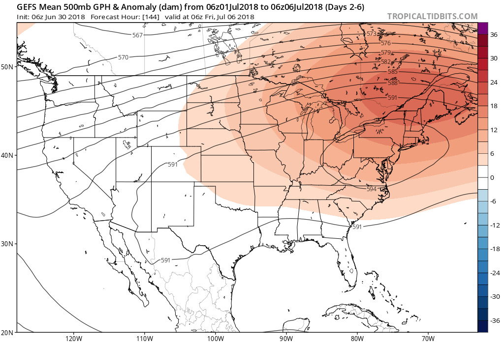
 Dry weather will be with us as high pressure remains in control of the period this weekend into early next week.
Longer term, a transition period should take place around the middle of July that should ultimately help set up a cooler close to the month and open to August- relative to normal and certainly to where we’ve been lately.
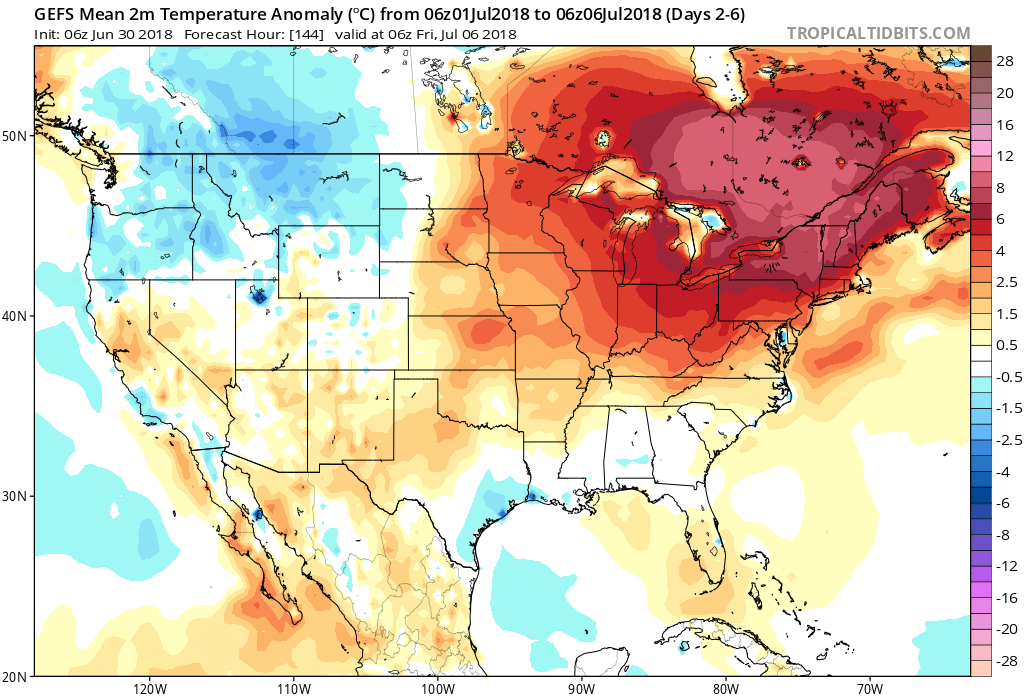 More specific to central Indiana, daily highs in the lower to middle 90s and overnight lows in the lower to middle 70s will continue into late next week. For the most part, this is a dry pattern, as well, BUT there will be a few exceptions.
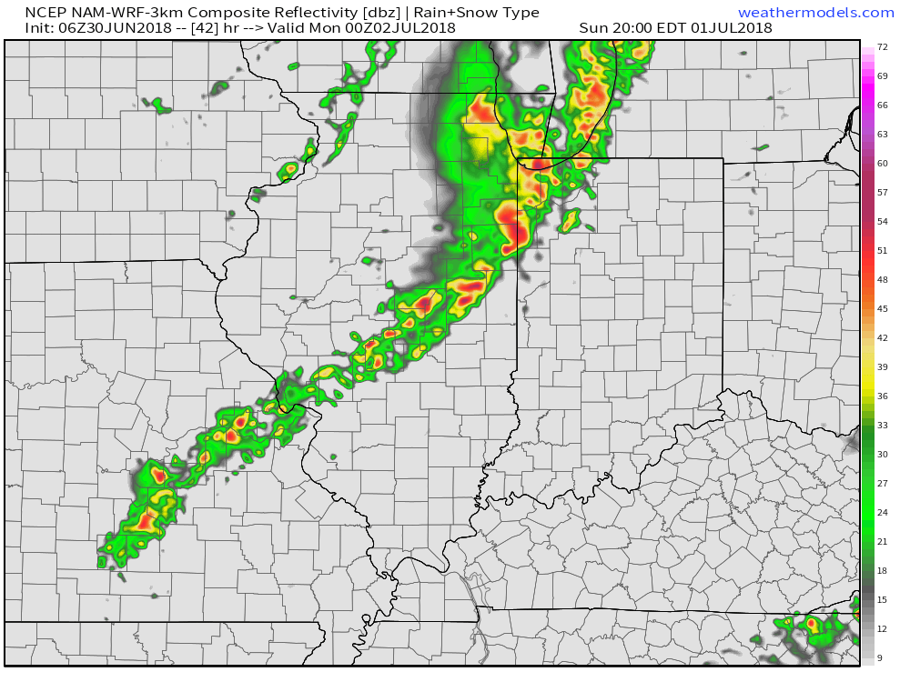
 Thereafter, additional isolated to widely scattered storm coverage is possible- primarily during the afternoon and evening hours, but more than not will remain rain-free. 7-day precipitation totals check in this morning in the 0.25″ to 0.75″ range.
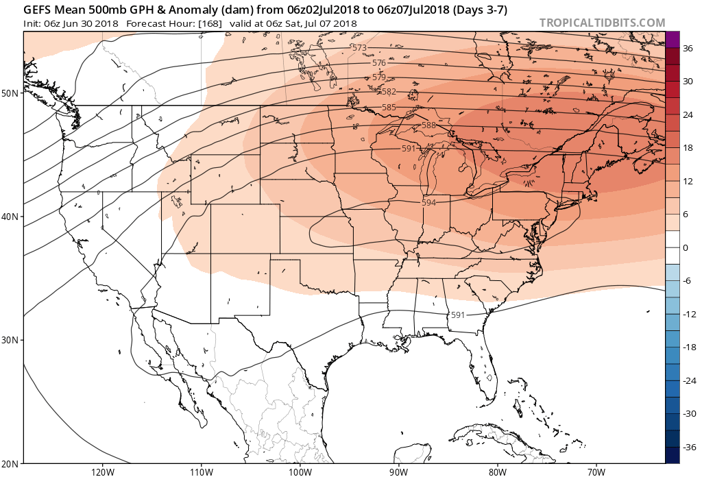

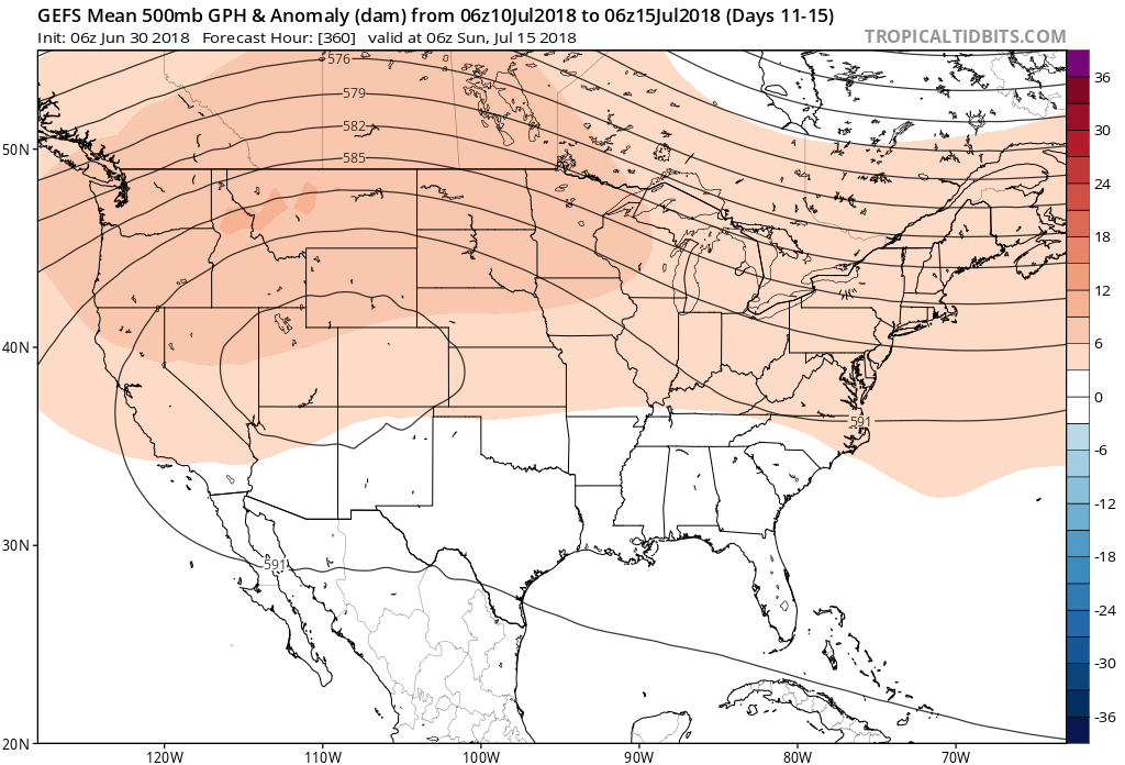 Not only will this likely lead to a cooler second half of July, but should also offer up an increasingly active and wetter northwesterly flow for our immediate region.