VIDEO: Short-Term Update On Flip To Wet Snow This Evening And Freezing Rain NYD Morning…
You must be logged in to view this content. Click Here to become a member of IndyWX.com for full access. Already a member of IndyWx.com All-Access? Log-in here.
You must be logged in to view this content. Click Here to become a member of IndyWX.com for full access. Already a member of IndyWx.com All-Access? Log-in here.

Rain Ends As Wet Snow This Evening…A cold rain will continue to overspread central Indiana this morning. A cold front will slip south across the state through the afternoon and temperatures will fall into the 30s prior to sunset across most of the region. One final wave of moisture will push northeast across the area as temperatures fall into the low and mid 30s leading to a brief period of wet snow between 6p and 10p (northeast to southwest). We’re likely only looking at a window of 1-2 hours of snow at any one location, but it could fall moderate to heavy during that brief window and accumulate between a dusting and 1.5″. We’ll keep an eye on model trends through the day.
New Year’s Eve will feature dry, but gloomy and cold conditions. Look for overcast skies and highs struggling to make it to freezing.
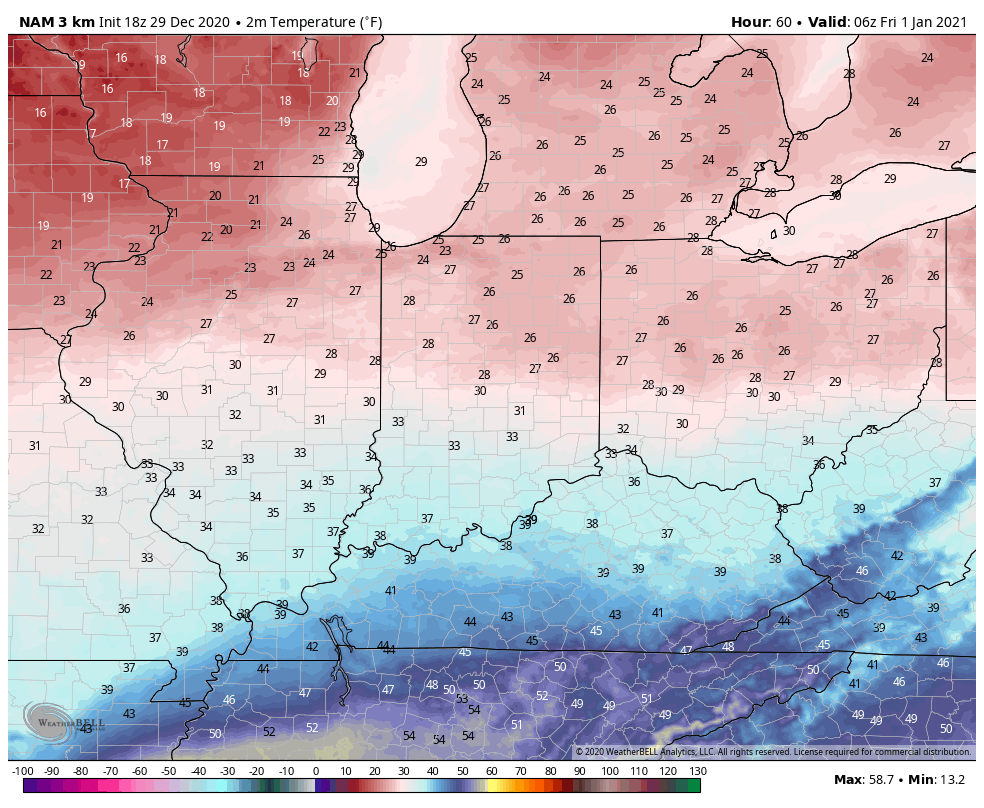
Our second area of low pressure will lift north from the northwestern Gulf Coast into the Midwest Friday and Saturday. This will help widespread precipitation overspread the Hoosier state New Year’s Day (before sunrise for most). With cold air locked in at the surface, precipitation at the onset, continuing for a few hours north of a line from Terre Haute, Bloomington, and Cincinnati, will fall as freezing rain. If traveling early, we’d recommend caution as a light icy glaze (less than .10″ for most) is a good bet. Eventually warmer air will win out, switching things to a “plain ole rain” late morning into the afternoon.
Lingering showers will end Saturday as a trailing piece of upper level energy moves east across the Ohio Valley. Dry skies will return as we open up the new work week.
Rain is on the move east early this morning and should overspread most of central Indiana prior to sunrise or shortly after.

Highs will top out in the mid-upper 40s this afternoon before beginning to fall into the 30s by late afternoon. Guidance has also begun to trend more bullish on a narrow band of wet snow developing across central Indiana around, or just after, sunset as the colder air filters into the region. For now, we’ll target between 6p and 10p for the changeover to wet snow across central Indiana. While we’re still not forecasting significant snowfall, a quick 1”-2” isn’t out of the question before drier air builds in by mid to late evening. We’ll continue to keep a close eye on things.
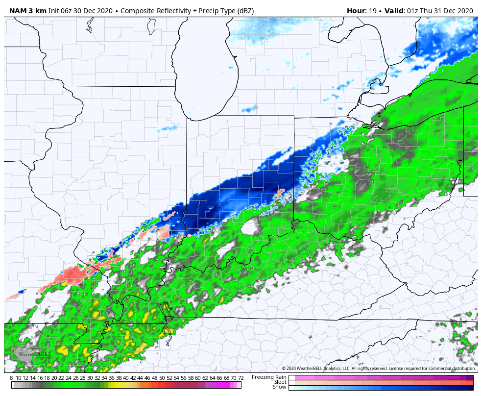
New Year’s Eve will feature a cloudy, cold, but dry day. Our secondary area of low pressure will lift north New Year’s Day, spreading moisture back into the state. Cold air will be entrenched early and allow this precipitation to take the form of freezing rain predawn Friday, continuing for a few hours before switching over to plain ole rain. Before this transition takes place, a light glaze (.1 or less) is possible across most of central Indiana (mainly along and north of a Terre Haute to Bloomington to Cincinnati line).

I’m still working on getting a video uploaded from the road. Fingers are crossed I’ll have success later this morning. Make it a great Wednesday!
First and foremost, thank you so much for your understanding of the “off schedule” posts this week. I’m trying to keep our normal content flowing but have run into a couple of issues getting our daily video content to load, per usual. I’ll keep working on it and appreciate your patience as we update from the road!
At any rate, we really don’t have any significant changes to our ongoing forecast to wrap up the year. Clouds have increased through the day and have begun to lower and thicken this afternoon. These clouds will eventually yield rain before dawn into Indianapolis, itself.
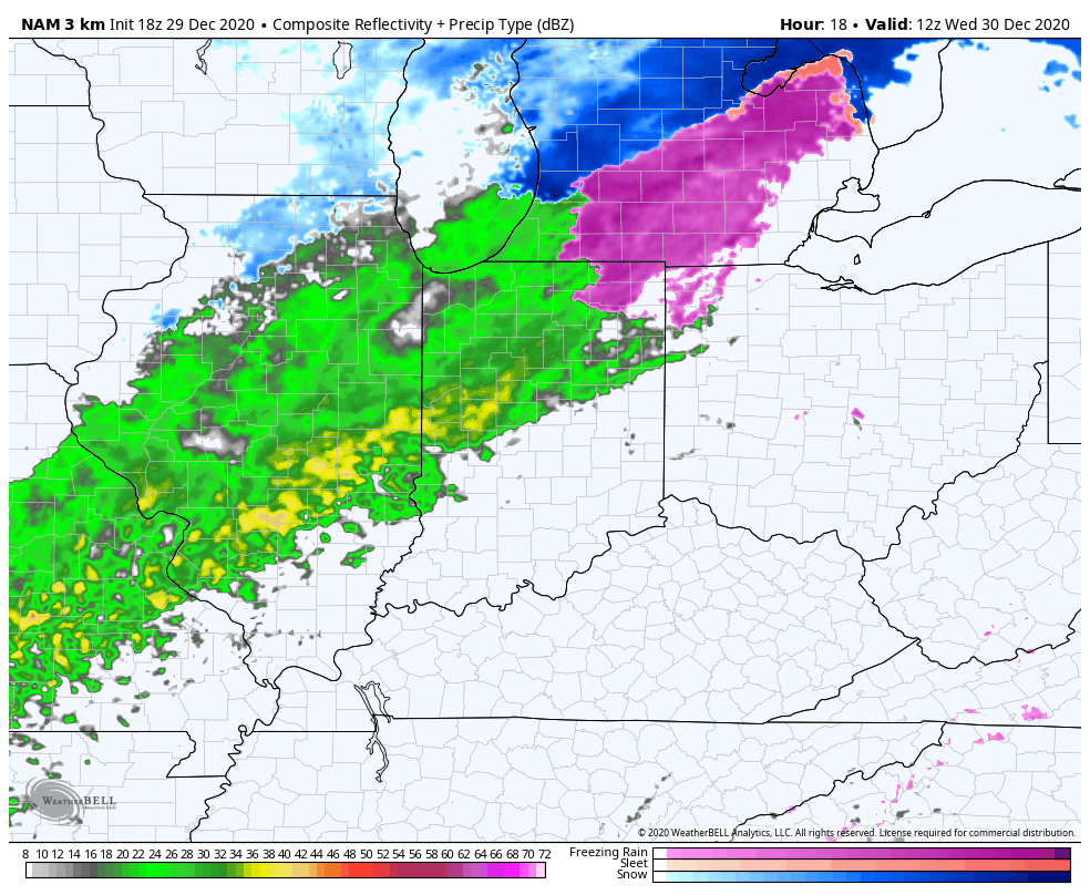
Rain will continue through Wednesday afternoon across central Indiana- totaling 0.50” to 1” for most.


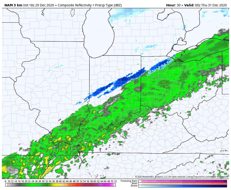
Precipitation may end as a brief period of wet snow after sunset Wednesday, but this shouldn’t be a big deal as the significant moisture will be pushing south as the cold air arrives.
New Year’s Eve, itself, should be dry and cold with temperatures holding around freezing.
A secondary area of low pressure will lift north into the western Ohio Valley New Year’s Day. This will allow widespread moisture to return predawn Friday. While there’s a chance of a brief mix of sleet and freezing rain at the onset, this shouldn’t be a big deal. A cold rain will fall throughout New Year’s Day (great day for a full slate of college football)!
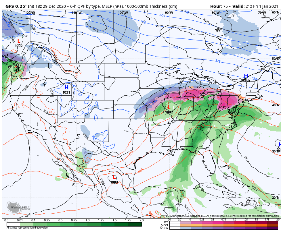
An additional 1” to 1.5” is a good bet Friday as the secondary low moves through.
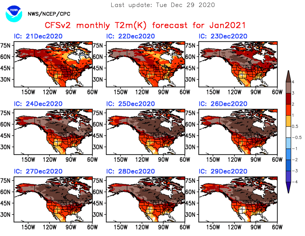
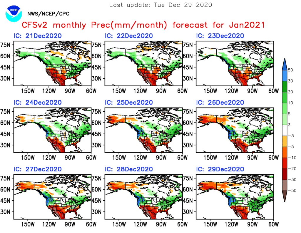
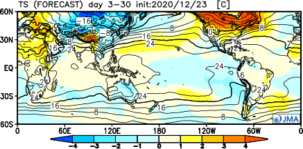
As we get set to flip the calendar to a new year, does the similar pattern that dominated in December roll over to January? Yes and no. While we anticipate the relative warmth to remain intact through the majority of the month, the storm track looks to aim itself through the Ohio Valley region for the better part of the month, helping generate above to well above average precipitation.
Forecast Models: Note the consensus on the warm (relative to average, of course), wet theme.
CFSv2
JMA

European


The MJO is becoming increasingly interesting. The European modeling wants to keep the MJO in the “null” phase, but the American modeling is showing the MJO get more amplified with time as we go through early-mid January.

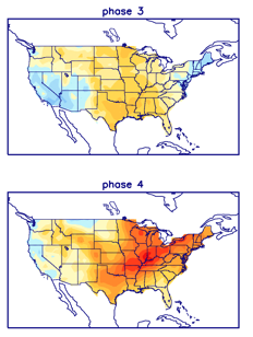
Despite favorable phases for cold (AO and NAO), the Pacific pattern (namely strongly positive EPO) is wrecking havoc on any sort of cold trying to get involved in the pattern with any sort of staying power. Unless we can get a disruption of the polar vortex (big “IF” at this point), the relative warmth should continue to dominate.

We think this will be an active month with multiple storms of significance impacting the Ohio Valley. Despite our thinking that relative warmth will dominate, remember January, climatologically speaking, is the coldest month of the year. It would only take 1 or 2 of the expected storm systems tapping into only marginally cold air to generate more meaningful wintry weather and this is something we’ll keep an eye on in the weeks ahead.