Category: Forecast Discussion
Heaviest concentration of storms Tuesday was along the I-70 corridor and points south. We think today coverage of rain and thunderstorms will be more widespread across the state…
We’re off to a cool and quiet start this morning, but think things will turn rather busy yet again as early as the early-mid afternoon hours. Unsettled conditions will continue through the night.
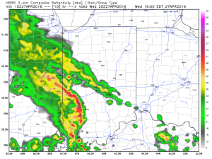
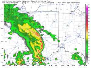
Latest scans of the HRRR future-cast radar product suggests we need to monitor for high wind potential during the early to mid afternoon hours. We’ll keep a close eye on this.

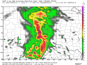
 The high resolution NAM future-cast radar is slower, but also shows strong to possibly severe storms into central IN late tonight.
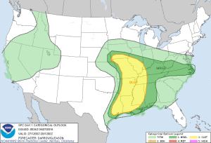
 The current SPC outlook highlights far southwestern IN for the chance of severe weather today. Don’t be surprised if this is expanded northeast with later updates today.
 Rainfall potential today-tonight should feature many neighborhoods accumulating an additional inch, with some locally heavier totals.
Permanent link to this article: https://indywx.com/2016/04/27/another-round-of-storms-this-afternoon/
We enjoyed a brilliant Saturday across central Indiana. Plentiful sunshine developed, as expected, after a cloudy, drizzly start in areas. Temperatures topped out in the mid to upper 60s for…
You must be logged in to view this content. Click Here to become a member of IndyWX.com for full access. Already a member of IndyWx.com All-Access? Log-in here.
Permanent link to this article: https://indywx.com/2016/04/23/active-times-my-friend/
April is running nearly 6° below average and nearly spot-on where we should be from a precipitation perspective through the 15th. As we move forward, the big story…
You must be logged in to view this content. Click Here to become a member of IndyWX.com for full access. Already a member of IndyWx.com All-Access? Log-in here.
Permanent link to this article: https://indywx.com/2016/04/16/saturday-morning-rambles-8/
You must be logged in to view this content. Click Here to become a member of IndyWX.com for full access. Already a member of IndyWx.com All-Access? Log-in here.
Permanent link to this article: https://indywx.com/2016/04/12/tuesday-evening-video-update-5/
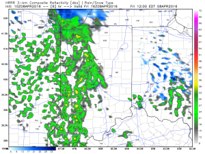
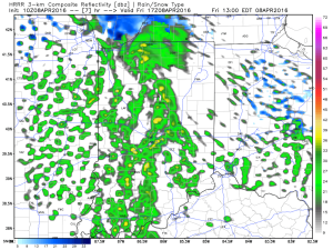
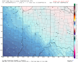
While the morning is off to a frigid and quiet start, changes will begin to take place as early as late morning into the early afternoon hours. Another disturbance will rotate through central IN this afternoon and evening and interact with the unseasonably cold air (both aloft and at the surface) to ignite convective showers. Some of these showers, mixed at times with sleet and snow, will be accompanied by thunder.

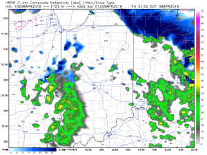
 Eventually, as cold air is reinforced this evening, all precipitation should transition to snow this evening into early Saturday. While it won’t snow for everyone, scattered heavy snow bursts will be plenty capable of producing a quick coating for some neighborhoods tonight.
 Speaking of the cold, highs Saturday will remain in the 30s for most. Yes, this is April…
 Hang in there, friends. After another chilly week next week, changes are in the offing for late month. Warmth is coming….eventually. 🙂
Permanent link to this article: https://indywx.com/2016/04/08/thundersleet-and-thundersnow-possible-later-today/
You must be logged in to view this content. Click Here to become a member of IndyWX.com for full access. Already a member of IndyWx.com All-Access? Log-in here.
Permanent link to this article: https://indywx.com/2016/04/07/thursday-morning-video-update-2/
The overall weather pattern is transitioning to open April and the end result will be a colder than average time of things for the better part of the first half…
You must be logged in to view this content. Click Here to become a member of IndyWX.com for full access. Already a member of IndyWx.com All-Access? Log-in here.
Permanent link to this article: https://indywx.com/2016/04/01/chilly-open-to-april/
We’re still focused on the potential of strong to severe thunderstorms this afternoon and evening. After morning showers move out of the region we should get into a drier…
You must be logged in to view this content. Click Here to become a member of IndyWX.com for full access. Already a member of IndyWx.com All-Access? Log-in here.
Permanent link to this article: https://indywx.com/2016/03/31/still-eyeing-an-evening-severe-threat/
You must be logged in to view this content. Click Here to become a member of IndyWX.com for full access. Already a member of IndyWx.com All-Access? Log-in here.
Permanent link to this article: https://indywx.com/2016/03/30/active-severe-weather-day-ahead-thursday/
Showers and embedded thunder increase tonight and we eye Thursday for severe weather potential across the region…
You must be logged in to view this content. Click Here to become a member of IndyWX.com for full access. Already a member of IndyWx.com All-Access? Log-in here.
Permanent link to this article: https://indywx.com/2016/03/30/wednesday-morning-video-update-turning-stormy/
 The high resolution NAM future-cast radar is slower, but also shows strong to possibly severe storms into central IN late tonight.
 The current SPC outlook highlights far southwestern IN for the chance of severe weather today. Don’t be surprised if this is expanded northeast with later updates today.
 Rainfall potential today-tonight should feature many neighborhoods accumulating an additional inch, with some locally heavier totals.
