You must be logged in to view this content. Click Here to become a member of IndyWX.com for full access. Already a member of IndyWx.com All-Access? Log-in here.
Category: Forecast Discussion
Permanent link to this article: https://indywx.com/2016/07/26/stormy-for-some-this-morning-transient-pattern-into-august/
Jul 21
Thursday Evening Rambles…
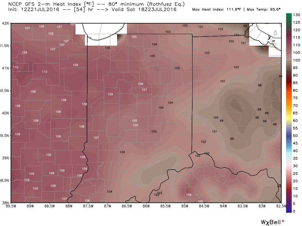
1.) A big ole ridge will supply oppressive heat and humidity across the Mid West this weekend. Unseasonably hot temperatures will combine with downright “soupy” air to create heat indices between 105-110 degrees across central IN this weekend. Take it easy and implement frequent breaks if your plans take you outdoors.
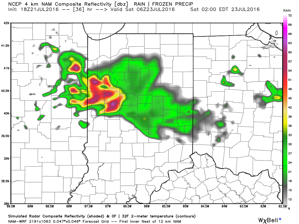
2.) Similar to what we’re seeing on radar this evening, thunderstorms will also make an appearance from time to time for some. With an atmosphere loaded with moisture, any storm that develops will be plenty capable of producing “frog straggler” type rainfall rates. Perhaps there will be a couple periods of more concentrated storm activity, focused on late tomorrow night and early Saturday, and again late Saturday night-Sunday morning. We’ll keep an eye on things.
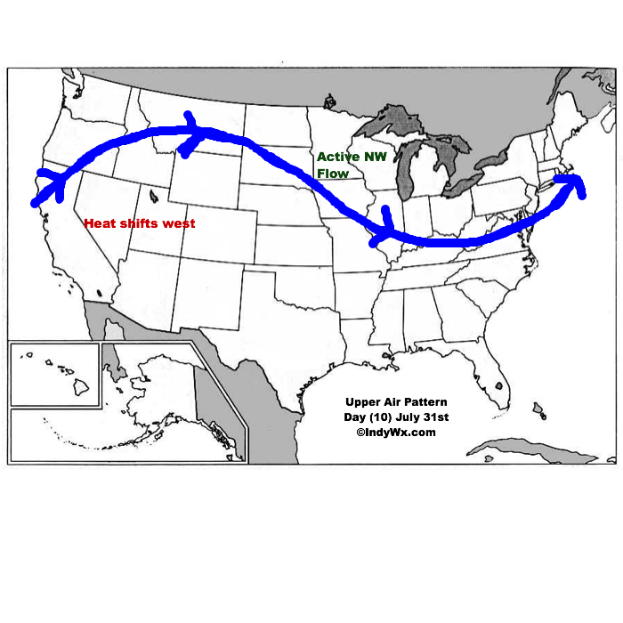
3.) The pattern is one (as has been the case all summer) that’s transient and the situation that develops to wrap up July and open August is an all-too-familiar look around these parts: NW flow aloft that offers storm potential, along with seasonal to slightly warmer than average. It’s a wet look, overall.
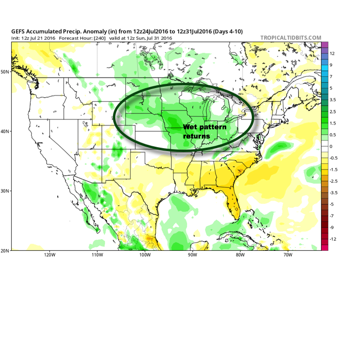
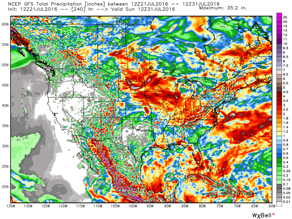
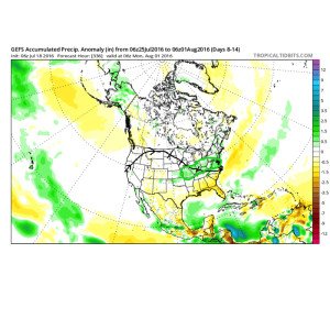
10-Day GFS rainfall numbers are impressive across the Mid West. Soaking rains for many. Courtesy Weatherbell.com
This is what the upper air pattern should look like as we close July- 10 days from now (hard to believe)!
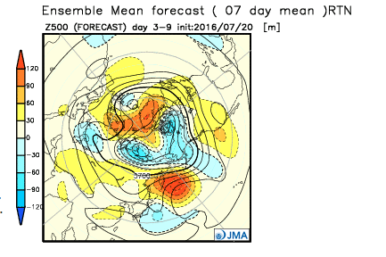
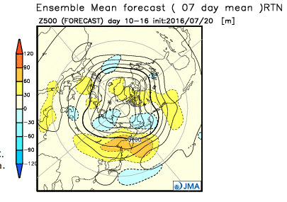
4.) Looking further ahead, the latest JMA Weeklies continue to suggest the most sustained hot pattern should remain across the west as we rumble deeper into August. That’s not to say we won’t deal with periods of hot weather here at times, but sustained heat will be hard to come by with such a pattern…
Permanent link to this article: https://indywx.com/2016/07/21/thursday-evening-rambles-2/
Jul 18
Heat Builds Late Week, But Doesn’t Last…
The pattern remains in a transient state. An upper ridge will build over the region late week into the weekend. With this will come the hottest air of the season (multiple days of lower to middle 90s starting Friday, continuing into early next week). The hottest days appear slated for Friday and Saturday. Heat indices will approach 105 degrees.
However, just as fast as the ridge builds over the area, we see the “want” to position itself over the Rocky Mountain region.
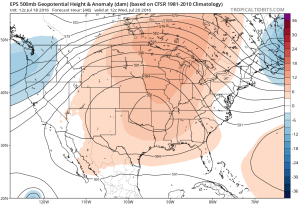
Hot dome will provide a couple days of highs in the middle 90s Friday-Saturday. Image courtesy of Tropicaltidbits
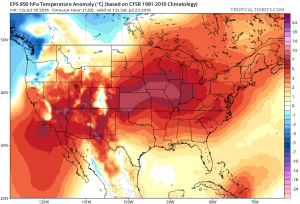
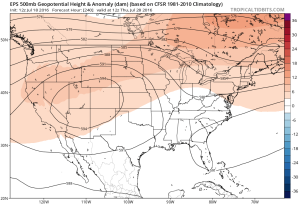
Note the difference of the ridge position by Day 10. Courtesy of Tropicaltidbits
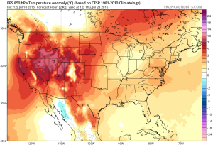 While some oppressive heat and humidity will impact our local area to wrap up the work week and head into the weekend, this is a pattern where it’s incredibly difficult to deal with any sort of one particular weather pattern for any time of substance. Looking forward to August, we don’t see this changing. Remember that word we leaned on to begin summer? “Transient” remains the best way to describe the pattern moving forward, as well.
Additionally, this is a pattern that should result in a return of wet and active times as we put a wrap on July and welcome August. It’s impossible to nail down the precise details of any one particular neighborhood’s rainfall numbers from this distance, but understand the pattern is one that should yield more locally hefty rains in the weeks ahead.
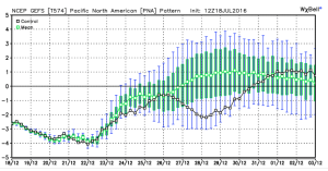
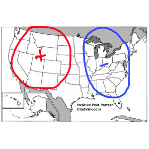
 To close, we’ll leave you with a look at the latest PNA pattern. This has been the primary driver of our weather this summer, and it also argues any sort of dry, hot weather doesn’t last. Note the positive PNA returning to close July. This also lines up well with our idea of unsettled times returning…
Permanent link to this article: https://indywx.com/2016/07/18/heat-builds-late-week-but-doesnt-last/
Jul 17
Sunday Video Update: Storms & Heat…
You must be logged in to view this content. Click Here to become a member of IndyWX.com for full access. Already a member of IndyWx.com All-Access? Log-in here.
Permanent link to this article: https://indywx.com/2016/07/17/sunday-video-update-storms-heat/
Jul 14
Pleasant Weekend On Deck…
You must be logged in to view this content. Click Here to become a member of IndyWX.com for full access. Already a member of IndyWx.com All-Access? Log-in here.
Permanent link to this article: https://indywx.com/2016/07/14/pleasant-weekend-on-deck/
Jul 14
Hot, Drier Pattern Awaits…
We’ve been relatively spoiled so far this summer- both in regards to temperature and precipitation. That said, as we approach the second half of July, things appear to be changing for the hotter and drier side of things.
July, so far, has been very pleasant, locally. BTW- another push of drier air is inbound that should lead to a nice weekend, including low humidity values.
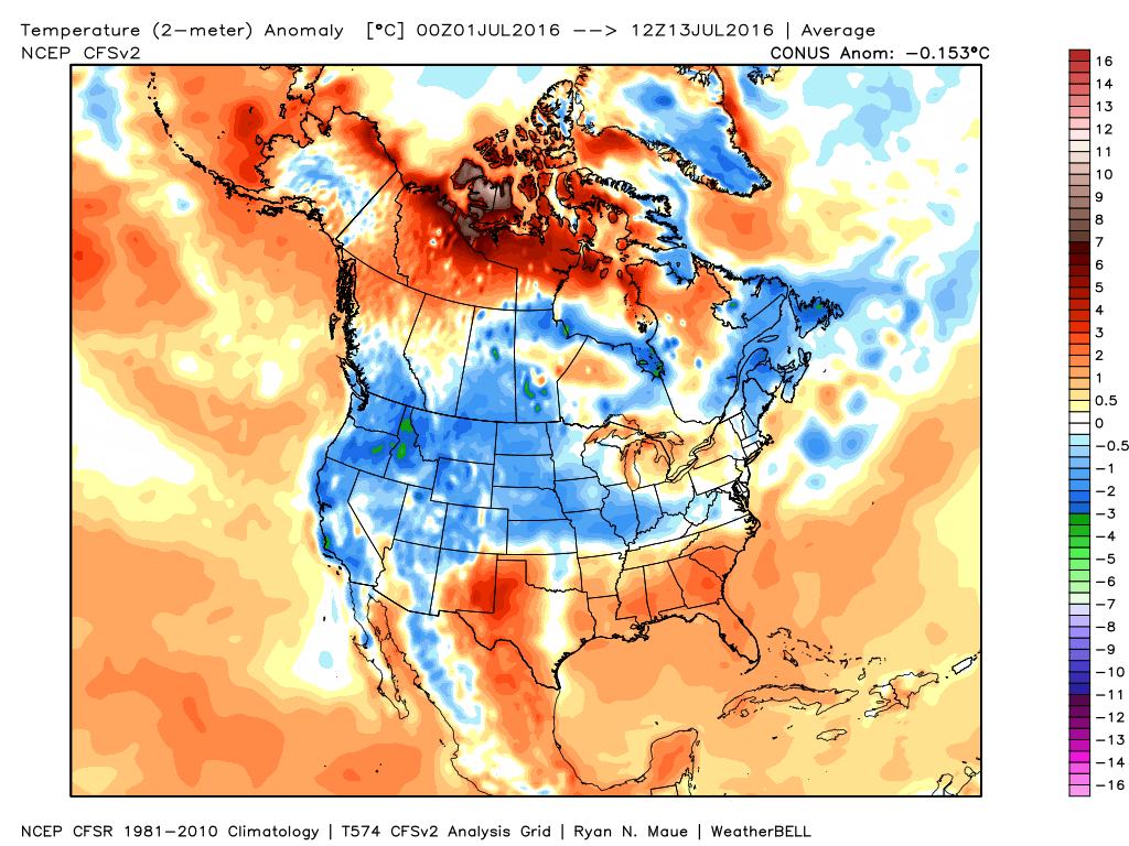 Ensemble data continues to suggest that the mean ridge position (hot dome) develops over the eastern portion of the country early next week before slowly retrograding northwest with time.
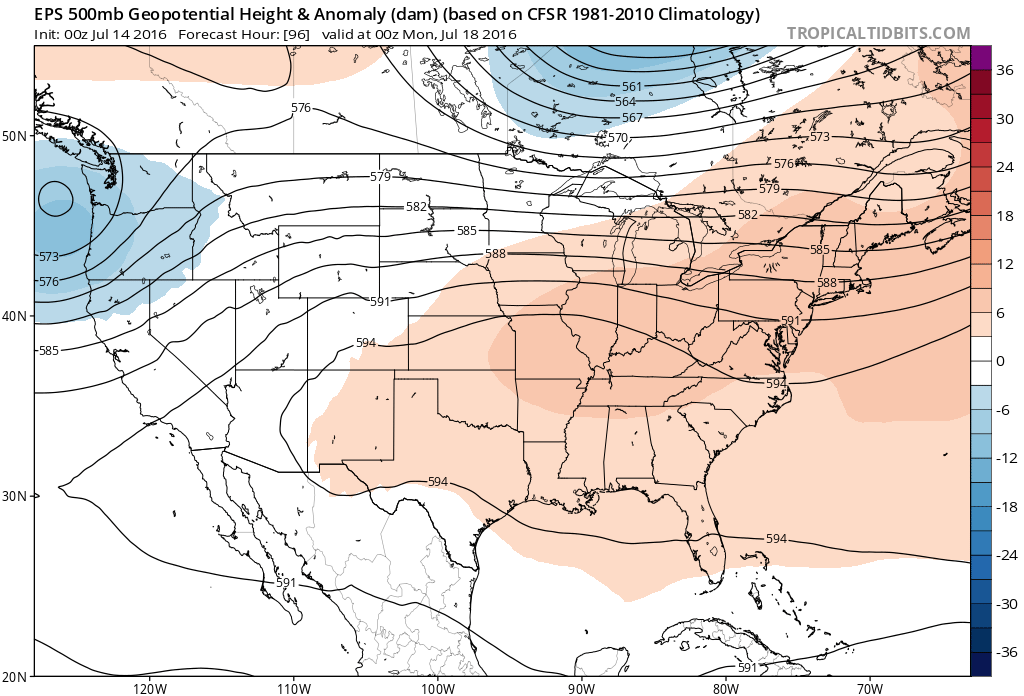 By the middle and latter portions of next week, the hot dome is set up in a position that will yield an extended stretch of hot temperatures across the state, including multiple mid-90 degree highs across central IN.
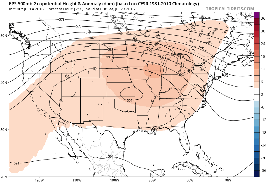
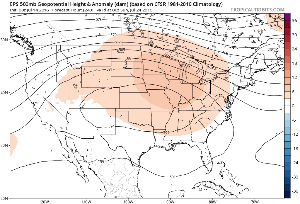 Given the current look of the ridge position, this would also be a rather dry pattern, as well, as the storm and rain track would shift north across the Canadian border into the northern Great Lakes states. (Follow that 588 line above for a good indicator of the storm track).
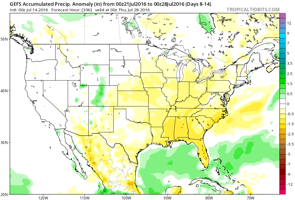 One always has to be careful in trying to predict the timing of the ridge breaking down/ overall placement this time of year (models can struggle), but for now it appears as if we really heat things up and dry things out as we move through next week- especially the middle and latter portions of the week.
Permanent link to this article: https://indywx.com/2016/07/14/hot-drier-pattern-awaits/
Jul 11
Monday Morning Video Update…
You must be logged in to view this content. Click Here to become a member of IndyWX.com for full access. Already a member of IndyWx.com All-Access? Log-in here.
Permanent link to this article: https://indywx.com/2016/07/11/monday-morning-video-update-2/
Jul 08
Friday Morning Rambles…
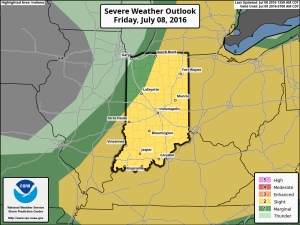
1.) We’ve got another warm, humid day dialed up and as a cold front moves in this afternoon, scattered strong to severe storms are possible. We think east-central Indiana stands the greatest threat at experiencing a severe storm later this evening.
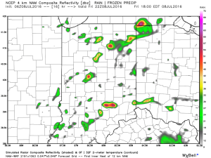 2.) The aforementioned cold front will sweep through the state tonight and allow a much drier and cooler air mass to push in for the weekend. We’ll enjoy a downright pleasant feel this weekend, including lots of sunshine. Enjoy!
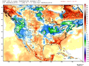 3.) Dry weather should continue into early next week, but wet and stormy weather will return as early as Tuesday, continuing into the latter portions of the week.
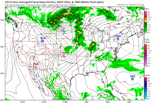 This is the start of what should be a rather wet period for mid and late month.
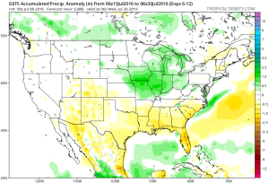 4.) This is also a continued “transient” pattern through the end of the month, meaning we really don’t see any sort of sustained dry, hot weather in the foreseeable future…
Permanent link to this article: https://indywx.com/2016/07/08/friday-morning-rambles-3/
Jul 07
Thursday Morning Video Update…
Severe potential is there tonight, but how does convection to our west during the day impact the situation downstream (locally) for tonight? We’re monitoring closely, but for the purpose of…
You must be logged in to view this content. Click Here to become a member of IndyWX.com for full access. Already a member of IndyWx.com All-Access? Log-in here.
Permanent link to this article: https://indywx.com/2016/07/07/thursday-morning-video-update-3/
Jul 05
Entering A Stormy Period…
We’re enjoying quiet times across Indiana this evening, but times are quickly changing to put us into a stormy position between Wednesday morning and wrapping up the work week.
While the overall pattern is an easy one to label from a broad scale perspective as “stormy,” the precise details are incredibly difficult to pin point much more than 12-24 hours in advance. With that said, most of the state is very much in fair game for periods of storms (generally tracking in a NW to SE fashion) between now and the end of the work week. Eventually, drier air will set us up for a very pleasant weekend, including lots of sunshine and cooler temperatures. In fact, latest data still suggests we can expect to wake up to the 50s Sunday and/ or Monday morning(s).
Before we enjoy the pleasant weekend weather, the first of a series of storm complexes will approach Wednesday morning. Mesoscale Convective Complexes (MCCs) can be a true pain for short-term modeling to handle, but the overall idea this evening is for the first of (2) complexes to impact parts of the region Wednesday morning.
This is an idea what the radar may look like around 9a. This would be the same complex that will deal quite the blow to portions of the eastern Plains and upper Mid West tonight (localized damaging straight line winds will be an issue to our NW). Thankfully, we expect weakening of this complex as it dives off to the SE, in our general direction.
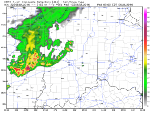 We’ll go through a quiet period during the afternoon hours before a second surge of storms takes aim on the region tomorrow night into Thursday morning (again, understanding we’ll have to “sure up” timing as we go).
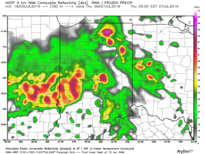 Additional storm complexes will follow Thursday into Friday before that drier air gets here. Some of these could be strong to severe.
While rainfall amounts won’t be uniform, there’s the potential for some neighborhoods to get 2″-3″ of rain between now and week’s end (where storms train).
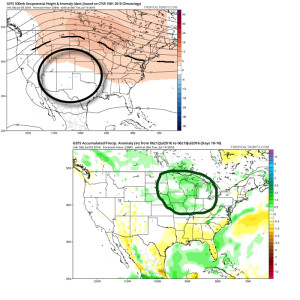
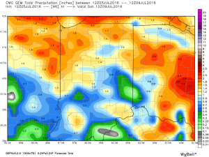 Looking ahead, after a dry weekend and open to next week, indications point towards a return of wet and active times as we approach Day 10. Long range ensemble data backs up the wet, stormy look nicely, and there’s really no end in sight…
Permanent link to this article: https://indywx.com/2016/07/05/entering-a-stormy-period/
