You must be logged in to view this content. Click Here to become a member of IndyWX.com for full access. Already a member of IndyWx.com All-Access? Log-in here.
Category: Forecast Discussion
Permanent link to this article: https://indywx.com/2017/05/28/video-not-bad-for-race-day-but-storms-may-threaten-this-afternoon-in-spots/
May 25
Latest Thoughts On Memorial Day And Race Weekend…
As the race weekend and Memorial Day draw ever-closer, data is able to pick up on some of the specifics associated with our weather for the all-important long weekend.
After scrolling through the data this evening, it appears as if we need to bracket late Friday night-Saturday morning and again late Saturday into Sunday morning for the potential of two rounds of gusty storms. Some of these storms could reach strong to severe levels, and the Storm Prediction Center continues to outline central Indiana for a Slight Risk Saturday (large hail and damaging straight line winds are of greatest concern, locally).
 Despite having to dodge a couple rounds of gusty storms this weekend, we want to stress that the majority of the holiday weekend should feature rain-free hours, and certainly isn’t worth cancelling any outdoor plans. In fact, after a beautiful Carb Day, most of the daytime hours both Saturday and Sunday should be rain and storm free. Have a means of getting the latest weather information, but plan to enjoy long stretches of rain-free hours this weekend.
Much more later!
Permanent link to this article: https://indywx.com/2017/05/25/latest-thoughts-on-memorial-day-and-race-weekend/
May 24
Cool And Increasingly Wet Today…
The morning is starting off dry across most of central Indiana, but that will begin to change as we progress into the afternoon and evening hours as rainfall grows in coverage and intensity.
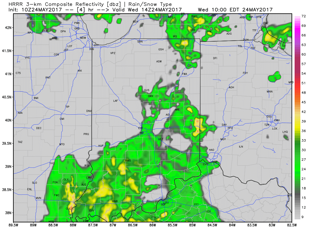
10a forecast radar
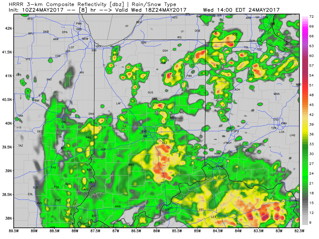
2p forecast radar
Widespread rain will continue tonight as low pressure tracks north out of the TN Valley and slowly meanders across eastern IN and OH tonight before pulling off to the northeast Thursday.
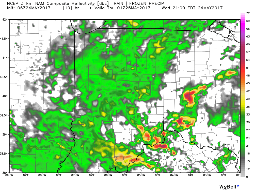 Thankfully, rain will begin to diminish Thursday morning and we’re back to mostly dry conditions by Thursday afternoon. Before dry weather returns, some neighborhoods can expect to accumulate between 1″-2″ of rain.
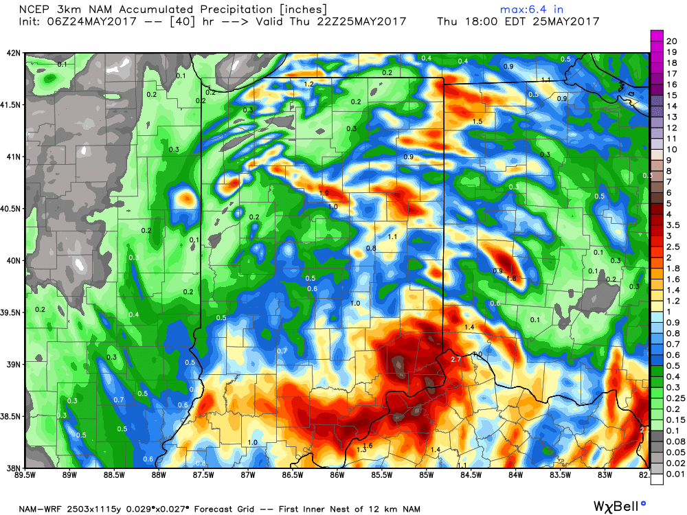 With the clouds and showers around, expect unseasonably cool conditions both today and Thursday. Highs will only reach the mid to upper 60s both days.
As we look ahead, we think our dry Thursday afternoon should continue into most of Friday before scattered showers and thunderstorms return to the forecast Saturday and Sunday. More on those details later today! Make it a great Wednesday!
Permanent link to this article: https://indywx.com/2017/05/24/cool-and-increasingly-wet-today/
May 23
VIDEO: Unsettled Weather Returns For Midweek And Looking Ahead To Race Day Weather…
You must be logged in to view this content. Click Here to become a member of IndyWX.com for full access. Already a member of IndyWx.com All-Access? Log-in here.
Permanent link to this article: https://indywx.com/2017/05/23/video-unsettled-weather-returns-for-midweek-and-looking-ahead-to-race-day-weather/
May 21
VIDEO: Sunday Morning Showers Give Way To Afternoon Sunshine…
You must be logged in to view this content. Click Here to become a member of IndyWX.com for full access. Already a member of IndyWx.com All-Access? Log-in here.
Permanent link to this article: https://indywx.com/2017/05/21/video-sunday-morning-showers-give-way-to-afternoon-sunshine/
May 19
Periods Of Storms Through The Weekend…
The Storm Prediction Center includes portions of the state, including Indianapolis, under a Slight Risk of severe weather today and Saturday.
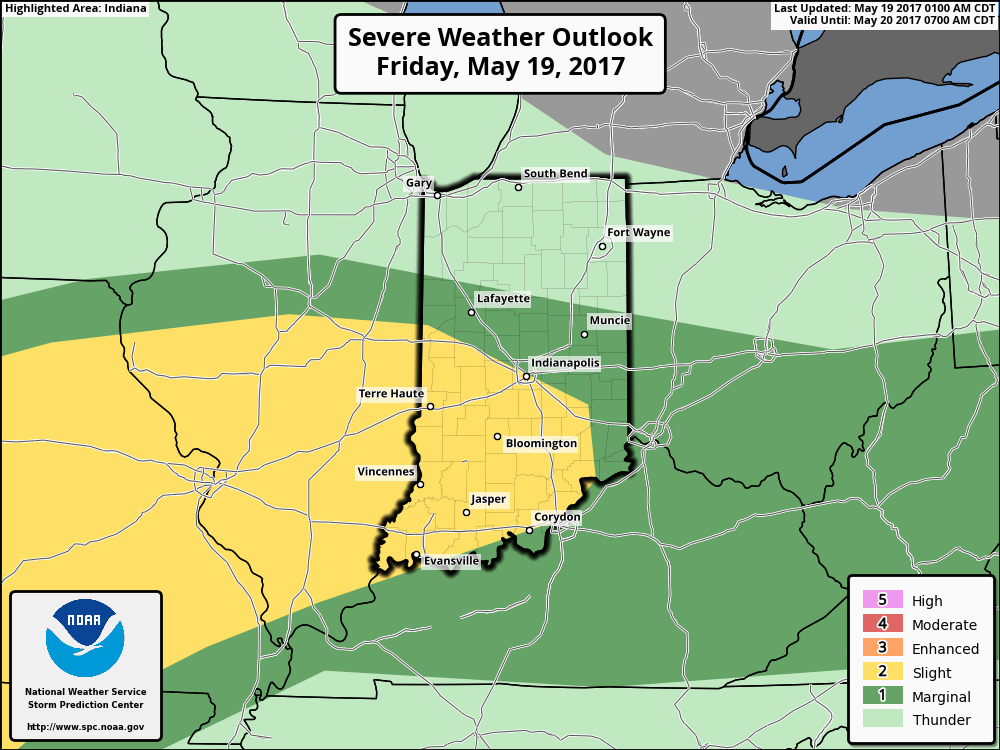
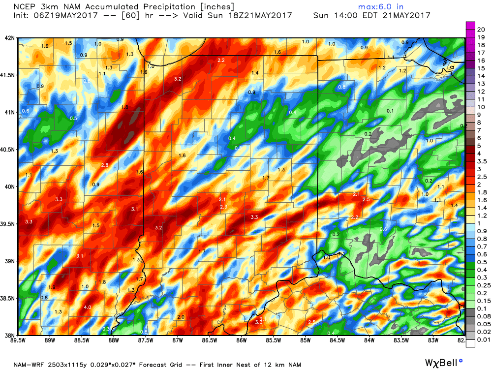
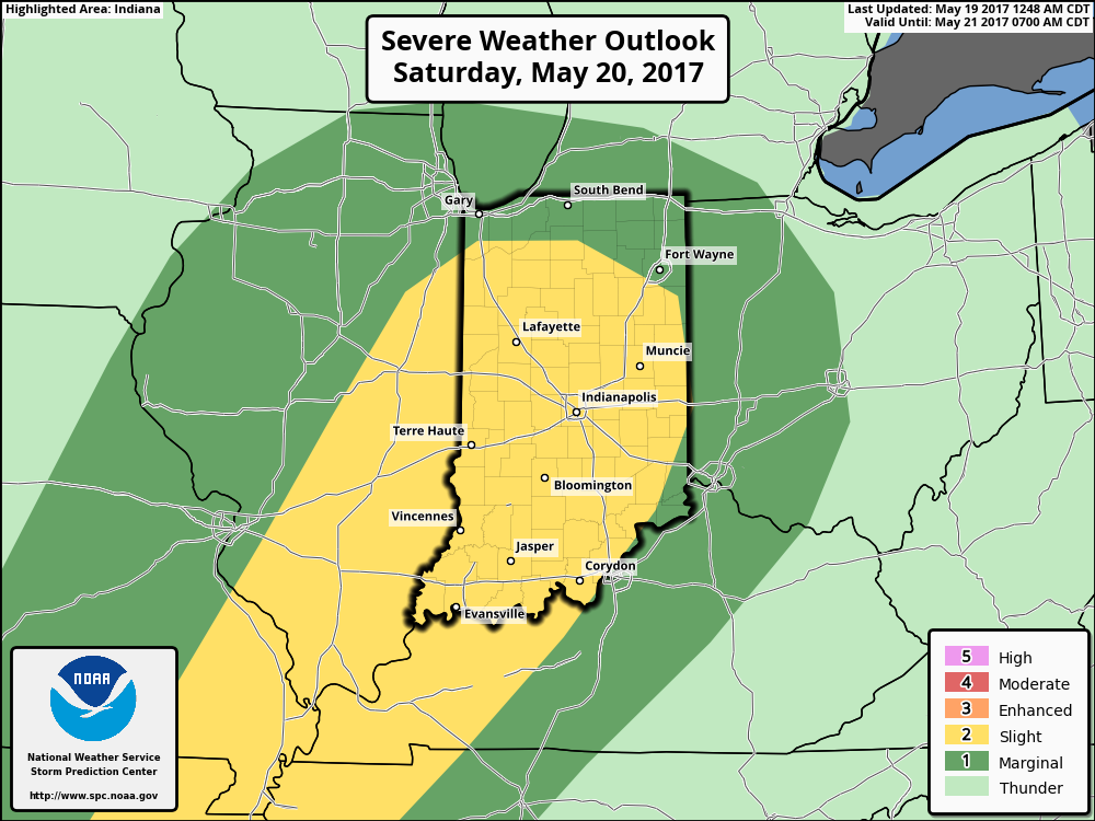 The culprit is a stalled frontal boundary that lies across the center of the state. This front will “bobble” around from time to time over the next 24 hours before lifting back north as a warm front Saturday evening. Accordingly, expect a significant temperature spread from north to south today and periods of showers and thunderstorms scattered about central Indiana. With high precipitable water values, localized heavy rains are expected, but, as mentioned, this won’t be a “uniform” event and there will be “haves and have nots.” Some neighborhoods can expect to pick up a 2-3 inches of rain between now and Sunday afternoon. Greatest severe threats include large hail and damaging straight line winds with storms, but we’ll also have to monitor things for the potential of a couple rotating storms as well.
Permanent link to this article: https://indywx.com/2017/05/19/periods-of-storms-through-the-weekend/
May 16
VIDEO: Late Week Storms And Much Cooler Next Week…
You must be logged in to view this content. Click Here to become a member of IndyWX.com for full access. Already a member of IndyWx.com All-Access? Log-in here.
Permanent link to this article: https://indywx.com/2017/05/16/video-late-week-storms-and-much-cooler-next-week/
May 11
Front Settles South…
A cold front will settle south today and lead to quite the temperature gradient across the state. Cooler north breezes will result in slowly falling or steady temperatures across the northern half of the state (upper 50s to lower 60s), while southern portions of Indiana rise into the lower and middle 70s this afternoon.
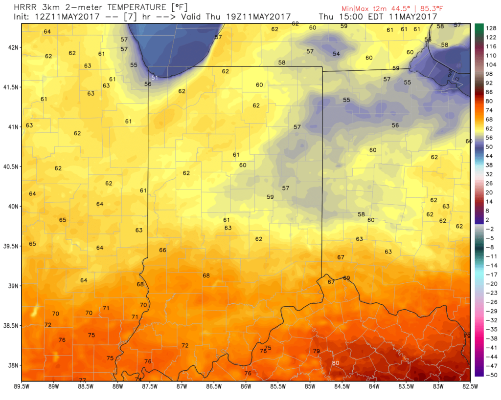 A new batch of showers will ride east and impact areas mainly along and south of I-70 as we move into late morning and early afternoon. While some embedded thunder is possible, severe weather isn’t expected today.
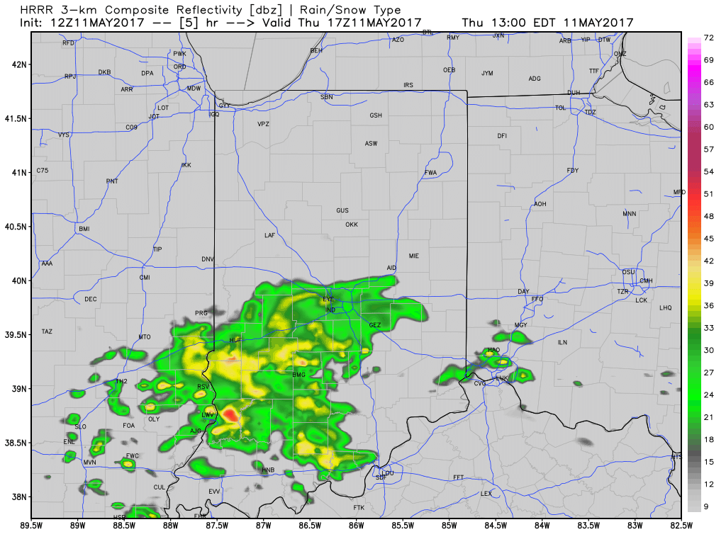
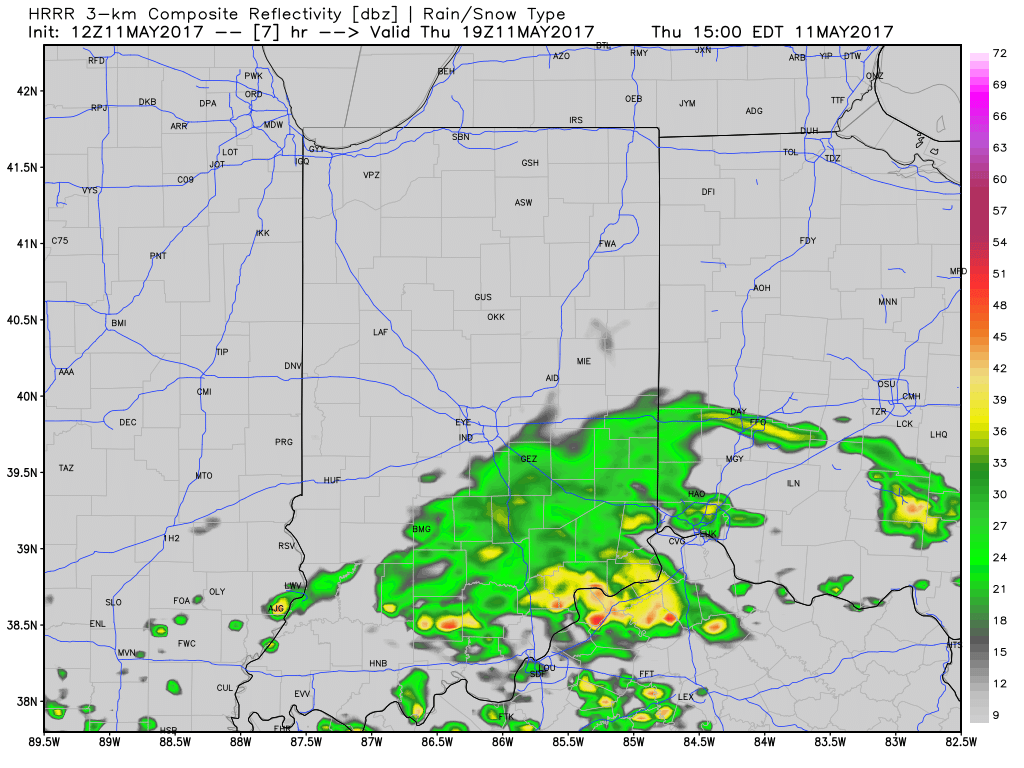 Drier and cooler air wins out for all tonight and paves way for a gorgeous weekend ahead. High pressure will support plentiful sunshine and comfortable conditions. More on the weekend and next week’s weather later today in an updated 7-day!

Permanent link to this article: https://indywx.com/2017/05/11/front-settles-south/
May 04
Heavy Rain And Flooding Update…
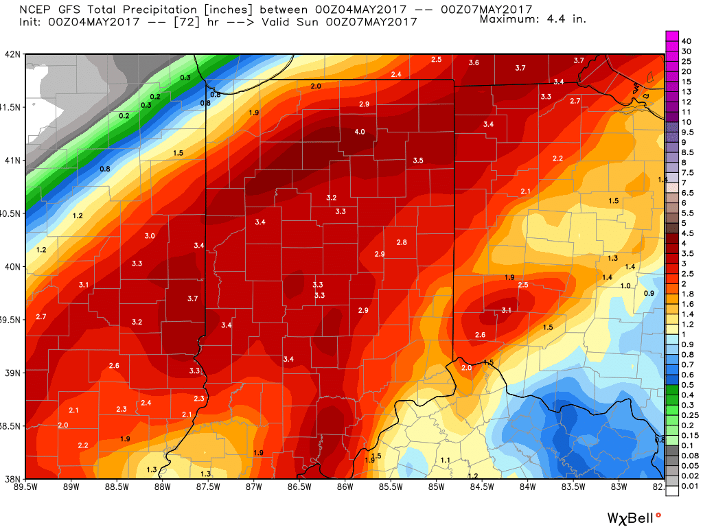
Unfortunately, we don’t have any changes to our ongoing forecast. Widespread rain will continue through Friday, occasionally heavy. By the time all is said and done, many local rain gauges will check in between 3″-4″. Lets break it down:
This morning’s radar shows rain intensifying across central and western portions of the state this morning, especially west of I-65.
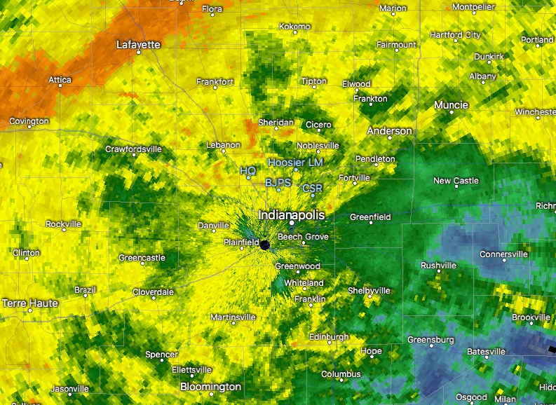
7:30a radar snap shot.
Plan on steady rains to continue today, periodically heavy. If you live near a body of water, remain aware of current water levels. Significant rises will begin to take place this afternoon as the periodically heavy rains add up.
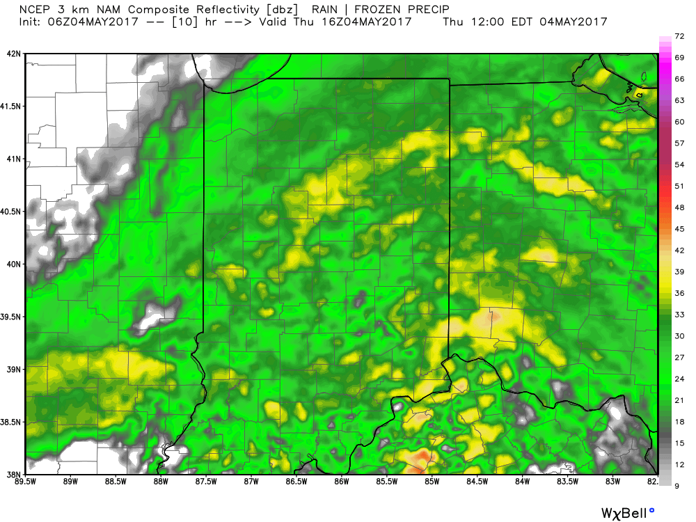
12p forecast radar.
Widespread rain will continue overnight into Friday morning. As low pressure slowly tracks northeast, we think a “deformation zone” will set-up shop across central Indiana Friday. Within this large band of rain, multiple intense rain bands will pivot through central Indiana. Flood concerns will remain high through Friday.
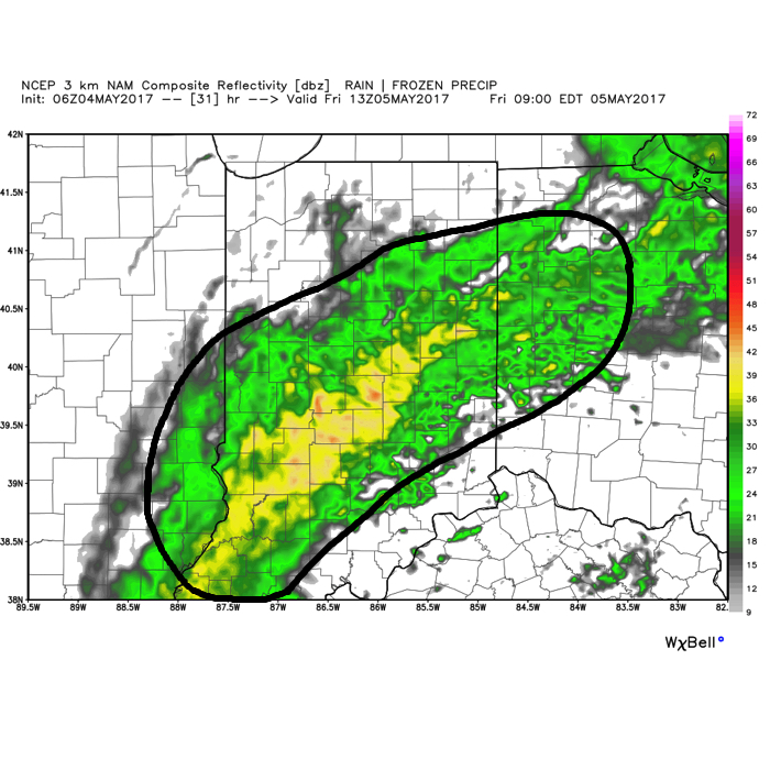 We should finally get into drier air Friday night before one last round of showers pushes southeast across the state Saturday morning. As of this update, we bracket the 4a-10a timeframe for renewed wet weather. By Saturday afternoon, drier air should win out and result in a much more favorable forecast Saturday night into Sunday.
By the time all is said and done, widespread 3″-4″ storm totals are expected, and will most certainly lead to flooding. Even localized 4″+ amounts can be expected within areas where the heaviest rain bands persist.
 In closing, as drier air begins to arrive on the scene Saturday evening, much cooler conditions will result in areas of frost into early next week. Lows in the lower to middle 30s will be common Sunday and Monday mornings across central Indiana.
Permanent link to this article: https://indywx.com/2017/05/04/heavy-rain-and-flooding-update/
Apr 28
Wet And Stormy Times Through The Weekend; MUCH Cooler Next Week…
While it won’t rain the entire weekend, central Indiana should be prepared for multiple rounds of heavy rain and thunderstorms over the next few days. For those with outdoor plans this weekend, unfortunately what we’re seeing this evening is only the beginning of stormy times ahead. There will be periods of dry weather in between the waves of storms, but the big story will be the hefty rain totals come Monday morning and embedded severe storms to boot.
Moisture content continues to increase across central Indiana this evening.
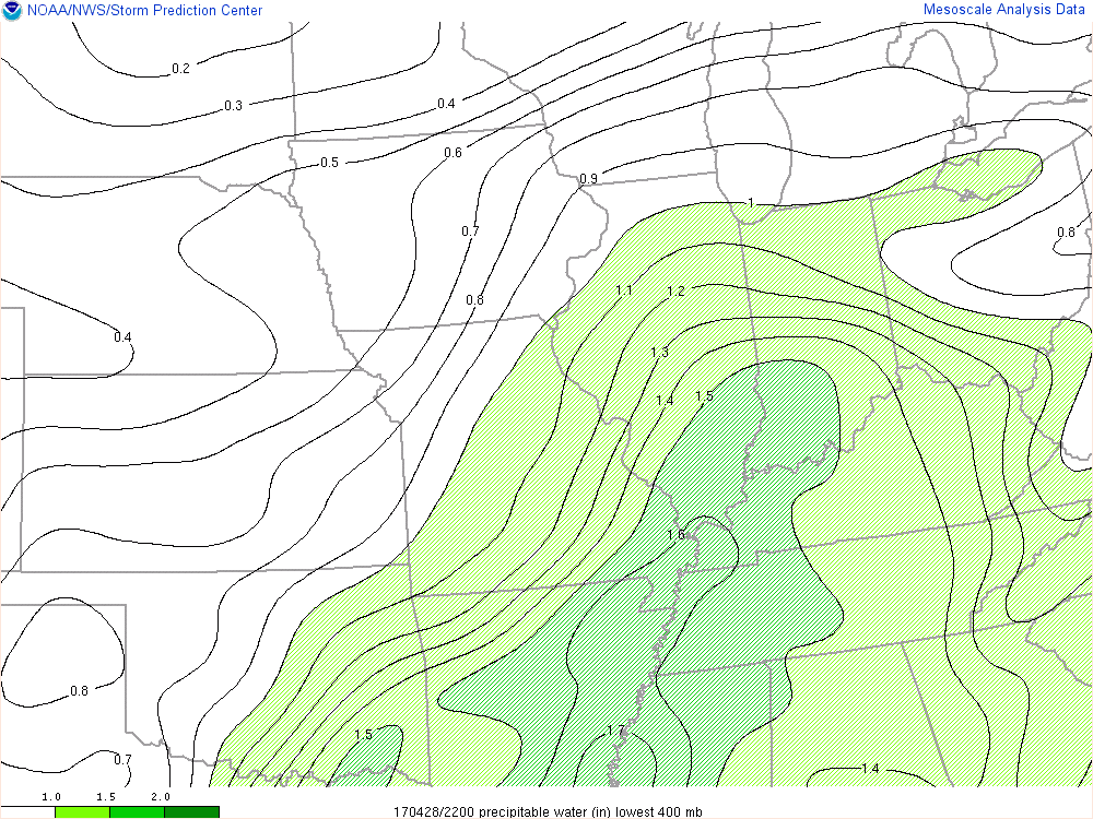
Precipitable water values continue to increase this evening and will aid in locally heavy rainfall tonight and through the weekend.
Forecast radar shows the waves of moisture that will impact the region throughout the night. We project most widespread heavy rain arrives on the scene Saturday morning.
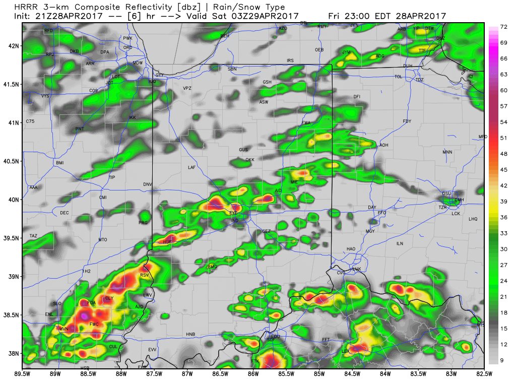
Forecast radar 11p
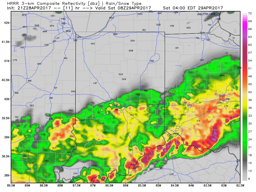
Forecast radar 4a
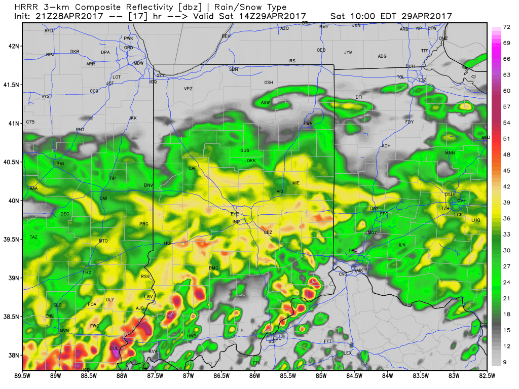
Forecast radar 10a
While scattered strong to severe storms will remain in our forecast Saturday afternoon through Sunday, we think the most widespread rains will diminish as we progress through the afternoon hours Saturday. That said, with such high moisture content, any storms that develop will be plenty capable of producing locally heavy rainfall in a short timeframe. It should also be mentioned that as the warm front lifts north, central Indiana will get into an increasingly warm and moist air mass Saturday afternoon and Sunday. In fact, highs Sunday may approach the lower to middle 80s. Add in a dew point that will approach 70°, a true muggy, summer-like feel will result.
Overall coverage of thunderstorms is expected to, once again, increase Sunday evening into the overnight period. Additional heavy rain is expected and with saturated soils in place, flash flooding may result. If you live near a creek or stream, please pay attention to the water levels into early next week.
The Storm Prediction Center outlines the region for the potential of severe weather tonight through Sunday (don’t be surprised if the “Slight Risk” is pulled further north on Sunday in future updates from the SPC).
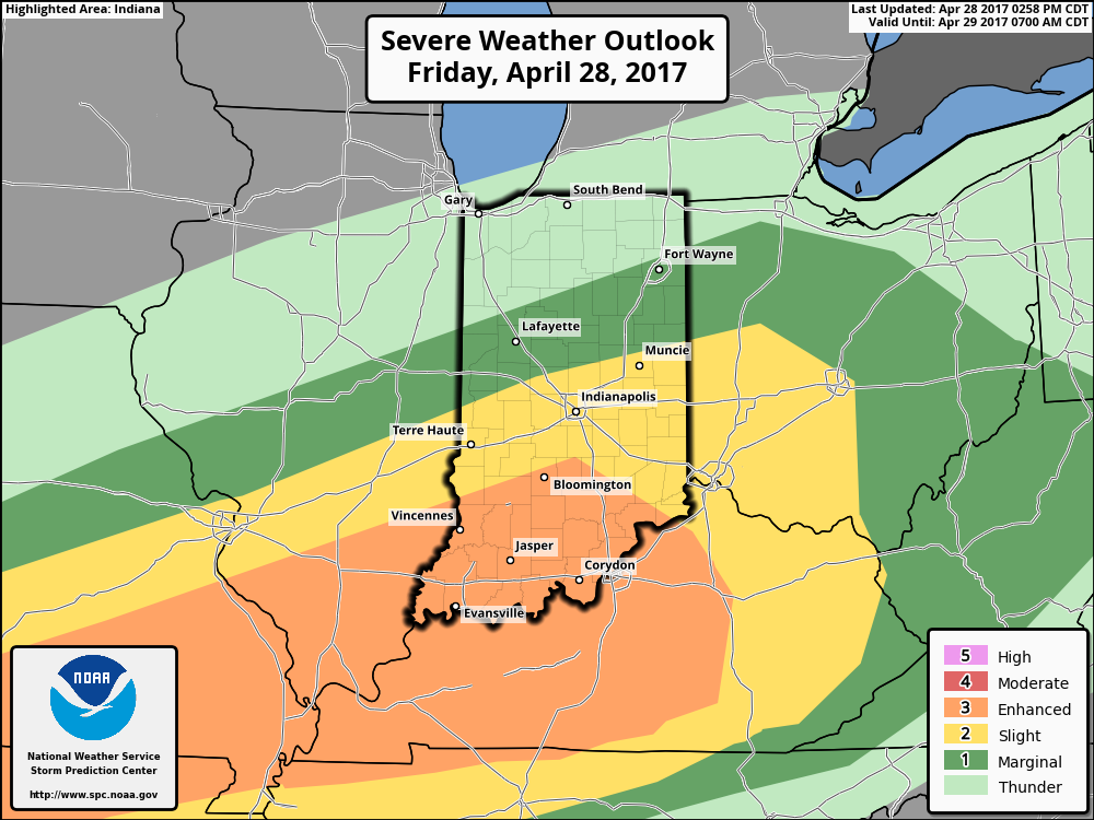
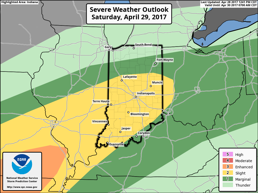
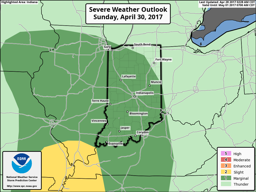 Once all is said and done, we anticipate widespread 2″-3″ rainfall totals through central Indiana, but also note there will be localized heavier amounts. Once to Monday we’ll look at a much cooler, windy, and “showery” regime. Look for falling temperatures through the day Monday and this will set the stage for the week ahead: MUCH cooler, overall…. More on that later this weekend!
Permanent link to this article: https://indywx.com/2017/04/28/wet-and-stormy-times-through-the-weekend-much-cooler-next-week/
