Updated 01.27.23 @ 7:47a Here are our latest thoughts on a very hectic pattern as we get into next week. Patience required, friends…
You must be logged in to view this content. Click Here to become a member of IndyWX.com for full access. Already a member of IndyWx.com All-Access? Log-in here.
You must be logged in to view this content. Click Here to become a member of IndyWX.com for full access. Already a member of IndyWx.com All-Access? Log-in here.
You must be logged in to view this content. Click Here to become a member of IndyWX.com for full access. Already a member of IndyWx.com All-Access? Log-in here.
You must be logged in to view this content. Click Here to become a member of IndyWX.com for full access. Already a member of IndyWx.com All-Access? Log-in here.
When: Overnight tonight through Wednesday afternoon
Temperatures: Lower 30s
Wind: E 10 to 20 MPH with gusts of 30 MPH across southeastern IN. Shifting to the north Wednesday PM.
Blowing/ Drifting: Minimal due to the wet nature of the snow
Pavement Impacts: Plowing and salting will be required throughout the region.
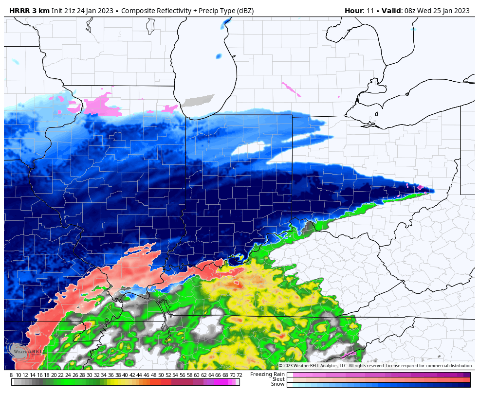
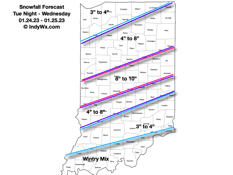
Summary: Central Indiana remains on deck for a heavy snow storm that will begin late tonight across southern IN, reaching the city itself, between 1a and 2a. Snow will quickly become heavy at times, including rates of over 1″ per hour. Needless to say, area roadways, including primary roads, will quickly become snow covered. Latest guidance is also suggesting embedded convective snow bands (thunder snow is not out of the question) will pivot into the city and surrounding areas, especially just west and north, mid and late morning. This “deformation band” will likely lead to jackpot totals approaching double-digits, and we’ve beefed our snowfall forecast up to account for these bands. “System” snow will end from southwest to northeast as we progress through the afternoon. We’ll then await on upper level energy to deliver additional light to moderate snow at times Thursday (additional light accumulation can be expected). Buckle up, there’s additional winter weather to follow…