You must be logged in to view this content. Click Here to become a member of IndyWX.com for full access. Already a member of IndyWx.com All-Access? Log-in here.
Category: Forecast Discussion
Permanent link to this article: https://indywx.com/2018/04/03/video-one-day-of-spring-before-we-go-back-to-winter/
Apr 02
Another Busy Week…
I. On the heels of a record-setting Easter snow event, attention will turn to showers (by this evening) and even the potential of gusty thunderstorms (Tuesday).
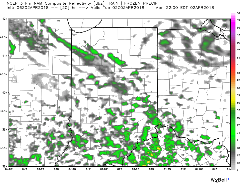
Forecast radar 10p.
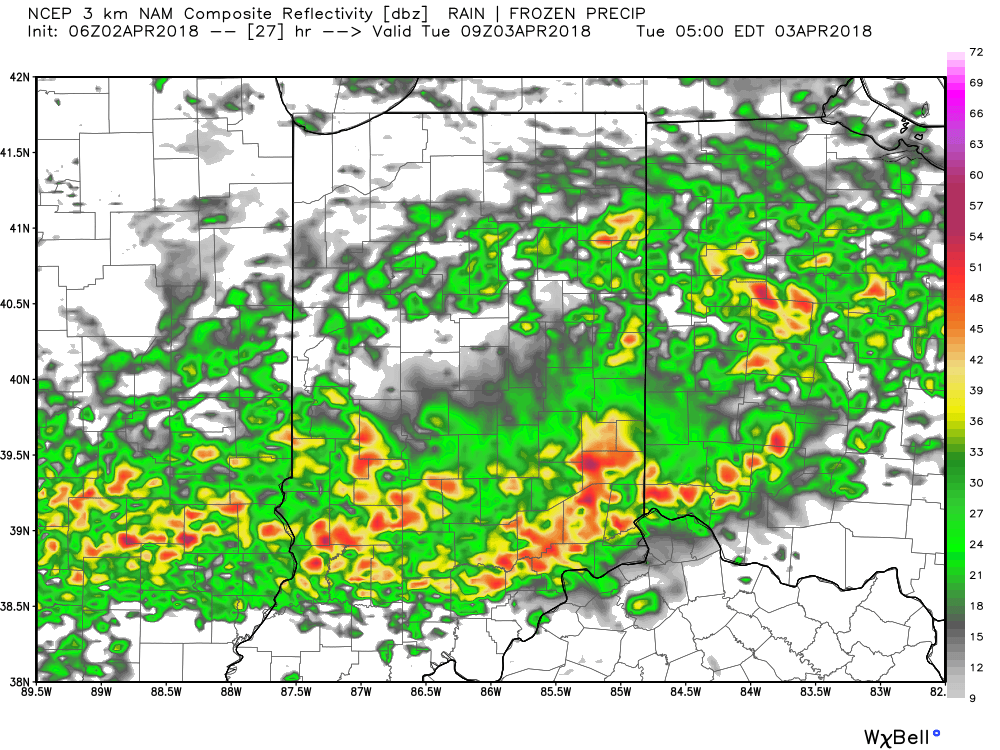
Forecast radar 5a Tuesday.
Best chance of the possibility of a strong to severe thunderstorm will lie within the southern half of the state, primarily south of the I-70 corridor. Greatest threats are large hail and damaging straight line winds.
All of us stand the chance of a thunderstorm as the cold front sweeps through the state Tuesday night.
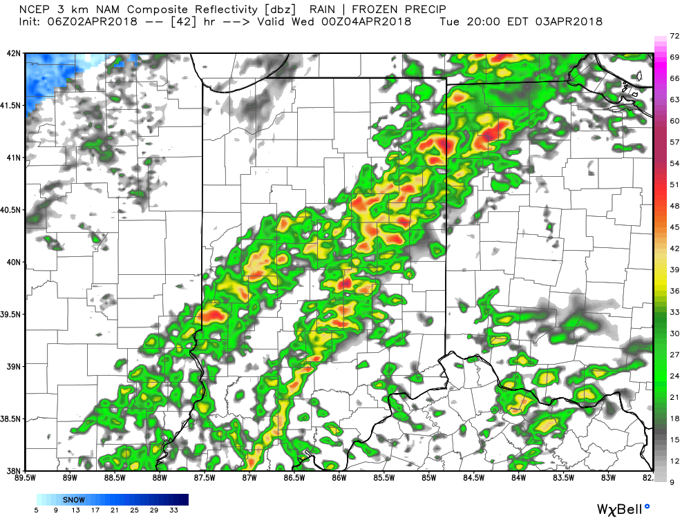
Forecast radar 8p Tuesday.
II. Much colder air will rush back into Indiana Tuesday night and the air will grow cold enough to allow lingering precipitation to transition to snow showers Wednesday morning. Don’t expect any accumulation this go around.
 III. Our next focus is on the prospects of late week/ weekend snow. Models will continue to struggle with the finite details over the next few days. I’m not so sure the suppressed look displayed currently is the correct one. Let’s remember, this time last week models were taking our Easter storm well to our south. We’ll keep a close eye on things over the next few days.
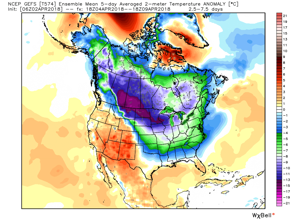
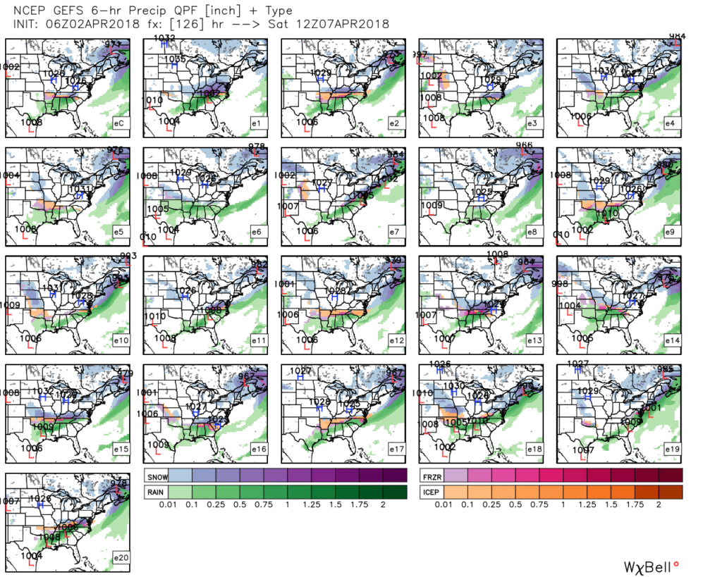 IV. Regardless of whether we get additional snow down or not, a first-class late season arctic blast will drill south this weekend. This will be cold enough to keep temperatures in the 30s for highs Friday and Saturday. Brutal stuff for early-April when average highs are around 60…
Permanent link to this article: https://indywx.com/2018/04/02/another-busy-week/
Apr 01
VIDEO: Heavy Wet Snow Arrives Before Sunset…
You must be logged in to view this content. Click Here to become a member of IndyWX.com for full access. Already a member of IndyWx.com All-Access? Log-in here.
Permanent link to this article: https://indywx.com/2018/04/01/video-heavy-wet-snow-arrives-before-sunset/
Mar 31
I’m Dreaming Of A White…Easter?
A cold front will blow through central Indiana this evening and colder air will spill into the region overnight. We’ll wake up with temperatures in the upper 20s to lower 30s Easter morning with dry conditions in place.
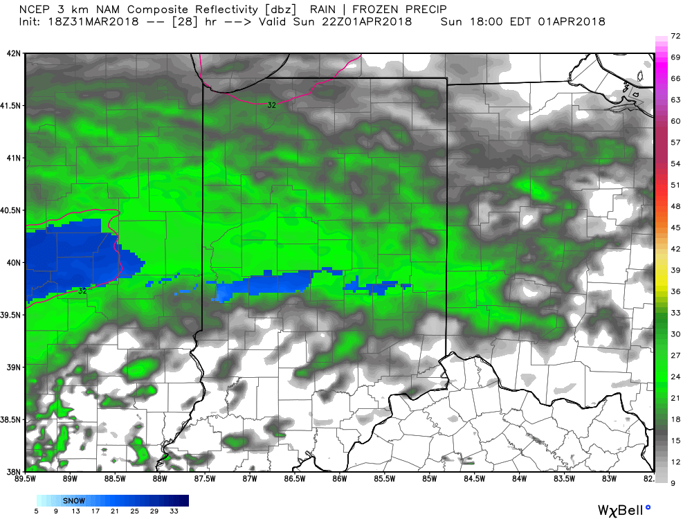
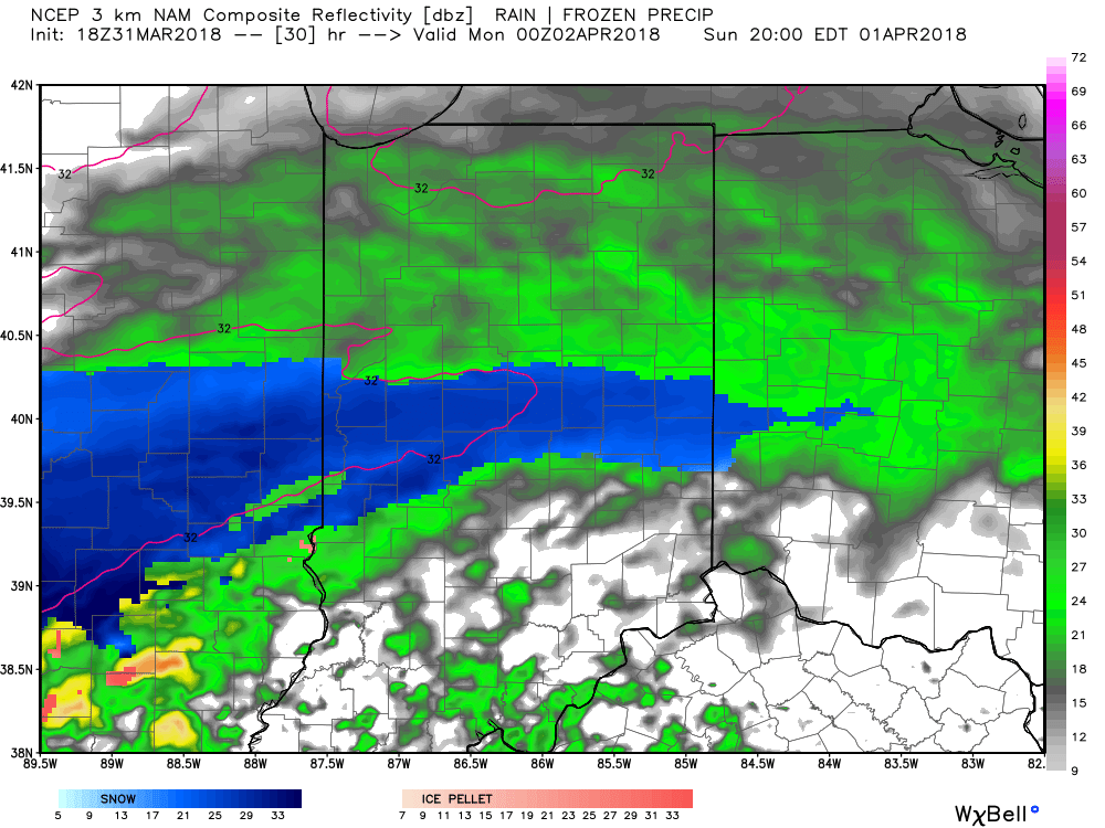
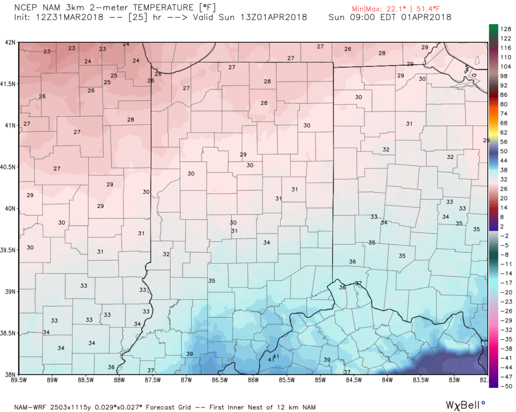 Most of the daytime Easter Sunday will feature dry conditions. Clouds will increase, lower, and thicken through the afternoon ahead of an area of low pressure that will track through the lower Ohio Valley Easter night. This will spread precipitation into central Indiana towards 5p-6p. Initially, precipitation is likely to begin as a cold rain, but we expect a rather quick transition to wet snow shortly after the onset. Periods of moderate to heavy snow will fall into the nighttime across the I-70 corridor. This will lead to reduced visibility and slick travel as snowfall rates will (once again) overcome marginally cold surface and pavement temperatures. If you must travel tomorrow night and early Monday, expect roadways to be slick at times- including being slush and snow covered.
Here’s an idea of what the radar may look like tomorrow night, courtesy of weatherbell.com:
6p forecast radar
8p forecast radar
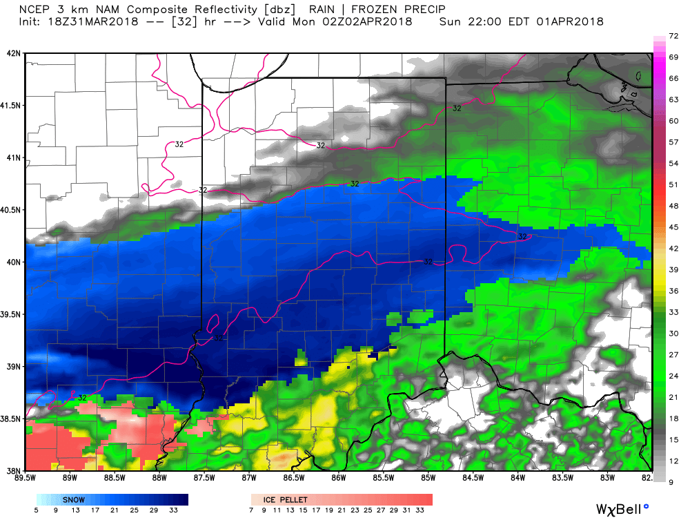
10p forecast radar
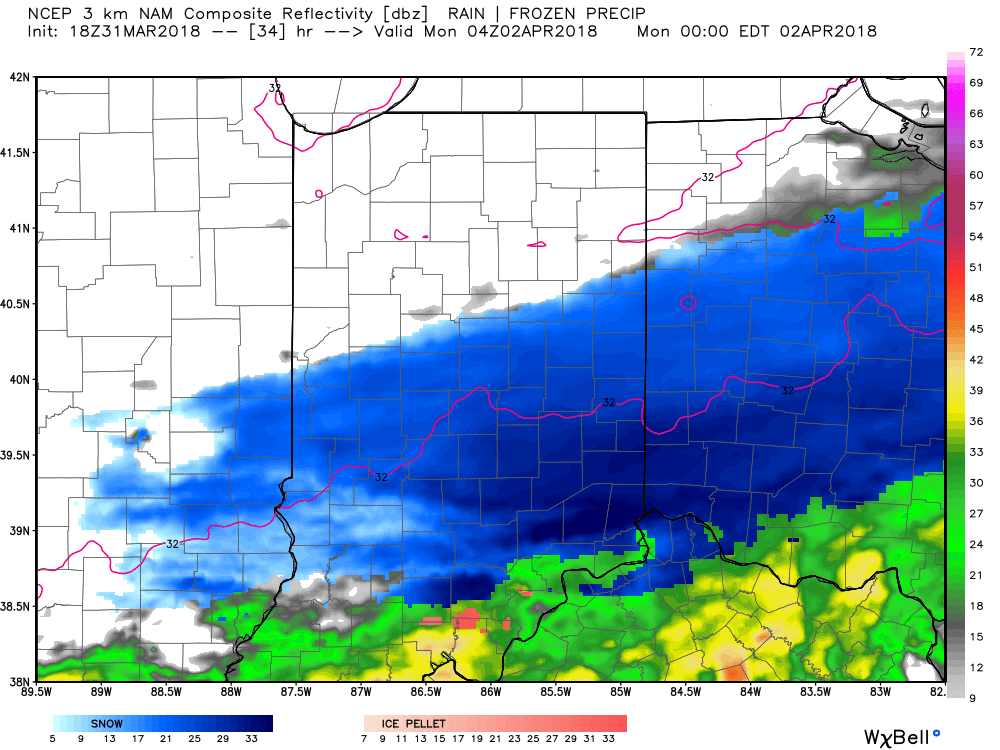
12a forecast radar Monday
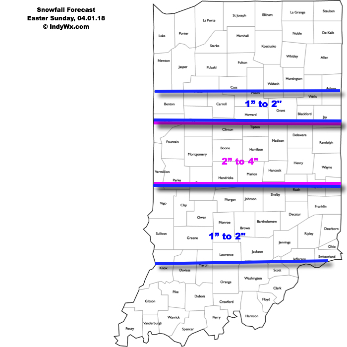
This will be a rather quick-hitting event, but “thump” potential is written all over it, including localized intense banding. These localized bands could result in a couple of reports of 4″+ in spots. We think heaviest snow falls in the 6p-midnight window.
Our current snowfall forecast:
 Another winter event is possible next weekend, including the potential of additional accumulating snow. Should we get snow down, the possibility of near-record cold is present with the late season blast of arctic air next weekend. Lows in the 10s aren’t out of the question at least one night next weekend- likely Sunday.
Permanent link to this article: https://indywx.com/2018/03/31/im-dreaming-of-a-white-easter/
Mar 31
VIDEO: Gusty Winds & Showers This Afternoon; Accumulating Snow For Easter…
You must be logged in to view this content. Click Here to become a member of IndyWX.com for full access. Already a member of IndyWx.com All-Access? Log-in here.
Permanent link to this article: https://indywx.com/2018/03/31/video-gusty-winds-accumulating-snow-for-easter/
Mar 30
Easter Snow Is No April Fool’s Joke For Parts Of The Region…
A cold front will blow through the state Saturday evening (accompanied by showers and gusty winds) before becoming stationary across the Tennessee Valley region on Easter Sunday. At the same time, a relatively flat wave will scoot east out of the Plains and across the southern Ohio Valley Sunday afternoon and night. This will spread moisture across the southern half of Indiana Sunday evening. With unseasonably cold air in place, most, if not all, of the precipitation will fall in the form of snow Sunday evening into the wee morning hours Monday.
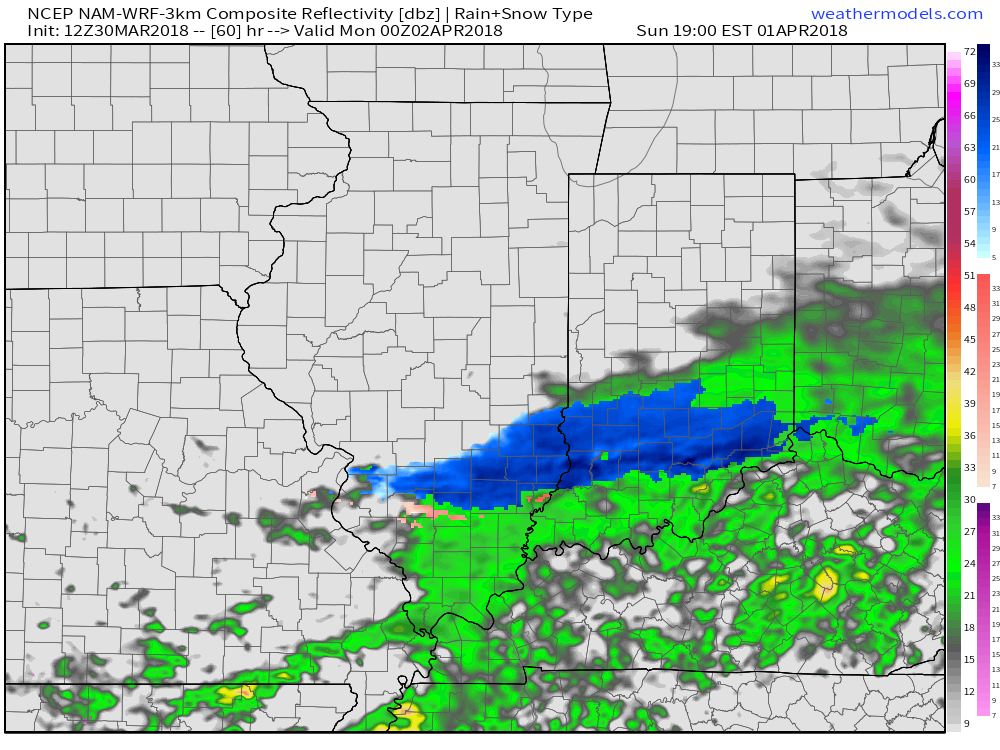
Forecast radar 7p Easter Sunday, courtesy of Weathermodels.com.
While we still have another 24-36 hours to monitor the modeling, confidence is rather high from this distance that the southern half of the state (especially south of the I-70 corridor) will experience at least a light accumulation of snow Sunday evening and night- potentially a 1″ to 3″ type event. This won’t be anything like central parts of the state dealt with last weekend, but considering the time of the year, this will serve as a reminder that winter isn’t giving up without a fight this year.
Speaking of that, don’t look now, but another attempt at an accumulating snow event may be on the table next weekend. Sigh…
Permanent link to this article: https://indywx.com/2018/03/30/easter-snow-is-no-april-fools-joke-for-parts-of-the-region/
Mar 29
VIDEO: Active Pattern Continues; Wintry Fun And Games Next Weekend?
You must be logged in to view this content. Click Here to become a member of IndyWX.com for full access. Already a member of IndyWx.com All-Access? Log-in here.
Permanent link to this article: https://indywx.com/2018/03/29/video-active-pattern-continues-wintry-fun-and-games-next-weekend/
Mar 29
Light At The End Of The Tunnel? Think Again.
March sure has been a wild month! Indianapolis is running close to 4° below average on the month with around one foot of snow. The highlight was obviously the 10.2″ of snow that fell last Saturday.
Largely this was driven by the return of blocking- something that has been missing most of this winter and, for that matter, the past couple of winters. Note the prolonged, sustained negative NAO. As we’ve written in the past, the NAO, or North Atlantic Oscillation, is the “king” this time of year. In late winter and spring, negative NAO phases will result in cold periods, even in the face of potentially warmer signals from other, less dominant, teleconnections.
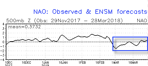 As we look ahead, we don’t really see any significant changes with the forecast NAO into mid-April.
 To no surprise, the pattern remains colder than average over the next couple of weeks, overall.

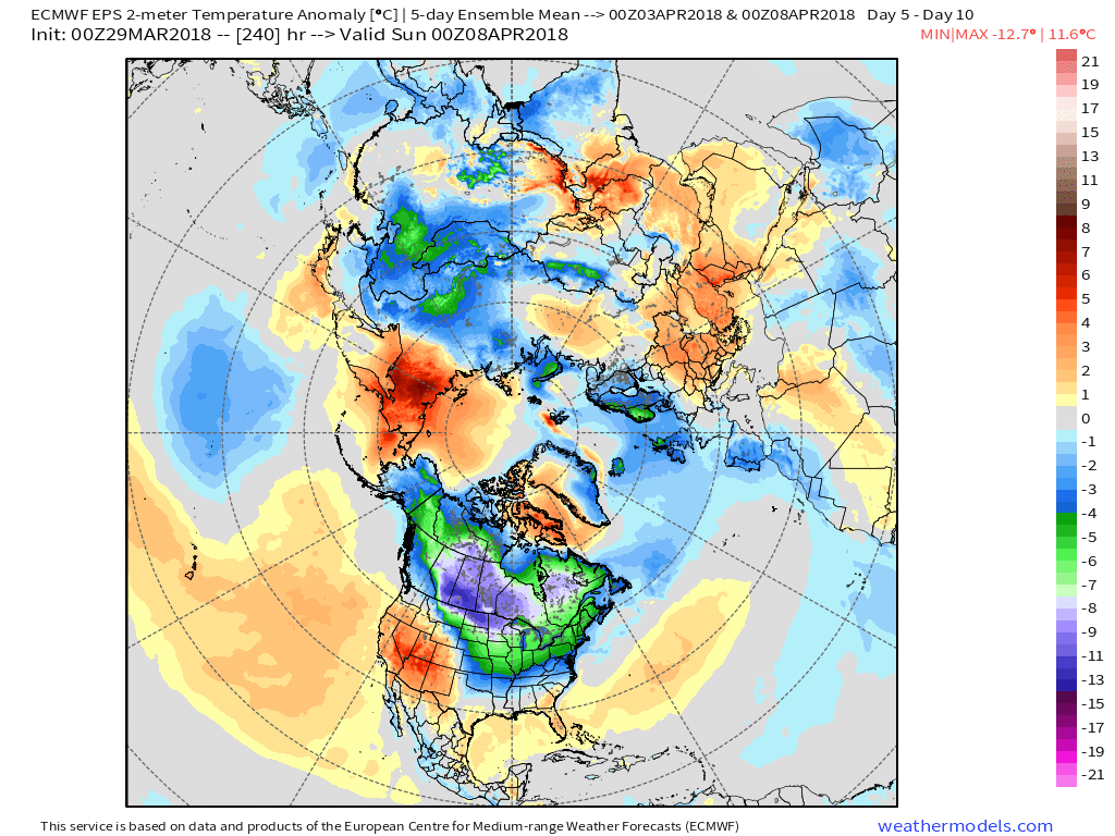
European ensemble predicts well below normal temperatures in the Day 5-10 period, courtesy of Weathermodels.com.

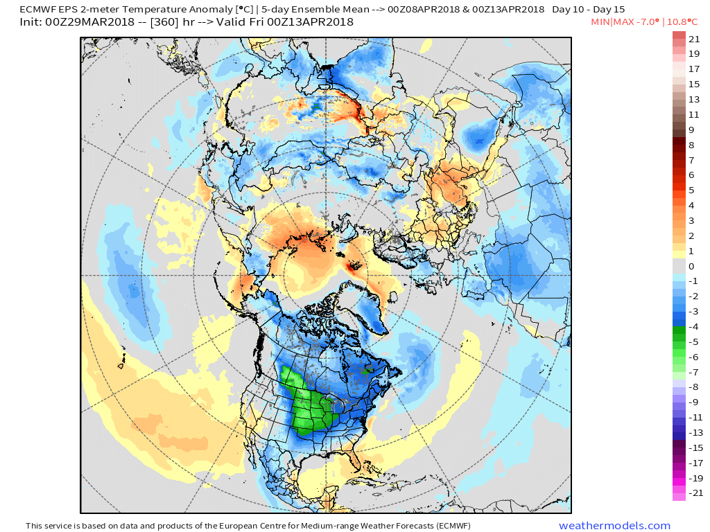
European ensemble predicts well below normal temperatures in the Day 10-15 period, courtesy of Weathermodels.com.
With all of the cold around, it should also be no surprise that at least the threat of additional accumulating snow is on the table. In fact, an item of “interest” will eject out of the Rocky Mountain region and into the Plains and eastern half of the country in the 8-10 day period. It’s far too early for specifics, but at least the potential of accumulating snow is present next weekend across the Ohio Valley.
Permanent link to this article: https://indywx.com/2018/03/29/light-at-the-end-of-the-tunnel-2/
Mar 27
VIDEO: Active Pattern Remains…
You must be logged in to view this content. Click Here to become a member of IndyWX.com for full access. Already a member of IndyWx.com All-Access? Log-in here.
Permanent link to this article: https://indywx.com/2018/03/27/video-active-pattern-remains/
Mar 25
Looking Ahead To Close March And Open April: Cold Set To Return?
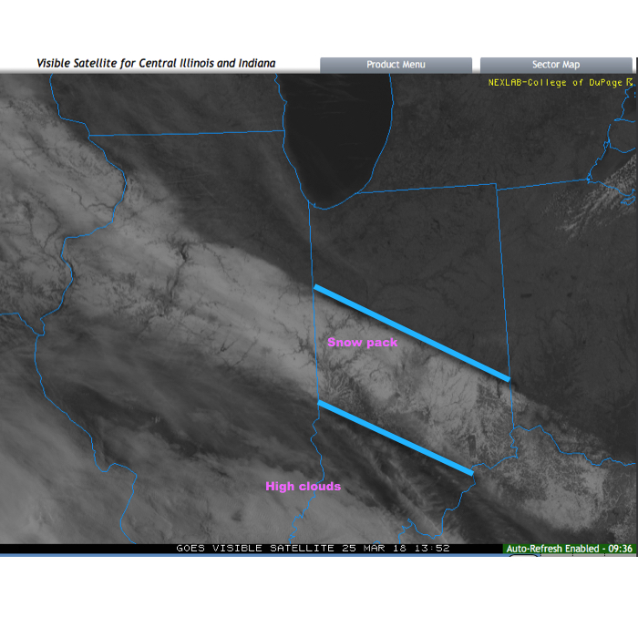
Before we discuss some of what has our attention as we move through the next couple of weeks, check out this cool visible satellite image from this morning. The snowpack shows up nicely. It’s also neat to see the high resolution modeling understand where that snow pack is and the associated cooler forecast highs compared to areas south and north that didn’t see the heavy snow Saturday.
 As we look ahead, a wet week is in store for the region. Periods of widespread rain, heavy at times, will come at us in waves:
- Monday evening-Tuesday
- Thursday
- Next weekend, including Easter
When totaled up, widespread 2″ totals can be expected, with locally heavier amounts.
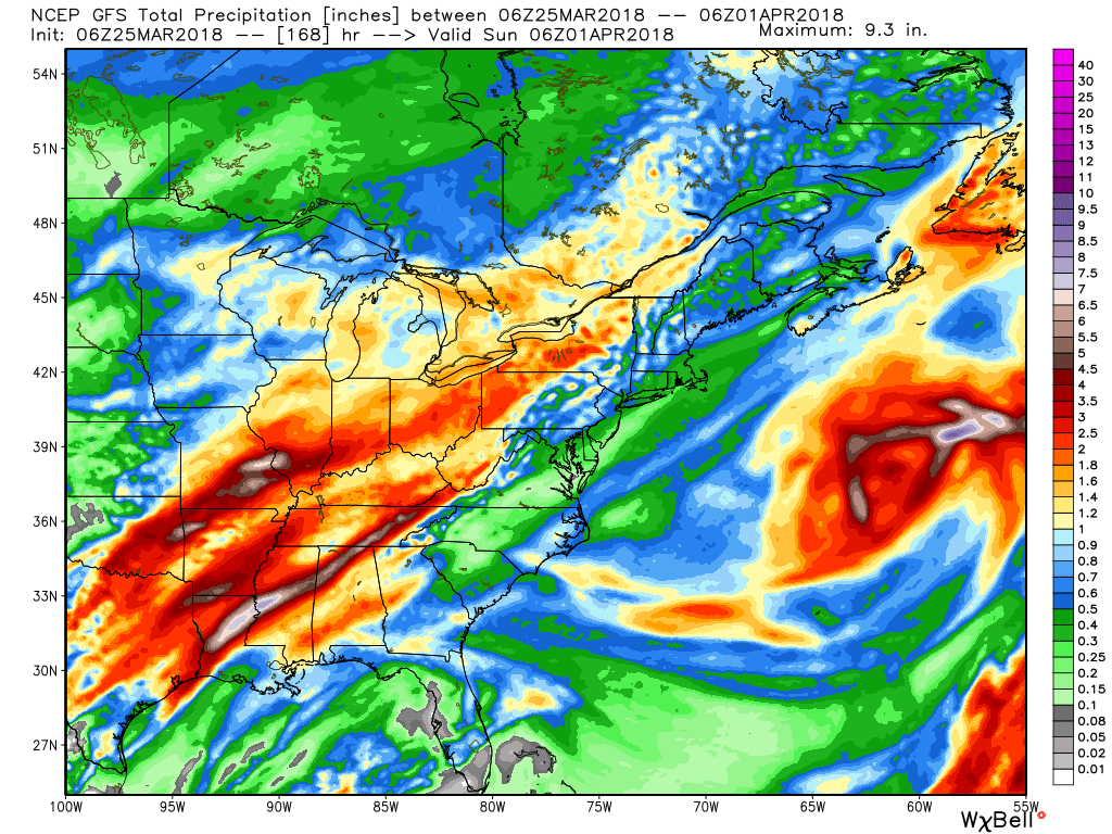
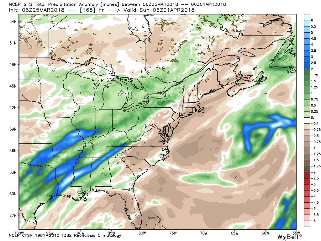 After a brief relaxation in the unseasonably cold regime, well below average temperatures are expected to return as we move through early April. It’ll feel more like winter than spring through the better part of the first half of the month.
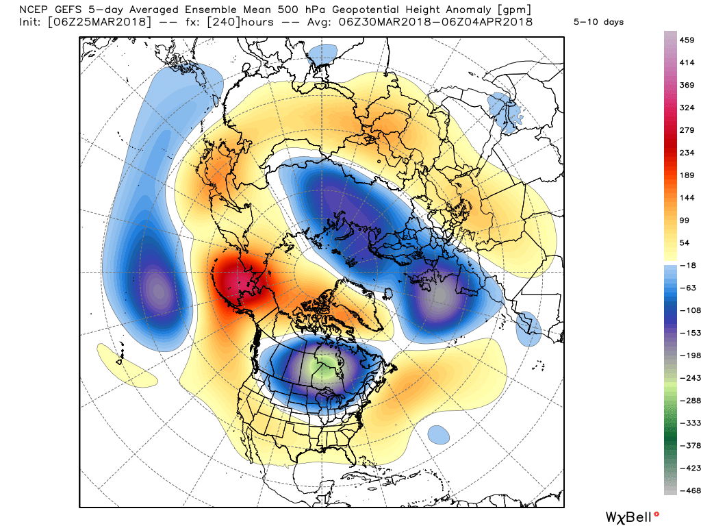
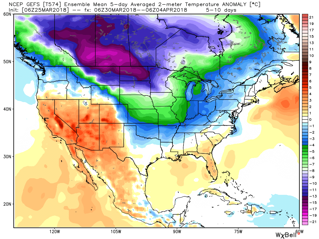
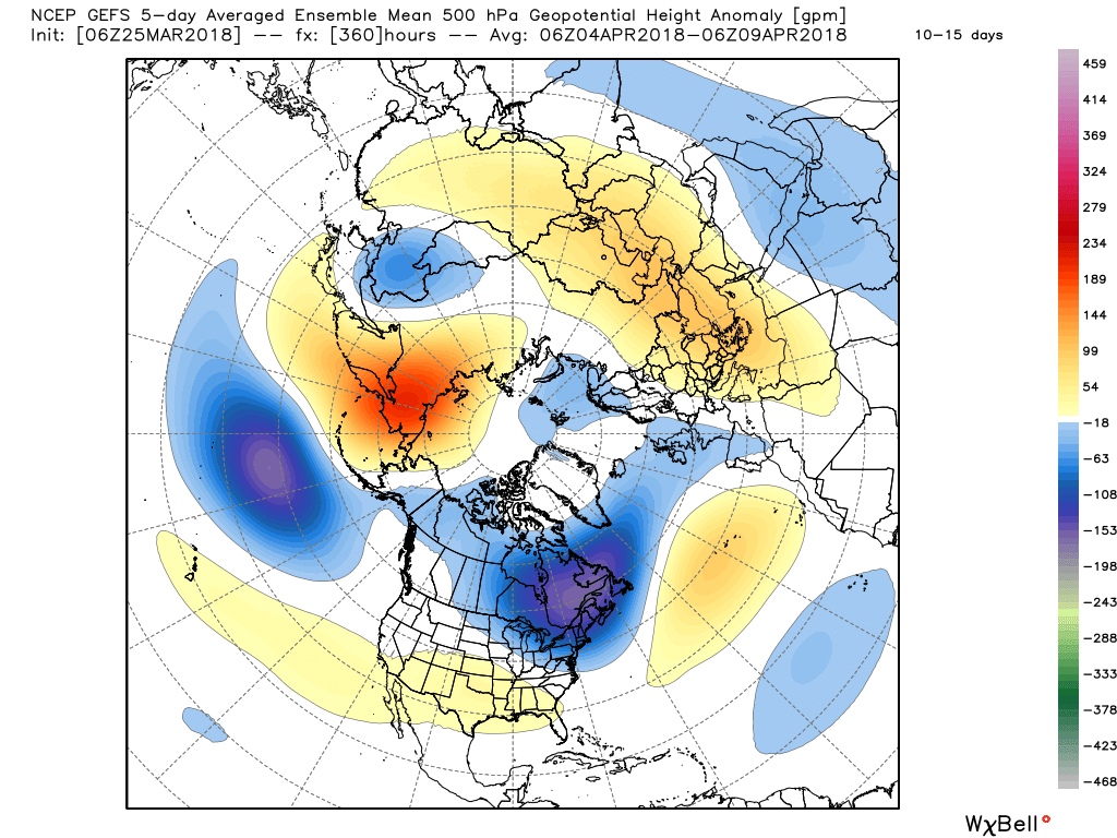
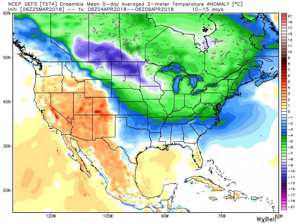 It’s also too early to think about yesterday as the last snow of the season. Given the early April look, it wouldn’t surprise us if an additional snow event or two came along…
(As a reminder, you can always catch our most up-to-date 7-day forecast in the top left of the homepage).
Permanent link to this article: https://indywx.com/2018/03/25/looking-ahead-to-close-march-and-open-april-cold-set-to-return/
