Concerned For Significant Flooding Tonight Into Thursday…
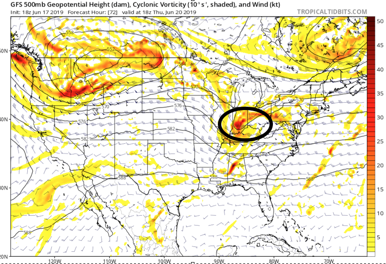
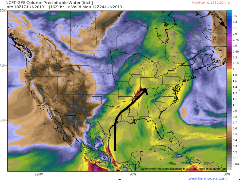
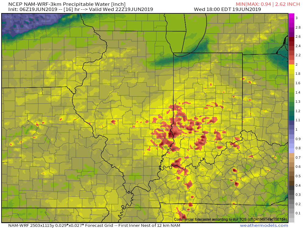
The day is opening dry across central Indiana (and sunny for some), but another heavy rain event looms by the end of the day. The culprit? A stalled front remains draped across central Indiana and a surface wave will move along this boundary this afternoon into tonight. A “juicy” airmass will remain intact across the region with precipitable water values topping out at 2.5″ across the southern half of the state. This will promote any shower or thunderstorm that develops to drop very heavy rainfall in a short period of time (1″ to 2″ per hour at times).
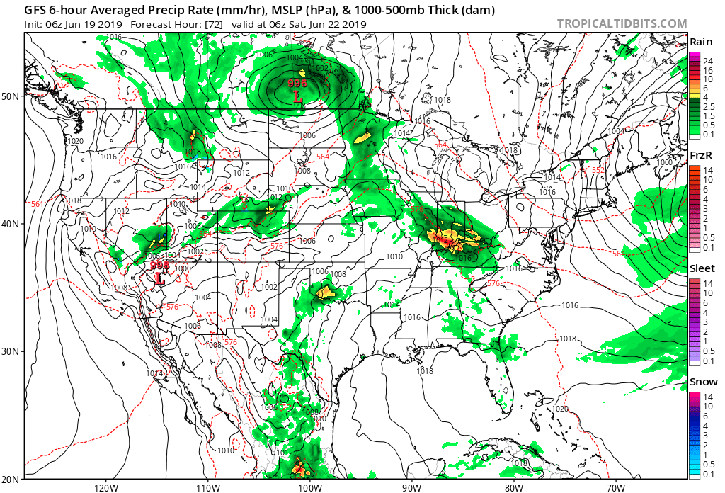
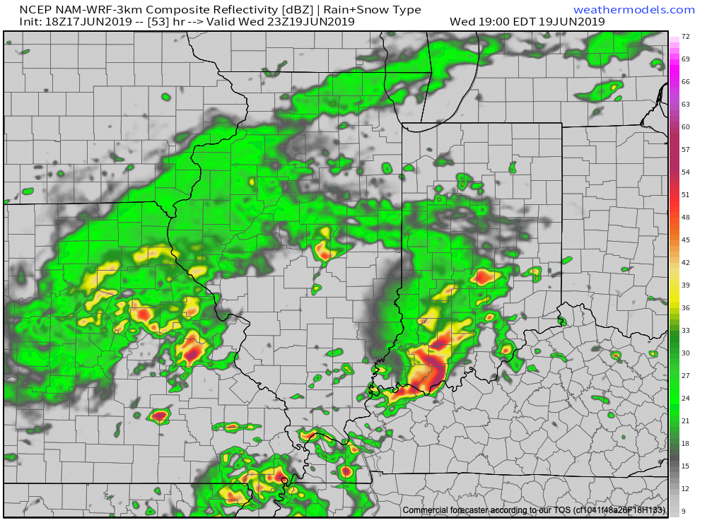
As the surface wave interacts with the tropical air mass in place, widespread showers and thunderstorms will blossom across the region through the afternoon into tonight. Rain will continue into Thursday afternoon.

We’re still also concerned for severe weather this afternoon and evening, including a couple of tornadoes across the southern half of the state.
By the time the rain comes to an end Thursday evening, widespread 2″ to 4″ can be expected across the heart of the state, including Indianapolis, itself.
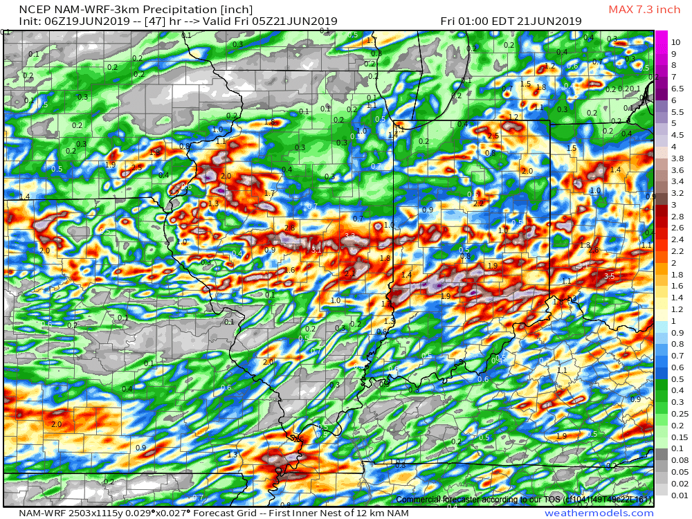
If that’s not enough, heavy rain and thunderstorms will return late Friday and continue in an “off and on” fashion straight through the weekend.
Unfortunately, some central Indiana rain gauges can expect to pick up an additional 5″+ of rain between this afternoon and next Tuesday…