
You must be logged in to view this content. Click Here to become a member of IndyWX.com for full access. Already a member of IndyWx.com All-Access? Log-in here.
Category: Flooding
Permanent link to this article: https://indywx.com/video-a-very-wet-week-is-on-deck-early-july-thoughts/
Jun 15
VIDEO: Classic Pattern For A Significant Flood Event…
You must be logged in to view this content. Click Here to become a member of IndyWX.com for full access. Already a member of IndyWx.com All-Access? Log-in here.
Permanent link to this article: https://indywx.com/video-classic-pattern-for-a-significant-flood-event/
Jun 09
Localized Bands Of Flooding Rain Possible This Afternoon-Evening…
An upper level low will have control of our weather today. We’re seeing widespread mostly light rain this morning and that will begin to diminish as we move into the late morning and early afternoon.
We’ll then likely see a few breaks in the cloud cover and that will serve to provide just enough energy to help showers and thunderstorms redevelop by mid to late afternoon. With a juicy air mass in place (precipitable water values will exceed 2″ in spots), locally heavy rain is likely.

With weak steering flows in place this afternoon and evening, the concern we have is that localized bands of this heavy rain/ embedded thunder will “train” over the same areas, potentially leading to flash flooding in localized spots across central Indiana.
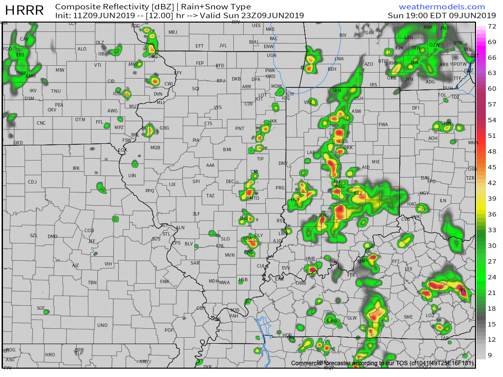
We expect these south-to-north moving bands of rain to begin to organize towards the 4p to 6p time frame, continuing into the evening and nighttime hours. Where the heavier rain bands organize, a quick 2″ to 3″ of rain is likely this evening.
More around the #AGwx report for the upcoming week will be posted later this morning!
Permanent link to this article: https://indywx.com/localized-bands-of-flooding-rain-possible-this-afternoon-evening/
May 14
Watching From Afar: Summer-Like Warmth, But Heaviest Rain/ Severe Threat Remains NW Of Immediate Region…
An expanding upper level ridge will drive the warmest air so far this season into the Ohio Valley, including central Indiana, as we get set to close the work week and head into next week.

This will not only deliver mid to upper 80s, but the first truly “oppressive” feel of the season as moist Gulf of Mexico air flows northward into the Ohio Valley. At times, dew points will approach the 70 degree mark.
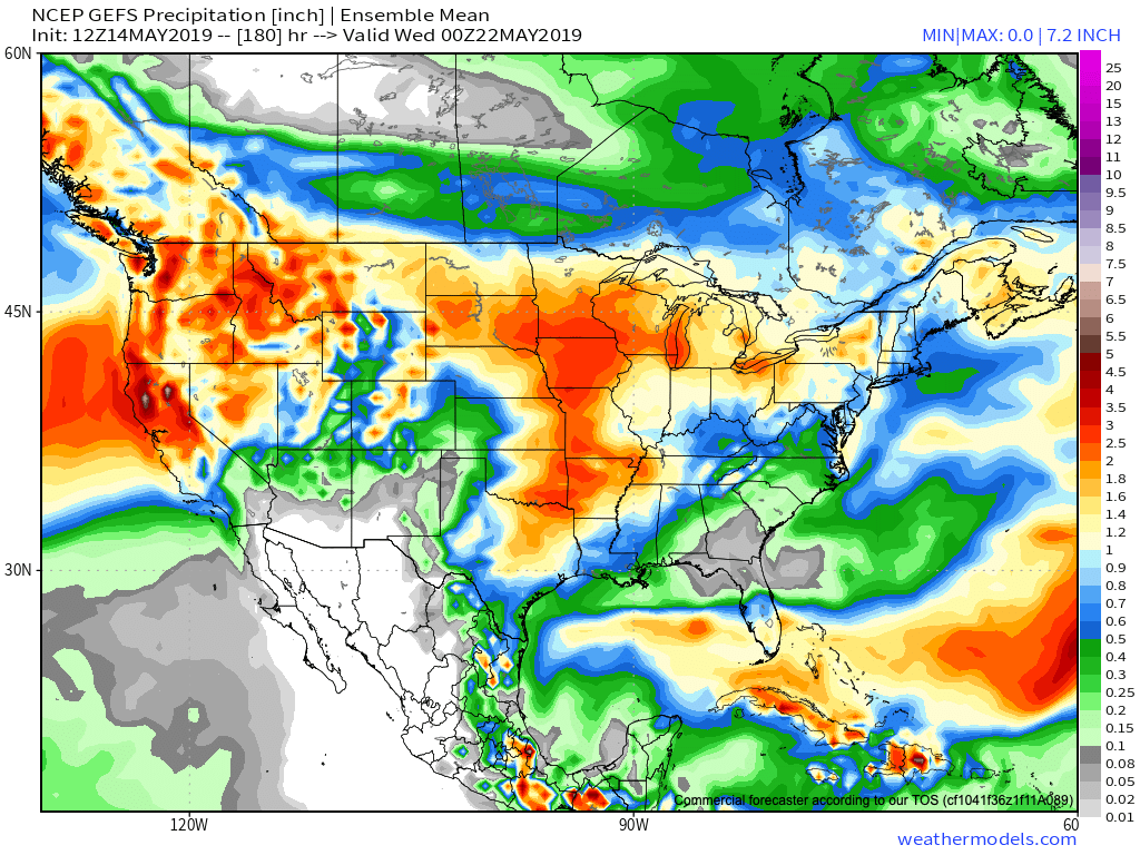
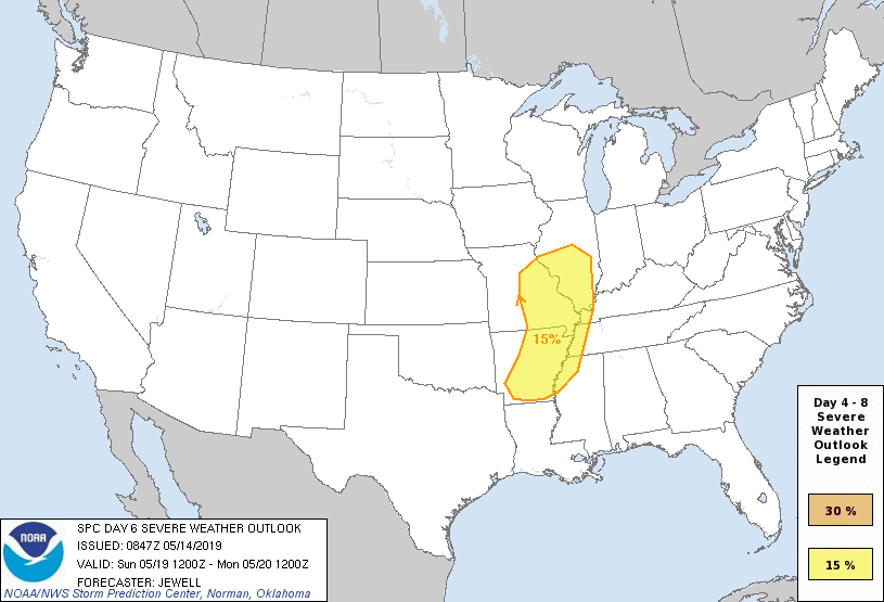
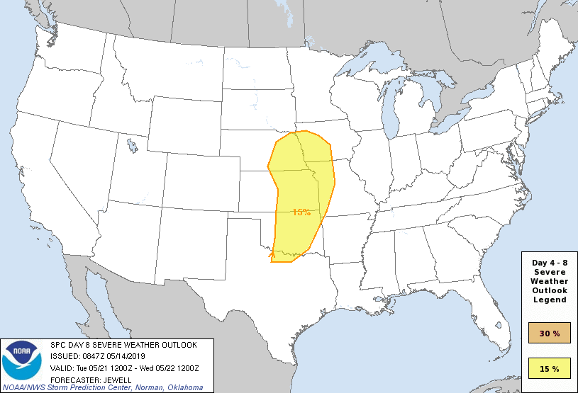
Though the pattern will turn warm and humid, the worst of the heavy rain events are expected to remain to our west-northwest. (Unfortunately, this pattern is one that will lead to a multi-day severe weather and eventual flood threat for the Plains into the upper Midwest).
That isn’t to say we won’t see rain and storms at times (most numerous Thursday night across northern and east-central Indiana, Sunday afternoon across all of the state, and again Tuesday), but instead the most concentrated heavy rain and severe potential will be focused from OK, MO, IA, and into MN and WI over the upcoming 7-day period. Instead of us looking at widespread 2″ to 4″ totals, we’re instead looking at 7-day rainfall amounts around an inch, with locally heavier amounts.
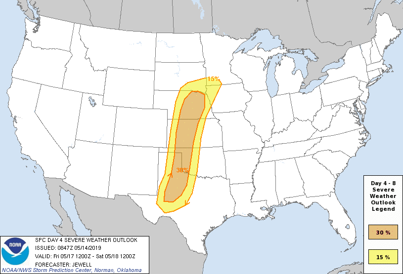
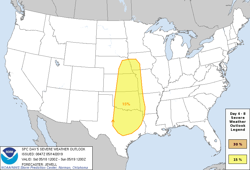
From a severe perspective, similar to the heavy rain events, this, too, is expected to remain to our west for the better part of the upcoming 7-day period. While storm chasers coverage on the Plains this weekend into next week, we’ll, thankfully, be watching the bulk of the action from afar for the better part of the period.
Days 4-8 Severe Weather Outlook, courtesy of the Storm Prediction Center (SPC), can be found below:

Permanent link to this article: https://indywx.com/watching-from-afar-summer-like-warmth-but-heaviest-rain-severe-threat-remains-nw-of-immediate-region/
Apr 26
VIDEO: Walking Through The Weekend; Flood Threat High Next Week…
You must be logged in to view this content. Click Here to become a member of IndyWX.com for full access. Already a member of IndyWx.com All-Access? Log-in here.
Permanent link to this article: https://indywx.com/video-walking-through-the-weekend-flood-threat-high-next-week/