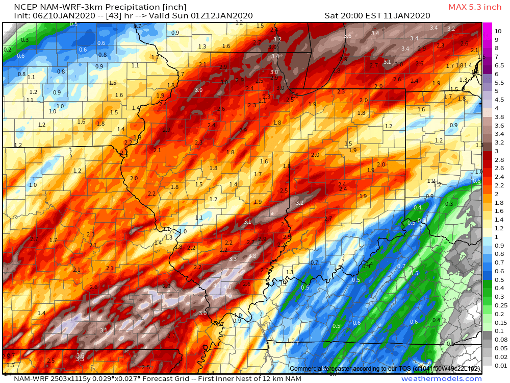
Category: Flooding

 VIDEO: Heavy Rain & Flooding Update…

You must be logged in to view this content. Click Here to become a member of IndyWX.com for full access.  Already a member of IndyWx.com All-Access?  Log-in here.

Permanent link to this article: https://indywx.com/2017/05/04/video-heavy-rain-flooding-update/

Heavy Rain And Flooding Update…

Unfortunately, we don’t have any changes to our ongoing forecast.  Widespread rain will continue through Friday, occasionally heavy.  By the time all is said and done, many local rain gauges will check in between 3″-4″.  Lets break it down:

This morning’s radar shows rain intensifying across central and western portions of the state this morning, especially west of I-65.

7:30a radar snap shot.

Plan on steady rains to continue today, periodically heavy.  If you live near a body of water, remain aware of current water levels.  Significant rises will begin to take place this afternoon as the periodically heavy rains add up.

12p forecast radar.

Widespread rain will continue overnight into Friday morning.  As low pressure slowly tracks northeast, we think a “deformation zone” will set-up shop across central Indiana Friday.  Within this large band of rain, multiple intense rain bands will pivot through central Indiana.  Flood concerns will remain high through Friday.

We should finally get into drier air Friday night before one last round of showers pushes southeast across the state Saturday morning.  As of this update, we bracket the 4a-10a timeframe for renewed wet weather.  By Saturday afternoon, drier air should win out and result in a much more favorable forecast Saturday night into Sunday.

By the time all is said and done, widespread 3″-4″ storm totals are expected, and will most certainly lead to flooding.  Even localized 4″+ amounts can be expected within areas where the heaviest rain bands persist.

In closing, as drier air begins to arrive on the scene Saturday evening, much cooler conditions will result in areas of frost into early next week.  Lows in the lower to middle 30s will be common Sunday and Monday mornings across central Indiana.

Permanent link to this article: https://indywx.com/2017/05/04/heavy-rain-and-flooding-update/

Flooding Concerns Return…

Highlights:

  • Heavy rain returns
  • Unseasonably cool
  • Drier weather returns late in the weekend

Live Near A Body Of Water? Keep An Eye On The Level…Central Indiana will deal with an extended period of rain, occasionally heavy, tonight through Friday afternoon.  With saturated soils in place, an additional widespread 2.5″-3.5″ (with locally heavier amounts) between now and Saturday morning, flooding concerns are very high.  As the lead off states, please remain aware of water levels if you live near a creek, stream, or river.  The other aspect of this storm will be unseasonably chilly air and gusty easterly winds that will shift to the north Friday night into Saturday.

The weekend will provide a drier trend, but the improvements will be slow to occur.  Showers remain in our Saturday forecast before drier air finally wins out Sunday with sunshine.  The worry once to Sunday and Monday mornings will be the potential of frost and freeze conditions- especially in communities away from downtown.  Remember, no planting around these parts until after Mother’s Day!  😉

Shower chances return by the middle of next week!

Upcoming 7-Day Precipitation Forecast:

  • Snowfall: 0.00″
  • Rainfall:  3″ – 4″

Permanent link to this article: https://indywx.com/2017/05/03/flooding-concerns-return/

Unseasonably Chilly; Another Heavy Rain Maker Blows Into Town…

Clouds will lower and thicken Wednesday morning and give way to an expanding rain shield late morning into the early afternoon hours.  Initially this rain won’t be heavy, but will begin to increase in overall coverage and intensity as we progress into the nighttime hours.

Forecast radar around lunchtime shows rain increasing across central IN.

Rain becomes heavy Wednesday night.

The culprit behind this new heavy rain maker is a deepening surface low pressure system that will slowly track from Arkansas (Wednesday night) northeast along the Ohio River (Thursday) and into Ohio (Friday).  Not only will this spread heavy rain across central Indiana, but will also result in strong and gusty easterly winds Thursday into Friday, and unseasonably cold air.  In fact, temperatures Friday will likely remain in the 40s across central IN with wind chills in the 30s.  Add in that wind-driven rain and we have the makings for an UGLY day.

Periods of heavy rain will fall on the region Wednesday night into Friday and by the time all is said and done (Saturday night) widespread rainfall of 3″ is likely across most of central Indiana.  Locally heavier totals will be possible where the most persistent heavy rain bands set-up shop.

We’ll begin to dry things out Saturday night into Sunday, but unseasonably chilly air will remain.  Lows over the weekend into early next week will grow cold enough to allow patchy frost to develop in outlying communities.  We think low to mid 30s will be common across the region Sunday and Monday mornings.

Permanent link to this article: https://indywx.com/2017/05/02/unseasonably-chilly-another-heavy-rain-maker-blows-into-town/

Another Big Rain Maker; Unseasonably Chilly…

Highlights:

  • Limited sunshine
  • Another big rain event awaits
  • Prolonged period of chilly weather

Jackets And Rain Gear Needed…Without question, Tuesday appears to be the “pick of the week” across central Indiana as we get into some briefly drier air.  Enjoy it, as a new storm system will deliver heavy, wind-driven rain and unseasonably chilly air as we progress through mid and late week.

Clouds will lower and thicken Wednesday morning and give way to an expanding shield of rain as morning wears into afternoon and evening.  As the surface low tracks closer to the region, an increasingly strong and gusty easterly wind will develop and combine with the chilly rain to lead to a truly “raw” period of weather to close the work week.  It’ll feel more like early-March than early-May around these parts.  Unfortunately, it still appears as if this next storm will deliver hefty rainfall totals on our already water-logged landscape.  Data paints a widespread swath of 2″-3″ totals with locally heavier amounts.  Flooding, once again, appears likely and if you live near a body of water, it’ll be important to keep a close eye on water levels Thursday into the weekend.

Widespread rain Friday should slowly give way to improving weather conditions over the weekend: scattered showers Saturday and dry, cool weather Sunday.  Speaking of cool, temperatures will continue to run well below average, and lows Saturday through Monday mornings’ may result in patchy frost in outlying areas…

Upcoming 7-Day Precipitation Forecast:

  • Snowfall: 0.00″
  • Rainfall: 2.50″ – 3.50″

Permanent link to this article: https://indywx.com/2017/05/01/another-big-rain-maker-unseasonably-chilly/

More Heavy Rain And Storms Ahead; Cooler Week On Deck…

Highlights:

  • Widespread rain and strong storms today
  • Falling temperatures, windy, and wet Monday
  • Midweek storm brewing

Flooding Concerns Remain High…Another slug of moisture will lift north through central Indiana this afternoon into the nighttime hours.  Locally heavy rain will result in big flooding concerns as saturated soils are in place and many creeks and streams are already out of their banks.  Throw in an additional 1″-2″ with locally heavier totals and you have the makings of a dangerous flood situation into early week.  If that wasn’t enough to be concerned about, we’ll also have to watch how things evolve closely this afternoon for the potential of severe thunderstorms.  Damaging straight line winds are of greatest concern.

We’ll transition to a much cooler regime to open the new work week with gusty winds and showers continuing.  Temperatures will fall through the 50s during the day.  Jackets will be required!

Tuesday will provide a brief break from the wet weather and we should also introduce some sunshine for a while.  Unfortunately, we won’t have much time to dry out as a wet, windy, and chilly storm is brewing Wednesday evening into Thursday.  Widespread rain (some heavy) will combine with a raw easterly wind and temperatures in the 50s to lead to a rather miserable Thursday.

While shower chances remain early Friday, the theme heading into next weekend is a drier one and we should finally enjoy very pleasant weather by Saturday.

Upcoming 7-Day Precipitation Forecast:

  • Snowfall: 0.00″
  • Rainfall: 1.50″ – 3.00″

Permanent link to this article: https://indywx.com/2017/04/30/more-heavy-rain-and-storms-ahead-cooler-week-on-deck/

Gearing Up For The “2nd Half…”

Central Indiana has enjoyed a well deserved break in the rain and thunderstorms this afternoon, but, unfortunately, stormy times will return tonight.  With an increasingly moist air mass in place (warm front is currently draped across central IN and slowly lifting north), renewed heavy rain is expected tonight into Sunday.  Dew points will approach 70° and precipitable water values (PWATs) will periodically reach 2″ between this evening and Sunday night.  With that kind of moisture content in the atmosphere, locally heavy, flash flood-producing, rains are a “lock.”  Should you live near a creek, stream, or river, please keep abreast of water levels into early next week and have a plan in place to move to higher ground.

The Storm Prediction Center paints a “Slight Risk” of severe weather across central and southern Indiana tonight.

We think an eastward-advancing line of thunderstorms will blow into central Indiana later this evening (between 9p and midnight).  Some of these may reach strong to severe levels with damaging straight line winds of greatest concern.  Additionally, torrential downpours will occur within this line of storms.

Overall coverage of rain and thunderstorms should diminish Sunday morning before ramping up and increasing in overall coverage and intensity (yet again) Sunday evening and night.  In fact, we may be looking at another severe weather episode Sunday night- again with straight line damaging winds of greatest concern.  By the time all is said and done we expect an additional 1″-2″ of rain across central Indiana with locally heavier 3″+ amounts where storms train over the same area.  Obviously, with saturated soils in place across central Indiana, this amount of rain will create flood concerns into Monday morning.  By the time we get to Monday, the big weather story will be strong and gusty NW winds, much cooler air (falling temperatures through the 50s) and nuisance-level showers.

Another heavy rain maker looms Thursday and we’ll cover that in our updated 7-day later tonight or Sunday.

Permanent link to this article: https://indywx.com/2017/04/29/gearing-up-for-the-2nd-half/

Wet And Stormy Times Through The Weekend; MUCH Cooler Next Week…

While it won’t rain the entire weekend, central Indiana should be prepared for multiple rounds of heavy rain and thunderstorms over the next few days.  For those with outdoor plans this weekend, unfortunately what we’re seeing this evening is only the beginning of stormy times ahead.  There will be periods of dry weather in between the waves of storms, but the big story will be the hefty rain totals come Monday morning and embedded severe storms to boot.

Moisture content continues to increase across central Indiana this evening.

Precipitable water values continue to increase this evening and will aid in locally heavy rainfall tonight and through the weekend.

Forecast radar shows the waves of moisture that will impact the region throughout the night.  We project most widespread heavy rain arrives on the scene Saturday morning.

Forecast radar 11p

Forecast radar 4a

Forecast radar 10a

While scattered strong to severe storms will remain in our forecast Saturday afternoon through Sunday, we think the most widespread rains will diminish as we progress through the afternoon hours Saturday.  That said, with such high moisture content, any storms that develop will be plenty capable of producing locally heavy rainfall in a short timeframe.  It should also be mentioned that as the warm front lifts north, central Indiana will get into an increasingly warm and moist air mass Saturday afternoon and Sunday.  In fact, highs Sunday may approach the lower to middle 80s.  Add in a dew point that will approach 70°, a true muggy, summer-like feel will result.

Overall coverage of thunderstorms is expected to, once again, increase Sunday evening into the overnight period.  Additional heavy rain is expected and with saturated soils in place, flash flooding may result.  If you live near a creek or stream, please pay attention to the water levels into early next week.

The Storm Prediction Center outlines the region for the potential of severe weather tonight through Sunday (don’t be surprised if the “Slight Risk” is pulled further north on Sunday in future updates from the SPC).

Once all is said and done, we anticipate widespread 2″-3″ rainfall totals through central Indiana, but also note there will be localized heavier amounts.  Once to Monday we’ll look at a much cooler, windy, and “showery” regime.  Look for falling temperatures through  the day Monday and this will set the stage for the week ahead: MUCH cooler, overall….  More on that later this weekend!

Permanent link to this article: https://indywx.com/2017/04/28/wet-and-stormy-times-through-the-weekend-much-cooler-next-week/

Busy Weather Pattern…

Highlights:

  • AM showers then cooler and windy
  • Stormy weekend ahead
  • Cooler next week

Busy Times In The Weather Office…A cold front will sweep through the state this morning with lingering showers and an abrupt wind shift.  Gusty westerly winds and cooler air (we’ve already seen our high for the day) will be with us this afternoon, along with a variably cloudy sky.

Unfortunately, we don’t have many changes to the ongoing idea of hefty weekend rains.  A warm front will begin to slowly lift north Friday into Saturday and this will be the focal point for heavy rain and thunderstorms.  Overall coverage and intensity of rain and thunderstorms will increase as we rumble through the second half of Friday.  A couple of storms could be strong to severe- especially across southern Indiana Friday afternoon and night.

The aforementioned warm front will lift north and be located across the southern Great Lakes region Sunday.  This will put our neck of the woods squarely into the warm and humid air mass Sunday.  Though storm coverage will likely be more scattered in nature when compared to Saturday, heavy thunderstorms will develop, especially during the afternoon and evening hours.  With a deep-rooted tropical connection along with saturated soils in place from early weekend rains, flood and flash flood potential will be high as we go into early portions of next week.

As we open up the work week, we’ll shift gears from a moisture-rich southerly flow to one that’s out of the northwest and much cooler.  Showers will continue through Monday.  Our next storm system will then set it’s eyes on the region by the middle of next week.

Upcoming 7-Day Precipitation Forecast:

  • Snowfall: 0.00″
  • Rainfall: 2.50″ – 3.50″

Permanent link to this article: https://indywx.com/2017/04/27/busy-weather-pattern/

VIDEO: Stormy Wednesday Evening For Some; Weekend Flood Threat…

You must be logged in to view this content. Click Here to become a member of IndyWX.com for full access.  Already a member of IndyWx.com All-Access?  Log-in here.

Permanent link to this article: https://indywx.com/2017/04/26/video-stormy-wednesday-evening-for-some-weekend-flood-threat/

IndyWx.com